
| Etna
index |
||
| Geology | Geological history | Cones and craters |
| Eruptive characteristics | Eruptions before 1971 | Eruptions since 1971 |
| Etna and Man | References | Web sites |
| Weather forecasts | FAQ | Latest news |
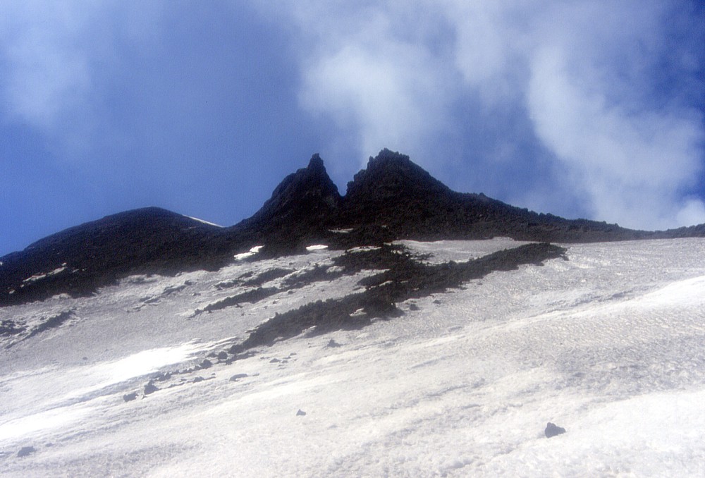 |
Black
beak of the Southeast Crater, the "Levantino" yawns
toward a blue winter sky on 18 March 2004, nearly three year after
its rapid growth. This steep-sided vent sits on the northeast
flank of the Southeast Crater and was built up during a series
of paroxysmal eruptive episodes in June-July 2001, just before
the flank eruption of that year. The March 2004 visit was made
during a topographic survey of the Southeast Crater, aimed at
establishing the height of its cone and creation of a new digital
map |
Etna
photo gallery: 2004
Reconstruction and yet another eruption
![]()
Following the dramatic and destructive 2002-2003 eruption, Mount Etna remained very quiet for more than nineteen months, the longest repose interval for the past 8 years. This has offered an occasion for various hikes on the flanks of the mountain, to places I had not yet visited, and, obviously, to get a vast amount of work done. Reconstruction continued busily in the areas stricken by the latest eruption, and in the summer of 2004, both the Piano Provenzana and the Rifugio Sapienza ("Nicolosi nord") tourist stations were the sites of intense activity. The volcano remained quiet until 7 September 2004, although there was little doubt that a new eruption would occur sometime sooner or later. That eruption came with virtually no warning but fortunately turned out to be a very peaceful one, a tourist spectacle representing no threat to human property. The volcano thus once more proved to be the second most active volcano on Earth, but this time it also confirmed its notion of being "a good volcano", as it is called by many people living next to it.
Part 1: January-September 2004
During the spring of 2004, Etna showed very little signs of eruptive activity, although gas was steadily emitted in varying amounts from the summit craters, and fresh magmatic ash was emitted at least once, in February 2004. It was during this quiet period that I climbed the cone of the Southeast Crater for the first time since 1999, in order to obtain GPS measurements and map the morphology of the cone and its conspicuous satellite vent, the "Levantino". These measurements revealed that the summit of the Southeast Crater cone stood at about 3300 m and thus was only about 20 m lower than the highest point on Etna. The climb itself was tremendous: the cone was extremely steep and its flanks were unstable and generated frequent rockfalls; the crater rim was strongly fractured and in places overhanging. Mapping of the Southeast Crater had become necessary after its rapid growth during 1998-2001and the new digital map represents a unique document since it is likely that it will erupt and experience further growth in the future. In fact, the 2004 eruption very likely originated from the conduit of this crater, although the activity started at the base of the Southeast Crater cone.
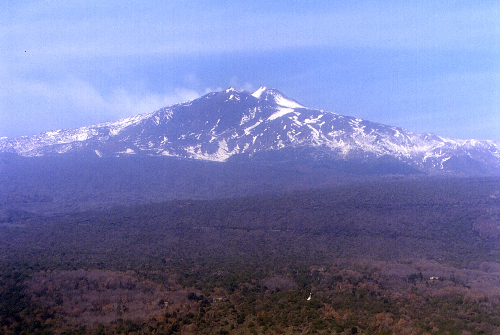 |
Etna
in a state of quiescence and covered by the remains of the winter
snow cover: this view is from Monte Salto del Cane on the south
flank, March 2004. The prominent dark peak immediately below the
summit is the Montagnola, behind which, to the right, the cone
of the Southeast Crater is visible. Although much of that cone
is covered with snow, its south flank is snow-free due to continued
heat emission |
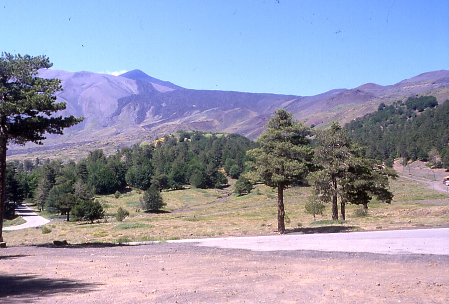
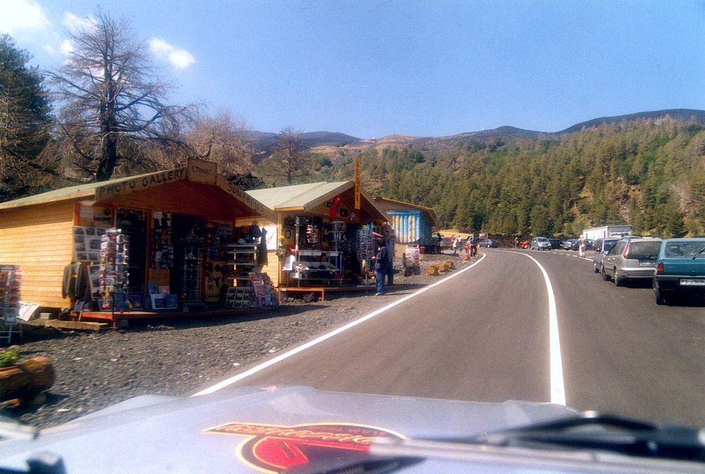
Resurrection of Piano Provenzana, 2004
To all who know Etna well, the devastation of the tourist station of Piano Provenzana in late October 2002 was a deep shock, not only because virtually all of the place was erased swiftly and relentlessly, but also because this had been one of the most beautiful spots on the mountain. Furthermore, that event represented a tremendous blow to tourism business on Etna's northern side, which had always remained much less known and visited than the other tourist station on Etna's south flank, near the Rifugio Sapienza. For more than one year, very little reconstruction was done in that place because no emergency funds had arrived, but in the spring of 2004 Piano Provenzana began to rise from its ruins. A very comfortable, broad road was built across the 2002 lava flow, not far from the former access road buried under that lava, and by the summer of this year, a small cluster of huts and containers invited visitors to have a drink at a bar, buy souvenirs, or acquire tickets for a jeep ride to near the summit. Piano Provenzana is alive again, but close to the humble new structures, the bleaching skeletons of pine trees and the remainders of ski lifts and what once had been hotels and restaurants still bear vivid testimony to the dramatic hours that marked the end of old Piano Provenzana. Although changed beyond recognition, this place is still one of startling beauty
 |
 |
 |
The
same site seen at three different times: Piano Provenzana in the
summer of 1999, before destruction (left), in June 2003, after
destruction (center), and in September 2004 (right). The tourist
facilities lay to the right of the view field in the left photograph;
right photograph shows the newly constructed access road |
||
 |
 |
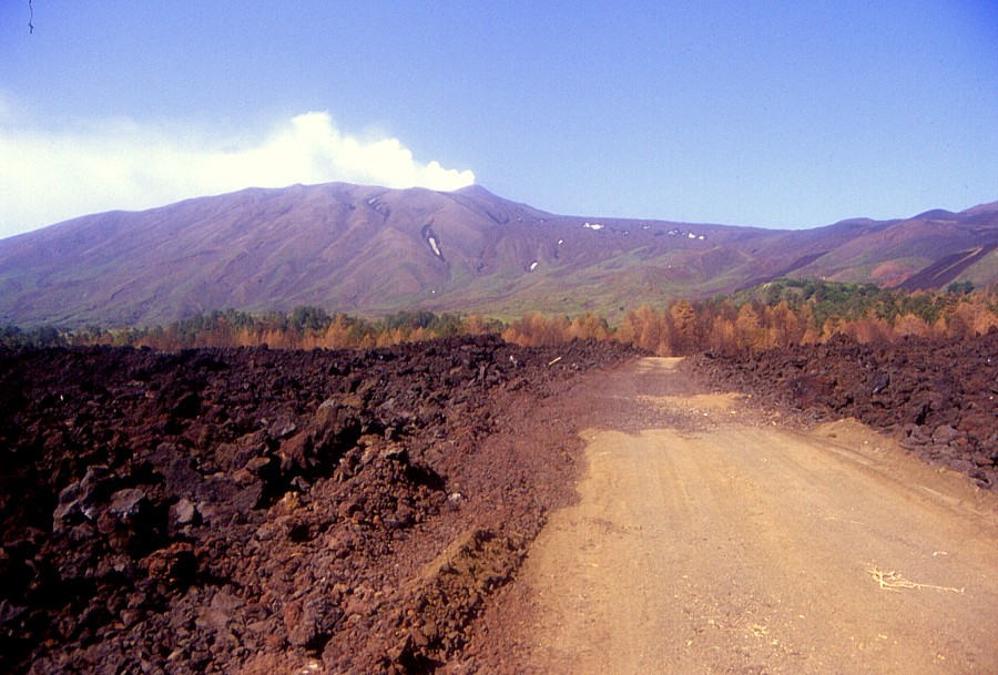
Two
years after the eruption that devastated Piano Provenzana and
buried large portions of the access road, the new road to the
tourist station is probably the finest road that exists on Etna
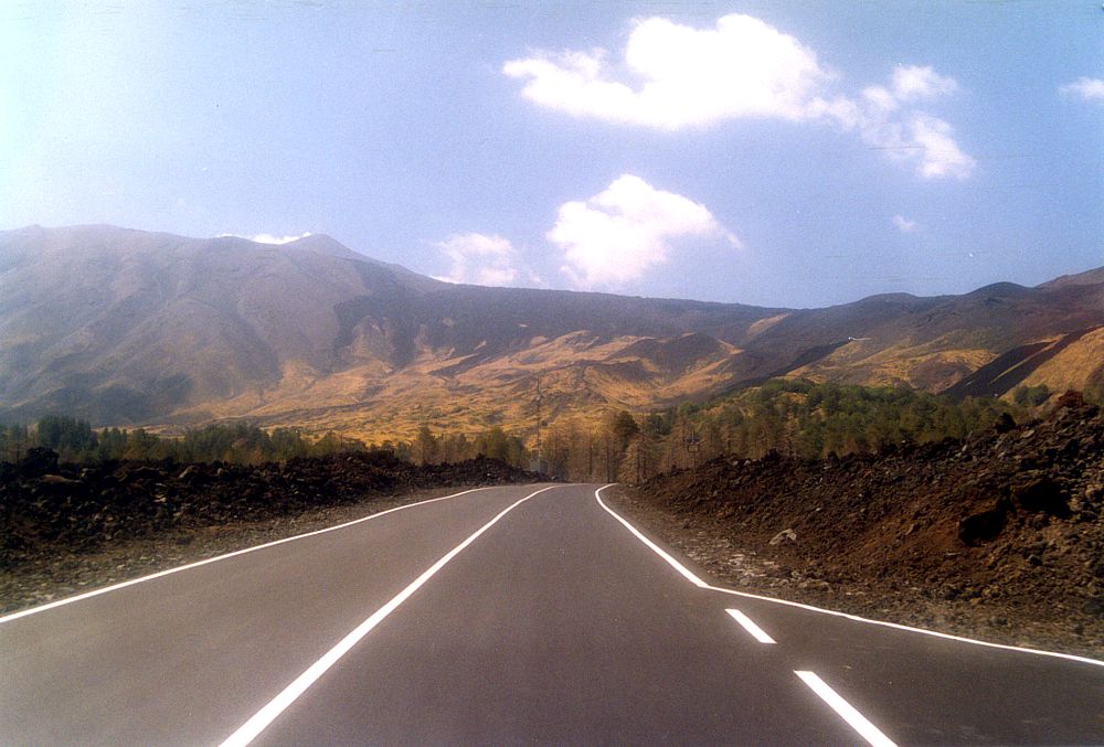
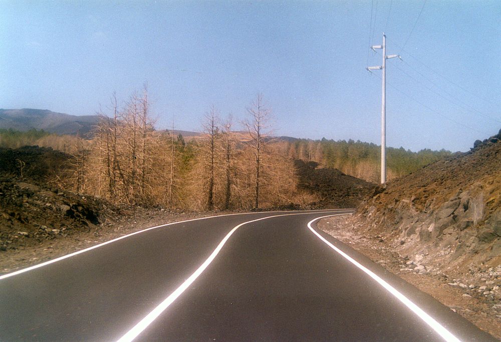
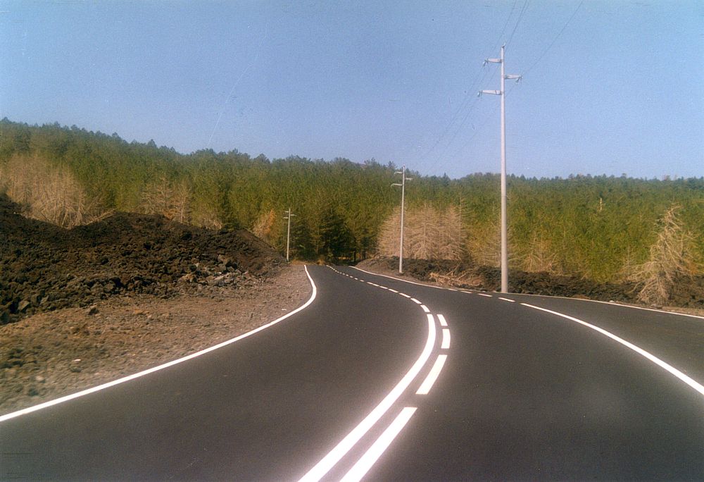
at this time. It has been built across the lava flow of October-November
2002, thus offering dramatic views of the devastation of the Ragabo
pine forest and the surrounding landscape |
|
 |
 |
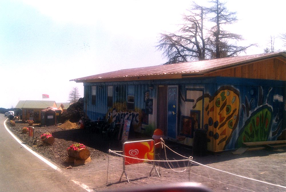 |
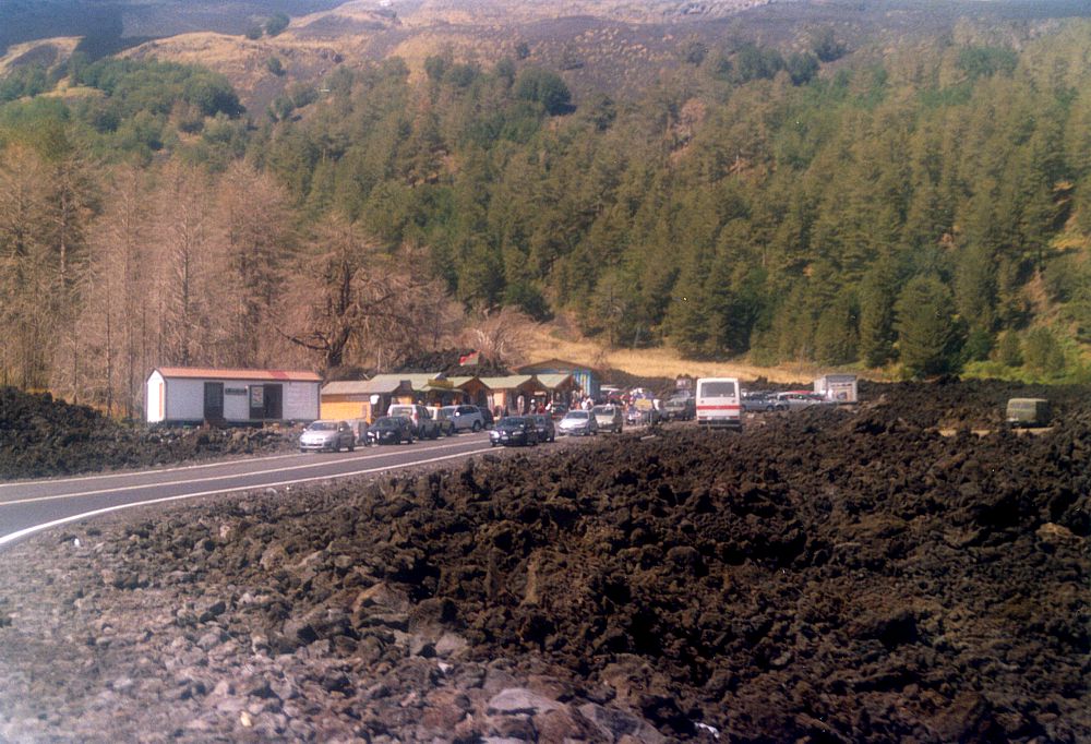
A
small cluster of humble shacks and containers constitutes the new
Piano Provenzana tourist station. Situated a few hundred meters
to the east of the former site, these structures include a ticket
desk for jeep tours (seen at extreme left in left photo), three
souvenir shops (center photo), and a bar (right photo). The bar
is of Ignazio Russo, whose restaurant-hotel was not buried by the
lava in 2002 but set afire by incandescent bombs. Only the "Monte
Conca" restaurant, located still further to the east, survived
the 2002 eruption and was reopened first after the access road was
rebuilt |
||
Destruction and reconstruction of the cable-car, 2001-2004
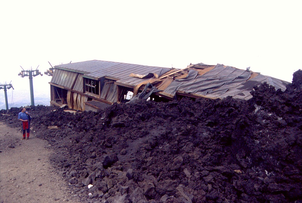
The
history of the Etna cable-car tells a tale of the perpetual battle of
man against an active volcano. The first cable-car was constructed on
the upper south flank of Etna in the late-1950s and was operating as
of 1960; it arrived at the southern base of the central summit cone,
near the Etna Observatory - much higher than today. Destruction came
with the 1971 eruption, which also obliterated the Observatory. A new
cable-car was built to about 2600 m elevation in the late-1970s and
was running by 1981 but destroyed in 1983; a second eruption in 1985
caused further damage to the structure. Reconstruction began thereafter,
and the third Etna cable-car started running in 1990. The July-August
2001 eruption brought the destruction of the arrival station and several
poles of this cable-car - fortunately the cabins could be saved before
the onset of that eruption. Reconstruction started one year after the
eruption but was soon interrupted by the next eruption, in 2002-2003,
which buried the site of the building under many meters of new lava.
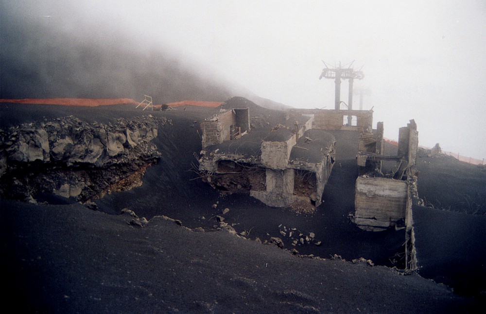
Several months after the end of this latest eruption, reconstruction
was once more resumed, and by August 2004, the Etna cable-car was once
more running, now in its fourth generation. Reconstruction was facilitated
by the fact that few of the poles of the cable-car were buried by lava
and rendered completely useless.
One might wonder why this expensive structure is rebuilt always in the
same site, known to be frequently affected by eruptions. The answer
is simple: there's big business at stake. The cable-car IS the motor
of tourism on Etna. During good days, several thousand visitors profit
from the occasion of reaching Etna's upper region without any effort
(except for an economic one: the price for a full two-way ticket including
a jeep ride up to Torre del Filosofo and the assistance of mountain
guides is now 42 Euro).
 |
 |
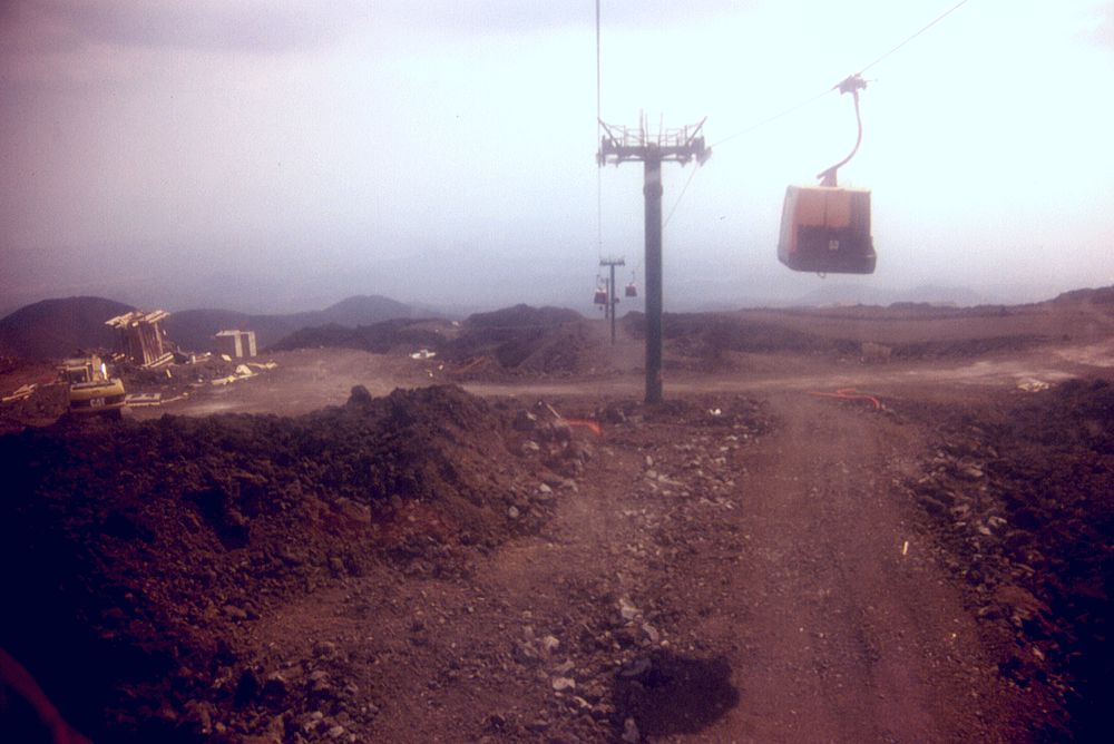
Two
photographs showing the different stages of destruction of the
old arrival station of the cable-car . Left photo was taken after
the building was surrounded and set ablaze by a lava flow during
the summer 2001 eruption. The ruin was demolished in September
2002 and reconstruction initiated, but the 2002-2003 eruption
set a brusque end to this work. Right photo shows the site of
the building in early November 2002, covered by a thick sheet
of ash of that eruption; subsequently several lava flows buried
all that remained of what once had been the cable-car station |
|
 |
 |
 |
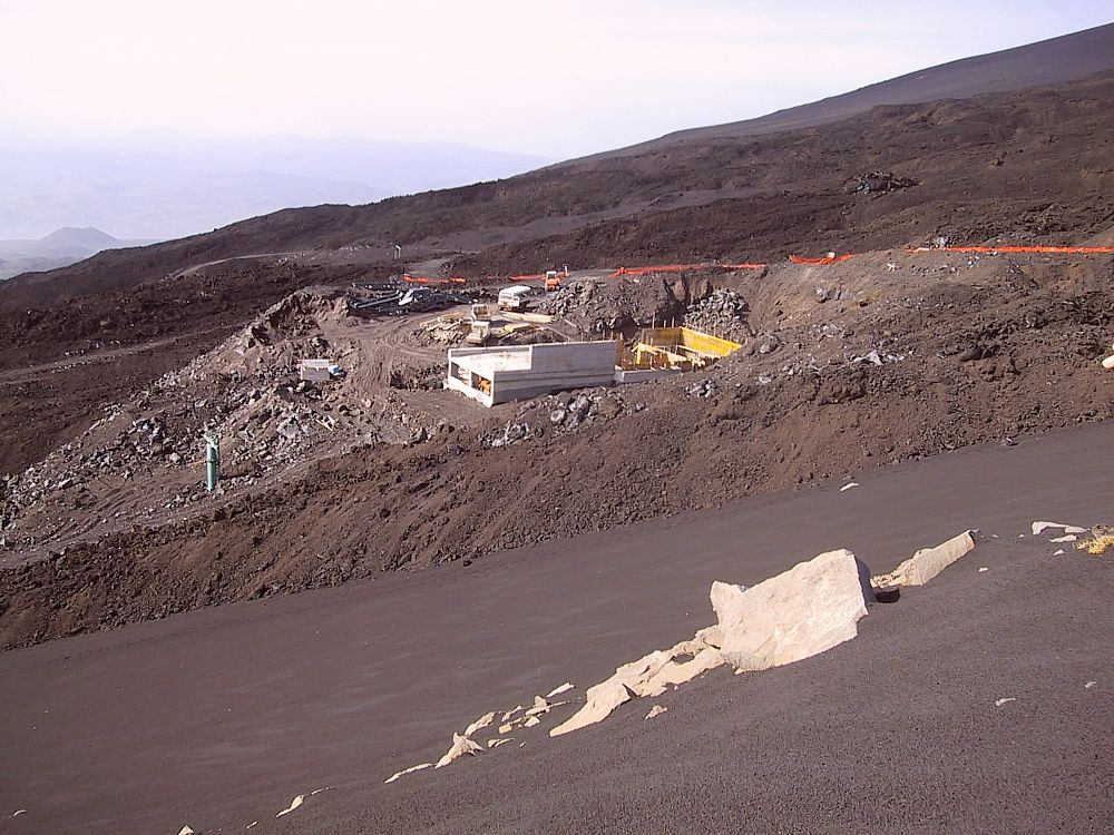
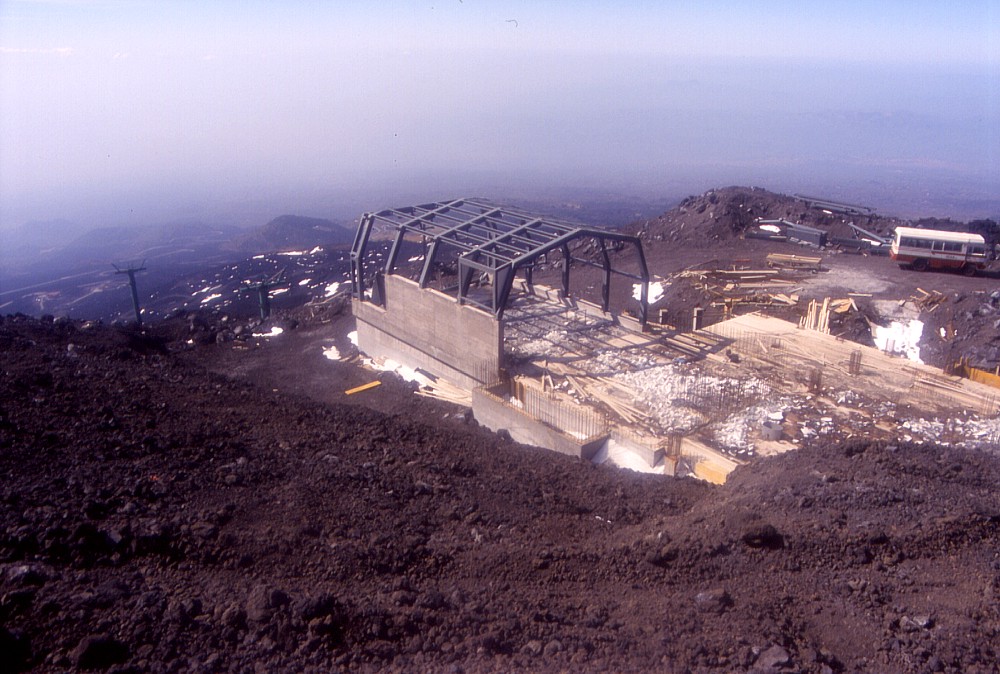
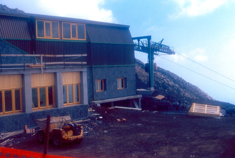
Reconstruction
of the arrival station of the cable-car, 2003-2004: left photo shows
the new foundations in concrete as of November 2003; center photo
shows the same site (seen at a different angle) in mid-March 2004,
with the skeleton of the arrival hall already standing; photo at
right shows the functioning new arrival station of the cable-car
in September 2004 |
||
 |
 |
 |
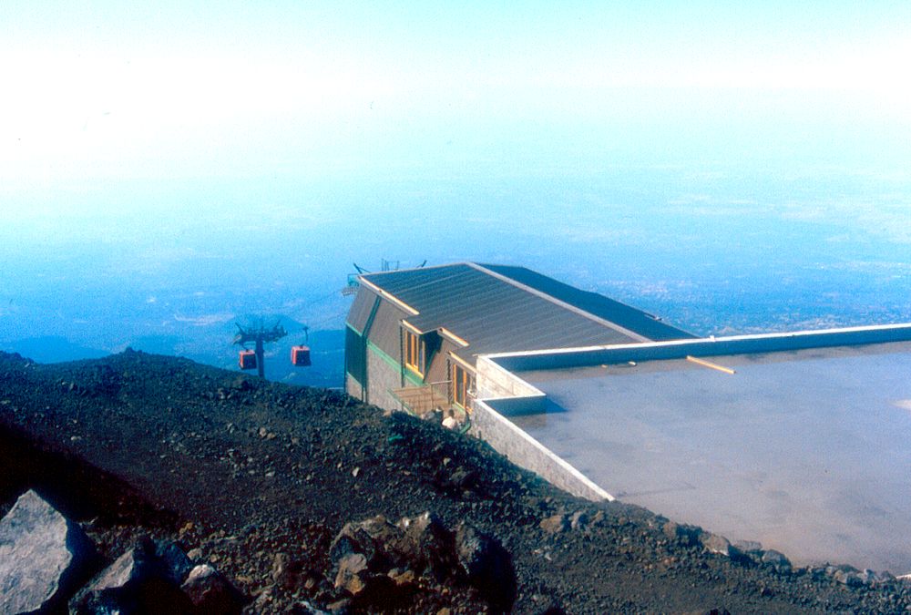
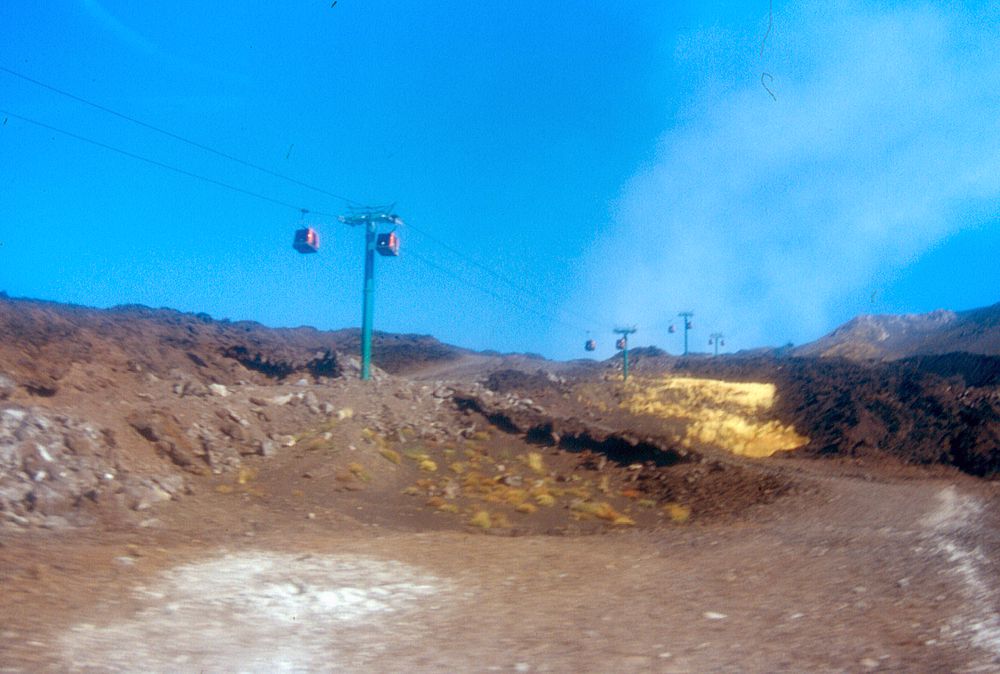
The
new-old cable car in September 2004, seen from a driving car (left),
from within one of its cabins (center), and from the new arrival
station (right) |
||
Return to the Etna photo gallery
Copyright © Boris Behncke, "Italy's Volcanoes: The Cradle of Volcanology"
Page set up on 25 January 2004, last modified on 17 September 2004