
| Aeolian
Islands index |
||
| Geological setting | Alicudi | Filicudi |
| Salina | Stromboli | Panarea |
| Vulcano | References | Travelling in the Aeolian Islands |
The Aeolian Islands (Isole Eolie)
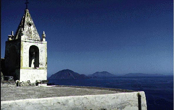 Enchanting view (towards east) from the Chiesetta di San Bartolo on Alicudi showing, from left to right, the neighboring islands of Filicudi, Salina, and Lipari. From other vantage points, also Stromboli and Vulcano can be perfectly seen, while Panarea is not visible because it lies in line behind Salina. Taken on the afternoon of 30 August 1994. |
|
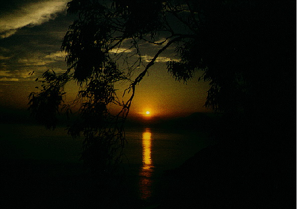 Sunset seen from the village of Leni, on the south side of Salina, 26 September 1995. The Isole Eolie offer frequent and ever-changing displays of this kind. |
|
|
|
Introduction
The Aeolian Islands (Isole Eolie in Italian, also known as the Lipari Islands) lie off the northeastern coast of Sicily. The south coast of Vulcano lies about 25 km NW of the northern tip of the Milazzo peninsula; Stromboli lies about 75 km to the north of that point. The archipelago consists of seven major and numerous small to very small islands. Lipari, the largest of the islands (see table below), is also the most populated and the administrative center of six of the seven islands (Comune di Lipari); Salina is politically independent and has three individual towns (comuni), Santa Marina di Salina, Malfa, and Leni.
ISLAND     AREA (sq km)     ELEVATION (m)     INHABITANTS

Alicudi    5.2              675               100
Filicudi   9.5              774               250
Salina     26.8             962               2300
Lipari     37.6             602               8500
Vulcano    21               500               450
Panarea    3.3              421               300
Stromboli  12.6             924 (or 926)      400
The geological framework of the Aeolian islands is described on a separate page.
Since the 1970's the islands have become one of the major tourist attractions of southern Italy, and tourism has become the main source of economic activity in the archipelago. The dramatic influx of tourists especially during the high season (July-August) has caused, in the late 1990s and in the first years of the new millennium, an almost total breakdown of organization on some of the islands, so that measures to "channelize" the tourist invasion were applied, such as a special "access tickets", similar to paying for visiting a museum or a monument. A ticket is necessary to visit any of the islands, and further tickets must be paid by those who wish to climb the volcanoes of Vulcano and Stromboli. Following the major 2002-2003 eruption of Stromboli, access to the volcano is limited to about 400 m, which means that the summit is off-limits. In recent years hundreds of tourists had crowded the summit area of Stromboli at any given moment, and it must be considered mere luck that there have been only few accidents. It was also luck that the 2002-2003 eruption began during the winter - during the summer season it would have certainly caused numerous fatalities.
|
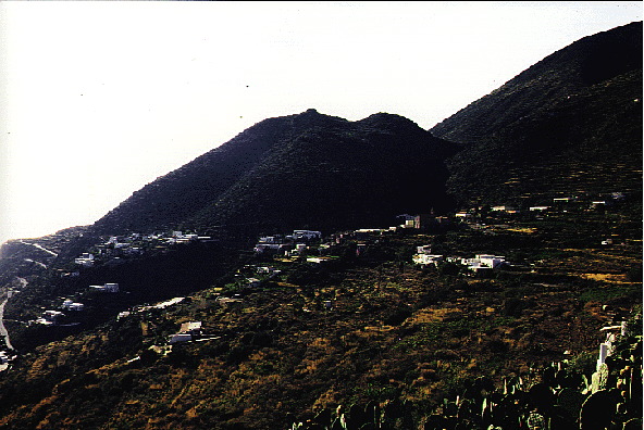
Alicudi 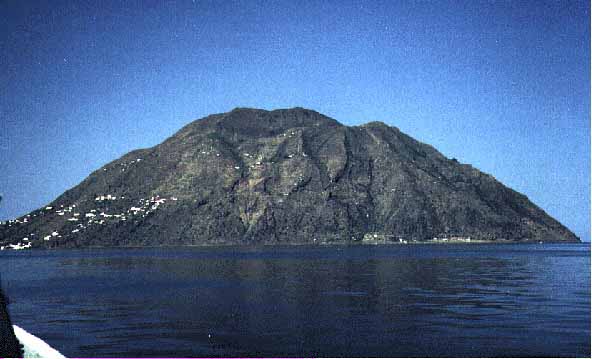 Alicudi seen from the east, showing the relatively simple morphology of the island. The settlement is scattered over the SE slope (at left) of the mountain which constituted the island. Photo taken on 30 August 1994. |
|
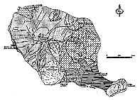
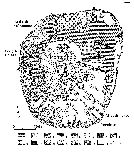 Geological sketch map of Alicudi, simplified version after Manetti et al. (1995b). |
|
|
Filicudi 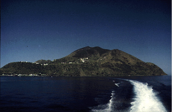 The island of Filicudi seen from the east. Highest peak is Monte Fossa Felci (774 m); the low, dome-shaped peninsula at left is Capo Graziano. Photo taken 30 August 1994. |
|
 Geological and structural sketch map of Filicudi, after Manetti et al. (1995a). Click on image to see the large (85 k) version and legend. |
|
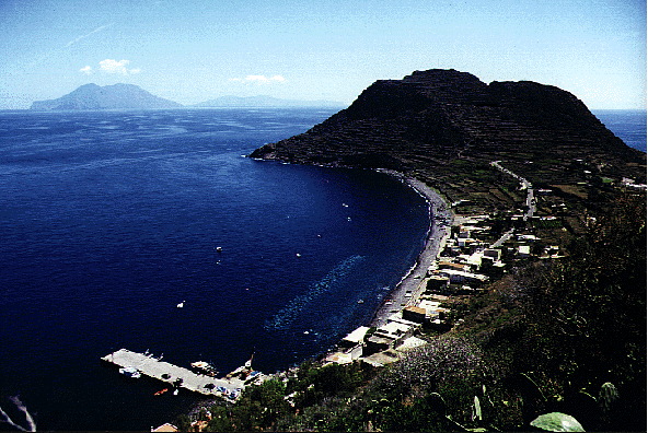
 View of the well-preserved lava dome complex of Monte Montagnola from the SE, 9 September 1995. The village of Pecorini lies in the area below the dome. Monte Fossa Felci lies out of the image to the right. |
|
 View from Valdichiesa, on the E flank of the Fossa Felci complex, down towards Filicudi Porto and the lava dome complex forming Capo Graziano, on 10 September 1995. The islands of Salina (left) and Lipari (right) are visible in the background. View is to the SE. |
|
|
Salina 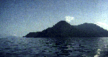 Salina, the second largest of the Aeolian islands, seen from the SW. Monte dei Porri (860 m) is at left, superseded in height by Monte Fossa delle Felci (962 m) to the right: this is the highest mountain of the archipelago.Distant neighbor, Stromboli island lies on left margin of the photograph. Photo taken 30 August 1994. |
|
 Simpified geological map of Salina, from Barca & Ventura (1993). Click on the image for large version and description. |
|
|
Stromboli 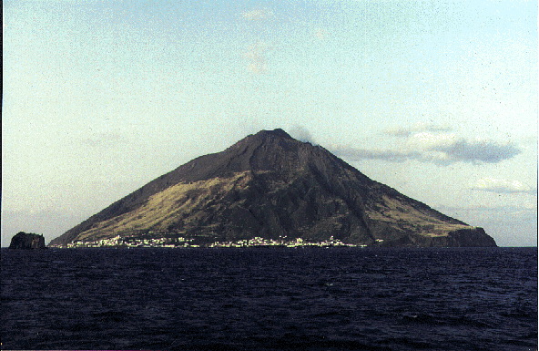 Stromboli seen from the north on 18 March 1992. |
|
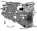
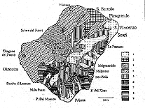 Simpified geological map of Stromboli, from Hornig-Kjarsgaard et al. (1993). Click on the image for large version and description. |
|
|
Panarea 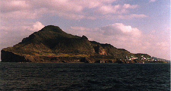 Panarea seen from the SW on 7 November 1990. |
|
|
Lipari 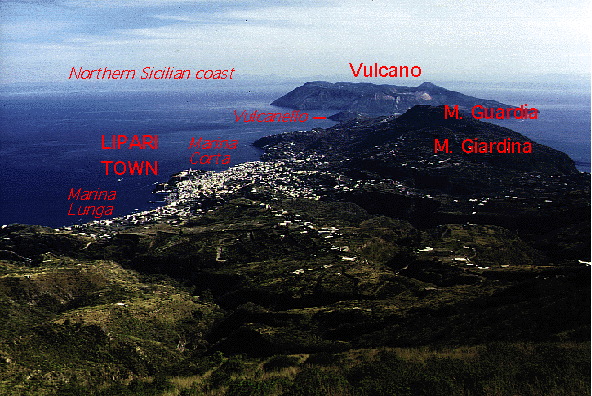 Photo above: Panoramic view of the southern part of Lipari, from the summit of Monte S. Angelo, on 15 September 1995. Notable features are annotated (visible in the large ca. 150 k JPG version of the photo). |
|
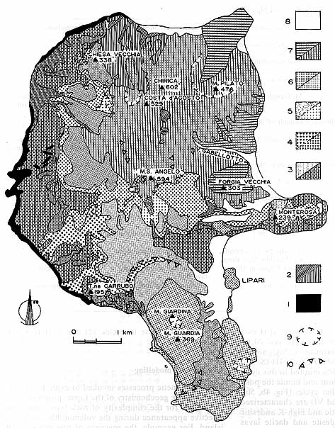 Simplified geological map of Lipari, taken from Crisci et al. (1991). |
|
|
Vulcano  Fumaroles deposit yellow sulfur on the N rim of the most recently active crater of the island, the Fossa crater (or Gran Cratere). In the background of this photo, taken on 18 April 1995, the islands of Lipari and Salina are visible. |
|
 Geological sketch map of Vulcano island, from Ventura (1994). Click on image for large version and explanation. |
|
|
|
Most
remote and westernmost of the Aeolian Islands, Alicudi has retained much
of the "savage" character that all of these islands once had. Rising steeply
from the sea, the island does not offer much opportunity to build roads;
thus there is only one leading from the port to the largest hotel on the
island - its length may be at best 300 m. Everything else is stairs. The
principal means of transport on Alicudi is donkeys.
The
highest place on the island is 675 m-high Montagnola, with its neighboring
peak Filo dell'Arpa (662 m).
Geologically,
Alicudi is more recent than previously believed. In a recent paper by
Manetti et al. (1995b), an age of 28 ka is given for the youngest volcanics
on the island, a cluster of lava domes (Filo dell'Arpa) within a small
summit caldera both of which are visible in the image.
| Alicudi
at a glance |
||
| Area:
5.2 km2
|
Notable
morphologic features: Residents: about 100 (in a small settlement extending up the SE flank of the steep slope of the island) |
|
Significantly more complex than Alicudi, Filicudi has several small villages, a road network, and more varied volcanic centers. the highest point is Monte Fossa Felci (almost identical to the name of Salina's highest peak), reaching 774 m elevation. Important secondary volcanic centers are Montagnola (a name frequently used for minor but prominent hills or mountains in Italy) and Capo Graziano. The youngest of these features is the dacitic lava dome cluster of Montagnola, probably extruded some 35,000 years ago.
Filicudi appears to have some of the oldest rocks exposed anywhere in the Aeolian islands (>1 million years). Many of the volcanic centers on the island, however, have a youthful morphology.
A prehistoric (bronze age) village is located on the flank of the Capo Graziano dome, the main tourist attraction of the island. Other places worth seeing are the Grotta del Bue Marino and the tall, narrow rocky islet of "La Canna" off the W coast of the island. Filucudi furthermore offers tantalizing panoramic views from many locations, and a church tower whose topmost part has been rotated and displaced by an earthquake in 1978.
| Filicudi
at a glance |
||
| Area:
9.5 km2
|
Notable
morphologic features: Residents: about 250 |
|
Salina, the "green island", hosts the highest mountain of the Aeolian Islands and offers marvellous landscapes, panoramic views, lovely villages, and the charming crater of Pollara where many outdoor scenes of the movie "The Postman" (1994) were filmed. While all other islands of the Aeolian archipelago are administered by the municipality of Lipari, Salina has three independent municipalities, which is reflected in a strongly different attutude toward tourism. The island is much quieter even during the month of August, the peak of the tourist season. Although its most recent eruptions occurred about 11,000-13,000 years ago, it is not sure whether the island is to be considered volcanically extinct. No signs of volcanic unrest have occurred in historical time, although weak fumarolic activity is occurring offshore from the island's most recent volcano, Pollara.
| Salina
at a glance |
||
| Area:
26.5 km2
|
Notable
morphologic features: Residents: about 2500 |
|
Northernmost of the Aeolian islands, Stromboli enjoys its fame as having one of the few volcanoes on Earth that erupt virtually continuously, and most tourists who visit the island only come to see the volcano. The volcano, though most of its activity is relatively mild, presents a significant hazard potential, and tourists climbing to its summit are exposed to the risk of being surprised by "larger-than-normal" explosions. Lava flows are emitted episodically (most recently in 1975, 1985-1986, and 2002-2003) while stronger explosive events are also known, such as in 1919 and 1930. The lastest major eruptive event, in 2002-2003, generated a small but damaging tsunami which led to the total evacuation of the island for the first time in its history.
| Stromboli
at a glance |
||
| Area:
12.6 km2
|
Notable
morphologic features: Residents: about 400 |
|
Panarea, the "jet set" island among the Eolie, is geologically much younger than has been believed until relatively recently. The island, which is highly dissected and tectonized, is only a part of a much larger, mainly submarine, volcanic complex whose most recent eruptive activity occurred only 10,000 years ago. Increased activity at the submarine fumaroles of Panarea - which are known since classical times - began in November 2002, subsided during the first months of 2003, and resumed in late January 2004. The significance of this phenomenon is not clear but probably represents nothing else than "normal" fluctuations in the lifetime of a dormant volcano.
| Panarea
at a glance |
||
| Area:
3.4 km2
|
Notable
morphologic features: Residents: about 300, increasing to 2000 in August |
|
The largest of the Aeolian Islands, Lipari, is geologically extremely complex and its eruptive history has extended to the very recent past. The island is covered with the products of extremely violent explosive eruptions. In spite of the - even though relatively low - volcanic hazard, the island is flooded with tourists during the summer season and hosts the main town in the Aeolian archipelago.
| Lipari
at a glance |
||
| Area:
38 km2
|
Notable
morphologic features: Residents: about 8500 |
|
All volcanoes of the world owe their name to Vulcano, the southernmost of the Aeolian Islands. Though morphologically relatively unspectacular, the eruptive activity at its active cone in Ancient times impressed observers that much that they suggested it was the home of the God of Fire. Vulcano is potentially extremely hazardous, but a village, overcrowded during the summer season, lies right at the foot of its most recently active cone. The most recent eruption occurred at the Fossa crater in 1888-1890 and was purely explosive; viscous lava was extruded during an eruption in the 18th century. The northernmost portion of the island is constituted by the youngest volcanic edifice, Vulcanello, which began to form during the second century B.C. and remained active through the 16th century.
| Vulcano
at a glance |
||
| Area:
21.2 km2
|
Notable
morphologic features: Residents: about 500 (permanent, but during the summer season up to 10,000 people stay on Vulcano each day) |
|
Copyright © Boris Behncke, "Italy's Volcanoes: The Cradle of Volcanology"