
| Etna
index |
||
| Geology | Geological history | Cones and craters |
| Eruptive characteristics | Eruptions before 1971 | Eruptions since 1971 |
| Etna and Man | References | Web sites |
| Weather forecasts | FAQ | Latest news |
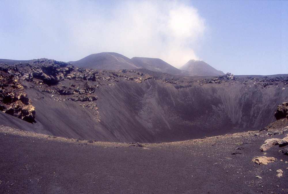 |
Partly
filled with ash of the 2001 and 2002-2003 eruptions but still
impressive, the Cisternazza collapse pit yawns in the southeastern
part of what used to be called the "Piano del Lago"
(the plain of the lake) until the latest eruptions led to the
growth of large new pyroclastic cones on the former plain. The
Cisternazza formed at the beginning of the 1792-1793 eruption
and is a typical though unusually large example of collapse pits
forming in the uppermost portions of eruptive fissures of flank
eruptions at Etna. In the background (center) lie the two large
pyroclastic cones built up during the 2002-2003 eruption, and
behind them to the right, the still larger cone of the Southeast
Crater, one of Etna's four summit craters. A gas plume is fed
from the Northeast Crater, which lies behind the Southeast Crater.
View is to the NNW, taken in mid-June 2003 |
Mamma
Etna's countless children
1792-1793 eruptive vents
SSE flank, 15.008144° E, 37.725378° N (Cisternazza);
15.026762° E, 37.707978° N (uppermost effusive vent)
elevation: ~2630 m (Cisternazza); ~2000-1850 m (effusive vents
outside the Valle del Bove)
![]()
In
late May 1792, a long-lived and voluminous flank eruption began on the
upper SSE flank of Etna, initially from vents on the lower Piano del Lago
and within the upper southern part of the Valle del Bove. On 1 June of
that year, new vents opened outside the Valle del Bove, immediately below
its southern crest (known as "Schiena dell'Asino", which means
"the back of the donkey") and a little further downslope, between
2000 and 1850 m. A large volume of lava was emitted from the lowermost
portion of this system of eruptive fissures, with the most advanced lava
fronts coming very close to the village of Zafferana. In spite of the
volume of emitted lava, this eruption was almost non-explosive, with only
some explosive activity at the beginning of the eruption on the Piano
del Lago, where a spectacular collapse pit, the Cisternazza, was formed.
The eruption ended late in May 1792, after one year. In some respects
it was similar to the 1991-1993 eruption, which also threatened Zafferana
and was essentially non-explosive, but this latter eruption was confined
to the Valle del Bove.
Many of the 1792-1793 eruptive vents are still well visible today. The
Cisternazza, which lies in the southeastern part of the Piano del Lago
(or what used to be called Piano del Lago until the eruptions of 2001
and 2002-2003), is a simple circular pit about 200 m in diameter and (before
2001) 70 m deep, and with subvertical walls. Some of its depth probably
was lost due to the heavy tephra falls of the 2001 and 2002-2003 eruptions.
The first effusive vents to become active, high on the southwest wall
of the Valle del Bove, have been buried under the lavas of the 1991-1993
eruption. Outside the Valle del Bove, nearly on the crest of the "Schiena
dell'Asino", lies a shallow pit crater about 20 m in diameter, from
which a narrow tongue of lava extends about 1.3 km down the slope. At
the northern rim of the pit lie the remains of a small scoria or spatter
cone, which formed before the nearby pit collapsed, exposing a narrow
dike within the remainder of the spatter cone.
Further downslope, about 0.5-0.6 km southeast of the small pit, the main
section of the 1792-1793 eruptive fissure system is marked by a series
of hornitos, small, steep-sided cones consisting of welded spatter. From
here the largest lava flow of the eruption was emitted, which transformed
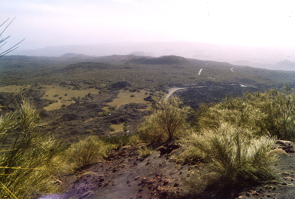
much of Etna's middle southeast flank into a monotonous lava plain. Nowadays
the 1792-1793 lava field is covered with some vegetation, and furthermore
it is one of the few lava fields on this volcano that has abundant pahoehoe
lava surfaces. Two spectacular lava caves lie within this lava field,
the Grotta Cassone and the Grotta Tre Livelli, both of which were discovered
during the construction of the road that leads from Zafferana to the tourist
facilities around the Rifugio Sapienza.
The photos on this page were taken during two visits to the eruptive fissure
outside the Valle del Bove in 1998 and 2001, and to the Cisternazza in
2003.
 |
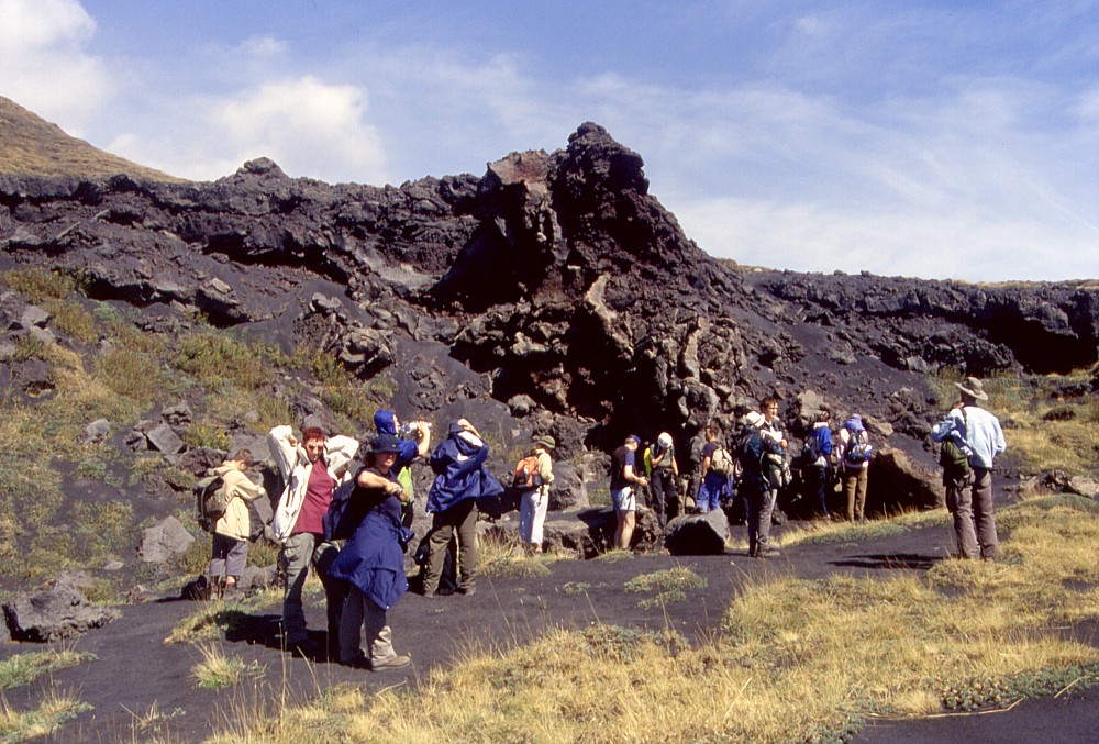
The
rising sun is casting long shadows on the SSE flank of Etna on
the early morning of 24 May 1998, rendering morphological features
well visible. Among these are a small collapse pit (at extreme
left), flanked by a half-collapsed mound of scoriae (seen in left
foreground), from which a narrow lava flow with low levees extends
down the slope. This pit lies immediately to the south of the
south rim of the Valle del Bove, here known as "Schiena dell'Asino"
(the back of the donkey), and formed during the second phase of
the 1792-1793 eruption. Most of the lava produced by this eruption
was emitted from vents on both sides of the "Schiena dell'Asino",
within the Valle del Bove and on its outer SSE slope. The low
cone with a large crater in the right background is Monte
Salto del Cane |
 |
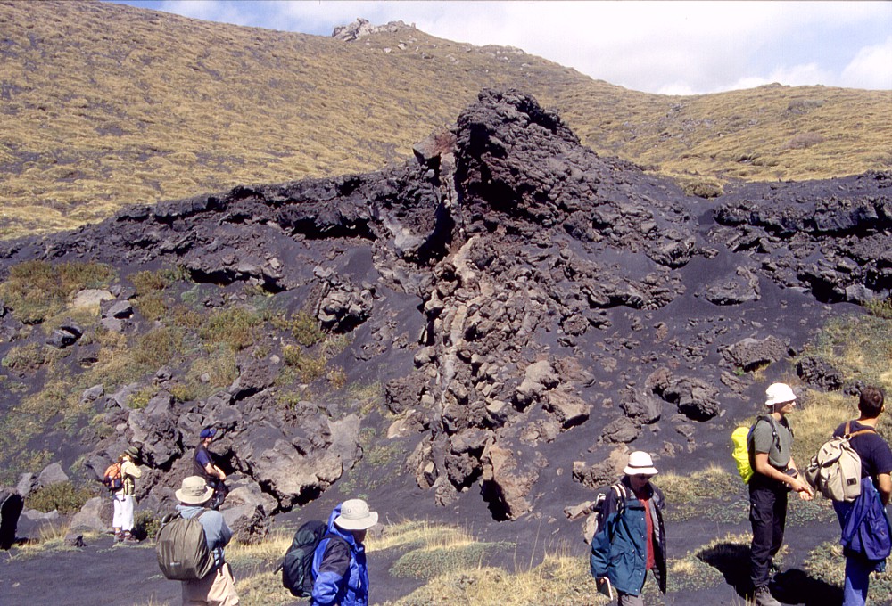 |
Geology
students from Germany examining the small collapse pit immediately
to the south of the Schiena dell'Asino (whose crest is visible
in the background in right photograph), where the interior of
a small spatter cone is exposed on the pit's rim. The cone formed
shortly before the collapse of the pit and is seen to have been
fed by a narrow (0.3-0.5 m) dike. Photos taken in early September
2001 |
|
Copyright © Boris Behncke, "Italy's Volcanoes: The Cradle of Volcanology"
Page set up on 11 March 2004