
| Etna
index |
||
| Geology | Geological history | Cones and craters |
| Eruptive characteristics | Eruptions before 1971 | Eruptions since 1971 |
| Etna and Man | References | Web sites |
| Weather forecasts | FAQ | Latest news |
 |
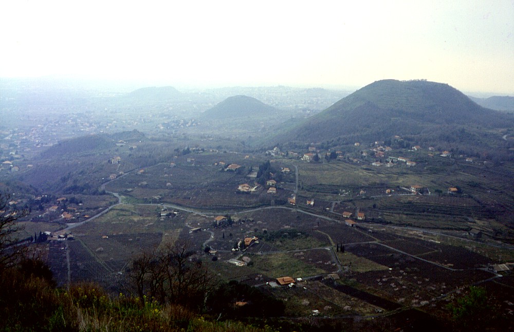
Seen
from some locations on the southeast flank of Mount Etna, the
two large cones of Monte Gorna (foreground) and Monte
Ilice (in the distance at right) appear like twins among the
many "baby volcanoes" dotting Etna's slopes. Both are
actually of very similar size and both are nearly symmetrical
cones truncated by large summit craters. This photograph was taken
in early March 1997 from the summit of the smaller and much older
Monte S. Nicolò, about
1.3 km southeast of Monte Gorna |
Mamma
Etna's countless children
Monte Gorna (or Monte Gurna
or Monte Urna)
SE flank, 15.081871° E, 37.664573° N
summit elevation: 850 m
![]()
When
travelling on the road that leads from Catania across Viagrande and Monterosso
to Zafferana and on to Milo and Linguaglossa, shortly after passing the
large cone of Monte Serra near Viagrande, two large green but youthful
and symmetrical cones are seen sitting on the lower southeast flank of
Mount Etna. The nearer of these is Monte Gorna, seemingly a photocopy
of the more distant (but more recent) Monte Ilice. This cone stands about
1.5 km west of the village of Monterosso, dwarfing the much older cones
of Monte S. Nicolo to the south and Monte Caterratte to the east. The
youthful shape of Monte Gorna suggests a relatively recent formation,
and in fact some sources attribute its birth and growth to a historically
documented flank eruption in 394 BC, whose lava flow reportedly entered
the sea at S. Maria la Scala after passing immediately to the north of
the present-day town of Acireale. About 8.5 km to the east of Monte Gorna,
the lava flow cascaded down the steep slope of the Timpa di Acireale (which
is an impressive east-facing fault scarp about 100 m high) and entered
into the Ionian Sea, forming a delta more than 1.5 km wide. Palaeomagnetic
dating of this lava flow (and thus presumably of the formation of Monte
Gorna) by Tanguy et al. (2003) suggests a more recent emplacement date,
about 150-50 BC.
Monte Gorna, like its "twin" Monte Ilice about 1.8 km away,
was built up on irregular terrain and thus its relative height varies
from about 200
m on its east side to 90 m on its northwest side. A circular crater, 220-240
m in diameter and up to 60 m deep, lies at its summit. Lava apparently
issued exclusively from vents at the base of the cone during the Monte
Gorna eruption, as during many other flank eruptions of Etna that form
large pyroclastic cones. A climb to the summit of the cone is rewarded
by fine panoramic views across the surrounding field of pyroclastic cones
on the southern and southeastern flank of Etna.
I visited and climbed Monte Gorna for the first time in early March 1997
and passed nearby on a number of other occasions. The photos on this page
were taken during the first visit and in March 2004.
 |
 |
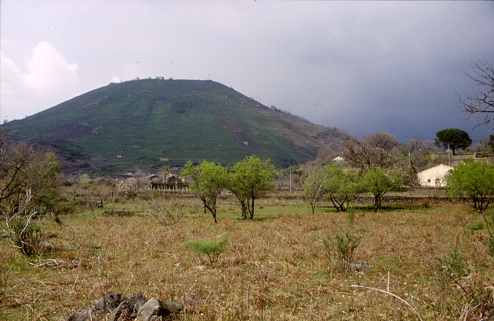 |
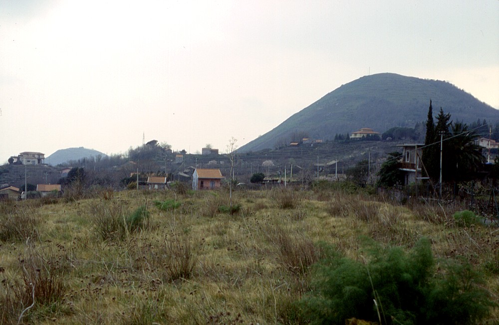
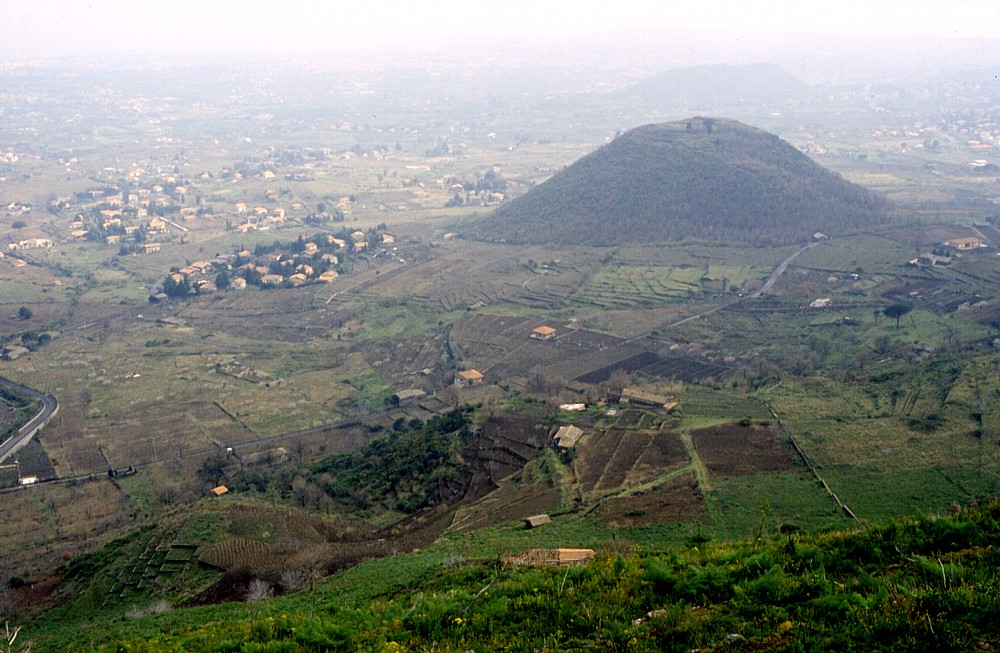
Left:
Monte Gorna is the large cone at right in this image taken from
the summit of Monte Ilice, approximately 1.6 km to the NNE. Three
smaller cones can be seen in this view, Monte
Caterratte (center left), Monte
S. Nicolò (center), and Monte
Serra (left distance) Center: in this view, taken from north, Monte Gorna is seen as a tall cone at right, with an antenna on its top, while the summit of the much smaller Monte S. Nicolò is barely visible at left Right: a broader, bulky appearance of Monte Gorna is seen from areas lying to the east. Photos taken in early March 1997 |
||
 |
 |
 |
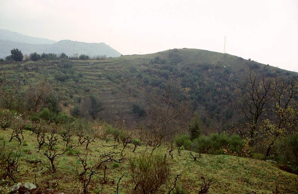
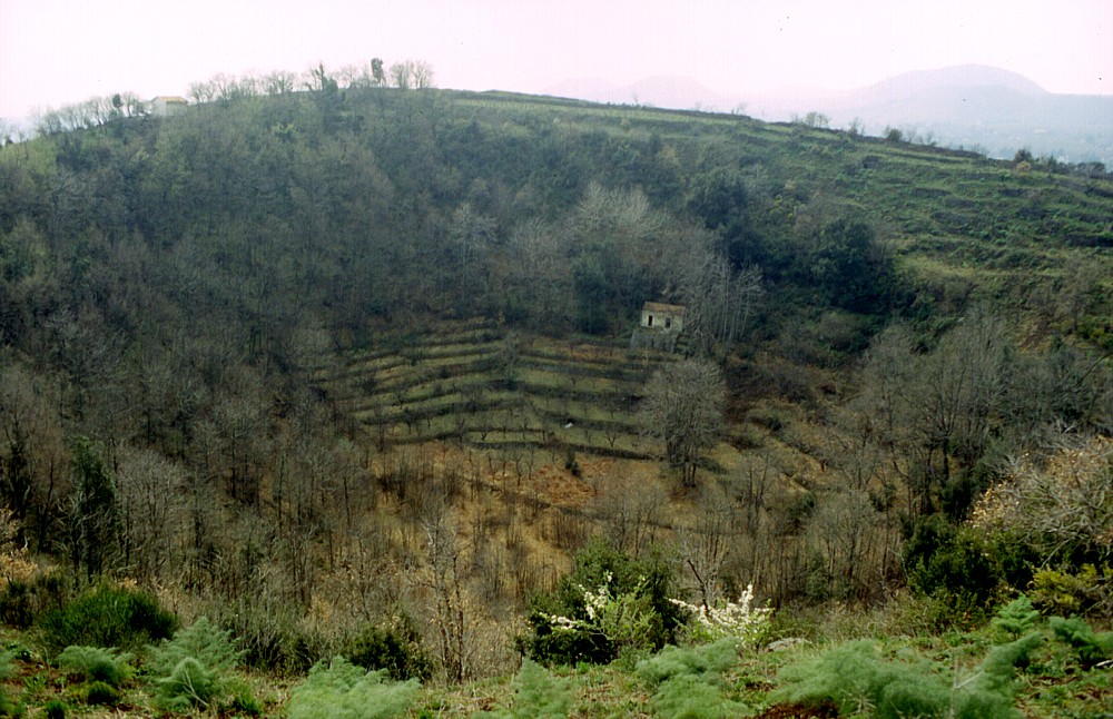
The
large and deep crater of Monte Gorna is shown in the photographs
at left and center, seen from its southern (left) and northern (center)
rims in early March 1997. Photograph at right shows the view from
the cone's summit to the south, with the symmetrical cone of Monte
S. Nicolò at center right (Monte
Serra is barely discernible in the haze behind it). In the foreground,
at the base of the cone of Monte Gorna, a circular feature can be
seen, which probably is an effusive vent active during the Monte
Gorna eruption. Photo taken in early March 1997 |
||
Copyright © Boris Behncke, "Italy's Volcanoes: The Cradle of Volcanology"
Page set up on 9 March 2004