
| Etna
index |
||
| Geology | Geological history | Cones and craters |
| Eruptive characteristics | Eruptions before 1971 | Eruptions since 1971 |
| Etna and Man | References | Web sites |
| Weather forecasts | FAQ | Latest news |
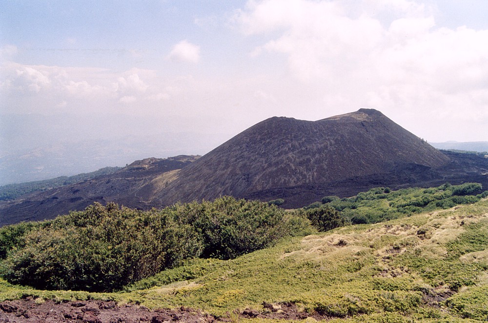 |
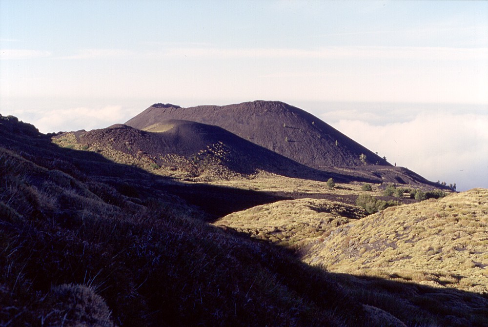
Beautifully
shaped Black Mountain (which is the meaning of Monte Nero) at
the lower end of the Northeast Rift of Etna, a huge pyroclastic
cone formed during a large eruption in 1646-1647. Lying in one
of the areas of highest vent density on Etna, this cone is one
of the largest of the numerous flank cones of the volcano and
forms a prominent landmark visible even from Taormina and other
remote areas to the north of Etna. In this photograph, taken in
mid-August 2002, the view is from Monte Timparossa to the southwest |
Mamma
Etna's countless children
Monte Nero
NE flank, 15.028353° E, 37.807783° N (NW rim of crater)
Summit elevation: 2050 m
![]()
During
the first 70 years of the 17th century, between 1600 and 1669, Etna produced
a number of unusually large and devastating flank eruptions. One of the
smaller eruptions during that period - and yet a very large one if compared
to the eruptions of the past 300 years - occurred between November 1646
and January 1647 on the lower Northeast Rift where a much smaller eruption
had occurred three years earlier. Strong explosive activity built up a
row of large cones, the largest of which, at the lower end of the eruptive
fissure, rose about 150 m above the former surface and now forms one of
the most prominent landmarks on the northern-northeastern flank of Etna.
This cone was named Monte Nero, the Black Mountain (actually there are
three cones on Etna's flanks that bear this name). A large lava flow extended
toward the Alcantara valley and threatened several small settlements (the
longest lobe of the lava field attributed to the 1646 eruption, however,
is about 80 years older).
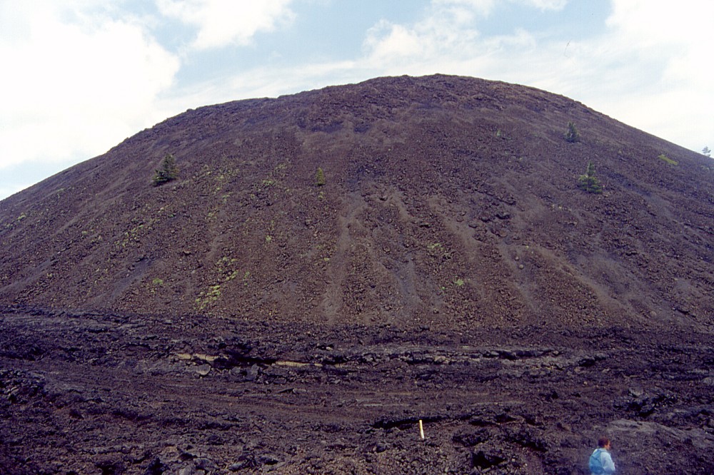
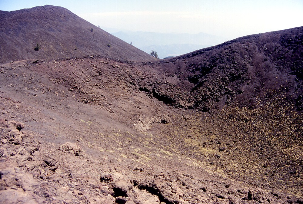
Monte Nero is a huge horseshoe-shaped cone open to the northeast, with
a base diameter of up to 0.5 km and its crater is nearly 200 m wide. On
the open side, the breach in the crater rim is filled by a conspicuous
ridge topped by an elongate depression, marking a series of effusive vents.
However, this ridge seems to be a feature formed relatively late during
the eruption. Morphological evidence indicates that Monte Nero first grew
as a symmetrical cone with a completely closed crater, before lava began
to pond within the crater and broke through the northern crater rim, pushing
two huge sections of the broken cone's flank for a distance of several
hundred meters. Then the lava broke through the front of the debris that
it had pushed ahead to form the large lava flow that extended toward the
Alcantara valley. The remains of the entrained debris derived from the
broken flank is now visible as a peculiar "collar" around a
broad lava-filled depression on the north base of Monte Nero, cut on its
northeast side by the lava flow that extended downslope.
Still more peculiarly, Monte Nero is one of the few examples on Etna where
a pre-existing flank crater has been the site of a more recent eruption.
During a major eruption in 1923, a system of eruptive fissures propagated
downrift in the direction of Monte Nero. When the dike cutting the surface
arrived at this cone, it was split up into three branches, two passing
on either side of Monte Nero, while a third one cut right across the cone
and arrived at the surface on its lower northeast flank in precise correspondence
with the late-formed effusive vents of the Monte Nero eruption. A small
volume of lava was erupted from this fissure segment, covering a portion
of the basin that lies within the debris "collar" formed by
the breaching of Monte Nero during its 1646-1647 eruption.
But Monte Nero is only the largest of a series of sizeable cones formed
during the same eruption. A little further uprift, one cone grew so large
that it was given a name on its own, Monte Ponte di Ferro. The uppermost
portion of the 1646-1647 eruptive fissure lies buried under younger lavas,
mostly those erupted in 1911 and 1923.
Until the 2002 eruption a little further to the east, the Monte Nero area
was a popular destination of hikers, and a trail leading from Piano Provenzana
to Monte Nero was completed in the spring of 2002, a few months before
the eruption. The hike was about 30 minutes and went across beautiful
forests before arriving in the Monte Nero area. Nearly all of the trail
was buried under the lavas erupted in late October-early November 2002
that also devastated Piano Provenzana, as were most other trails and dirt
roads leading to the Monte Nero area, so that all of a sudden this had
become one of the most isolated places on Etna. In the summer of 2003
a small footpath was made across the lowest part of the 2002 eruptive
fissure to render access to Monte Nero once more a bit easier, because
this area is really a volcanic showpiece. While the massive cone of Monte
Nero clearly dominates the scene, there are numerous smaller features
that are worth a close look. Foremost among these is the main eruptive
fissure of 1923 and its countless spatter cones and open pits. A climb
to the summit of Monte Nero is not an easy enterprise but is rewarded
by breathtaking panoramic views up and down the Northeast Rift and the
adjacent forested areas including the Alcantara valley and the Nebrodi
and Peloritani mountains to the north.
I first visited Monte Nero on a foggy day in early May 2000 and returned
a few weeks later when weather conditions had improved. Since then I have
visited the site several times a year, frequently with groups of hikers
and geology students. The photographs on this page were taken during many
of these visits and under quite variable meteorological conditions and
during different seasons of the year.
 |
 |
 |
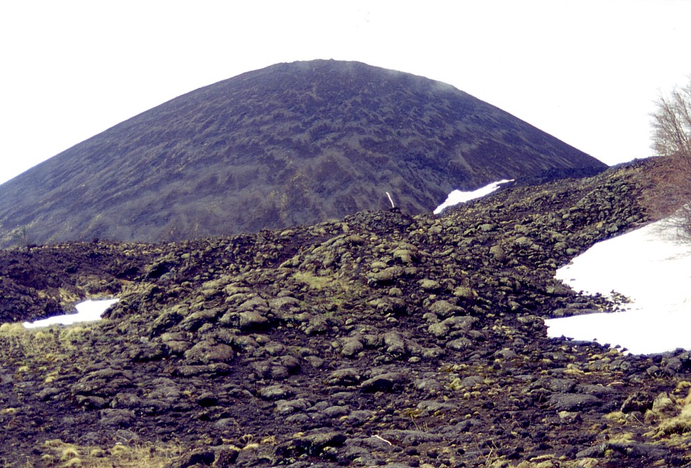
Monte
Nero seen from different directions in May 2000. Left image is a
view from the east, with a small black spatter rampart rising at
the main segment of the 1923 fissure and a black tongue of lava
at left, which was fed from vents higher upslope during the same
eruption. In the center image, Monte Nero is seen from west, with
peculiar wind and solifluction-generated patterns of tephra on its
slope, spatter in foreground are of a small eruption that occurred
three years prior to the formation of Monte Nero, in 1643. Right
photograph is a view from northeast, showing breach in the near
side of the cone and a lower edifice built up along effusive vents
within the breach. The reddish ridge in the left foreground is a
portion of the section of the Monte Nero cone that was entrained
when lava broke through the near side of the cone and entrained
a portion of it to a distance of several hundred meters. Dark lava
seen in right middle ground was erupted from a small fissure in
the breach in 1923. The green feature in right background is Monte
Timparossa |
||
 |
 |
 |
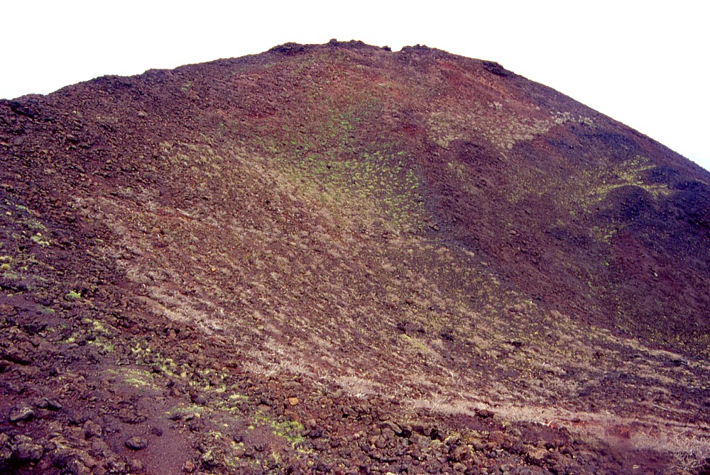
Climb
to the summit of Monte Nero in late May 2000. Left photograph shows
northeast flank of the cone and breach partially filled by spatter
accumulated next to effusive vents active in late stage of the Monte
Nero eruption. Center view is toward the summit area, taken from
about halfway up the cone; here a lava stream is seen at the bottom
of the breach. Photograph at right shows lower portion of the crater
and deep notch evolving into the breach where lava flowed out to
the NNE; view is to the west |
||
 |
 |
 |
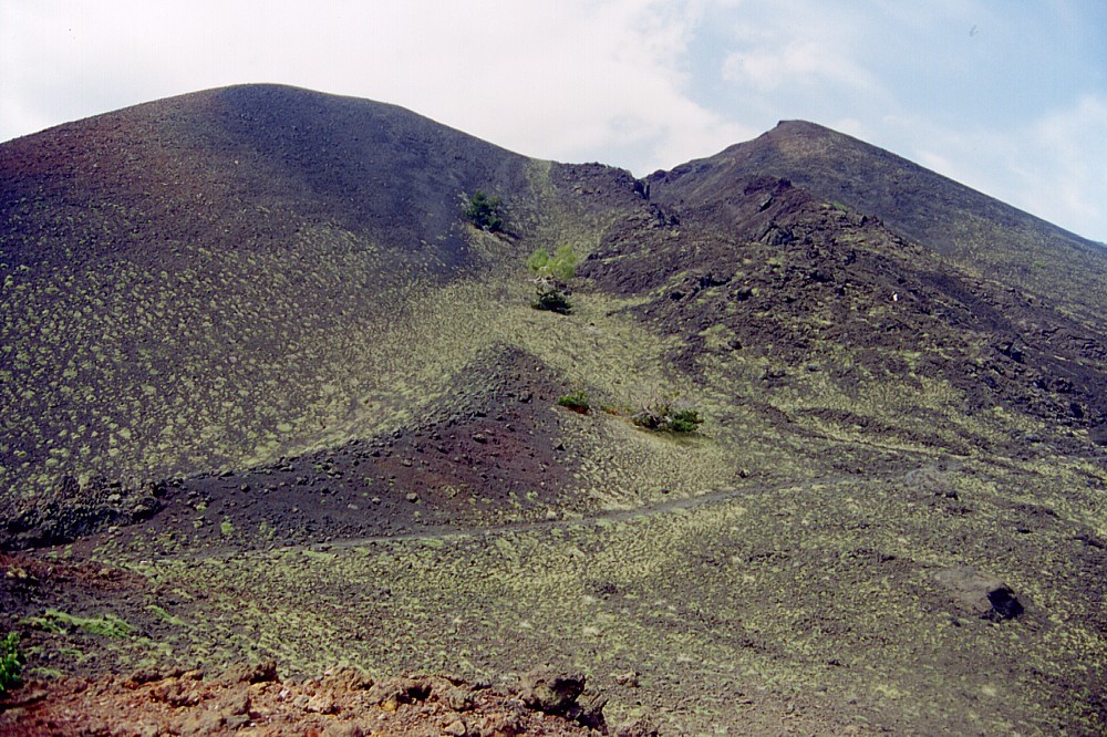
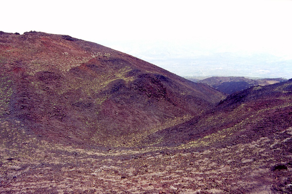
Left
and center: the crater of Monte Nero seen from east (left) and southeast
(center). Note concentric slump features on inner walls of the crater Right: view down the NNE flank of Monte Nero. At the base, a peculiar sub-circular "collar" of reddish-brown rocks was formed when the side of the cone was breached by lava, which entrained the broken sector of the cone to form the "collar". The dark lava on the floor of the depression surrounded by the "collar" was erupted in 1923. Photos taken in late May 2000 |
||
 |
 |
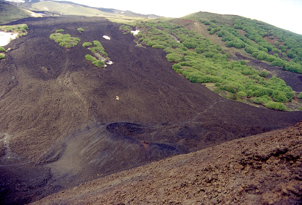 |
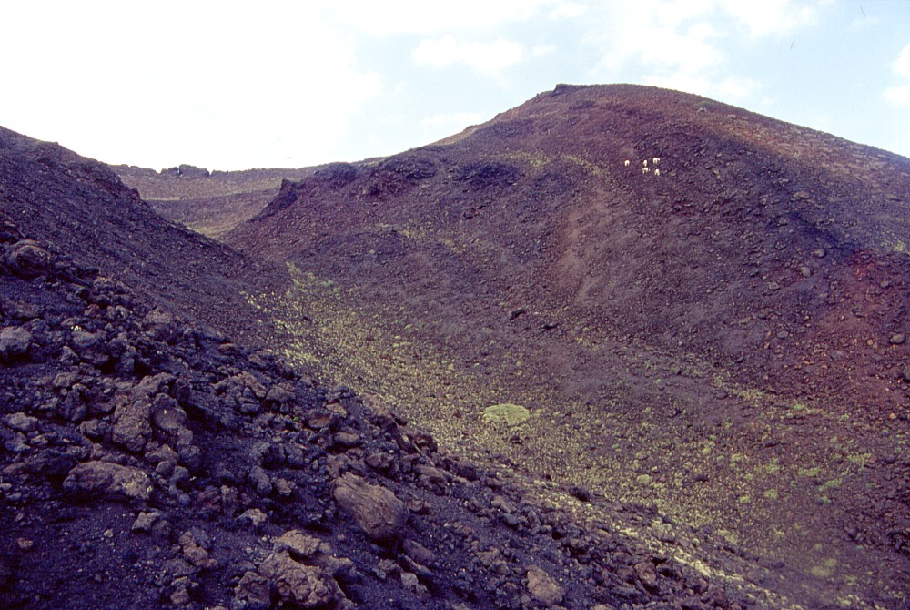
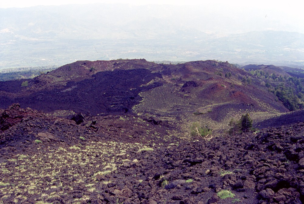
Left:
southern portion of the crater of Monte Nero, seen from southeastern
crater rim Center: spectacular panoramic view from the south rim of the crater of Monte Nero on numerous eruptive vents and cones of different size, shape and color and formed during different eruptions. The large crater seen in center-left part of the image was formed during the same eruption that built up Monte Nero, in 1646-1647, whereas the line of smaller, dark vents on its right (western) side were formed in 1923 Right: view from the same lookout on the south crater rim of Monte Nero but in a more westerly direction. The small horseshoe-shaped cone in the foreground was formed during the 1923 eruption, whereas the age of the dark lavas behind it is not known (it must be quite recent in any case). The cone covered with green vegetation at right is Monte Timparossa. Photos taken in late May 2000 |
||
 |
 |
 |
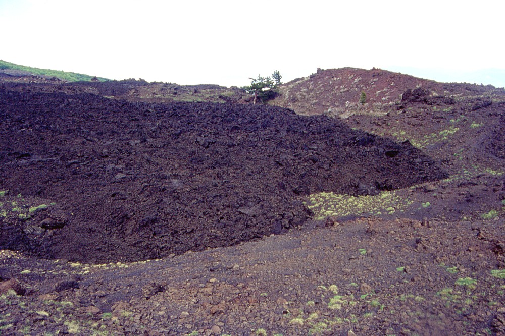
Left:
a remarkably thin tongue of 'a'a lava emitted in 1923 extends from
the northeastern face of Monte Nero to the northeastern margin (in
the foreground) of a wide, flat basin surrounded by the "collar"
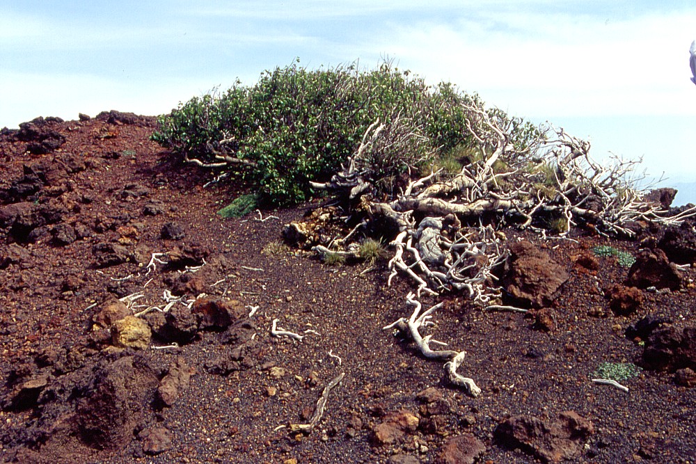
of slumped and entrained material from the cone's flank Center: another view of the 1923 lava lobe, surrounded by the "collar" of debris in the foreground and at right Right: dwarf tree clinging to the crest of the debris "collar" on the northeastern base of Monte Nero. Such plants grow in areas frequently subjected to strong winds. Photos taken late May 2000 |
||
 |
 |
 |
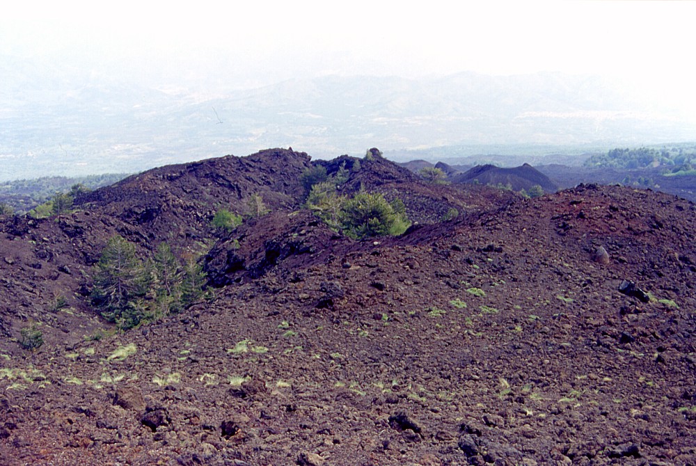
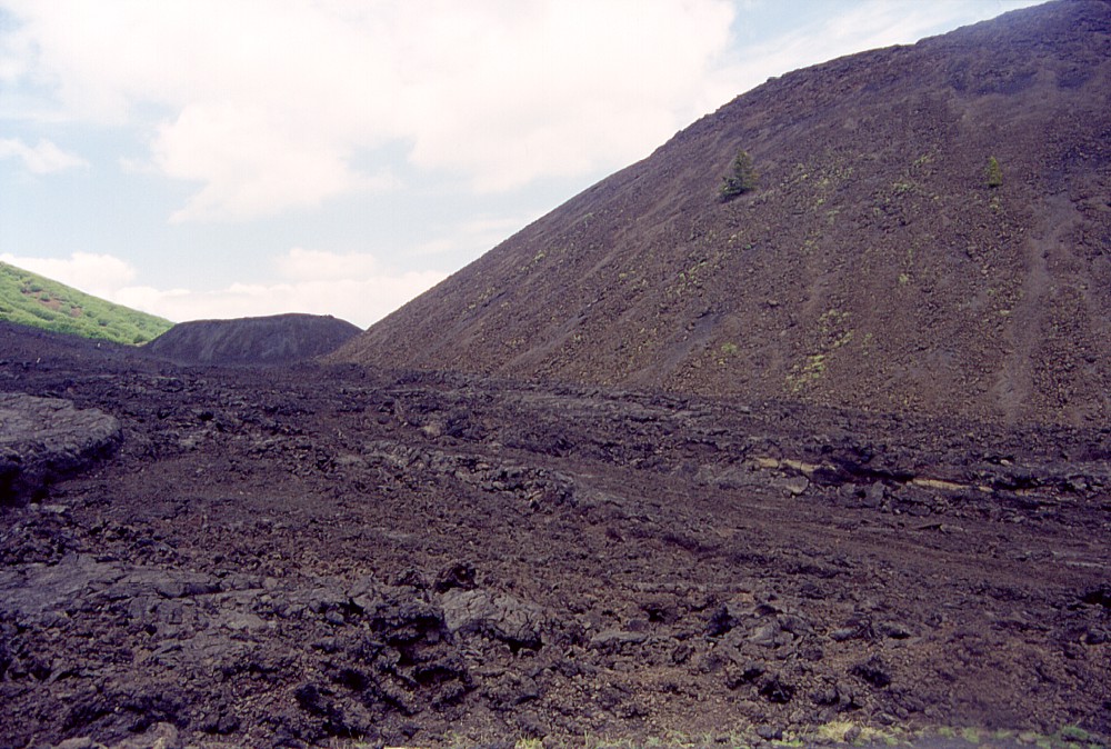
Left
and center: an enormous lava flow-channel extends from the northeastern
rim of the debis "collar" downslope toward the Alcantara
valley (in the background). Nearly 360 years after the eruption
that generated this lava flow, there are only a few scattered pine
trees growing on it Right: Downslope from Monte Nero, the view is across countless lava flows of different ages, the most recent of which were emplaced in 1879, 1911 and 1923. The Alcantara valley and the Nebrodi Mountains are in the background. Photos taken late May 2000 |
||
 |
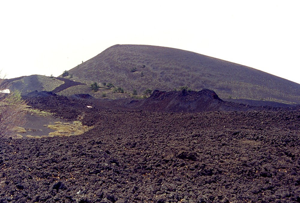
 |
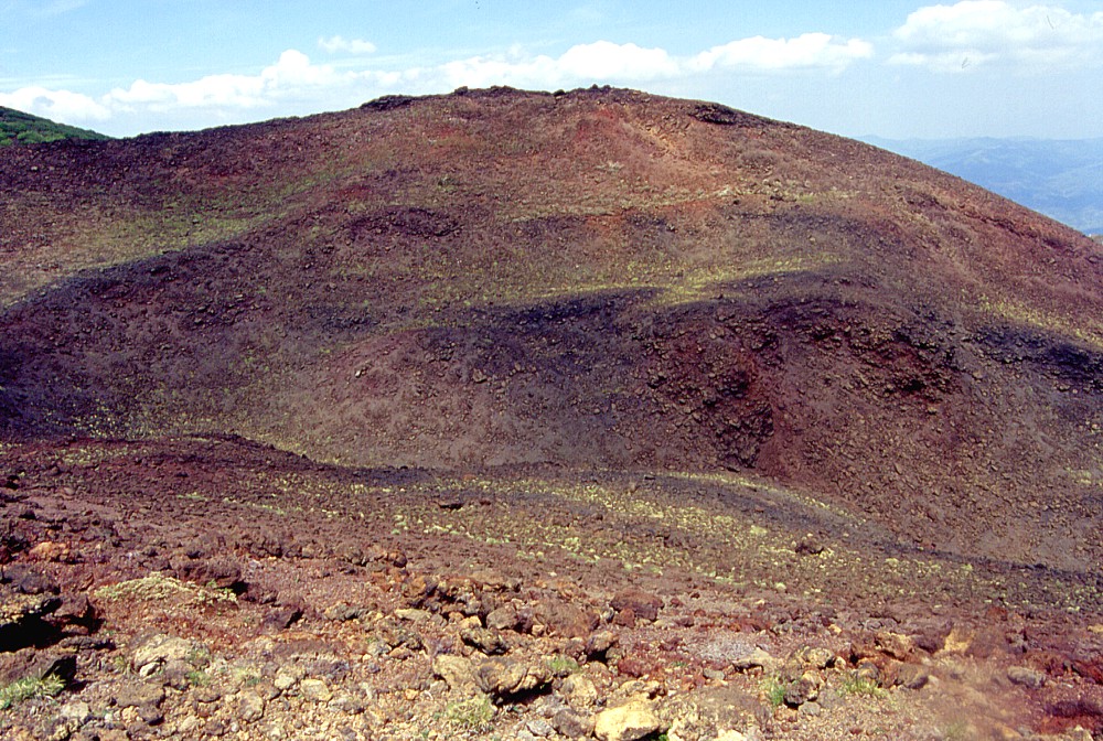
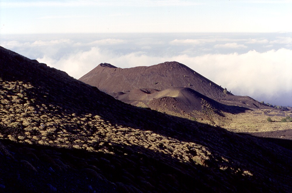
South
face of Monte Nero in early May 2002, showing lava flows of the
1923 eruption in the foreground, and in the right photograph a miniature
cone is seen at the left (southwest) base of the much larger Monte
Nero. This dwarf cone formed also during the 1923 eruption, which
evidently was much less explosive than the Monte Nero eruption nearly
three centuries earlier |
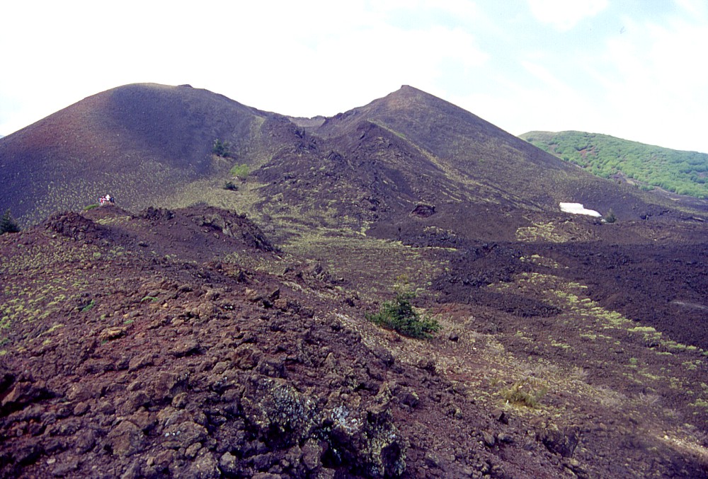
|
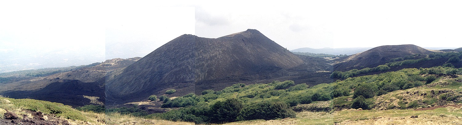 |
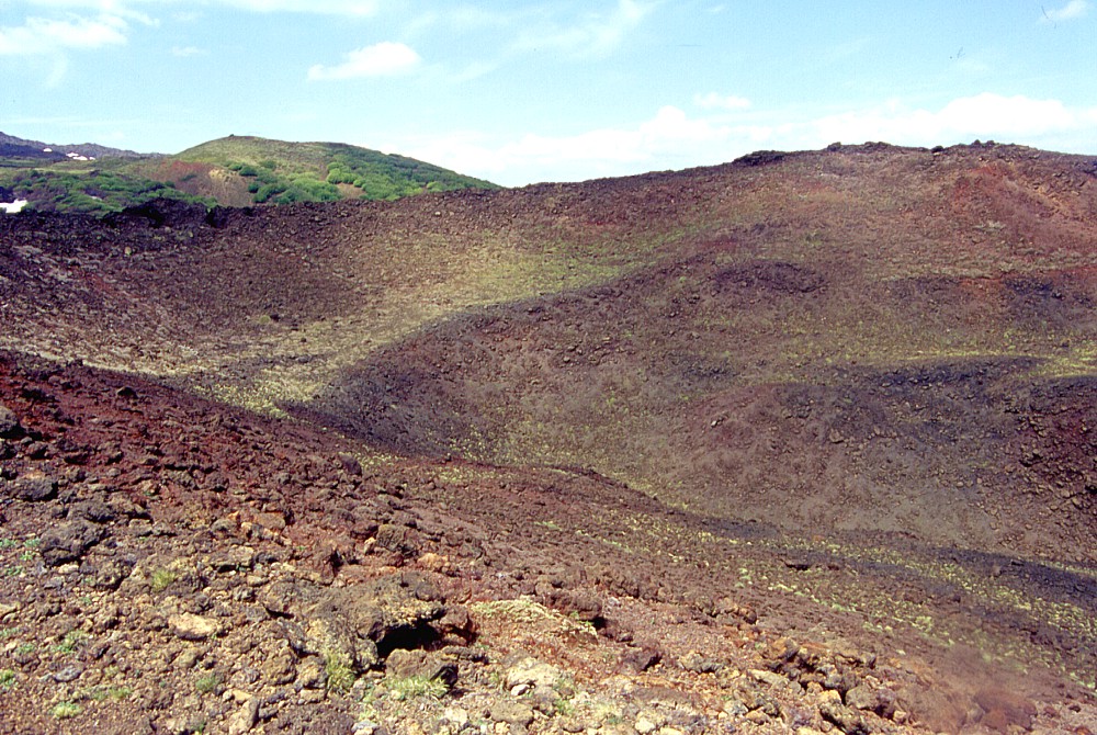
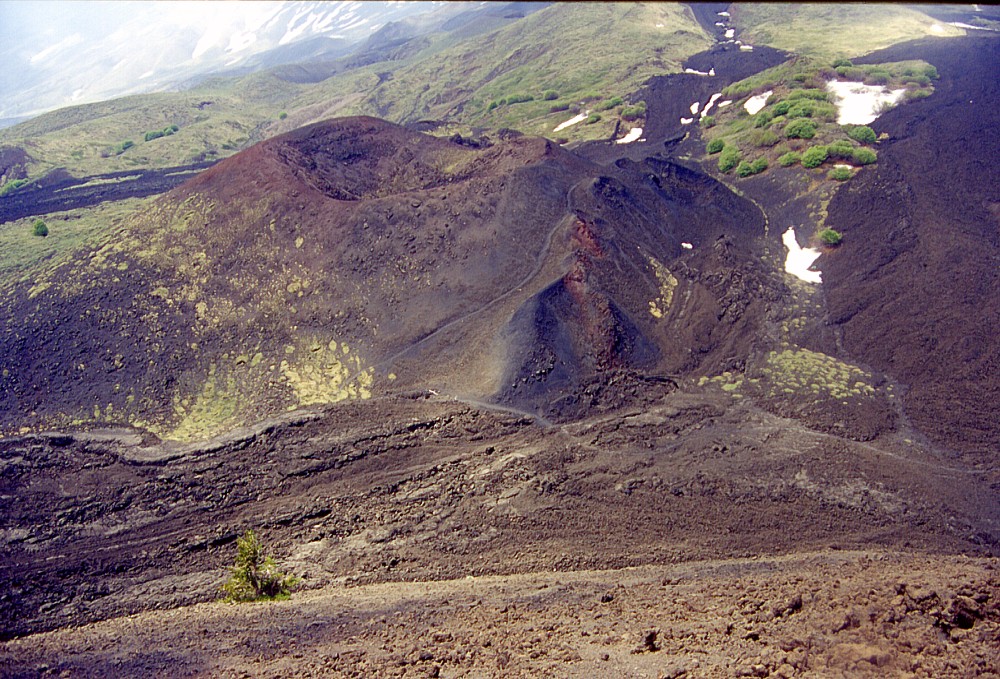
Panoramic
photo mosaic of Monte Nero and its surroundings taken in mid-August
2002 from nearby Monte Timparossa. Black lavas to the left of Monte
Nero are of 1911 and 1923, while the smaller cone to the right (Monte
Ponte di Ferro) was formed during the same eruption that built up
Monte Nero, in 1646-1647 |
 |
 |
 |
Left
and center: Monte Nero and its smaller neighbor Monte Ponte di Ferro
(lying before it in both images) seen one late afternoon in late
September 1999. These photographs were taken from the site where
new craters opened on 27 October 2002, which emitted the lava flows
that devastated nearby Piano Provenzana Right: the crater of Monte Ponte di Ferro is seen in the foreground in this early May 2002 photograph, with the eastern portion of Monte Nero in the background |
||
Copyright © Boris Behncke, "Italy's Volcanoes: The Cradle of Volcanology"
Page set up on 23 February 2004