
| Etna
index |
||
| Geology | Geological history | Cones and craters |
| Eruptive characteristics | Eruptions before 1971 | Eruptions since 1971 |
| Etna and Man | References | Web sites |
| Weather forecasts | FAQ | Latest news |
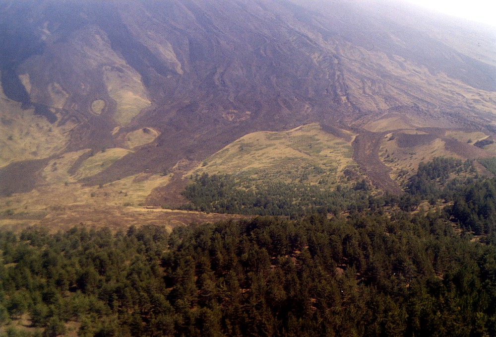 |
Monte
Palestra is the complex of cones seen in the central-right portion
of this photograph, taken from the summit of Monte Rosso, nearly
2 km to the WNW. The relatively sparse vegetation on this cone
cluster is due to the altitude - Monte Palestra lies just above
the tree line, at nearly 2000 m. Its age is unknown, and it is
unknown whether the entire cluster was formed during one single
eruption or different events. Dark lava tongues fed from large
summit eruptions, mostly in 1787, are seen extending down to Monte
Palestra; one lobe spilled down between two cones in the center
and at right. Photograph taken in September 2003 |
Mamma
Etna's countless children
Monte Palestra
W flank, 14.94093° E, 37.74256° N
Summit elevation: 1883 m (W rim of W crater)
![]()
The
origin of the name "Monte Palestra" is uncertain - palestra
in Italian means a sports hall, a gymnasium - no such structure does actually
exist within a range of more than 10 km from this cone. To hikers doing
the spectacular three-day excursion along the Forest Guard Road (strada
forestale) from the "Milia" gate to the northeastern side of
Etna (or vice versa), Monte Palestra marks the highest point of the entire
tour - nearly 2000 m. The cone actually rises to an elevation of 2033
m and is a rather complex feature built on an eruptive fissure with several
vents including two major craters. The upslope side of Monte Palestra
has been largely buried and surrounded by lava flows probably produced
during a large summit eruption in 1787, with some of the upper vents forming
an "island" (named "dagala" in the Sicilian dialect)
within these flows.
About 0.5 km to the NNW of Monte Palestra lies a small but nice mountain
hut of the same name, which offers shelter to hikers that arrive in the
area in the late afternoon and need to spend the night in a protected
place. A cistern generally contains water of sufficient quality to be
used for cooking.
Although I have passed numerous times next to Monte Palestra, I never
climbed it so far. The best photographs of it were obtained when climbing
down the steep western flank of Etna during the massive October-November
1999 eruption at the Bocca Nuova.
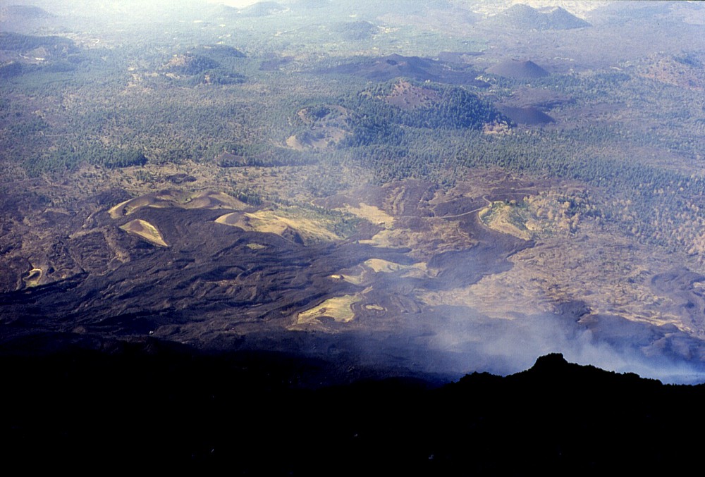 |
Many
of the pyroclastic cones on the west flank of Etna are seen in this
photograph, of which the nearest (covered with yellowish grassy
vegetation, in left center of photograph) is Monte Palestra. From
this perspective (taken high on the steep west flank of Etna's main
edifice) the 1787 and older lava flows fed from summit eruptions
are well visible, which have reached and partly buried the Monte
Palestra cone cluster. The large cone at upper right is Monte Ruvolo,
before it lies Monte Nuovo, and still nearer the densely forested
Monte Rosso, with the small but much younger Monte Mezzaluna at
its northern (right) base; the two summit craters of Monte Capre
are seen still further left. More distant to the left lie the Monti
Nespole and Monte Leporello. Steam rises in the foreground from
an active lava flow that was erupted from the Bocca Nuova (one of
Etna's summit craters) in October-November 1999 and spilled down
the west flank of Etna - the photograph was actually taken on 29
October 1999 |
Copyright © Boris Behncke, "Italy's Volcanoes: The Cradle of Volcanology"
Page set up on 15 December 2003, last modified on 21 February 2004