
| Etna
index |
||
| Geology | Geological history | Cones and craters |
| Eruptive characteristics | Eruptions before 1971 | Eruptions since 1971 |
| Etna and Man | References | Web sites |
| Weather forecasts | FAQ | Latest news |
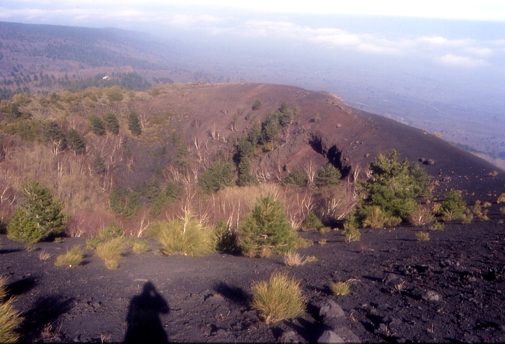 |
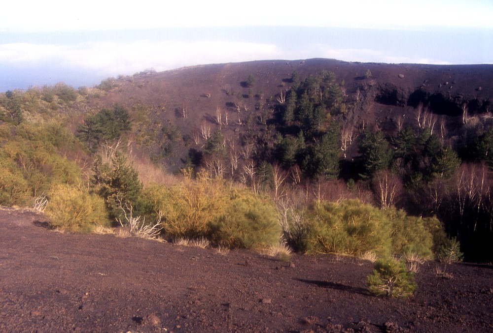
The
impressive crater of Monte Rinatu seen from its south rim on 16
March 2004. Many birch and pine trees grow within the crater,
whose floor lies about 60 m below the point from where this photo
was taken. In spite of the vegetation, the crater still has a
fairly recent aspect and may have formed only a few thousand years
ago. Phreatomagmatic deposits lie on the outer rim of the crater
on the far side, and lithic blocks lie scattered on the outer
slopes of Monte Rinatu |
Mamma
Etna's countless children
Monte Rinatu
ENE flank, 15.063858° E, 37.750389° N
summit elevation: ~1675 m (SW crater rim)
![]()
Almost
invisible from many locations on the ENE flank of Mount Etna, and thus
noted by few visitors, a large pyroclastic cone sits perched immediately
below the crest of the northern rim of the Valle del Bove, which is here
called Serra delle Concazze. This cone is Monte Rinatu. The name may mean
"the sandy mountain" ("rina" in Sicilian means sand,
and "rinatu" may mean "covered with sand" or "sandy");
it is actually covered with abundant tephra of the 2002-2003 eruption
but the name was given to it long before that eruption. Another possibility
is that is derived from "rinato", re-born, which would make
sense if it were of historical age. However, the date of its formation
is not known; it seems that it occurred in prehistoric time because the
lower slopes of the cone are covered with thick soil. It has a well-preserved,
deep summit crater, whose floor lies 30 m below the lowest crater rim
(on the north side) and more than 100 m below the high southwestern crater
rim, which now bears many trees, including abundant birch trees. Due to
its position on a steep slope, the cone is highly asymmetrical, rising
more than 100 m above its eastern base, but on its southwest side the
crater rim merges with the crest of the rim of the Valle del Bove. The
upper portion of the cone, which bears little vegetation, shows abundant
evidence for phreatomagmatic activity in the closing stages of the cone-building
eruption: large lithic blocks lie strewn on the surface, and the topmost
deposits exposed on the crater rim are of typical yellowish color and
rich in dense lithic blocks. The area around Monte Rinatu is strongly
dissected by deep ravines, which have been eroded by narrow torrents.
In spite of - or maybe because of - its relative isolation, Monte Rinatu
is one of the most suggestive places to visit in the area, because it
offers awesome panoramic views of the Valle del Bove with Etna's summit
craters at its head, and over the ENE flank with the lava flows of 1928
and 1971. A dirt road passes at the eastern base of the cone but there
is no well-marked footpath to its summit so that visitors have to struggle
their way through dense forest before arriving on the nearly barren crater
rim on the east side. The descent should be made on the same side, whereas
it should be avoided to descend on the north side, which is steep and
terminates at its base at the near-vertical sides of the bed of a torrent.
Among the many cones on Etna's flanks that I have visited over the years,
this is one of the most impressive to see, especially for the marvellous
panoramic views. Furthermore it lies far away from the tourist routes
and visitors will find themselves in a place of profound peace, unspoiled
by the unpleasant practice of many local people to drop their garbage
in the place after a picnick. Monte Rinatu cannot be reached by car and
therefore most local people do not choose to go there for picnicking.
I climbed Monte Rinatu on 16 March 2004, after having visited for the
first time Monte Salto del Cane,
on the south flank.
 |
 |
 |
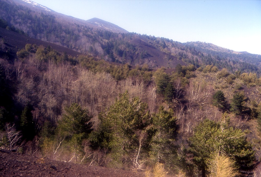
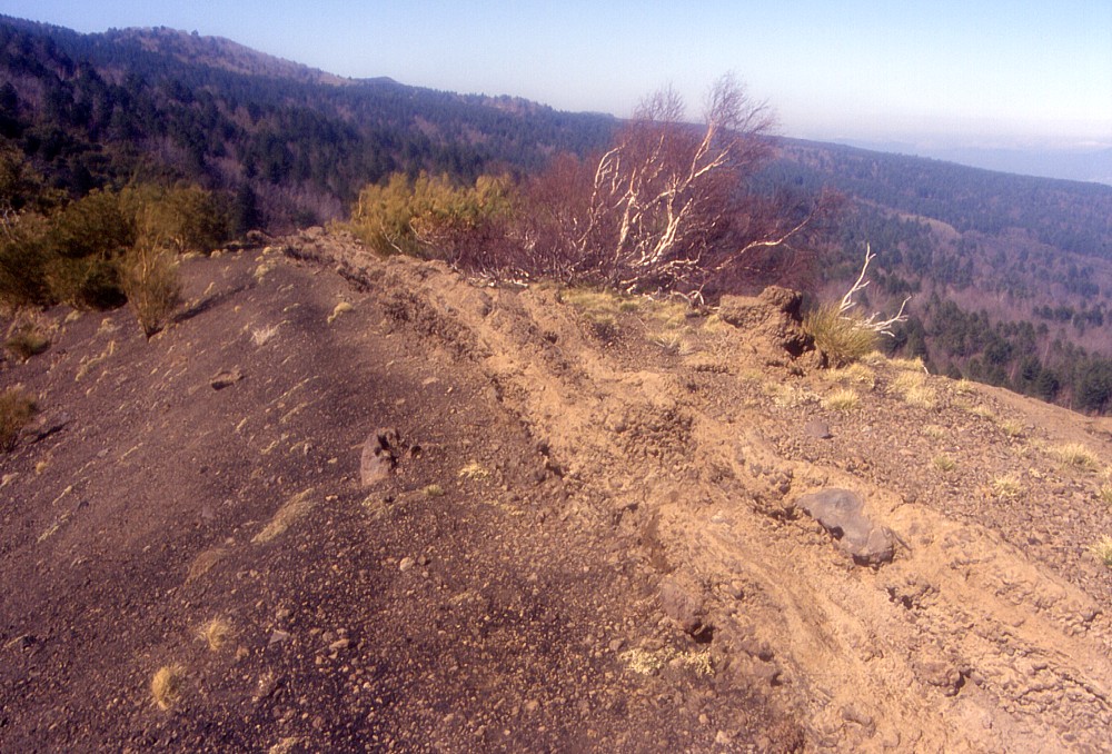
The
crater of Monte Rinatu seen from different directions. Left is
a view from ENE, with Monte Frumento delle Concazze in the background.
The center view is from east, while Monte Frumento delle Concazze
remains a prominent feature in the background. In the right image,
the crater is seen from ESE. The small yellowish knob at extreme
right is made up of phreatomagmatic deposits. Photos taken 16
March 2004 |
||
 |
 |
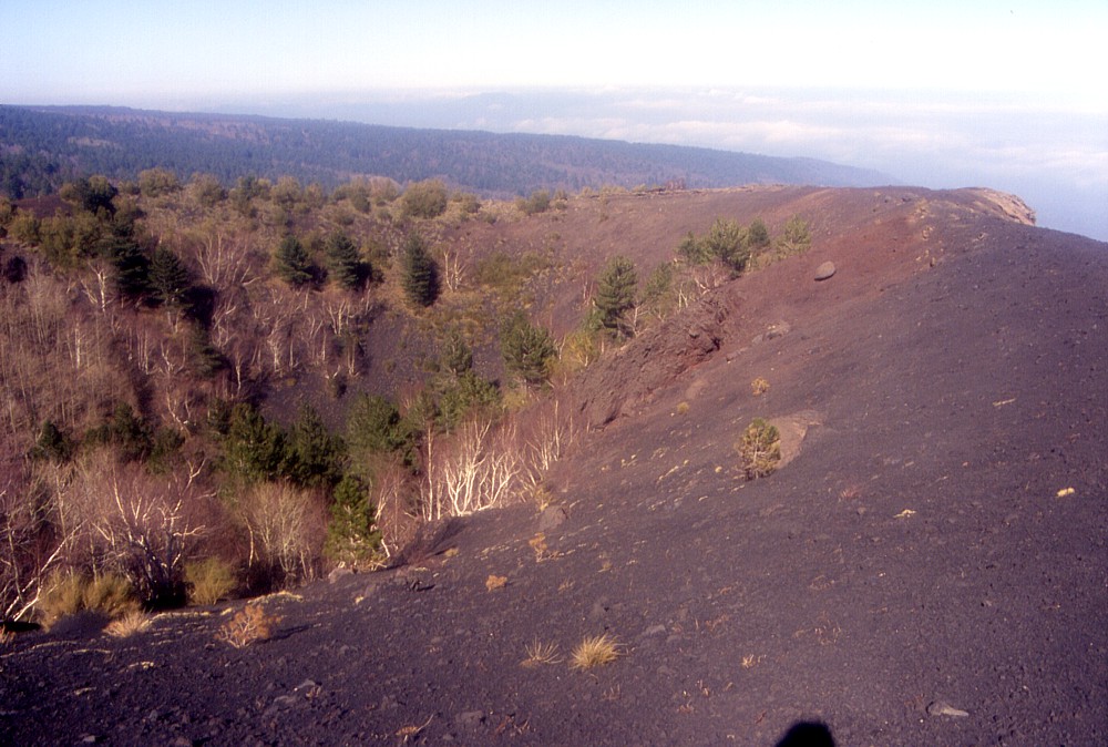
Crater
of Monte Rinatu seen from southeast (left) and west (right). Photos
taken 16 March 2004 |
|
 |
 |
 |
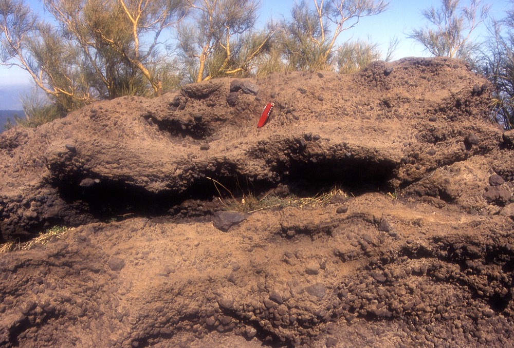
Evidence
for phreatomagmatic activity at the end of the eruption that created
Monte Rinatu: the topmost deposits exposed on the crater rim show
a peculiar yellowish color (compared to the more typical reddish
brown or black color of scoriae produced by magmatic activity),
are rich in lithic blocks (as seen in the center photograph, where
Swiss knife 9 cm long serves as a scale) but also contain discontinuous
horizons of very fine-grained material. Left and center photos
were taken on the northern crater rim, while right image shows
the northeast rim of the crater. Photos taken 16 March 2004 |
||
 |
 |
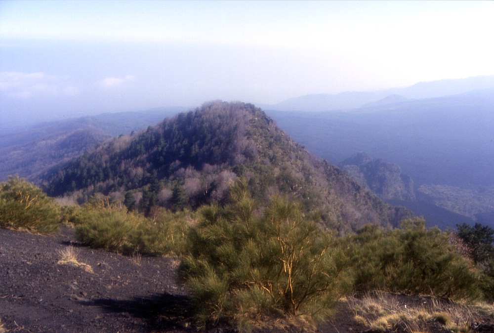 |
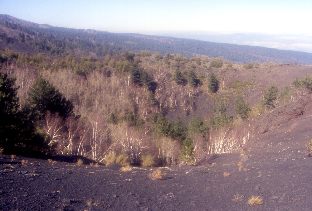
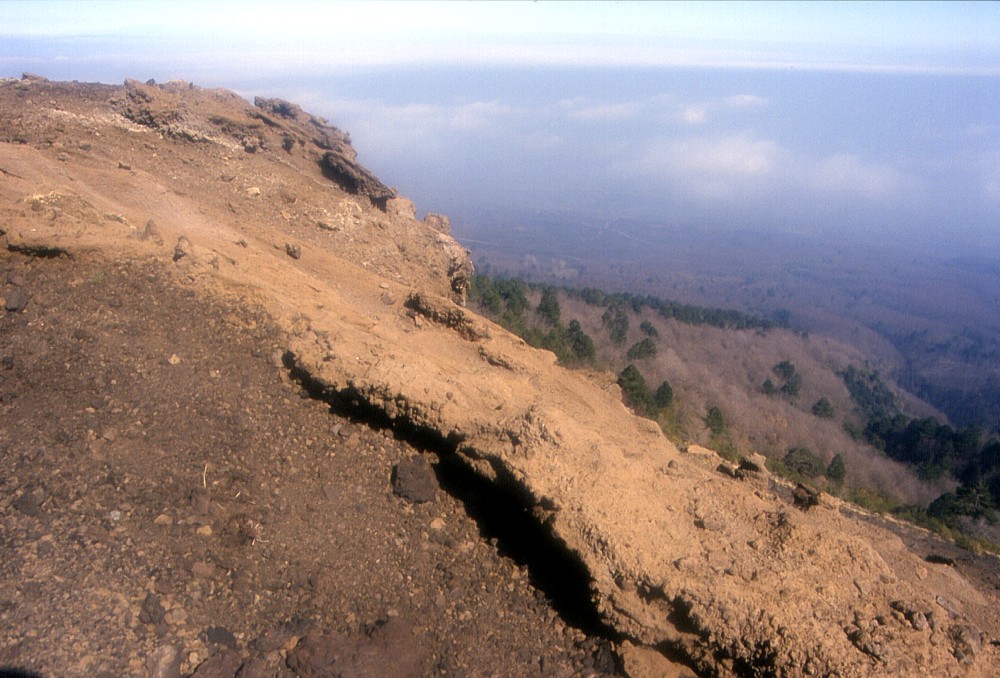
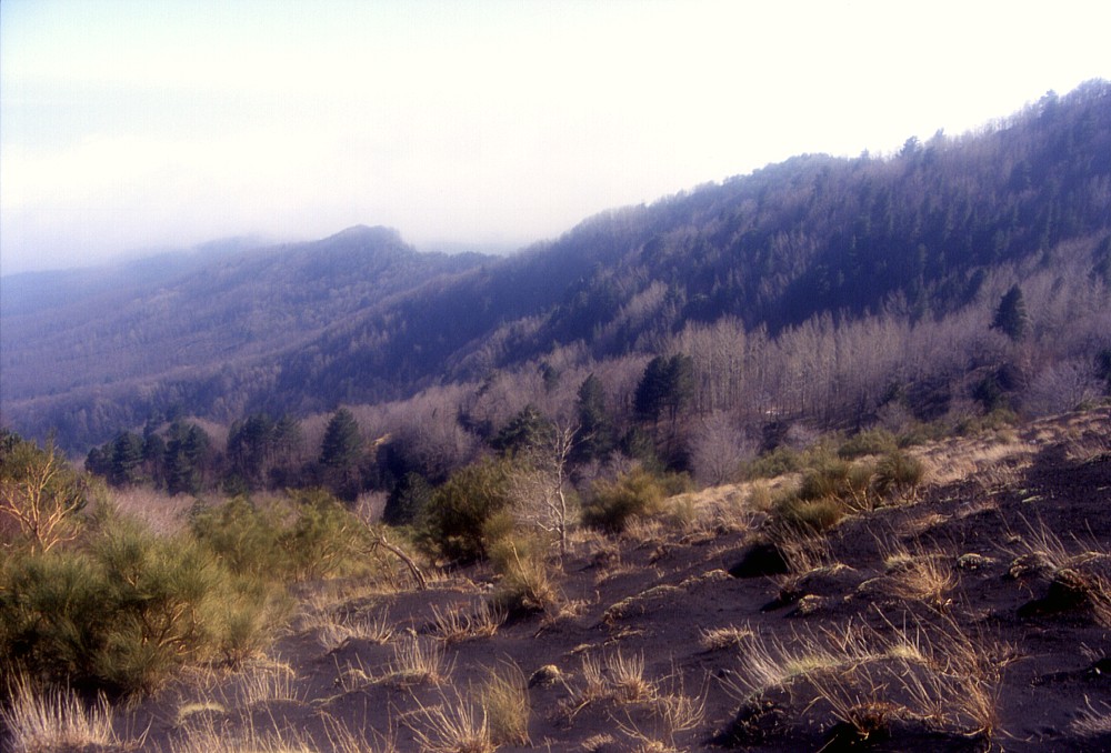
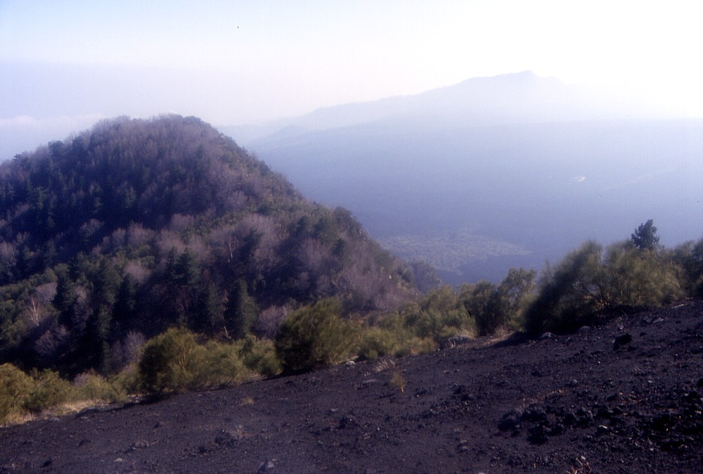
These
photos give just a few examples of the fine panoramic views that
can be enjoyed from Monte Rinatu. They all show the northern rim
of the Valle del Bove, known as the Serra delle Concazze, which
actually consists of numerous spurs separated by deep incisions.
The steep peak seen in center and right photos is Monte Scorsone.
In the center photograph, Monte Zoccolaro, a prominent peak on
the south rim of the Valle del Bove about 4.1 km to the south
of Monte Rinatu, is seen in the distance. Photos taken 16 March
2004 |
||
Copyright © Boris Behncke, "Italy's Volcanoes: The Cradle of Volcanology"
Page set up on 16 March 2004, last modified on 21 March 2004