
| Etna
index |
||
| Geology | Geological history | Cones and craters |
| Eruptive characteristics | Eruptions before 1971 | Eruptions since 1971 |
| Etna and Man | References | Web sites |
| Weather forecasts | FAQ | Latest news |
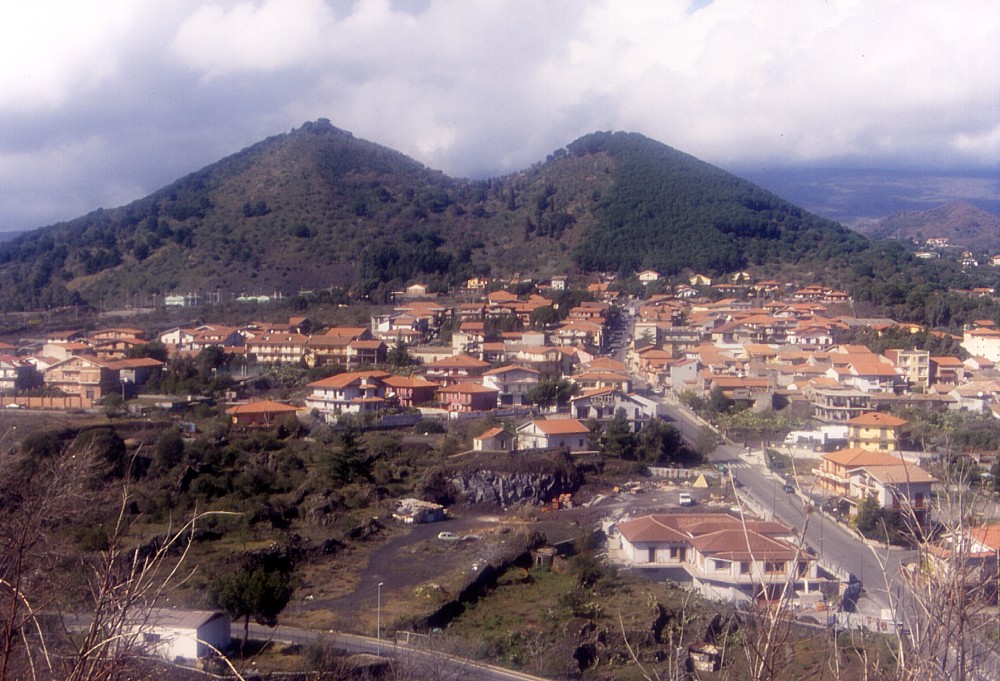 |
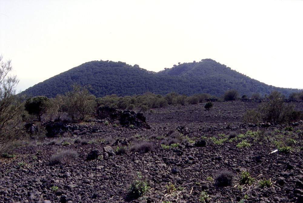
The
characteristic twin-peaked silhouette of the Monti Rossi looms
over recently constructed homes in a residential area in the western
part of the town of Nicolosi, which have been built on the lava
that issued from a vent at the base of the cone. This view is
from the north side of Mompilieri,
an older pyroclastic cone lying about 1.5 km to the SSE, which
is completely surrounded by the lavas that were produced during
the eruption of the Monti Rossi in 1669. Most of the vegetation
on the Monti Rossi has is a result of afforestation; until the
mid-20th century the cone was covered with very little vegetation.
Photo taken on 28 February 2004 |
Mamma
Etna's countless children
Monti Rossi (1669 eruption)
S flank, 15.010978° E, 37.618951° N
summit elevation: 945 m (W rim of crater)
![]()
Among
the numerous pyroclastic cones that lie on the middle to lower southern
and southeastern flanks of Mount Etna, the conspicuous twin-peaked cone
of Monti Rossi immediately next to the town of Nicolosi is the largest
and youngest. It was built by intense explosive activity during the devastating
1669 eruption, which also deposited many
meters of pyroclastics over a wide area around the cone and caused widespread
ash falls that probably were much more severe than those experienced by
the local population during the 2002-2003 eruption. When the eruption
finally ended after four months of inferno, a huge new mountain stood
where previously there had been a small, older pyroclastic cone. A vast
area around it had been transformed into wasteland, 15 towns and villages
had been buried under lava and several others seriously affected by heavy
tephra falls, the city of Catania had suffered considerable damage in
its western part, its harbor had been filled by lava, and enormous quantities
of precious fertile land were destined to lie barren for centuries. With
this balance (which, fortunately, did not include any human fatalities),
the people living in the area easily found a name for the new mountain
that had spread all that devastation: Monte della Ruina (mountain of destruction).
This was the name originally given to what later was re-named Monti Rossi
- which could either refer to the reddish color of the scoriae making
up the cone, or be a local corruption of "Monti Grossi", which
means "Big Mountains". The application of the plural form of
the name is due to the two prominent peaks at the summit of the cone,
which are nothing else than the two high points on the eastern and western
rims of its complex summit crater, which has a N-S diameter of nearly
400 m. This crater contains a large central, a smaller northern and a
very small southern vents, the largest of which has a diameter of 320
m with its floor lying 100 m below the high western rim (945 m high).
The eastern crater rim is about 15 m lower than the western rim, and the
total height of the cone above its southern base is more than 200 m, making
this one of the largest of Etna's flank cones, and the largest formed
in historical time. Deep notches lie in the northern and southern crater
rims, and a trench-shaped depression extends from the latter on the south
flank of the cone. Lava was presumably emitted from the lower end of this
trench, but there is some evidence that further effusive vents lay further
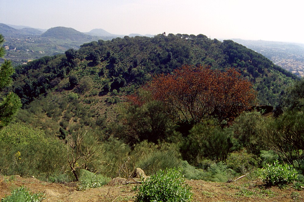
south, on the south base of the nearby and older Mompilieri.
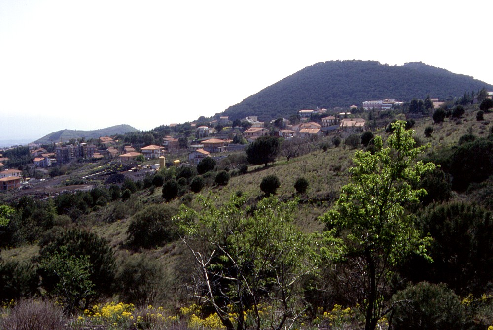
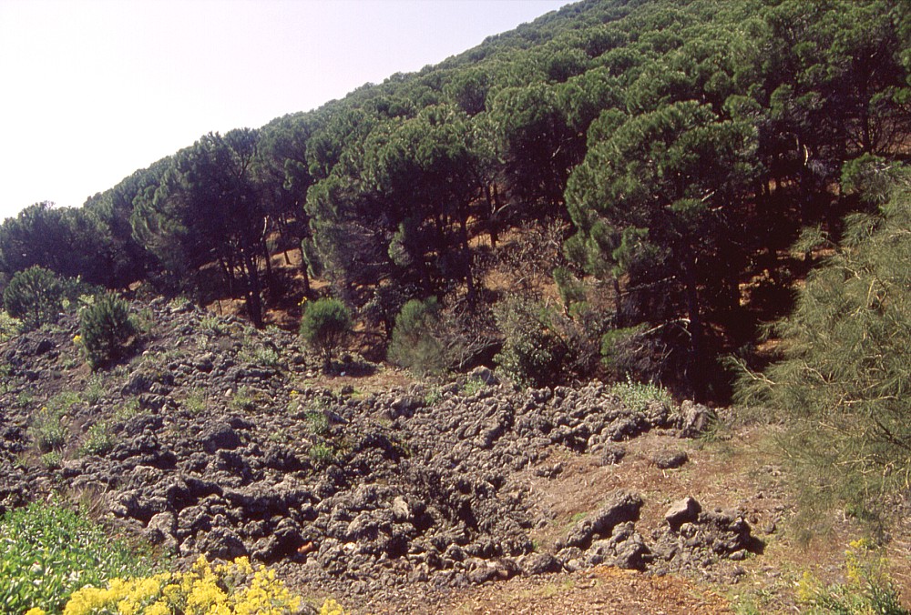
Through the mid-20th century, only grasses and small bushes grew on the
Monti Rossi, but afforestation started in the 1950s resulted in the growth
of a beautiful pine forest which is now the public park of the nearby
town of Nicolosi. A network of trails leads up and around the cone, from
which in some places fine panoramic views can be obtained. The most impressive
element of these views is the incredibly dense urbanization of the areas
surrounding the Monti Rossi, including the lava flow-field of 1669, which
is still nearly barren where no new constructions have been placed on
it. Inevitably the thought springs into the mind what would happen were
this eruption to occur nowadays: back in 1669 there were fifteen distinct
villages in the path of the lava flow. Now there is virtually no space
left between one town and the other, except in the western part of the
1669 lava flow-field. While Monti Rossi will never erupt again, a future
eruption may occur anywhere next to it and cause a disaster that would
dwarf that of 1669.
Monti Rossi was the first of Etna's flank cones I ever climbed, on the
morning of 23 September 1989, during my first visit to the volcano. Those
days I stayed in the Hotel Gemmelaro, at the northeastern base of the
cone, and my first exploration of the immediate surroundings led up to
the eastern summit. Since then I have returned several times to the Monti
Rossi and walked nearly every path on it. The photos on this page were
taken during many of those visits.
 |
 |
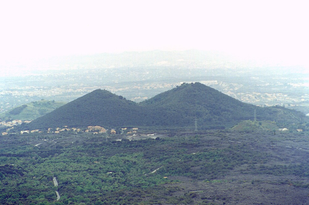
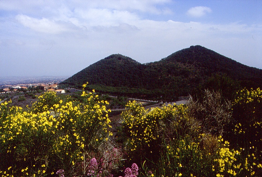
Left:
distant view of the Monti Rossi from Monte Gemmelaro (formed during
the 1886 eruption), about 6.5 km to the north, taken on 10 May 2000.
The crater of this cone lies between the two peaks, which lie about
320 m distant. Behind Monti Rossi to the left is a part of the older
and much smaller Mompilieri. Still smaller, and distinct for the
lighter green color, prehistoric Monte Fusaro lies in front of the
right base of the Monti Rossi Right: northern face of the Monti Rossi seen from about 0.7 km distance, 22 April 2000. Vineyards and fruit gardens are in the foreground, and the complex of the Hotel Gemmellaro lies at the left (northeastern) base of the cone |
|
 |
 |
 |
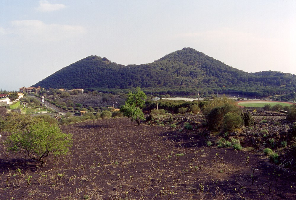
Different
views of the Monti Rossi: from northeast (left, 15 April 2000),
NNE (center, 15 April 2000), and NW (right, 24 May 2001). Left photograph
shows the summit of Mompilieri in left background; right photograph
was taken from Monte Fusaro, 0.7 km away |
||
 |
 |
 |
Left:
northeastern base of the Monti Rossi, with the most advanced lobe
of lava of the 1886 eruption (of Monte Gemmellaro) in the foreground.
This lava flow advanced menacingly close to Nicolosi and only stopped
in the moment when the veil of the patron saint of Catania, Agata,
was carried to the lava front (this is described as the most recent
ascertained miracle done by S. Agata) - maybe the veil was brought
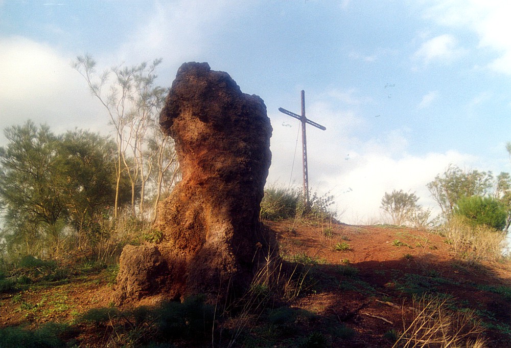
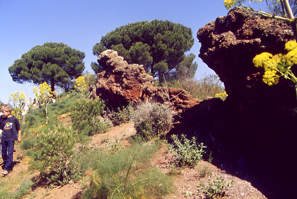
there just in the right moment... Photo taken 8 April 2001 Center: view from the western crater rim of the Monti Rossi across the largest of the three vents within the crater, with the eastern crater rim in the background, 8 April 2001. In the background are several other pyroclastic cones on the south and southeast flank of Etna Right: cross standing on the high eastern rim of the Monti Rossi crater, and peculiar rock formation sculptured probably by wind erosion during the more than 300 years since the crater formed in 1669. Photo taken 31 October 2003 |
||
 |
 |
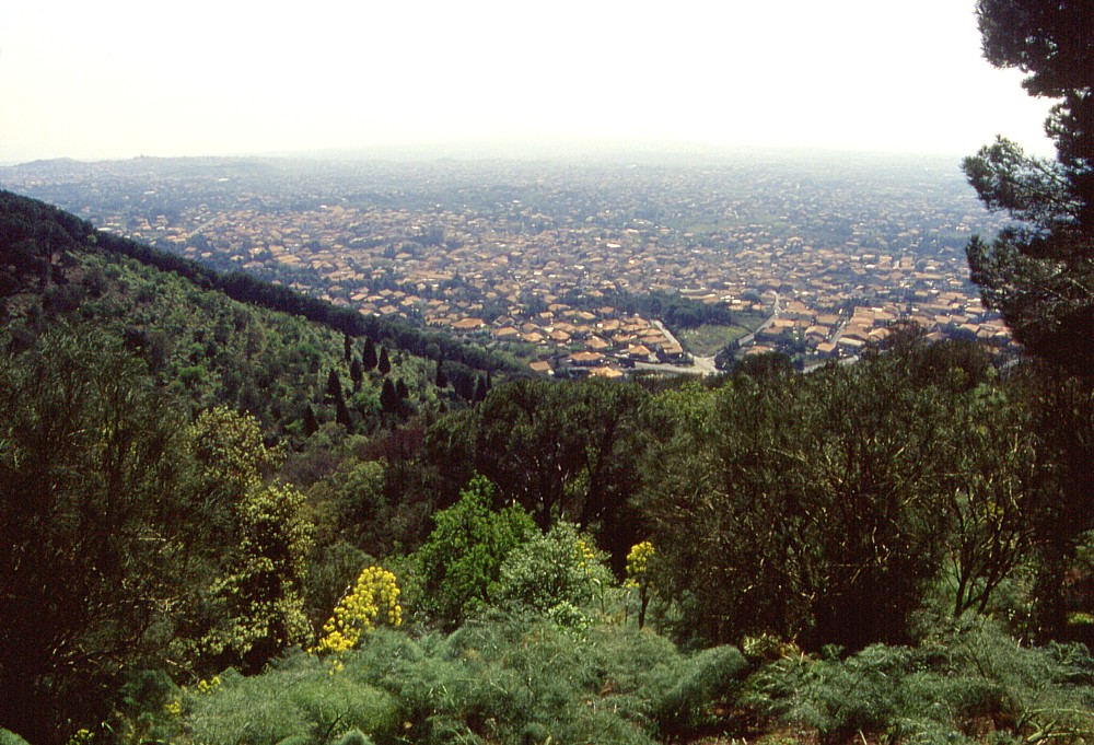 |
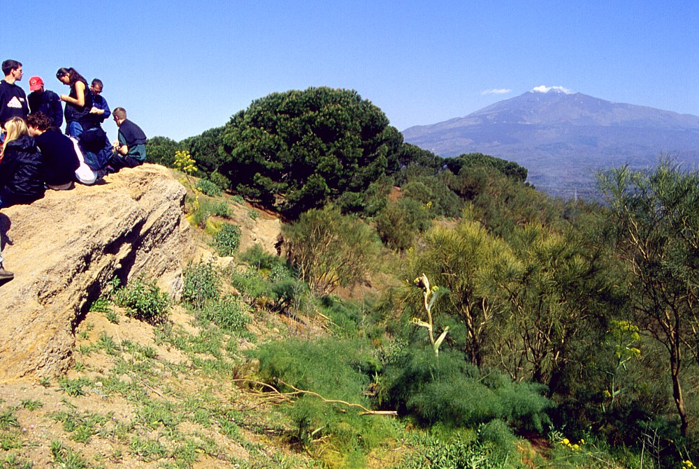
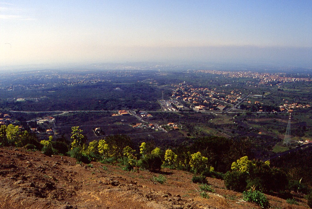
Left:
school kids from Switzerland on the highest point on the western
crater rim of the Monti Rossi, with Etna's main edifice in the distance.
Note fumarolically altered rocks that make up the crater rim in
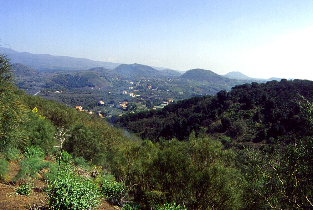
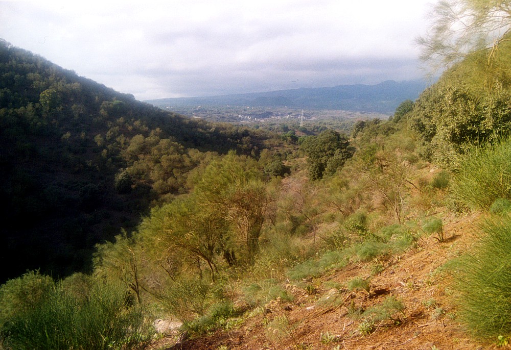
left foreground Center: view from the east rim of the Monti Rossi crater over the largely barren western portion of the 1669 lava flow-field. The town of Belpasso lies in the distance at right. Belpasso was rebuilt after its predecessor (ominously named Malpasso) was buried under the 1669 lava Right: view from approximately the same spot as in previous photograph, but this time over the eastern portion of the 1669 lava flow-field, which is covered with an endless quantity of buildings. Photos taken 8 April 2001 |
||
 |
 |
 |
Different
views of the interior of the Monti Rossi crater, seen from its central
portion. In the left image, the view is from the septum between
the northern and central vents toward north, with Etna's main edifice
in the background, showing low northern crater rim. Center photo
shows the same area but from a position further east, with outcropping
fumarolically altered scoriae and bombs in the foreground. The view
in the right image is to the southwest, showing high western crater
rim and septum separating the northern vent (foreground right) from
the larger central vent. Photos taken 8 April 2001 |
||
 |
 |
 |
Left:
southern part of the central vent within the crater of the Monti
Rossi, showing low south rim of the crater at left Center: outcrops of fumarolized reddish scoriae on the southwestern rim of the Monti Rossi crater Right: view from the southwestern crater rim of the Monti Rossi toward northeast, with numerous other flank cones in the distance. Photos taken 8 April 2001 |
||
 |
 |
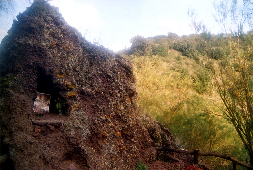 |
Left
and center: views of the low northern (left) and southern (center)
crater rims of the Monti Rossi on 31 October 2003 Right: outcrop of reddish scoriae within the crater of the Monti Rossi, at western end of the septum that separates the northern and central vents within the crater, transformed into a simple shrine for Sant'Agata, the patron saint of Catania. Photo taken 31 October 2003 |
||
Copyright © Boris Behncke, "Italy's Volcanoes: The Cradle of Volcanology"
Page set up on 14 March 2004