
| Etna
index |
||
| Geology | Geological history | Cones and craters |
| Eruptive characteristics | Eruptions before 1971 | Eruptions since 1971 |
| Etna and Man | References | Web sites |
| Weather forecasts | FAQ | Latest news |
 |
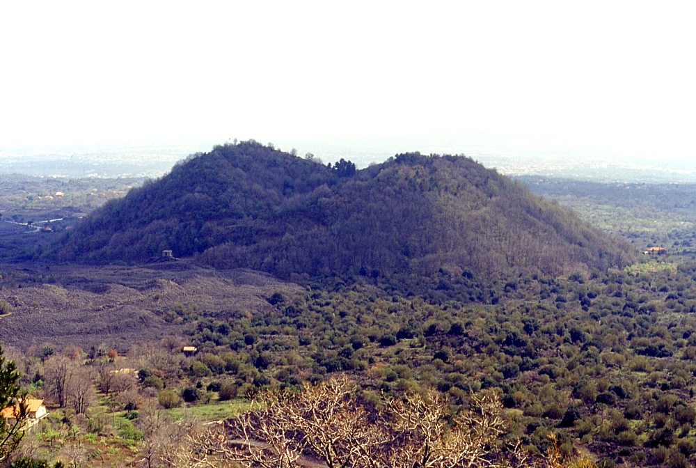
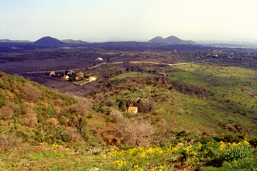
Mighty
cone of Monte S. Leo rises about 150 m above the surrounding landscape,
and two peaks differing about 10 m in height (the eastern peak,
to the right, is actually the higher, 1194 m) mark its summit
area. The crest between the two peaks separates two large summit
vents, of which the southern one is seen here, having a characteristic
notch on its south side. A low lava shield produced by an effusive
vent at the southeast base of the cone is seen in the foreground,
with a beautiful land villa standing on its side. Photograph taken
on 22 April 2000, looking northwest |
Mamma
Etna's countless children
Monte San Leo
S flank, 14.985100° E, 37.654566° N
Summit elevation: 1194 m
![]()
Impressive
sentinel standing to the left once the drive up Etna's south flank enters
into its serious phase, Monte S. Leo is a morphologically youthful cone
rising nearly 150 m above its southwestern base. Crowned by an irregular
summit crater with two vents, both inclined to the north and south, respectively,
this cone is certainly Holocene in age, and probably erupted sometime
during the past few thousand years. Its stratigraphic relationship with
the 122 B.C. tephra layer (produced by a powerful summit eruption; Coltelli
et al. 1998) indicates that it is older than that date (Del Carlo and
Branco 1998).
Monte S. Leo lies at the southern margin of a zone with a high density
of flank cones extending uslope on the south flank to the Montagnola (now,
after the 2001 and 2002-2003 eruption, this zone extends even higher upslope),
which is the main portion of the South Rift of Etna. To the south and
southeast, there is a gap in the rift, which then continues at Monte
Serra Pizzuta (about 3.5 km SE of Monte S. Leo) with another area
of densely clustered cones and opens fan-wise to the southeast.
Besides the main pyroclastic edifice of Monte S. Leo there is a smaller
(mostly effusive) vent at its SSE base, forming a circular pit several
tens of meters deep and surrounded by a low shield about 35 m high. This
probably formed during the same eruption that built up Monte S. Leo. It
is now occupied by private terrains with fine land villas. A small cluster
of private homes (some of them permanently inhabited) lies immediately
to the east. In contrast to this well-maintained area, the northern side
of Monte S. Leo has a somewhat desolate aspect, with illegal waste disposals
and never-completed buildings constructed without authorization.
I visited and climbed Monte S. Leo on 22 April 2000, when most of these
photographs were taken.
 |
 |
 |
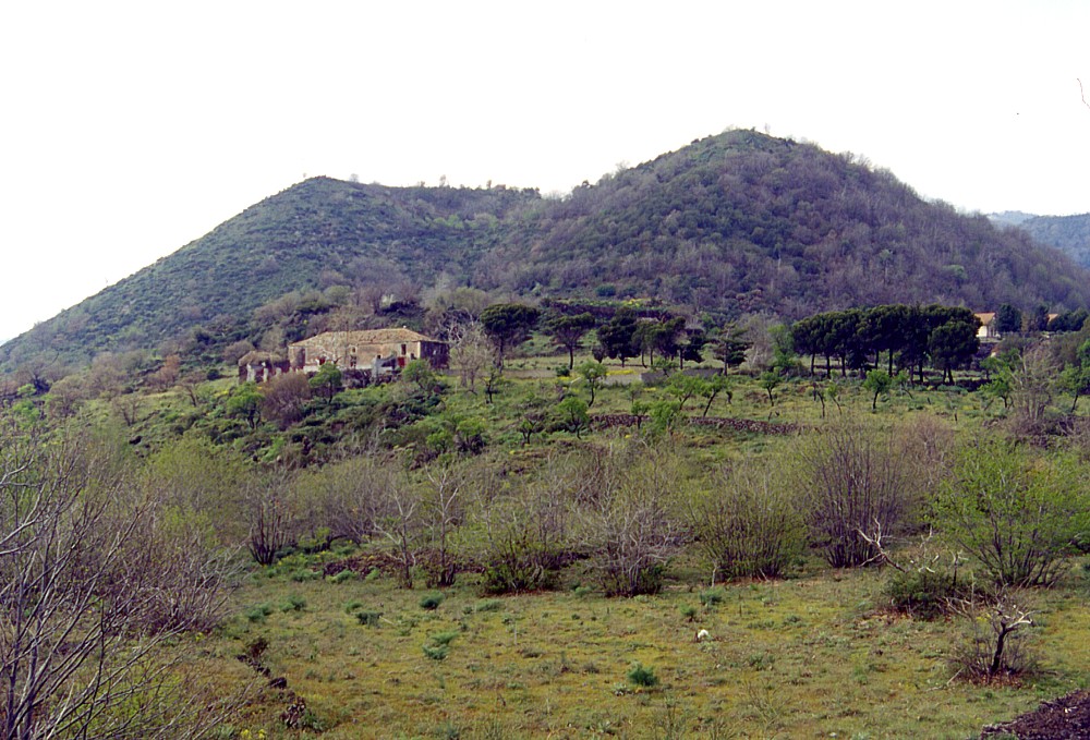
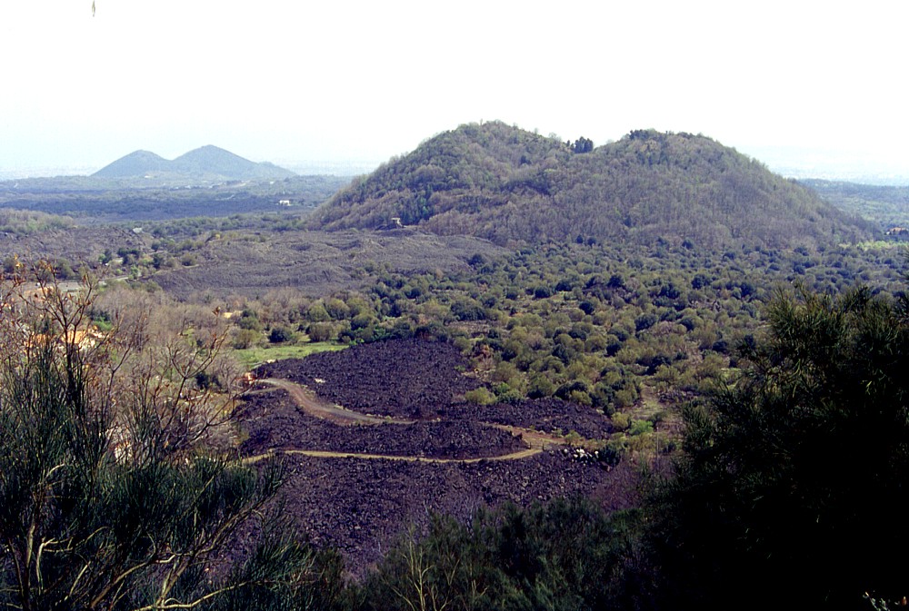
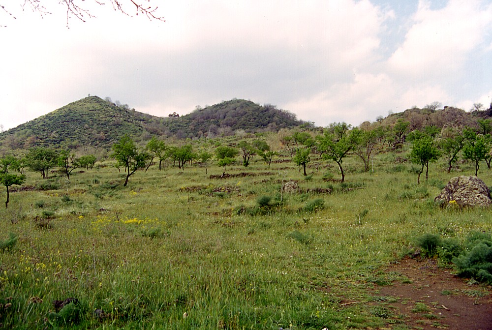
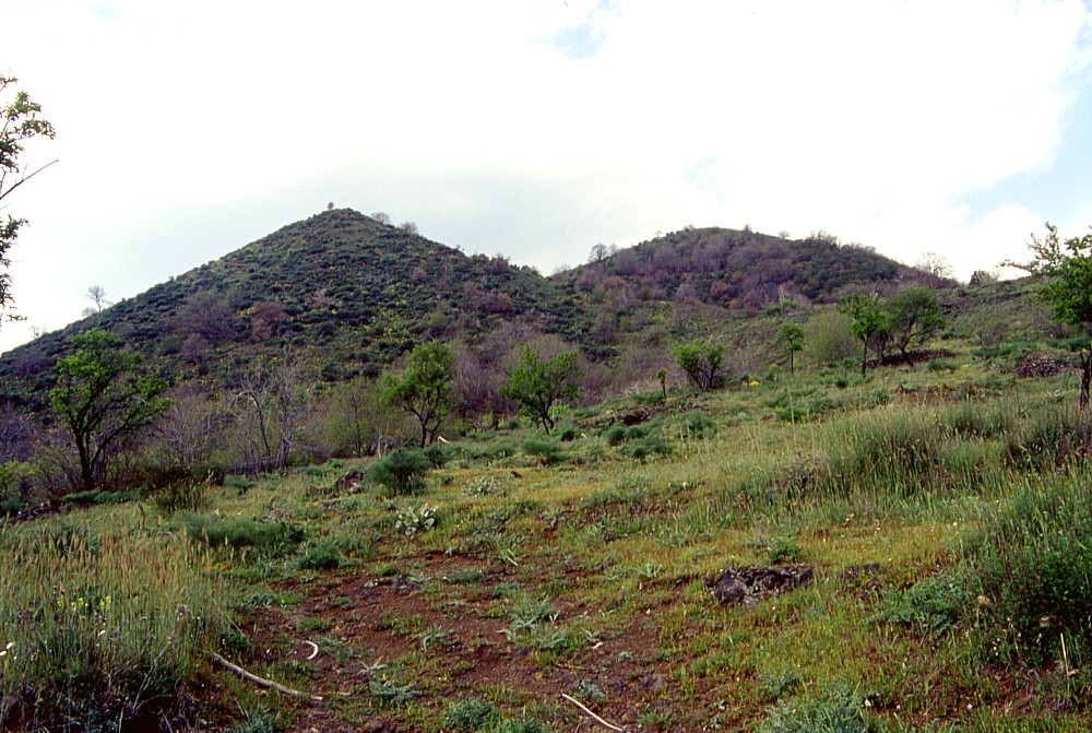
Distant
views of Monte S. Leo. Left image is a view from Monte
Gemmellaro, 3.3 km to the northeast, taken on 10 May 2000. The
smaller cone to the right of Monte S. Leo is Monte Mazzo. Center
and right images were taken from the south flank of Monte Sona,
about 1.3 km to the north, on 22 April 2000. The Monti
Rossi are visible in the distance in the center image |
||
 |
 |
|
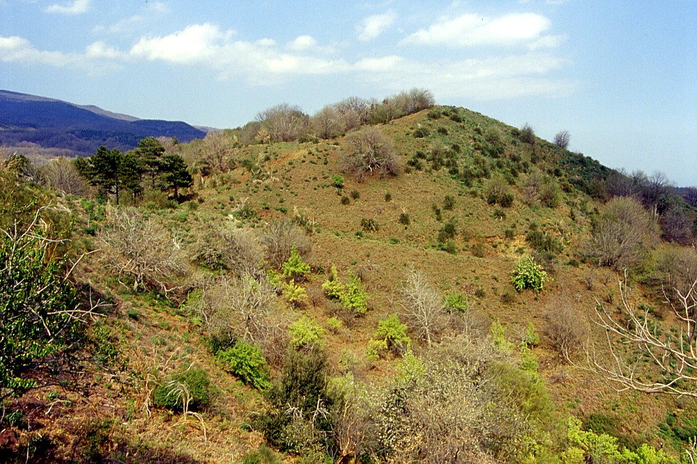
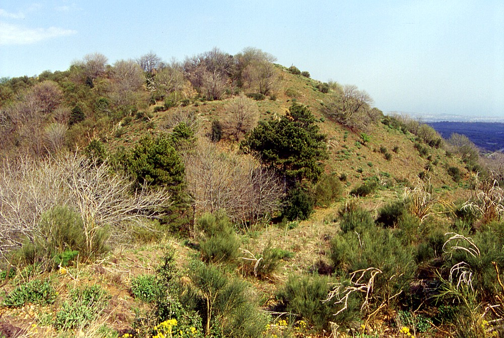
Left
and center: Monte S. Leo seen from its south base. The deep notch
in the south rim of its summit crater can be clearly seen Right: summit area of Monte S. Leo, seen from eastern crater rim. South vent of the summit crater, which is open to the south, is visible between the crater rim in the foreground and the west rim of the crater in the background. Photos taken 22 April 2000 |
||
 |
 |
 |
Different
views of the summit crater of Monte S. Leo on 22 April 2000. Left
image shows high east crater rim in the background and south vent
in the foreground. Center image shows septum that separates the
southern and northern vents of the crater, and high east rim of
the crater in the background. The north vent, largely overgrown
with trees and bushes and with a deep notch in its north rim, is
visible in right photo |
||
 |
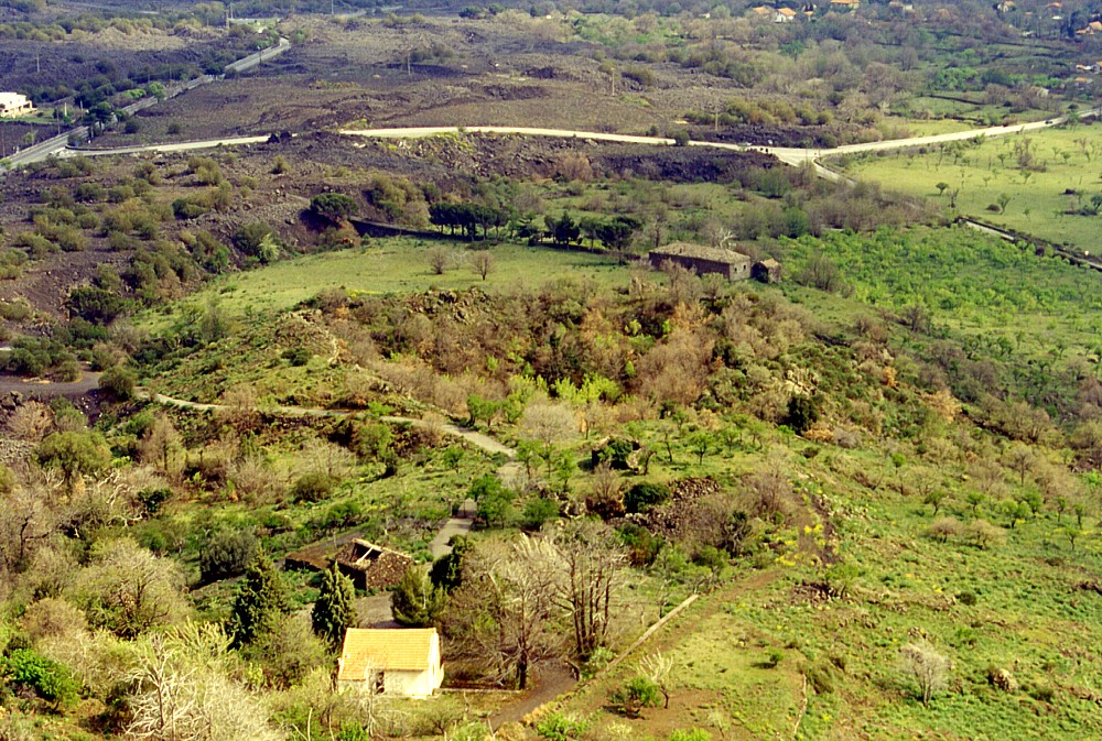 |
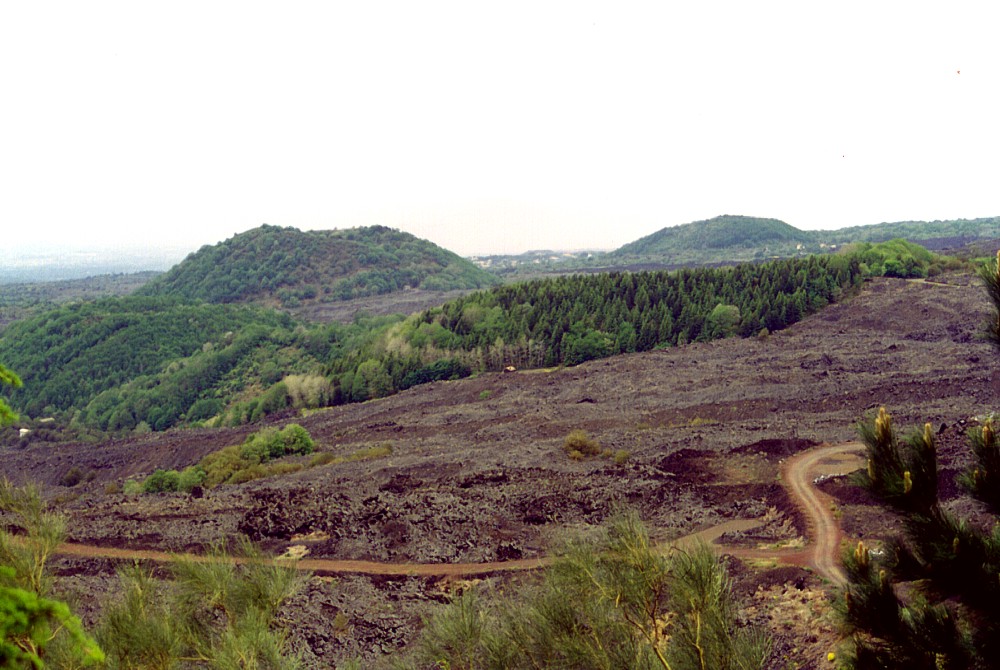
Two
views of the vents that lie at the southeast base of Monte S. Leo,
taken from the southern summit vent of the cone. Left is a panoramic
view (with the conspicuous cones of Monte Serra Pizzuta and Monti
Rossi in the background) showing the low shield that hosts these
vents, which were the site of lava effusion during the Monte S.
Leo eruption. Right image is a zoom on the circular pit (filled
with vegetation) that lies in the center of the shield and belongs
to a nice private terrain. Photos taken 22 April 2000 |
|
Copyright © Boris Behncke, "Italy's Volcanoes: The Cradle of Volcanology"
Page set up on 14 December 2003, last modified on 15 March 2004