
| Etna
index |
||
| Geology | Geological history | Cones and craters |
| Eruptive characteristics | Eruptions before 1971 | Eruptions since 1971 |
| Etna and Man | References | Web sites |
| Weather forecasts | FAQ | Latest news |
 |
What
is named Monte Spagnolo actually consists of two large cones,
the more westerly of which (at left) is Monte Spagnolo proper,
while the slightly smaller cone immediately to the east (right)
has no official name. These remarkable twin cones rise on the
side of Etna facing the town of Randazzo, and besides Monte Maletto
are the only sizeable flank cones on the northwestern side of
the volcano. This view, taken in mid-August 2001, is from the
southwest; the poorly vegetated lava flow in the foreground was
erupted probably in early Medieval time, around A.D. 950 |
Mamma
Etna's countless children
Monte S. Maria
N flank, 14.993999° E, 37.825399° N
Summit elevation: 1639 m (W crater rim)
![]()
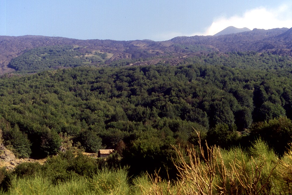
The
north flank of Etna has much less flank cones than most other areas of
the volcano. One of the few cones on the north flank is tiny Monte S.
Maria, a prehistoric cone rising only about 25 m above its southern base
and 50 m above its eastern and western base. The cone carries dense forest
but its crater floor is covered with grass, probably due to many animals
herding in the place. The crater has a maximum diameter of about 150 m
and its rim is lowest on the northern side, presumably because during
the eruption that formed this cone several vents were active along a north-south
oriented fissure cutting through the crater. This fissure is evident also
from the presence of several smaller vents lying to the south, one of
which is surrounded by a low pyroclastic cone. On the north flank of Monte
S. Maria, a well-developed but densely forested lava flow-channel is visible
when the sun is standing low and casts long shadows.
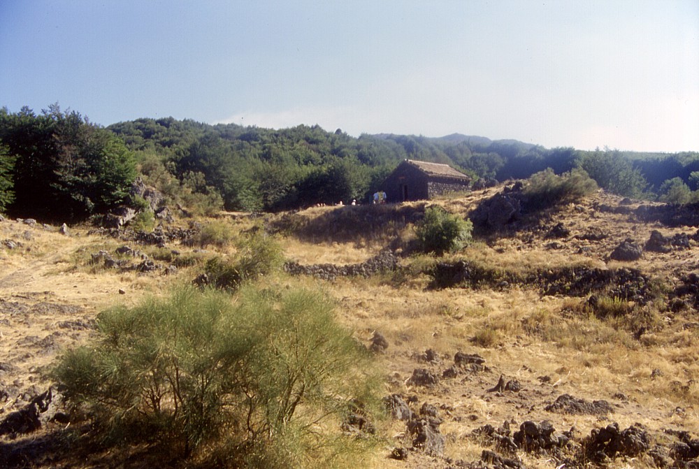
Monte S. Maria is well known to hikers making the spectacular round trip
on the Forest Service road because a simple though nice mountain hut lies
immediately to the south of the cone. From there it is only a five-minutes
walk to get to the summit of the cone and enjoy breathtaking views of
the surrounding areas, especially the broad valley of the Alcantara river
to the north.
I first visited Monte S. Maria in mid-August 2001, when all photographs
on this page (except for that at the top of the page) were taken. During
the following years I returned about once or twice per year.
 |
 |
 |
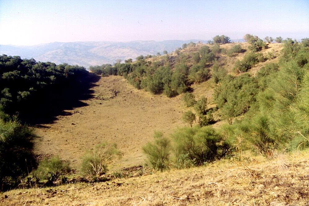
Left:
main crater of Monte S. Maria seen from south rim toward north
in mid-August 2001. Note wide notch in far (north) rim of the
crater, indicating the presence of several vents aligned along
a fissure within the crater |
||
 |
 |
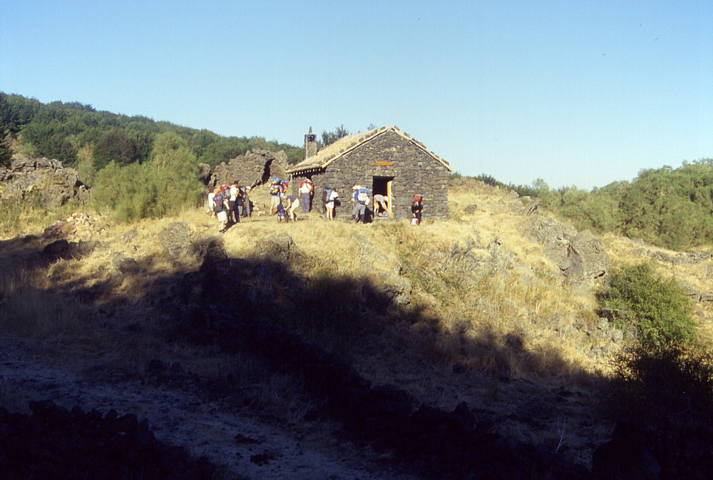 |
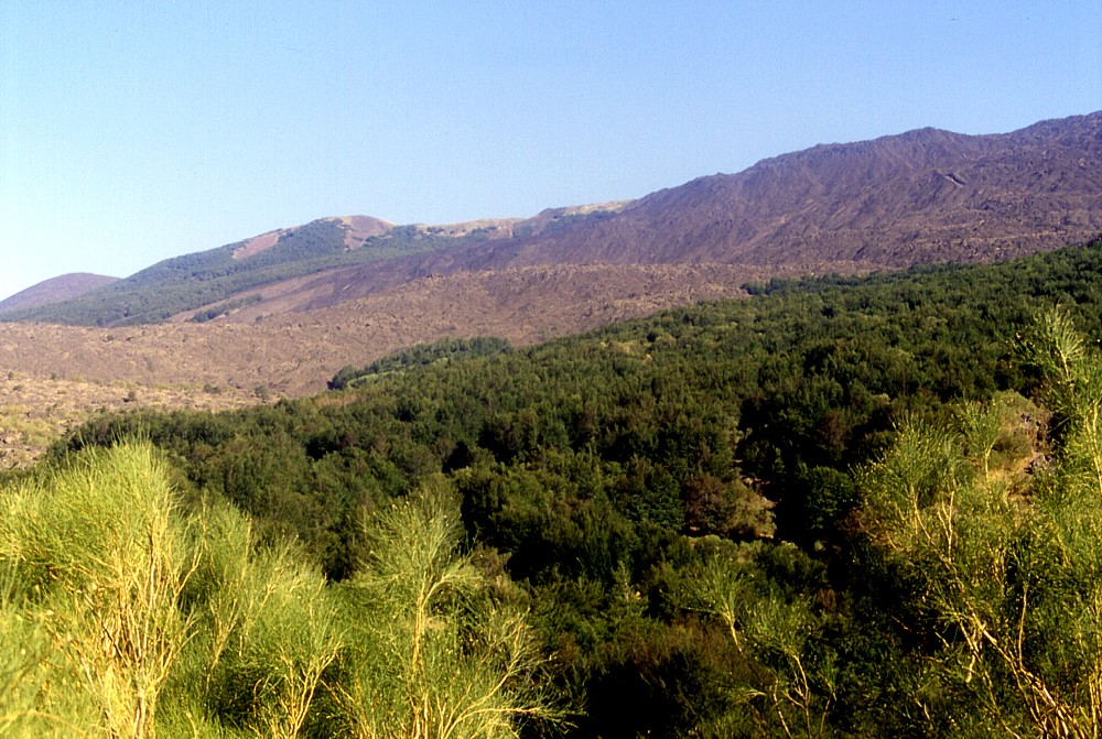
Left:
a closer look in the direction of the summit of Etna, marked by
the steaming cone of the Northeast Crater, and the Monte S. Maria
mountain hut (lower left foreground), which lies in an area of dense
forest. Photo taken mid-August 2001 Center: sitting on a low hill made up of prehistoric lavas, the Monte S. Maria mountain hut marks the first stop during the three-day hike on the Forest Service road from the Piano Provenzana area on the northeast flank of Etna to the Rifugio Sapienza area on the south flank. This mountain hut is very simple and in contrast with the Monte Scavo hut has no cistern, so hikers have to carry sufficient water to allow for cooking and drinking when staying in this hut Right: early morning view (in mid-August 2001) of the Monte S. Maria mountain hut, after spending a night there with a French excursion group |
||
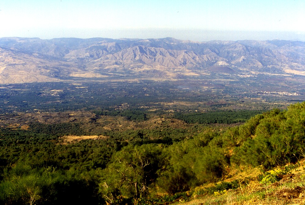 |
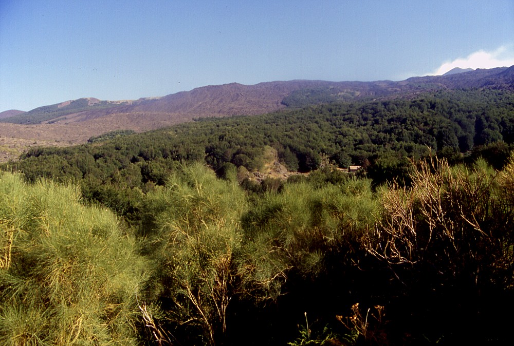
On
clear days, the view from the summit of Monte S. Maria toward the
Alcantara valley and the Nebrodi and Peloritani mountains to the
north is simply stunning. Down in the valley, on the far side of
the Alcantara river and at the base of the Nebrodi mountains lies
the remote cone of Monte Moio (right; with villages lying before
and behind the cone). Photograph taken one late afternoon in mid-August
2001 |
Copyright © Boris Behncke, "Italy's Volcanoes: The Cradle of Volcanology"
Page set up on 22 February 2004