
| Etna
index |
||
| Geology | Geological history | Cones and craters |
| Eruptive characteristics | Eruptions before 1971 | Eruptions since 1971 |
| Etna and Man | References | Web sites |
| Weather forecasts | FAQ | Latest news |
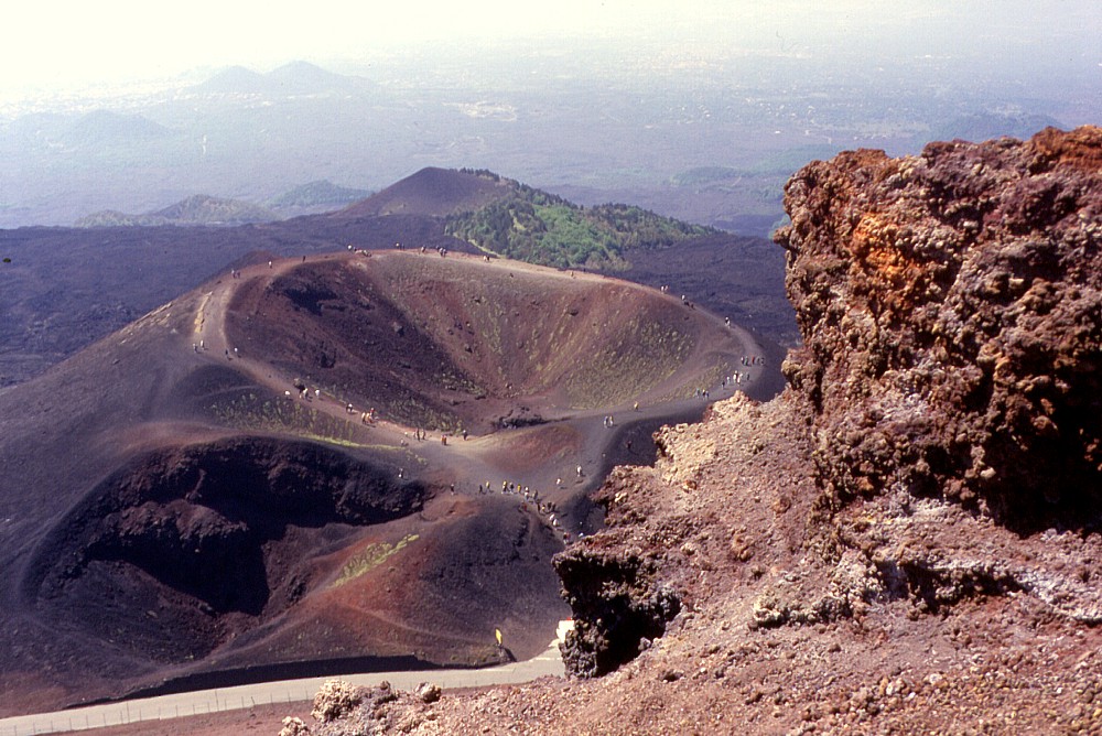 |
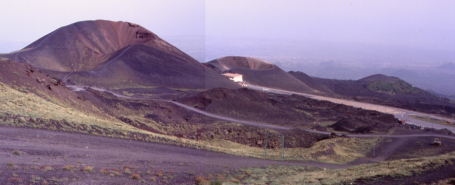
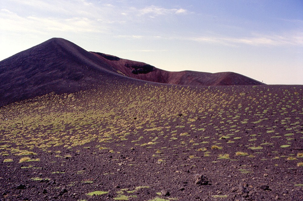
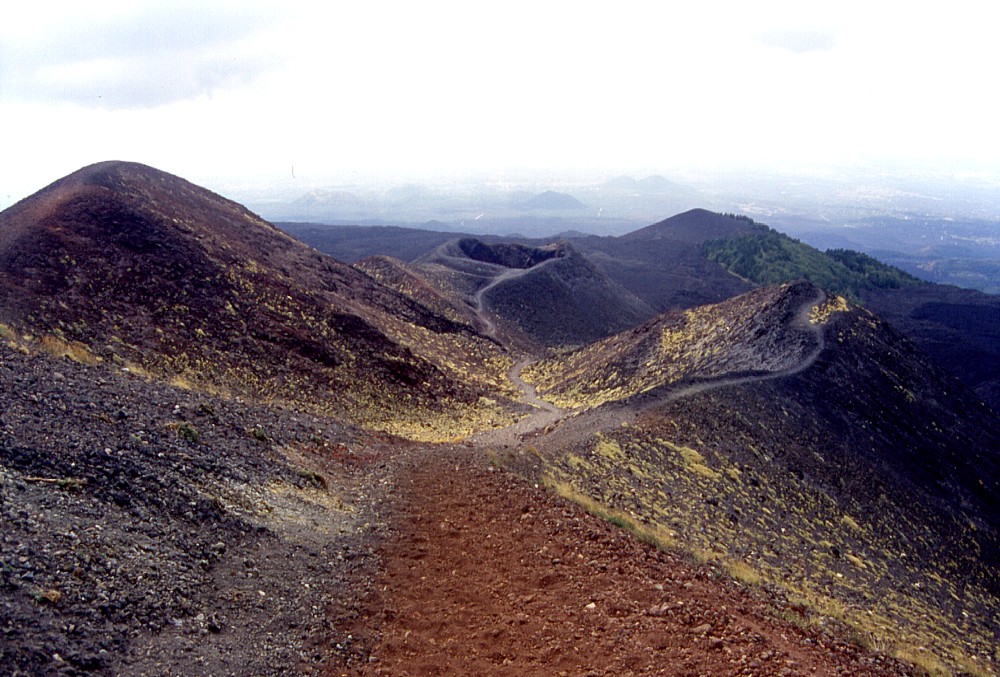
One
of the most photographed sites of Mount Etna: the view from the
peak of the tallest of the Monti Silvestri (Monte Silvestri superiore)
down to the second largest cone of the 1892 eruption, Monte Silvestri
inferiore, with its two craters that are nearly always crowded
with tourists. Note how the rim of the larger of the two craters
has been flattened by the millions of people that have walked
on it since its formation. The colorful rock in the right foreground
is a portion of the pyroclastics constituting the crater rim of
Monte Silvestri superiore, strongly eroded by wind and subject
to heavy fumarolic alteration during the months and years following
the 1892 eruption. View is to the south, taken on 24 May 1998
|
Mamma
Etna's countless children
Monti Silvestri (1892 eruption)
S flank, 15.005463° E, 37.700246° N
Summit elevation: 1997 m (M. Silvestri superiore)
![]()
For
many visitors they are Etna: the conspicuous, colorful pyroclastic
cones and craters that lie only a few hundred meters away from the cluster
of tourist facilities of the Rifugio Sapienza area, named after one of
the pioneers of Italian volcanology, Silvestri. Hundreds of thousands
of tourists per year clamber about on these craters to live the suggestive
experience of being on a volcano and look into its craters - although
they are still about 1300 m below the true summit craters of that volcano.
But these craters can be conveniently reached by car (and buses), leaving
just a short walk to the most accessible of them (Monte Silvestri inferiore).
As a consequence of the countless visits the craters are somewhat degraded,
although they still represent one of the more spectacular cases of a cluster
of flank cones at Etna.
The Monti Silvestri were formed during a large flank eruption that lasted
from 8 July until 29 December 1892 and was probably the second largest
flank eruption of Etna since 1669 (with a lava volume of 145
x 106 m3)
surpassed only by the 1991-1993 eruption. Yet it did little damage, because
its lavas covered mainly lava flows of previous eruptions (1763, 1766,
1886) and remained more distant from the town of Nicolosi than those of
1766 and 1886. The eruption produced heavy ash falls, probably similar
to those of the 2002-2003 eruption, but at that time the (much smaller)
human community living around the volcano was considerably less sophisticated
and thus less vulnerable than it is today.
Actually the Monti Silvestri consist of a quite large number of pyroclastic
edifices, in part of notable dimensions, and some of them even bearing
different names to those of the main cones, as Monte Nero, the southernmost
of the major pyroclastic cones. Others are simply nameless, and some lie
away from the trend of the main eruptive fissure on which the largest
cones were built, clear evidence for the complexity of the eruption that
gave birth to them. The largest of the cones, Monte Silvestri superiore,
is strongly asymmetric, with two craters, the more northerly of which
has its north rim standing only a few meters above the surrounding surface
(this rim was actually surmounted by a small tongue of lava of the 2001
eruption). In contrast, the southeastern portion of Monte Silvestri superiore
rises 100 m above its base, and a serious climb is required to enjoy the
commanding view onto the lower cones in the southern part of the row of
cones.
Monte Silvestri inferiore, about 0.4 km south of its larger neighbor,
rises to a height of 1912 m and has an impressive main crater whose bottom
is pierced by a pit about 8 m wide (in state of constant degradation due
to the numerous visitors trampling around on it); a second, smaller crater
with near vertical walls lies at its NE side. Further to the south rises
the steep-sided cone of Monte Nero (a name used for several flank cones
of Etna, but in this case truly justified), reaching a summit height of
1880 m. At its northern and southern bases lie two small pits, and lava
outflow apparently mainly occurred from the latter of these.
In the upper portion of the 1892 eruptive system there is another conspicuous
(but nameless) crater surrounded by a low pyroclastic cone, lying about
0.4 km from Monte Silvestri Superiore. A second, less expressed row of
eruptive vents formed along an eruptive fissure running parallel to the
main fissure, about 0.25 km to the west, characterized by low spatter
ramparts. The activity there was probably mainly effusive.
The photographs on this page were taken mainly during three extended visits
to the Monti Silvestri, on 24 May 1998, on 8 September 1999 and in mid-September
2001. Those taken before the 2001 eruption have become documents of a
landscape that now looks somewhat different due to that eruption.
 |
 |
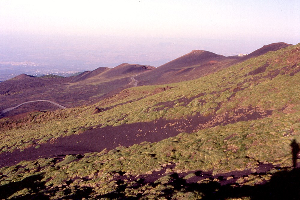 |
Left:
the impressive row of pyroclastic cones constituting the Monti Silvestri
is seen here from the road that leads from Nicolosi to the tourist
station around the Rifugio Sapienza ("Etna Sud"), from
a point about 2 km to the southwest. Photo taken on 22 April 2000 Center and right: the Monti Silvestri seen from nearly the opposite direction and two years earlier. The view in these two images is from the 1634-1638 eruptive fissure, approximately 1.5 km to the northeast. The photos were taken at sunrise on 24 May 1998, one of the most suggestive moments I have ever lived on Etna |
||
 |
 |
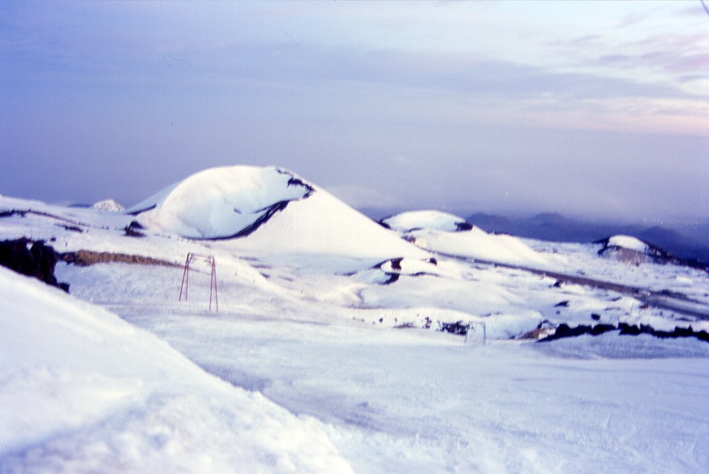 |
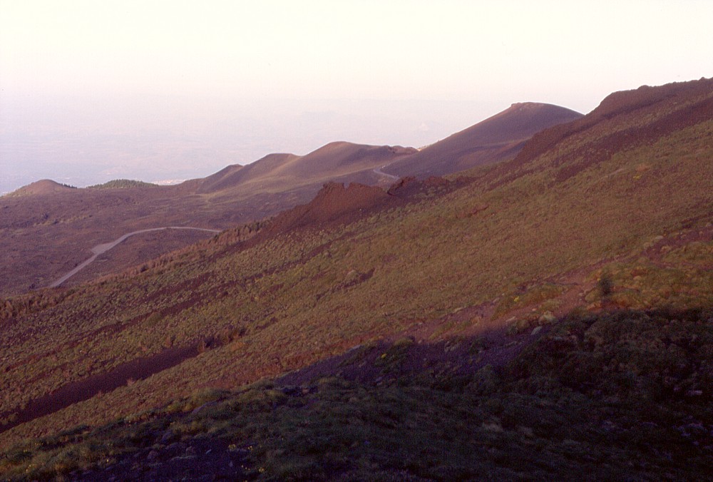
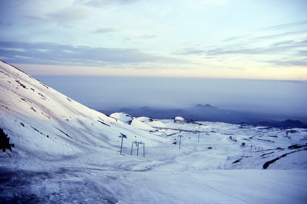
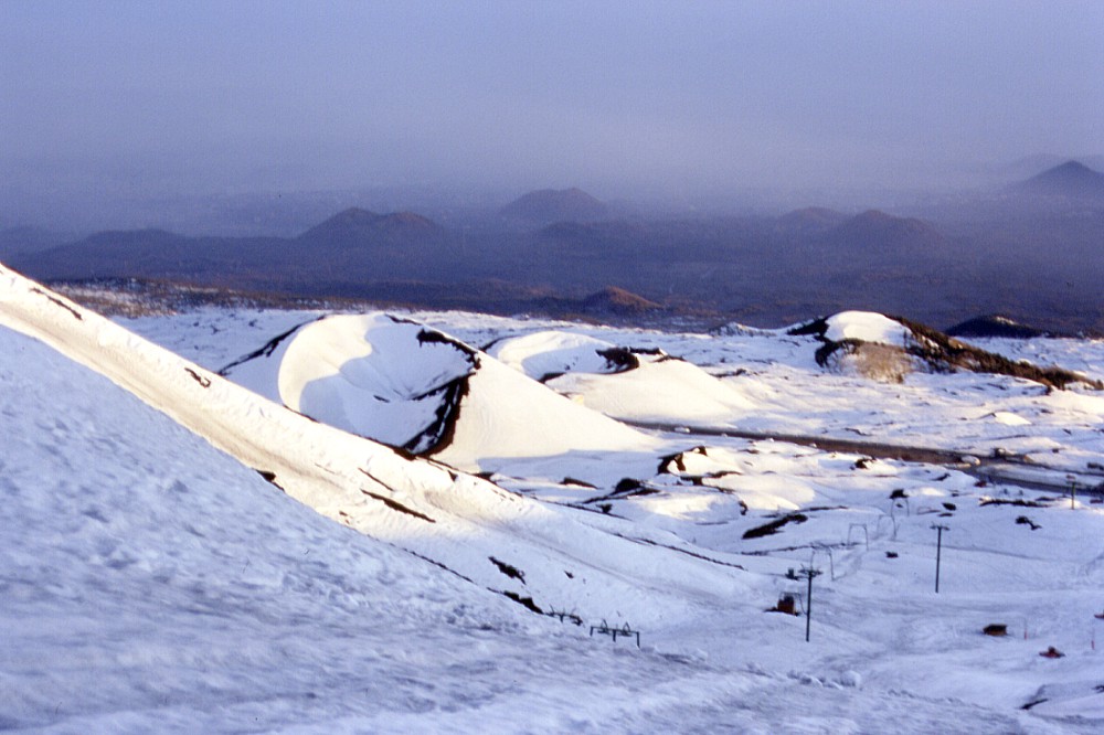
The
Monti Silvestri in a winter fairy tale (8 February 2000). The photos
were taken at sunset while descending the ski track that existed
on the western side of the Montagnola (whose slope can be seen in
the left and center images at left) until the 2001 eruption. Left
image shows the conspicuous twin-peaked silhouette of the Monti
Rossi (formed during the 1669 eruption)
in the distance; more of the flank cones on the south-southeast
flank of Etna are seen in the background of the center image (from
left to right: Monte Difeso, Monte Arso, Mompeloso [with the low
Monte Gervasi before it], Monte Salto del Cane [seen somewhat closer],
Monte S. Nicola, Monte Serra Pizzuta, a snow-covered nameless cone,
and the eastern half of the Monti Rossi at extreme right). Center
and right photos are slightly blurred to long exposure |
||
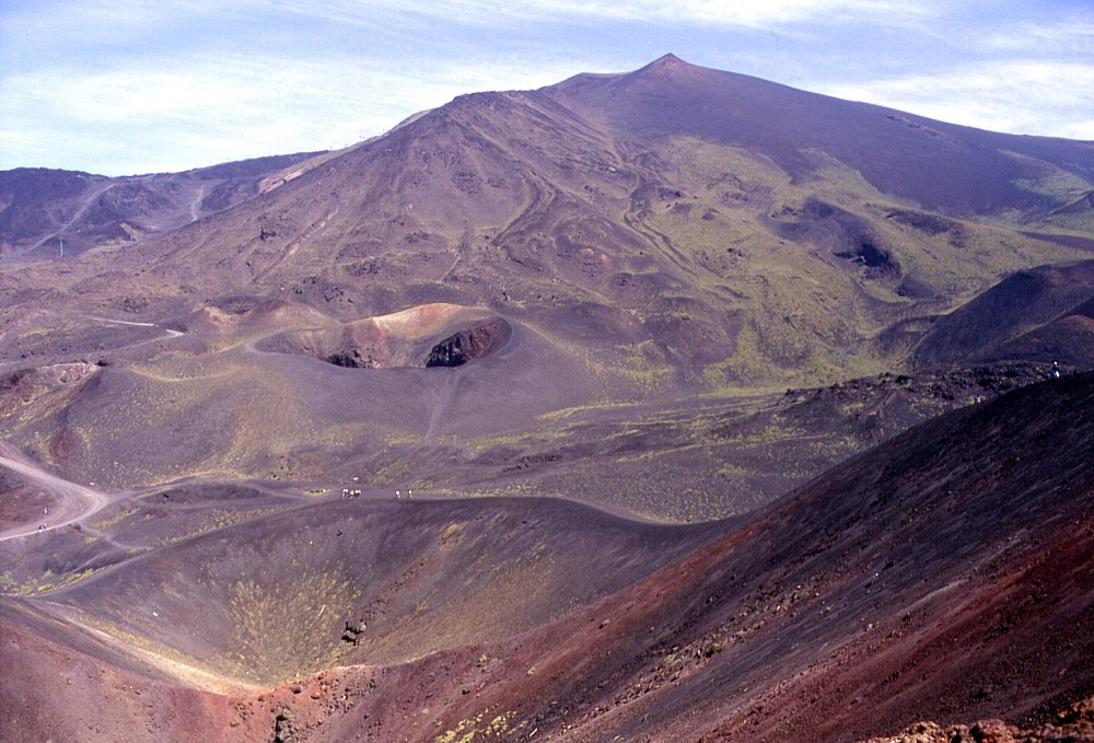
 |
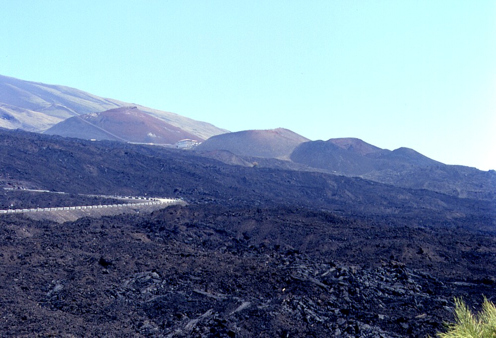
The
Monti Silvestri and their immediate surroundings to the west, an
area that was completely changed by the 2001 and 2002-2003 eruptions.
This photo was taken on 4 June 1999 and shows the large cone of
Monte Silvestri superiore with its twin craters at left (jeep track
and ski track in the middle ground and foreground); at its right
(south) base lies the Ristorante Corsaro, which narrowly escaped
from destruction during the first days of the 2001 eruption, and
the parking lot along the Provincial Road 92 (Zafferana-Rifugio
Sapienza), which was buried under lava in both the 2001 and 2002-2003
eruptions. Behind the restaurant lies the second largest of the
Monti Silvestri, and still further to the right is the dark cone
of Monte Nero. The partially forested cone further to the right
pre-dates the Monti Silvestri eruption in 1892, and no name is shown
for it on topographic maps |
 |
 |
 |
Left:
the strongly asymmetric shape of Monte Silvestri superiore, seen
from its northeast base on 24 May 1998. While the crater rim is
very high on the southeast side (left), it is extremely low on the
north (near) side, and during the 2001 eruption a small tongue of
lava actually surmounted this low rim to spill in the northern of
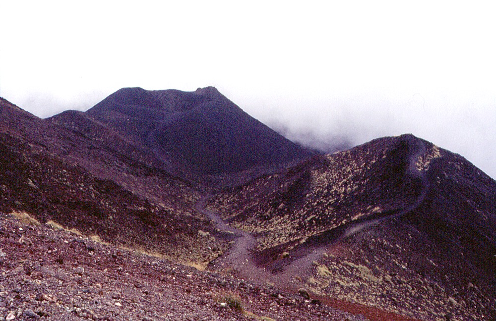
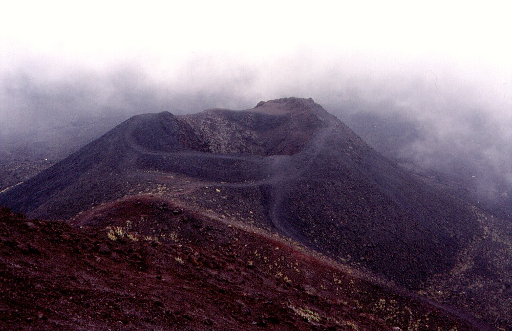
the two craters of this cone Center: northward view from the summit of Monte Silvestri superiore across its two craters (foreground) in the direction of the Montagnola (the sharp peak at the skyline), 24 May 1998. The open crater surrounded by a low pyroclastic cone in the middle ground was also formed during the 1892 eruption. The dark cones at extreme right are the Monti Calcarazzi (1766 eruption). The lowermost vents of the 2001 eruption opened in the light green area immediately behind and to the left of them Right: upslope (northward) view from Monte Silvestri inferiore toward its much larger neighbor "superiore", the Mont Calcarazzi to the right, and the Montagnola at the skyline. Photo taken 8 September 1999 |
||
 |
 |
 |
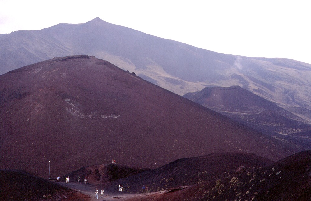
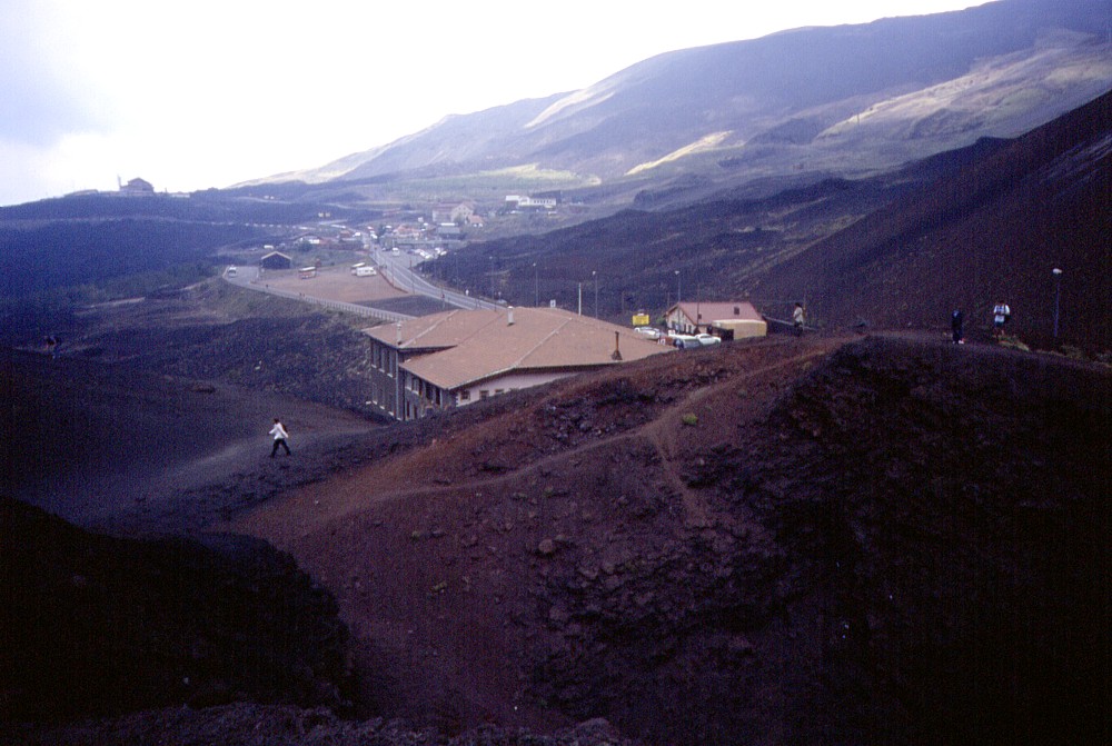
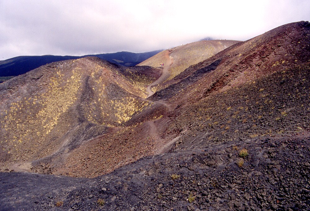
Left:
view from Monte Silvestri inferiore across the area of tourist facilities
around the Rifugio Sapienza, two years before the 2001 eruption
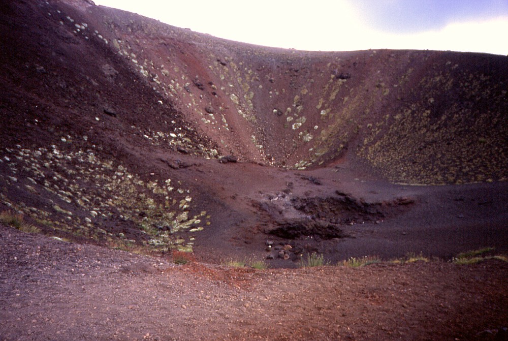
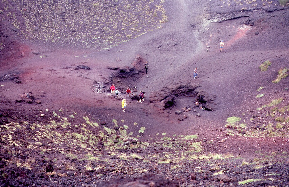
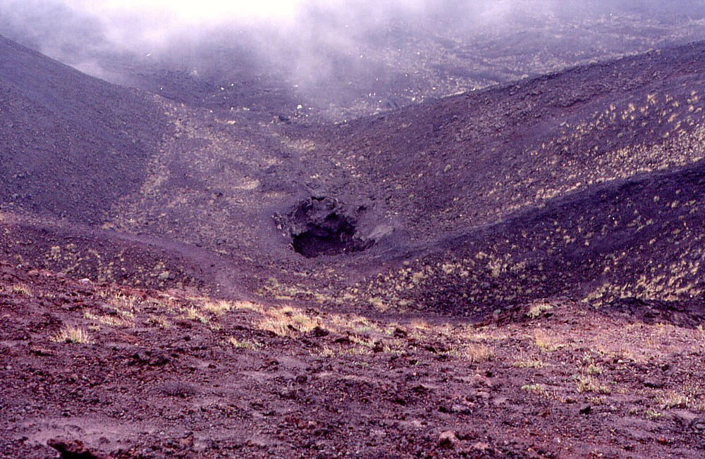
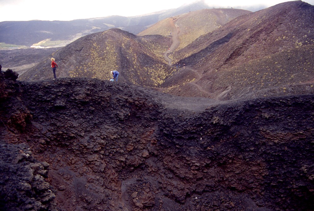
(16 June 1999), which changed the appearance of this place Center: the larger of the two craters of Monte Silvestri inferiore seen from its northwest rim, probably the spot on Etna that is walked on by more tourists than any other place on the volcano. On the floor of the ~130 m-wide crater lies a small pit about 8 m wide, which once was still open to a certain depth, but the visits of millions of tourists over the past few decades have caused serious degradation of this feature. Photo taken 16 June 1999 Right: tourists and hikers at the inner pit on the crater floor of Monte Silvestri inferiore, 8 September 1999 |
||
 |
 |
 |
Left:
lower portion of the Monti Silvestri crater row during poor weather
conditions on 8 September 1999. A shallow crater with notches in
its north (near) and south rims lies before the steep cone of Monte
Nero, which also formed during the 1892 eruption of the Monti Silvestri Center: more detail of Monte Nero, at the lower end of the Monti Silvestri eruptive fissure, is visible in this image, taken on 8 September 1999. A narrow (~35 m diameter) crater with vertical walls lies at its summit Right: open pit lying at the floor of a poorly defined crater at the northeast base of Monte Nero, the lowest of the 1892 craters, 8 September 1999 |
||
 |
 |
 |
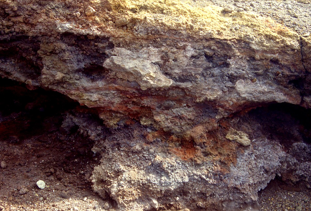
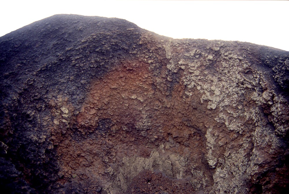
Left:
these vividly colored rocks lie on the southern crater rim of Monte
Silvestri inferiore, and testify to the strong fumarolic activity
that continued for years after the end of the 1892 Monti Silvestri
eruption. Photo taken 12 September 2001 Center: view from the south slope of Monte Silvestri inferiore over the lower portion of the 1892 eruptive fissure, showing strongly asymmetrical vent in the middle ground and the small cone of Monte Nero (with conspicuous footpath leading to its crater) behind it; many of Etna's lower flank cones on the south flank are visible in the background Right: view in nearly the opposite direction as in previous image, showing nested craters and the south slope of Monte Silvestri inferiore (illuminated by the sun and with persons indicating scale) in the background, 12 September 2001 |
||
 |
 |
 |
Left:
similar view as in previous photograph, but showing more detail
of pit in low vent at left Center: the inner north crater wall of Monte Nero, the southernmost cone on the 1892 eruptive fissure, and some of the nearby vents. Persons on crater rim indicate scale Right: the narrow, vertical-walled crater of Monte Nero at the lower end of the 1892 eruptive fissure, consisting of scoriae, black where not altered and reddish oxidized where exposed to fumarolic actvity after the end of eruptive activity |
||
Copyright © Boris Behncke, "Italy's Volcanoes: The Cradle of Volcanology"
Page set up on 14 December 2003, last modified on 14 March 2004