
| Etna
index |
||
| Geology | Geological history | Cones and craters |
| Eruptive characteristics | Eruptions before 1971 | Eruptions since 1971 |
| Etna and Man | References | Web sites |
| Weather forecasts | FAQ | Latest news |
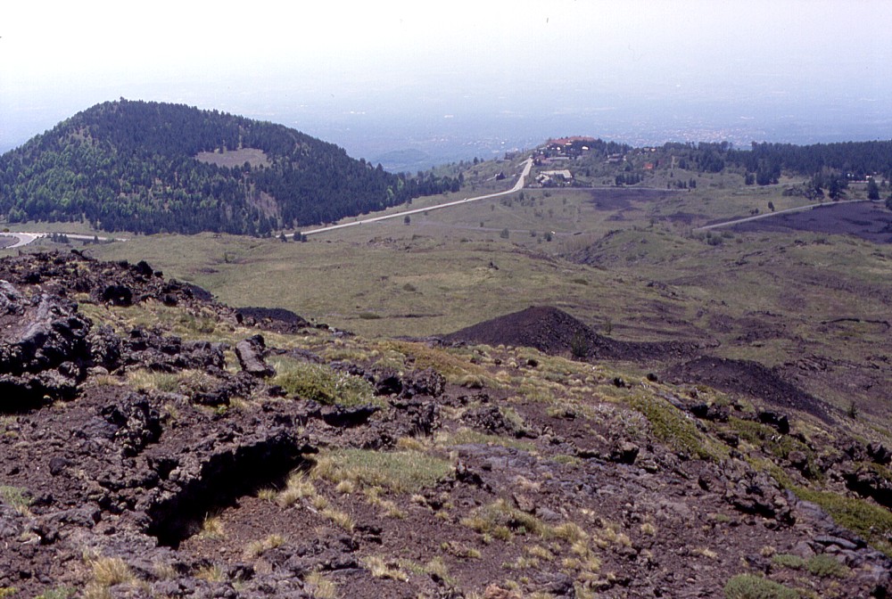 |
Strongly
irregular in shape, and with a remarkably flat crater bottom (possibly
occupied by a small temporary lake in the past), Monte Vetore
lies on the southern margin of a flat area, known as Piano Vetore.
The area attracts many people from nearby towns on fine weekend
days, who picnick in this scenic place. The dense forest on the
cone is the result of reforestation during the 1950s-1960s; probably
a previous forest had fallen victim to extensive deforestation
at Etna until the early 20th century. This view of Monte Vetore
was taken on 24 May 1998, looking SSW from a pile of fairly young
pahoehoe lavas (though their age is not known) that overlooks
the Piano Vetore and offers spectacular panoramic views over the
south flank of the volcano |
Mamma
Etna's countless children
Monte Vetore
S flank, 14.98520° E, 37.65457° N
Summit elevation: 1823 m
![]()
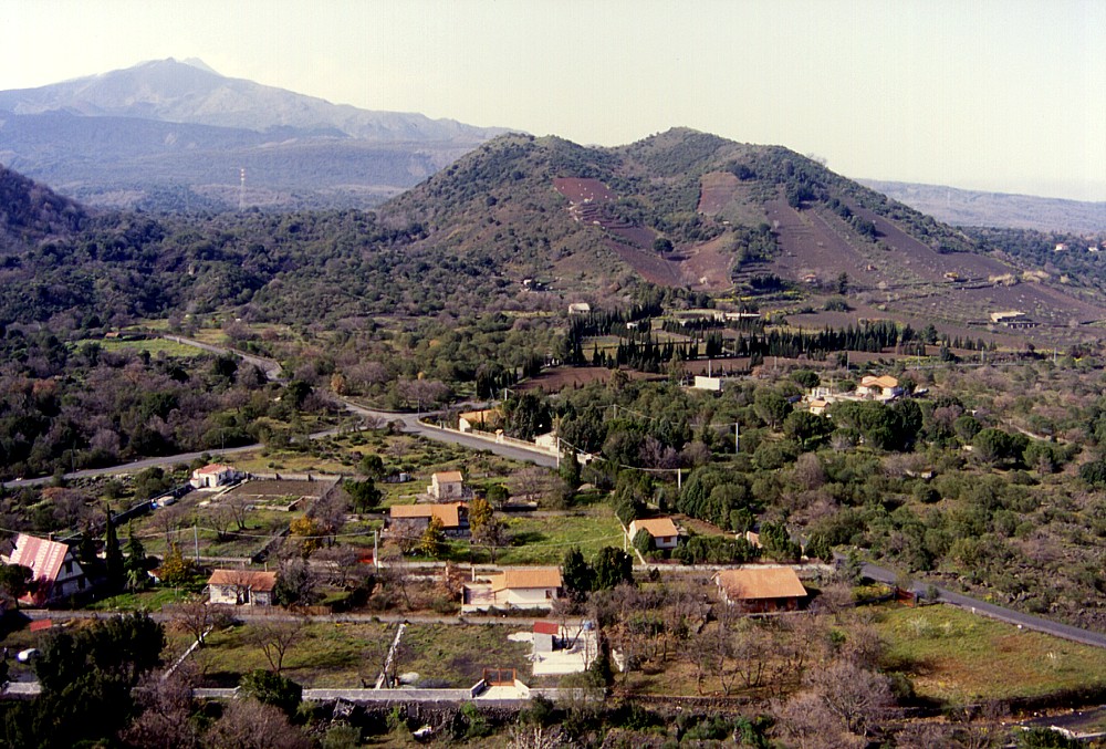
Monte
Vetore forms a conspicuous landmark in the relatively flat area area known
as Piano Vetore, located roughly between the Rifugio Sapienza tourist
facilities and the Astrophysical Observatory and the Botanical Garden,
at 1700-1900 m elevation on the south flank of Mount Etna. To persons
driving up to the Rifugio Sapienza area it signals the near end of the
long way up. It is covered by dense forest, which has grown since the
early reforestation efforts of the 1950s to 1960s; before that it seems
to have been one of those areas which were seriously deforested as a consequence
of human wood demand.
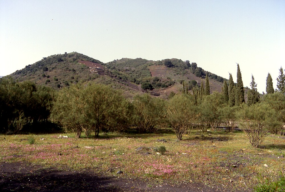
Lying perched on the upper part of a steep slope (which borders the Piano
Vetore plain to the south), the cone of Monte Vetore is highly irregular,
and its southern base lies at about 1660 m elevation, while its northern
base lies about 110 m higher. From there to the NW rim of the summit crater
it is an easy climb because on this side the rim lies only 30 m above
the surrounding plain. As at its base, Monte Vetore is also highly irregularly
shaped at its summit. Strong wind must have blown to the SE at the time
of its formation, leading to accumulation of ejected pyroclastics mainly
on that side, which culminates at 1823 m elevation. The crater has a flat
bottom, where possibly there has been a temporary lake after heavy rainfalls
in the past. A nice wooden building stands at the summit, which (as far
as I know) hosts a meteorological station, and a seismic station of the
INGV-Catania has been installed nearby. On fine weekend days, many residents
of nearby towns flock at Monte Vetore for picnicking ("'a scampagnata");
yet the Forest Service here does a good job in keeping the place tidy
(elsewhere on the lower slopes of Etna, unfortunately, this is not the
case).
I visited and climbed Monte Vetore for the first time on 24 May 1998 and
came back on several occasions during the following years. The photographs
on this page were mainly taken on 24 May 1998 and on 22 April 2000.
 |
 |
 |
Left:
a view of Monte Arso from the summit of Mompeloso,
1.3 km to the SSW, with Etna's main edifice in the background, and
the eastern slope of Monte Gervasi
at the extreme left. Monte Gervasi was the site of the second most
recent eruption in the Nicolosi area, sometime between A.D. 252
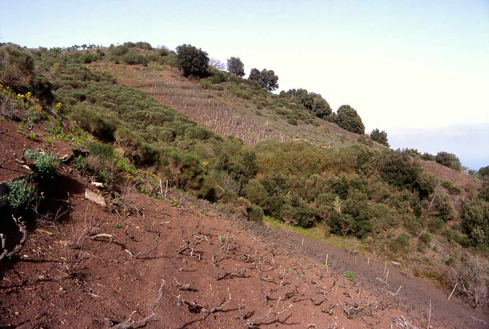
(or 253) and 1669 Center: Southern face of Monte Arso, seen from about 0.9 km distance from its summit Right: vineyards cover much of the southern flank of Monte Arso, and intense agricultural activity since many centuries masks the rim of a small half-cone (in right foreground) leaning on the lower southern flank of the main cone. A larger crater occupies the area between the viewing point and the tree-dotted crest in the background |
||
Copyright © Boris Behncke, "Italy's Volcanoes: The Cradle of Volcanology"
Page set up on 14 December 2003