[ Full page view | Villarrica Home Page | Home Page ]
Villarrica volcano, Chile
The 1971-1972 eruption (Photos)
1. Before the eruption

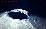
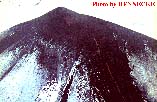
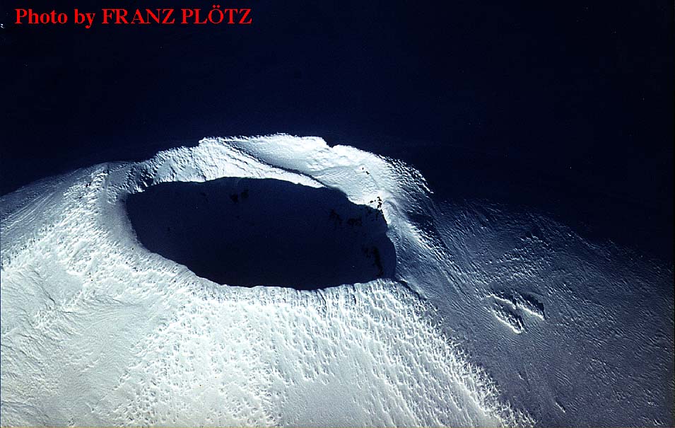
Aerial view of Villarrica, 1970 or 1971
(Full picture JPEG: 53K)
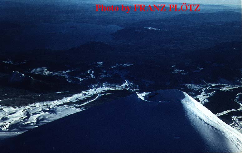
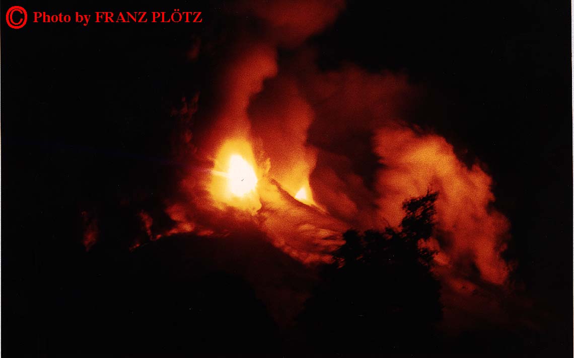
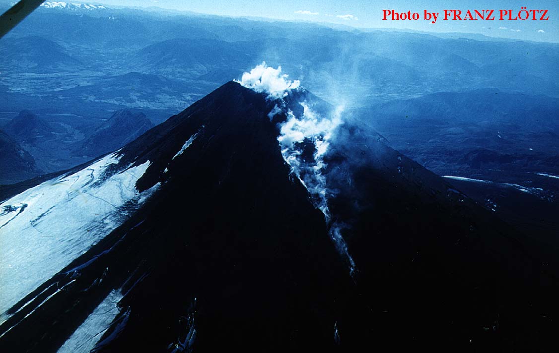
Aerial view from north of Villarrica during the Austral winter of 1970 or 1971. At this time, the volcano was perfectly quiet. Note rim of Villarrica I caldera in background. Lake Calafquén is in the far background. Photo by Franz Plötz, Germany.
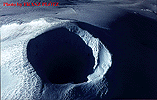
Crater of Villarrica between two eruptions
(Full picture JPEG: 104K)
Crater of Villarrica seen from the air during the Austral winter of 1970 or 1971. There was no activity occurring at this time. Note the small terrace on the far side of the crater, a remnant of the crater fill of 1963-1964. Photo by Franz Plötz, Germany.
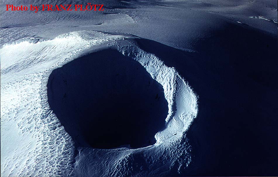
Villarrica's crater in a state of perfect quiet
(Full picture JPEG: 104K)
Zoom on the crater of Villarrica during the Austral winter of 1970 or 1971 when there was not even fumarolic activity. Thick snow mantles the crater rim. Note the pit left after the 1964 eruption and small terrace on right side. Photo by Franz Plötz, Germany.
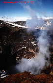
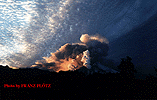
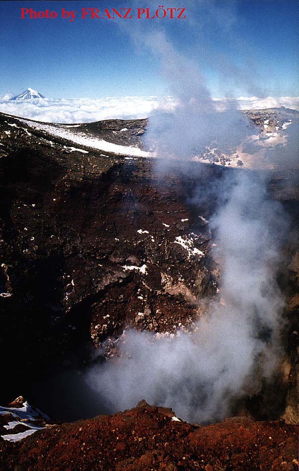
Steam rising from the crater's inner pit
(Full picture JPEG: 108K)
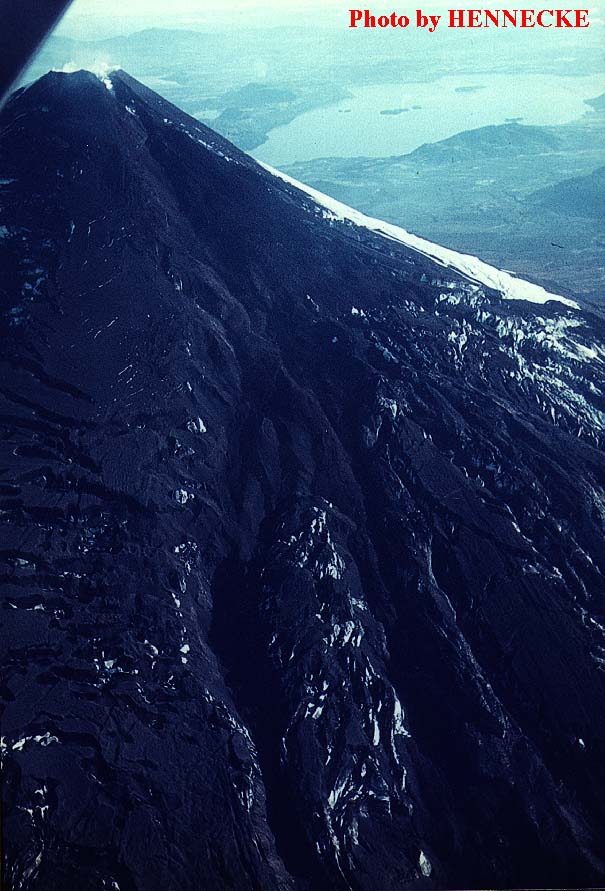
Austral summer, maybe 1970-1971, probably earlier (Gonzalez-Ferrán 1972 mentions that all fumarolic activity ceased by late 1970). Steam is rising from the inner pit of Villarrica's summit crater. Note section through 1963-1964 tephra deposits on far side of the pit, forming a small terrace. Photo by Franz Plötz, Germany.
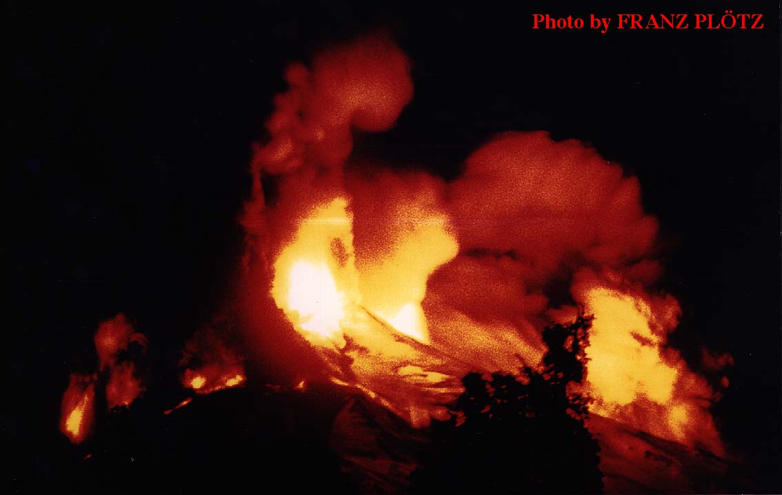
2. Initial stages of the eruption
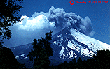
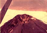
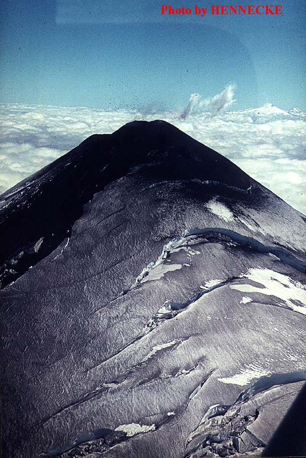
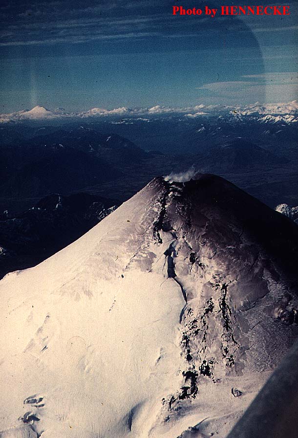
Villarrica in eruption, 15 December 1971
(Full picture JPEG: 156K)
Aerial view of Villarrica during the first phase of the 1971-1972 eruption, taken on 15 December 1971. A 50 m-high cinder cone has grown above the summit crater, and a lava flow is overflowing onto the SW flank (left). The summit cinder cone is in vigorous Strombolian eruption. More detail is visible on the zoom on the summit (104K JPEG image) which has been contrast and color enhanced to better show the bomb ejections and lava flow. Photo by Hennecke, Chile.

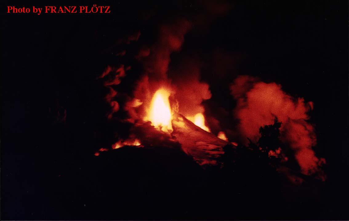
Summit cinder cone and lava flow, 15 December 1971
(Full picture JPEG: 143K)
Another aerial view of Villarrica taken on the same day as previous, showing the summit cinder cone with incandescent vent and narrow lava flow. The flow has formed several tubes a few tens of meters long, and older, cooled flows are visible adjacent to it. Click here for a higher resolution (but much larger: 380K!!!) GIF version of this image. Photo by Hennecke, Chile.
Close up of the summit cinder cone and upper part of lava flow
(Full picture JPEG: 133K)
Detail of preceding, to make the active cinder cone and upper part of lava flow more evident. More detailed but very large (380K) GIF version is available here. Photo by Hennecke, Chile.
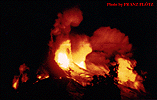
3. The catastrophic climax of 29-30 December 1971
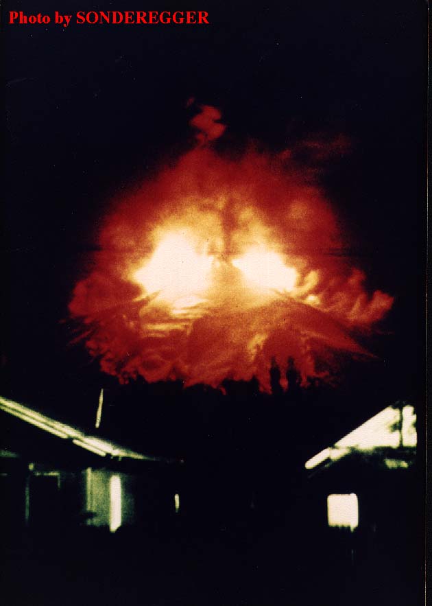
Climax of the 1971-1972 eruption: Villarrica ruptured
(Full picture JPEG: 48K)
Dramatic shot of Villarrica during the culmination of its 1971-1972 eruption, shortly before midnight on 29 December 1971. The upper part of the cone has been split by a fracture totalling 4 km in length, and two sheets of lava are jetting from the upper parts of the fracture, on the NNE and SSW flanks. Note that there appears to be no lava ejection from the summit crater itself. Photo was taken by Sonderegger, Chile.
Two curtains of fire jetting skyward on 29 December 1971
(Full picture JPEG: 48K)
Another photo taken by Sonderegger, taken at about the same time as the preceding. Here, the two curtains of fire shooting skyward from the eruptive fracture are even more distinct.
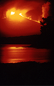
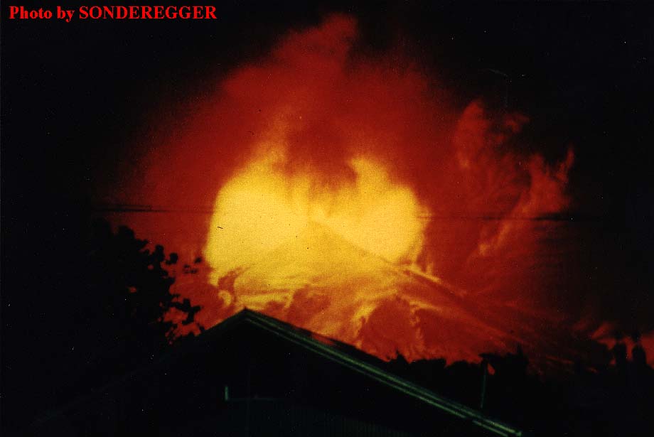
The eruption's climax viewed from Pucón
(Full picture JPEG: 45K)
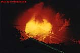
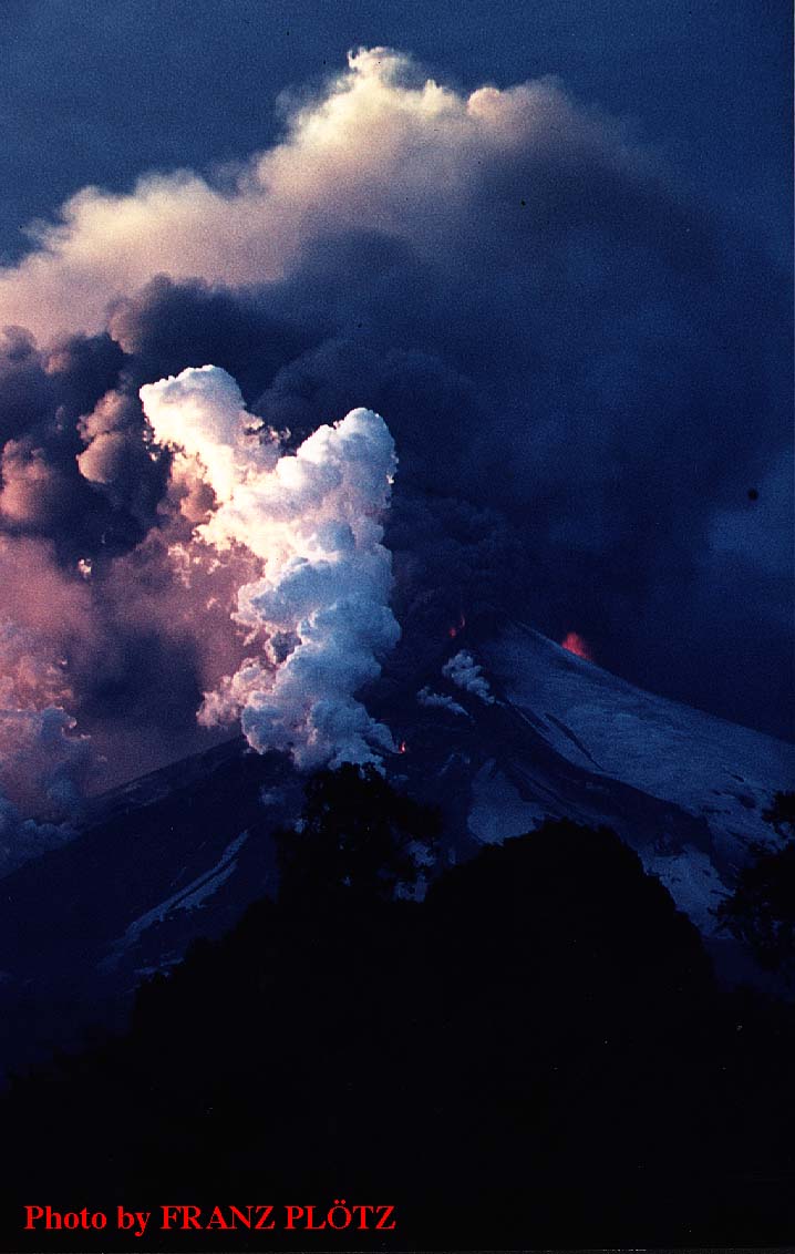
The view of the eruption from Pucón, at about 0005 local time on 30 December 1971; that is about 20 minutes after the beginning of the paroxysmal phase. There are two large fountains on both sides of the summit (which itself remains inactive), and several smaller ones in the lower parts of the NNE and SSW flank fractures. Lava flows are rapidly moving from the fissures, melting through glaciers, and causing large floods of meltwater. Photo by Franz Plötz, Germany, taken from a distance of about 7 km from the summit.
Fountains up to 600 m, and lava flows cutting the glaciers
(Full picture JPEG: 58K)
About one hour after the beginning of the climactic phase, 0045 local time on 30 December 1971. Note steam clouds illuminated by the lava flows over the lower left and right flanks. Photo by Franz Plötz, Germany, taken from same viewpoint as previous photo.

More fountains as the eruptive fissures propagate downslope
(Full picture JPEG: 38K)
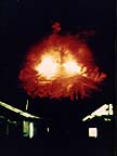
During the early hours of 30 December 1971, more vents open at still lower elevations on Villarrica's NNE and SSW flanks, as the eruptive fractures lengthen. New fountains are visible on the right (SSW) flank and on the near side of the mountain. The nearest two vents appear to have formed away from the NNE fissure's trend, and may actually be lava overflowing the rim of Villarrica II caldera. Shortly after the previous photo. Photo by Franz Plötz, Germany, from shore of Lake Villarrica near Pucón.
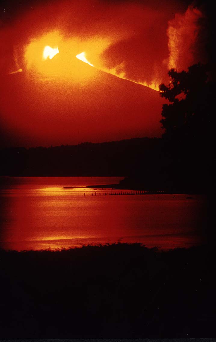
The fiery fury of Villarrica reflecting in a peaceful lake
(Full picture JPEG: 45K)
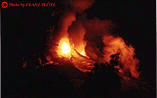
Lake Villarrica reflecting the glow of Villarrica's eruption, during the early hours of 30 December 1971. This view was taken from a site 17 km south of Pucón and shows the profile of the cone with the two main fountains. The vigor of the eruption is apparently subsiding, but lahars are heading towards Lakes Calafquén and Villarrica, the latter still lying peacefully in the foreground. Photo by Frindt, courtesy of Franz Plötz, Germany.
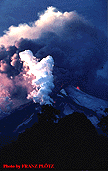
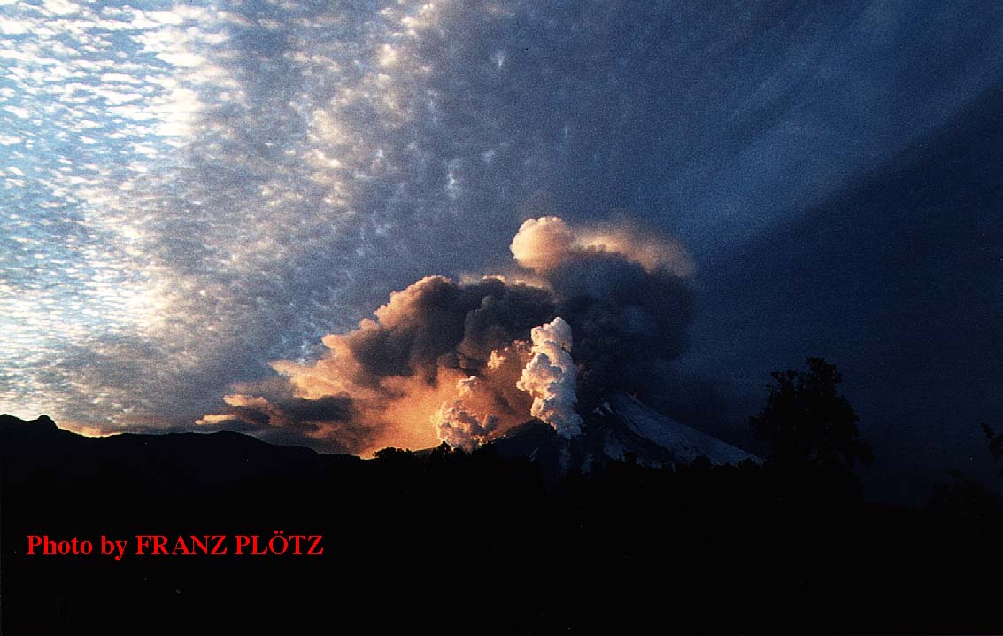
4. The morning after: 30 December 1971
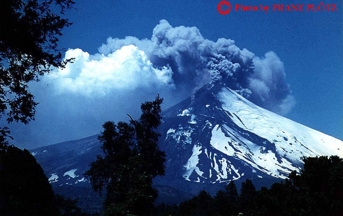
Declining activity after the paroxysm
(Full picture JPEG: 102K)
On the morning after the devastating paroxysm, lava is still fountaining from a few vents on the eruptive fractures on the SW and NE flanks, and ash is emitted from the summit area. White steam plumes indicate that lava is still flowing and interacting with glacial ice. View is from the N. Photo by Franz Plötz, Germany.
Detail of Villarrica's waning activity
(Full picture JPEG: 80K)
Detail of preceding. Small lava fountains from a few vents on both sides of the volcano and ash emission from the upper parts of the eruptive fractures are visible, as well as lava still interacting with glacial ice. Photo by Franz Plötz, Germany.

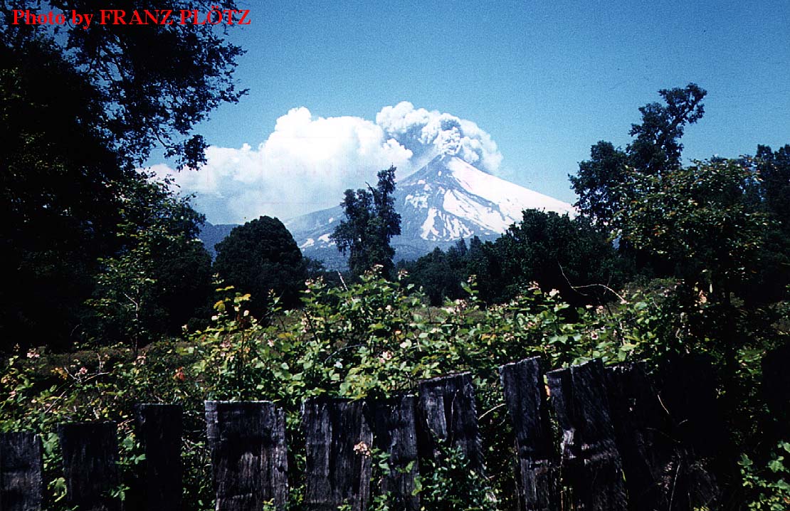
Still steaming on a Chilean summer day
(Full picture JPEG: 186K)
At about noon on 30 December 1971, steam and ash are continuing to issue from the volcano, but lava fountains are no longer visible. This scene could be of any sunny Chilean summer day were there not the volcano, showing the signs of last night's paroxysm. Photo by Franz Plötz, Germany.
The evidence of Villarrica's fury
(Full picture JPEG: 143K)
Detail of preceding. Ash is issuing from the upper parts of the eruptive fractures and from the summit crater. No incandescence is visible. White steam is rising from two points near the Villarrica II caldera rim, these have been the sources of small lava fountains (?) during the night which would mean that vents were active away from the NNE fracture's trend. Photo by Franz Plötz, Germany.
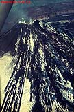
5. Products of the paroxysm: lava flows and lahars

Lava flow moving over lahar deposits
(Full picture JPEG: 109K)
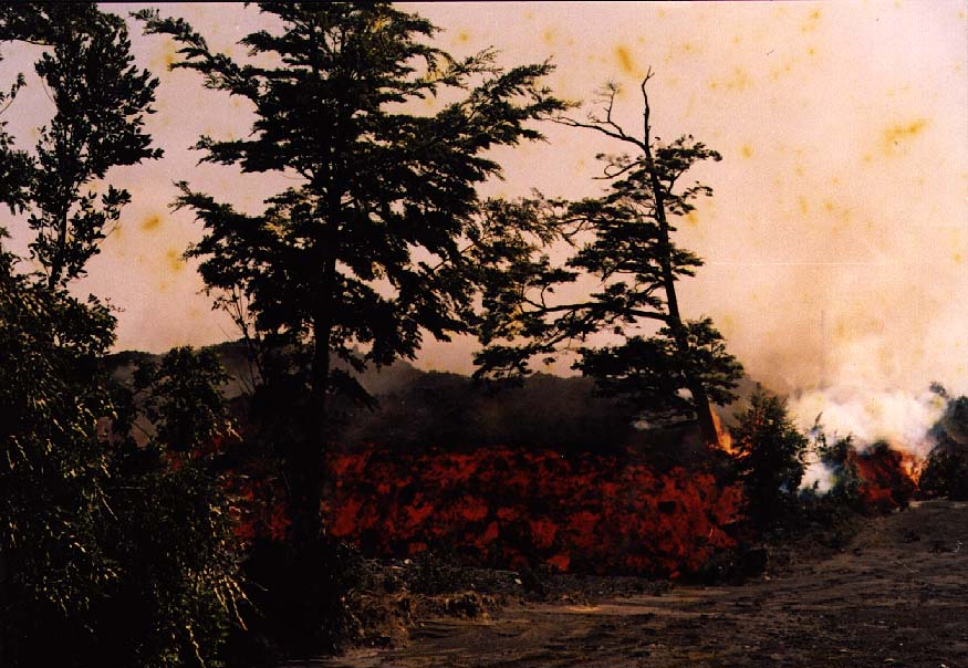
On 30 December 1971, lava is still moving down the Pedregoso and Chaillupén valleys, on the NNE and SSW flanks of the volcano, respectively. This photo, taken by an anonymous photographer, shows the front of the Chaillupén flow as it covers deposits of lahars that had rushed down the valley a few hours earlier. Photo supplied by Franz Plötz, Germany.
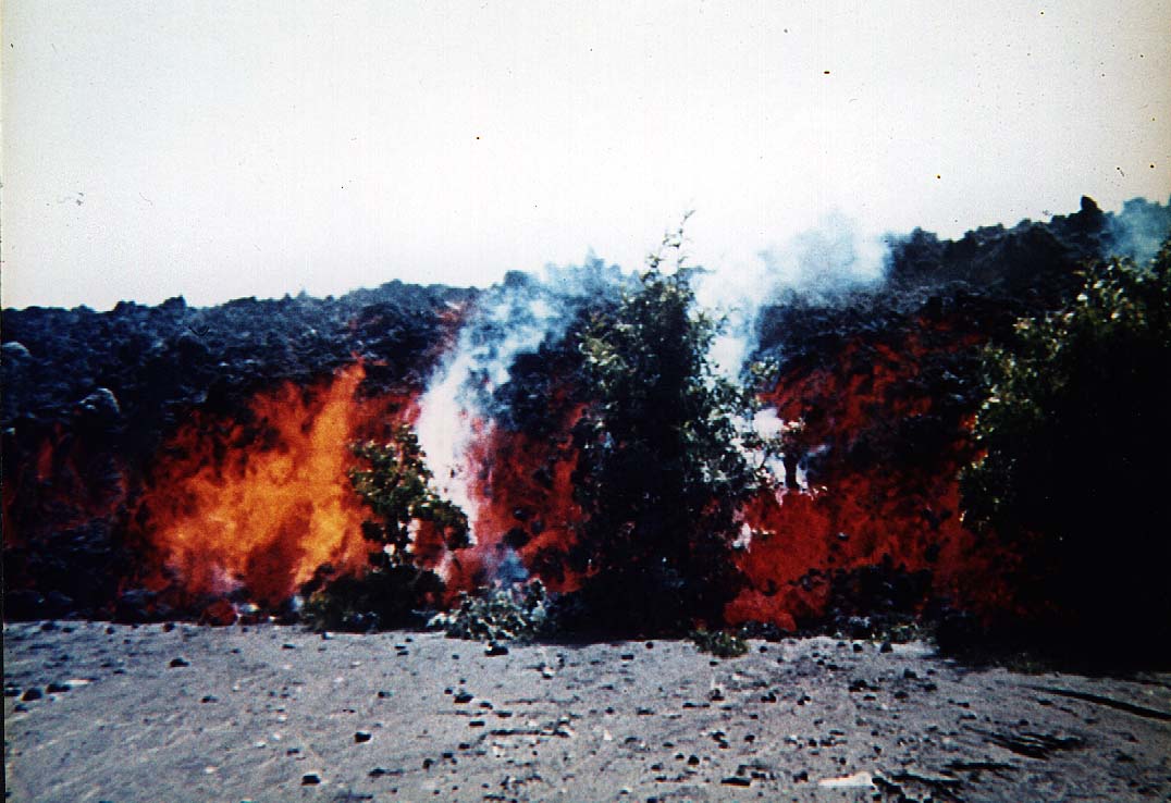
Lava flow destroying trees in the Chaillupén valley
(Full picture JPEG: 109K)
Another view of the Chaillupén lava flow eating through forest on the lower slopes of Villarrica, 30 December 1971. Photographer unknown, courtesy of Werner Keller.
Lahar deposits amidst a forest
(Full picture JPEG: 189K)
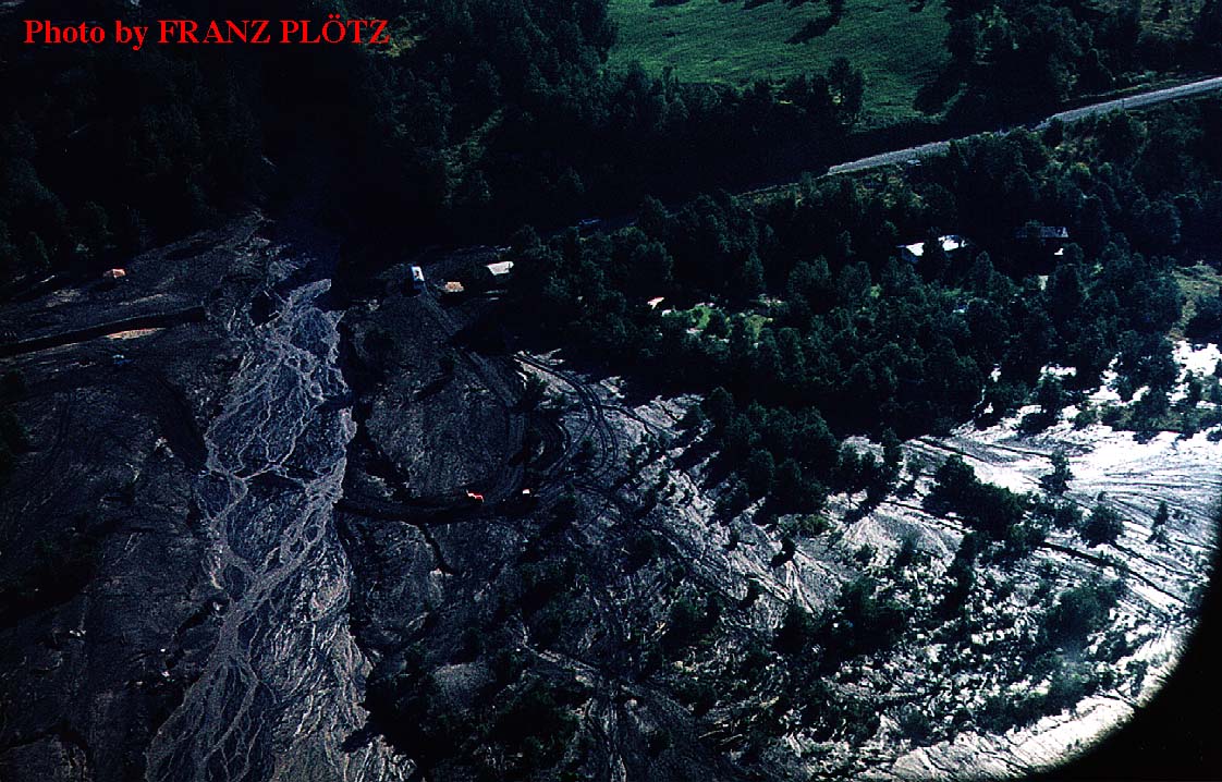
Aerial view of lahar deposits on the flank of Villarrica, taken a few days after the 29-30 December 1971 eruption. This lahar devastated a campsite named "Camping Narquimalal"; the location of that site is not precisely known. Campsite was to be inaugurated on 1 January 1972. Note channel eroded into central portion of the deposit, probably when hyperconcentrated flows cut into the deposits of denser earlier flows. Lahar velocity was estimated at about 30-40 m/sec. Photo by Franz Plötz, Germany.
6. Villarrica after the eruption
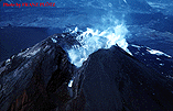
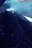
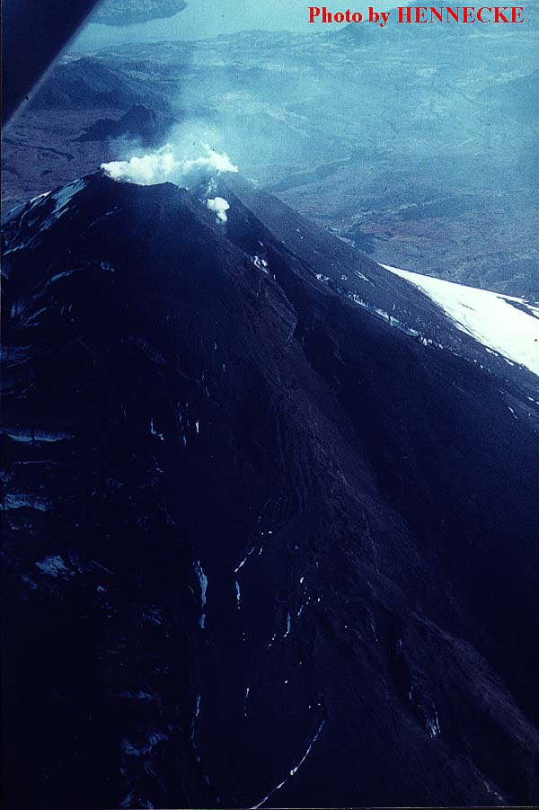
Summit of Villarrica with chasm on NNE side
(Full picture JPEG: 120K)
Looking down onto Villarrica's summit and upper part of the NNE flank fissure, shortly after the late December 1971 eruption. A large vent lies immediately below the former crater rim which itself has been partially breached. This is the site of the large lava fountain on the NNE flank. Chasm is at least 150 m deep, and a small vent in its upperpart is still emitting steam. Much more steam is coming from the summit crater where a large pit has formed, completely engulfing the cinder cone that had grown there before 29 December 1971. Note tephra-covered glacier on the SW flank (left). Photo by Franz Plötz, Germany.

SSW flank fissure and tephra deposits
(Full picture JPEG: 85K)
Aerial view of Villarrica's SW flank, showing upper part of the fissure on the SSW flank only a few days after the 29-30 December 1971 eruption. Much steam is being emitted from the fissure and the summit crater. Major V-shaped vent in the upper part of the fissure was the source of the large lava fountain on the SSW flank, but there is no breach in the summit crater rim on this side. Extensive tephra deposits are visible on this side, and minor lahars are at left. Nevados de Sollipulli volcano (with a large caldera that has been the source of a major Plinian eruption a few thousand years ago) lies in upper left corner of image. Photo by Franz Plötz, Germany.
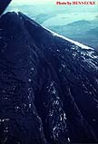
The fractured summit of Villarrica after the 1971-1972 eruption
(Full picture JPEG: 89K)
Aerial view of Villarrica's summit sometime after the eruption, showing the crater and the upper part of the NE flank fracture (left), a chasm at least 100 m deep. The SW part of the fracture is much less conspicuous. Compare this photo to shots taken during and after the 1984-1985 eruption that led to the complete filling of the NE flank fracture. Photo taken by G. Keller, courtesy of Werner Keller.
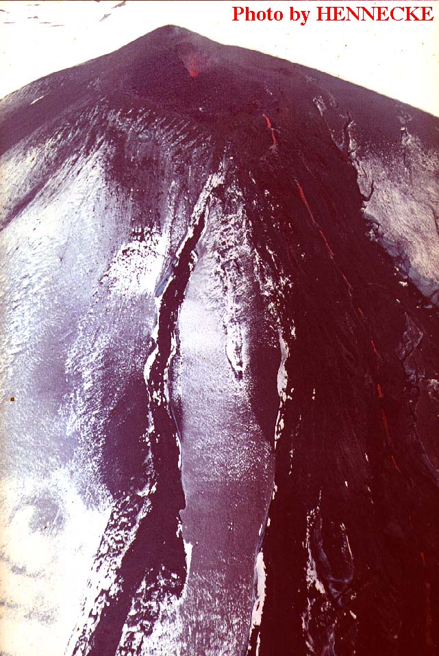
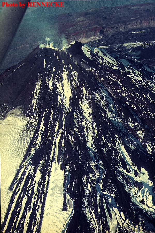
Eruptive fracture of 29 December 1971
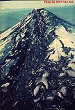
(Full picture JPEG: 96K)
Aerial view of Villarrica's NE flank, shortly after the 29 December 1971 paroxysm, taken by Hennecke early in 1972. The NNE part of the fracture and lava flows cutting deep scars into the icecap of the volcano are distinctly visible. Note that in areas of tephra fall, the glacial ice has not been melted but rather covered with a layer of dark pyroclastics. Neither fallout nor lava flows affected the NW flank (white snow visible on the upper right flank). Lago Calafquén is visible in the upper right part of the photo.
Detail of fracture on the upper NNE flank
(Full picture JPEG: 65K)
Detail of preceding photo, showing large V-shaped cleft immediately below the summit. The fissure is widest at some distance from the summit crater. Note sharp border of remaining ice on the far side of the fissure, right side of photo and tephra-covered ice in the foreground.
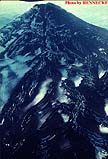
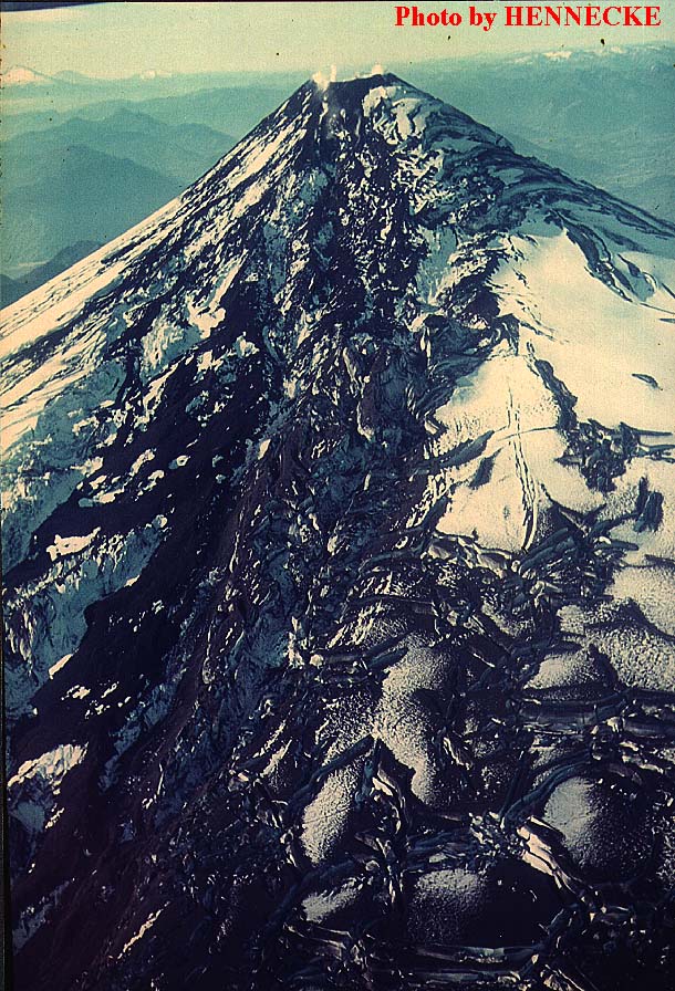
Eruptive fracture and small lahars on upper SSW and SW flanks
(Full picture JPEG: 204K)
Aerial view of the SW flank, with the SSW segment of the 29 December 1971 eruptive fracture, taken by Hennecke, Chile. The fracture is less pronounced on this side of the volcano. Many small lahars have flowed over the snow and ice in the foreground without cutting into it. Caldera rim and prehistoric eccentric cinder cones are visible in the background (upper part of photo).
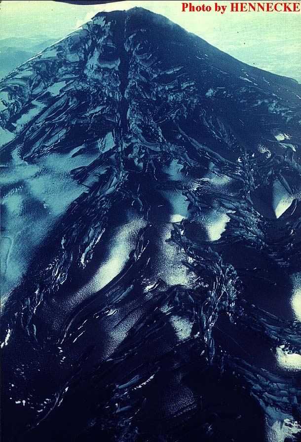
SSW flank with eruptive fissure and crevasses in icecap
(Full picture JPEG: 186K)
The SSW flank of Villarrica, shortly after the climactic eruption of 29 December 1971. A light dusting of new snow covers some of the tephra deposits and lava flows on the volcano. Destruction of the icecap by the lava flows is evident: large cracks and crevasses cut the glacial ice in many places. The lava flow on this side of the mountain attained a full length of 14 km and nearly reached Lago Calafquén, 16 km from the summit.
SSW flank, sometime after the December 1971 eruption
(Full picture JPEG: 136K)
This photo was evidently taken somewhat later than the photos shown above. Some new snow is dusting lava and tephra deposits of the 29 December 1971 eruption on the SSW flank while the eruptive fissure high on the cone is still well visible. Large volumes of glacial ice appear to have slid somewhat downslope. Gaping fractures are present in the icecap.
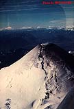
The restoration of the summit icecap, September 1972
(Full picture JPEG: 101K)
Aerial view by Hennecke of the SSW flank of Villarrica, about nine months after the catastrophic eruption of 29 December 1971 (September 1972). Rapid recovery of the icecap is evident. The fracture that has split open the upper part of the cone is still evident but has been filled with new snow and ice, and all lava flows has been buried. Southern Chile is an area of high precipitation rates. A light dusting of ash is visible on the E flank (right) but only minor steaming occurs from the crater. Note volcanic cones in the left distance (the largest may be Llaima).
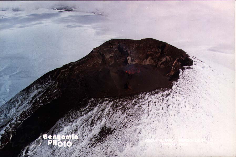
See Villarrica in eruption, 1948-1949, 1963-1964, 1984-1985, and most recently
Page set up on 1 December 1996, last modified on 10 December 1996
Hosted by VolcanoDiscovery


