
| Etna
index |
||
| Geology | Geological history | Cones and craters |
| Eruptive characteristics | Eruptions before 1971 | Eruptions since 1971 |
| Etna and Man | References | Web sites |
| Weather forecasts | FAQ | Latest news |
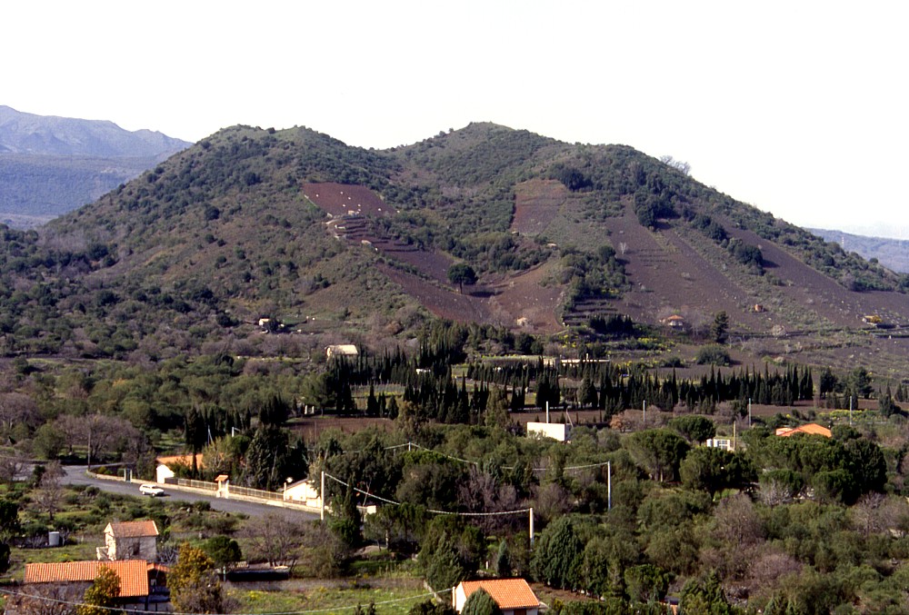 |
In
contrast to its relatively regularly shaped neighbor cone Mompeloso,
Monte Arso shows a distinct morphological complexity. While several
smaller vents on its southern flank have been partially obliterated
by agricultural activity, there are four major craters at the
summit, three of which have smaller craters lying nested within
them. This photograph, taken on 15 April 2000, was taken from
the north flank of Mompeloso, another youthful cone lying about
1.3 km to the SSW of Monte Arso. Note the presence of weekend
homes and land villas as well as the area with cypressus trees
(belonging to an "agriturismo") at the base of the cone |
Mamma
Etna's countless children
Monte Arso ("the burnt
mountain")
S flank, 15.037558° E, 37.644125° N
Summit elevation: 1035 m
![]()
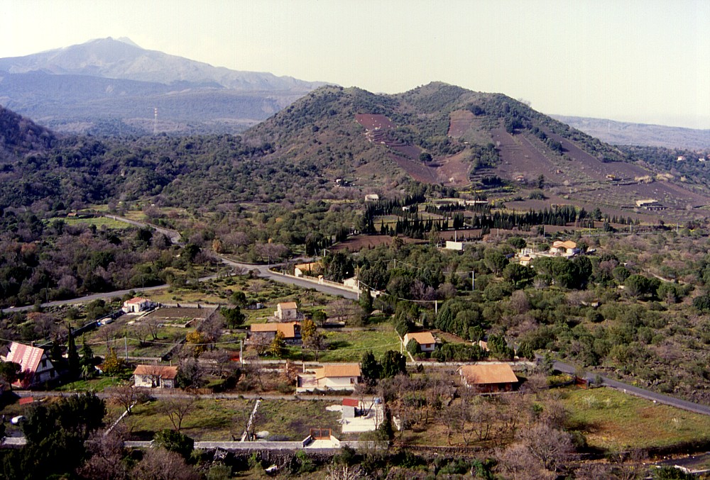
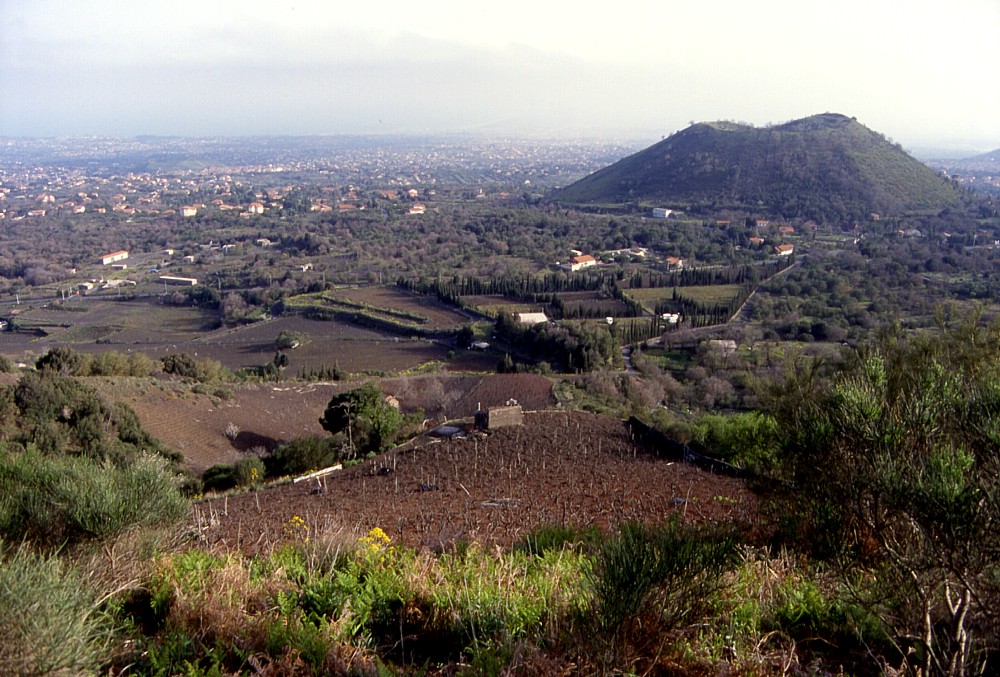
"The
burnt mountain", Monte Arso, is another conspicuous cone that forms
the background to the town of Nicolosi, with nearly a dozen of Etna's
baby volcanoes clustering in little more than 15 km2. Rising
about 150 m about the surrounding surface, it is one of the major flank
cones of Etna. Its youthful shape has led some to attribute an eruption
in the 15th century to Monte Arso, although its status is actually unclear
- Del Carlo and Branca (1998) have failed to establish the stratigraphic
relationship of the cone with the 122 B.C. tephra deposit, which is a
stratigraphic marker on the southern and southeastern flank of Etna. Yet
the morphology and the development of vegetation on the cone indicate
that it might be one of the more recent of the cones to the north and
northeast of Nicolosi, although the relatively sparse vegetation could
also be interpreted as resulting from a relatively recent eruption at
the nearby Monte Gervasi (which postdates
the A.D. 252 or 253 Mompeloso eruption,
further to the south).
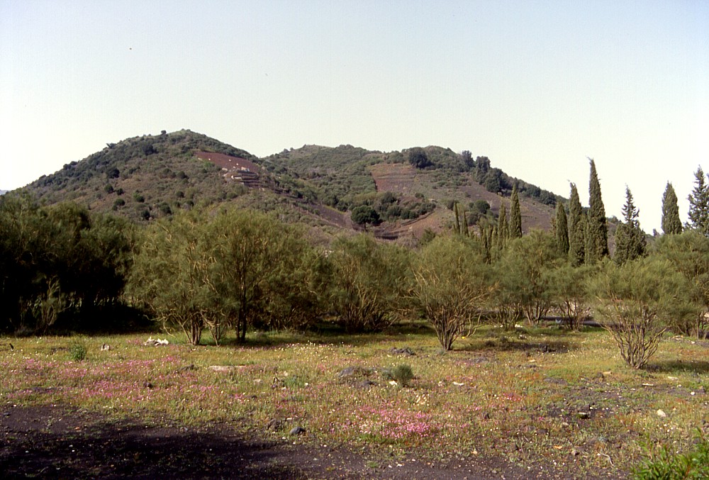
Monte Arso is one of the most complex cones in the area, with numerous
vents, some of them lying nested within others, at its summit and south
flank, marking an eruptive fissure about 0.7 km long. Like at Mompeloso,
about 1.3 km to the south, several smaller vents lie on its southern flank,
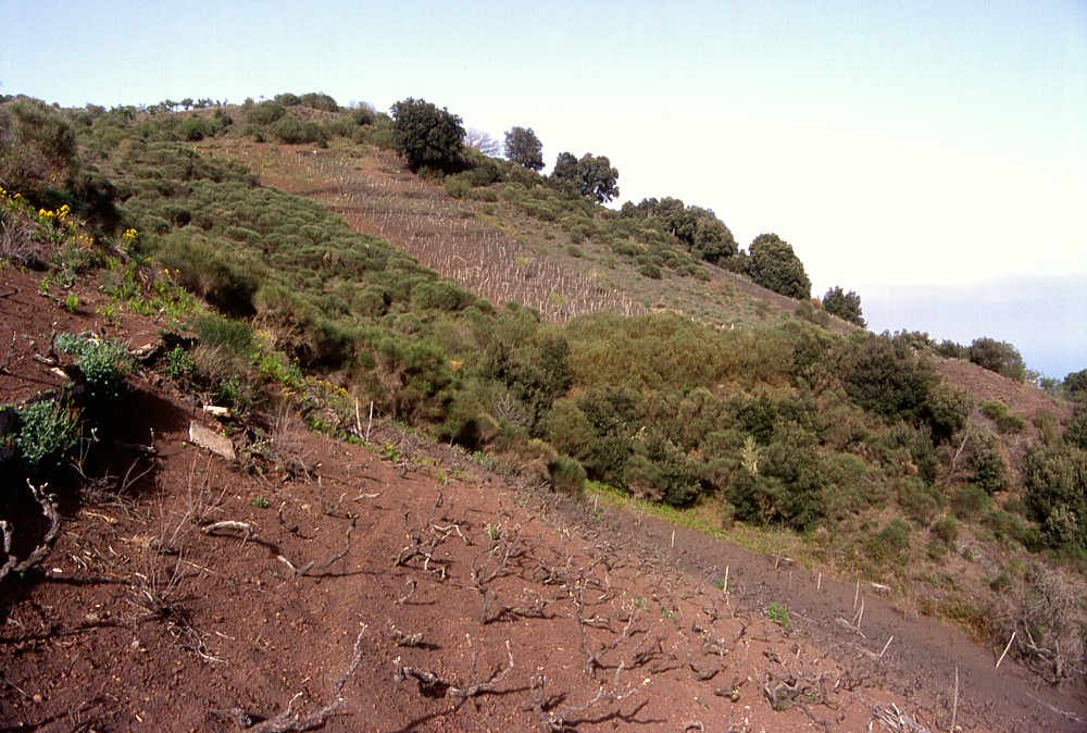
with one of them forming a half-cone on the lower south slope. Extensive
agricultural use (mostly vineyards with a few fruit gardens) has partially
masked these lower southern vents, whereas the summit area still shows
clearly the features of four major craters, and at least three smaller
craters lying nested within them.
I visited and climbed Monte Arso on 15 April 2000, when these photographs
were taken. I once more climbed it on 13 March 2004, mostly in order to
take photographs of nearby Monte Gervasi.
 |
 |
 |
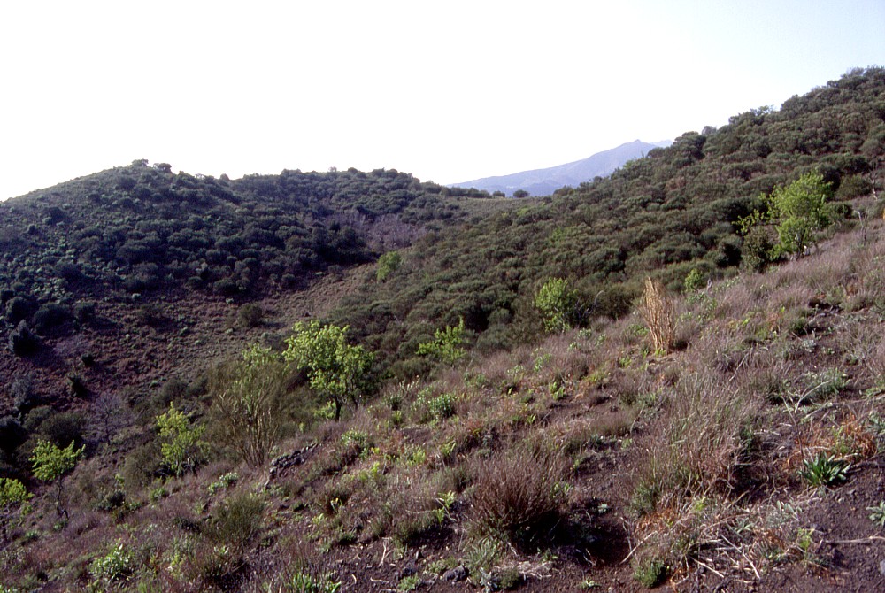
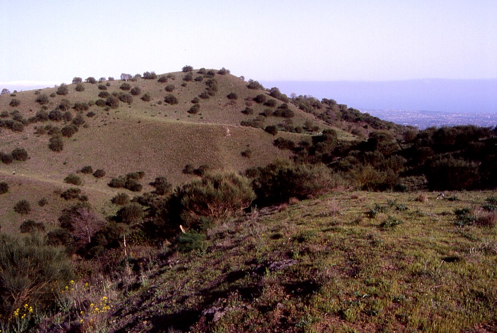
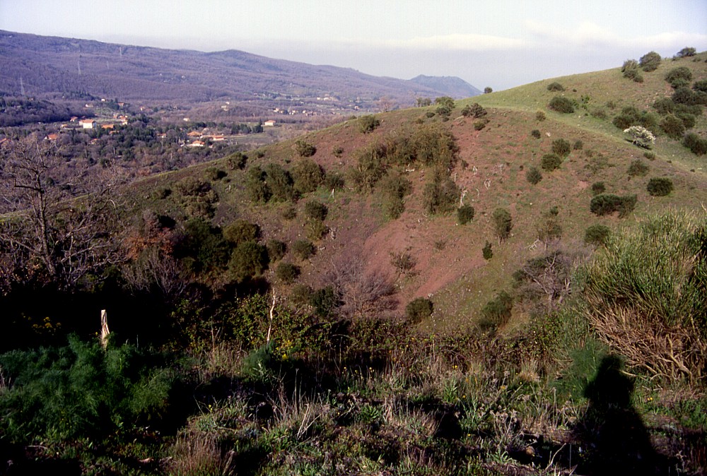
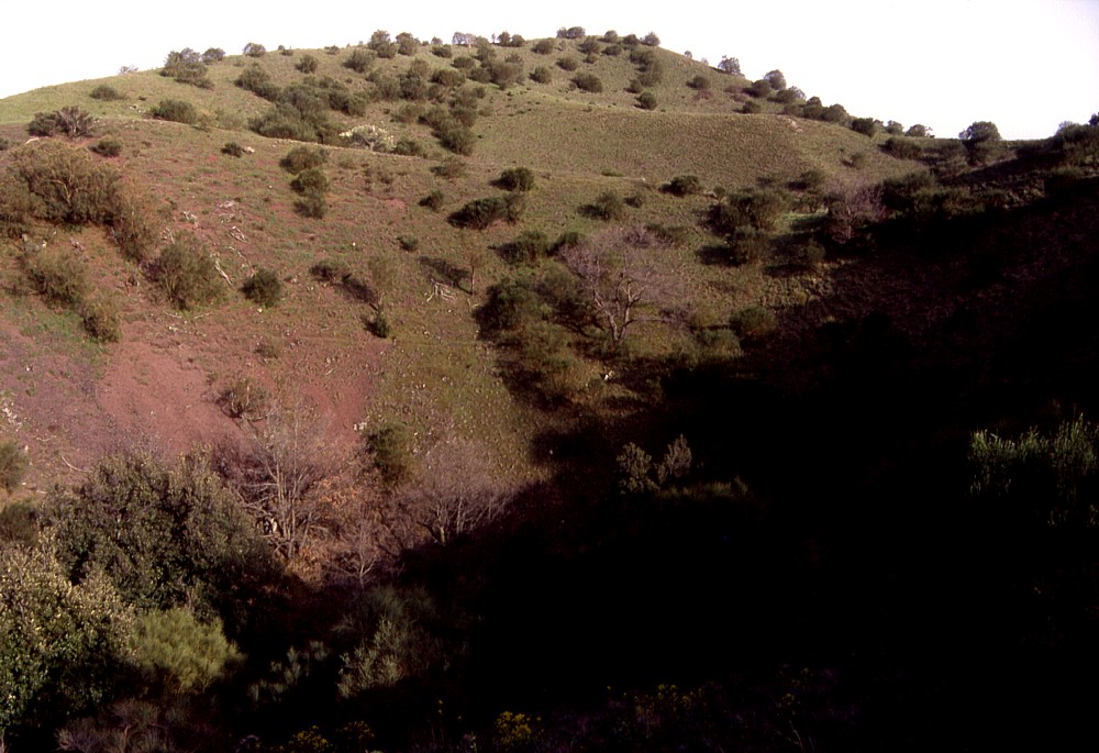
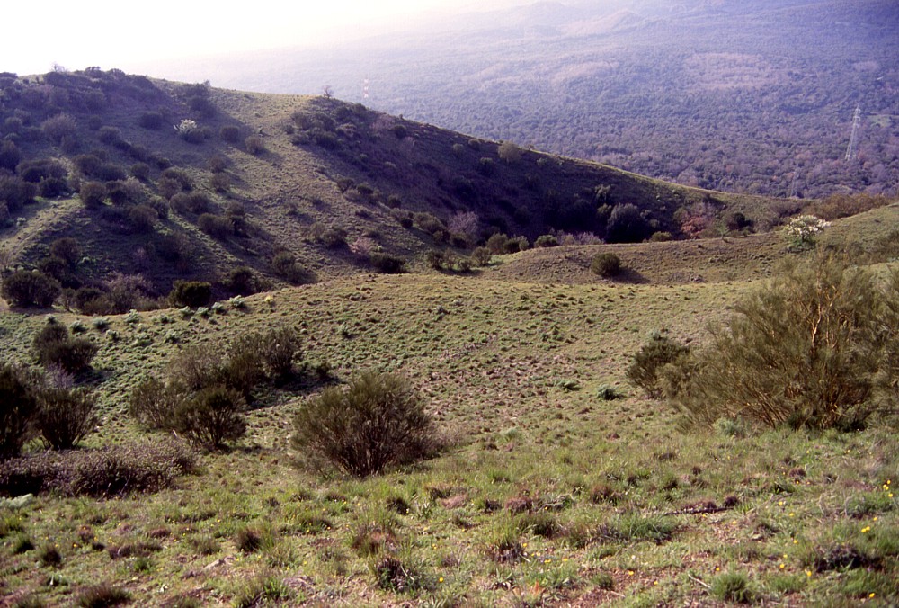
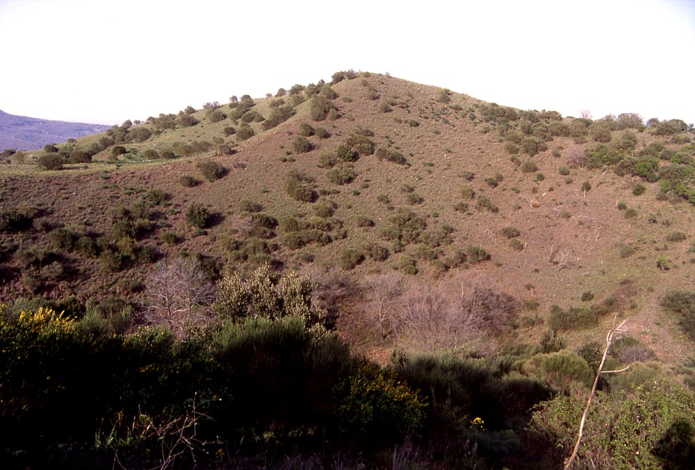
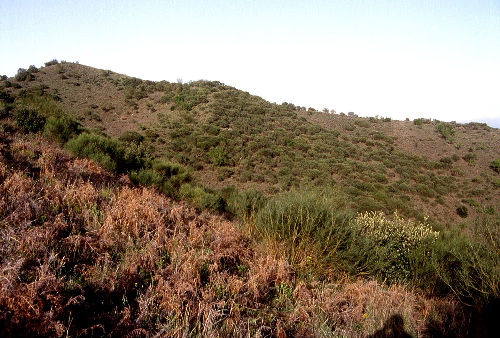
Left:
a view of Monte Arso from the summit of Mompeloso,
1.3 km to the SSW, with Etna's main edifice in the background, and
the eastern slope of Monte Gervasi
at the extreme left. Monte Gervasi was the site of the second most
recent eruption in the Nicolosi area, sometime between A.D. 252
(or 253) and 1669 Center: Southern face of Monte Arso, seen from about 0.9 km distance from its summit Right: vineyards cover much of the southern flank of Monte Arso, and intense agricultural activity since many centuries masks the rim of a small half-cone (in right foreground) leaning on the lower southern flank of the main cone. A larger crater occupies the area between the viewing point and the tree-dotted crest in the background |
||
 |
 |
 |
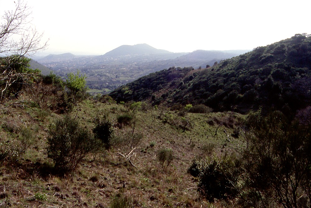
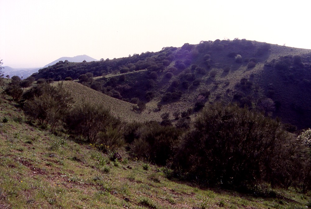
These
three photographs show different views of the southernmost of the
three major craters at the summit of Monte Arso. This crater is
open to the south, as its rim on that side was kept open by the
activity of several fissure vents further down on the southern flank.
Left photograph is a view from SE, whereas the center view looks
SW (the large cone in the background is Monti
Rossi, with the smaller Mompilieri
lying to the left of it), and the right photograph, toward SSE,
shows the cone of Mompeloso in
the left background |
||
 |
 |
 |
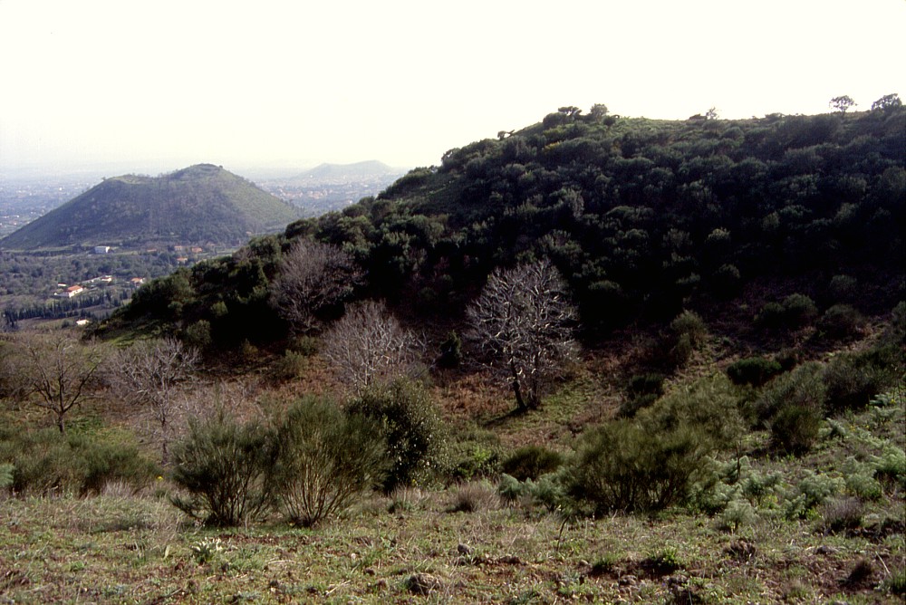
Left:
view across the summit craters of Monte Arso toward N, with Mount
Etna's main edifice in the background. This view shows that the
craters form several depressions separated by ramparts Center: more of the complexity of the summit crater complex of Monte Arso is seen in this photograph, with one smaller crater lying eccentrically toward the eastern (and highest) part of the summit area. View is to the SE Right: the northernmost of the summit craters of Monte Arso forms a low cone partially burying a neighboring larger crater (whose rim is seen at upper right). Monte Ilice, near Monterosso, is seen in the distance. View is to the ENE |
||
 |
 |
 |
Left:
view from NW rim of the northernmost summit vent of Monte Arso (seen
in the foreground) across the summit area of the cone, with one
larger and one smaller crater in the background Center: a smaller crater lies nested within the second most southerly of the four summit craters of Monte Arso, seen here from the eastern summit area (looking SE), which also forms the highest point of the cone. Monti Rossi cone is seen in the distance Right: a view from the same spot as in previous photograph, but looking NW, with northernmost two summit craters of Monte Arso |
||
 |
 |
 |
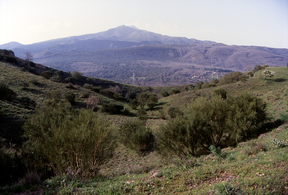
Left:
a relatively tall rampart (at upper left) separates the most centrally
located of the four summit craters of Monte Arso. High point on
far side of the crater area is the summit of Monte Arso, rising
to 1034 m elevation. View is to the NE Center: southernmost of the summit craters of Monte Arso (to the right) partially cuts into another of the four summit craters (at left), with no significant rampart having developed between the two. View is to the ENE Right: lower portion of the southernmost summit crater of Monte Arso, with vineyard covering its floor. The low crest behind it (best seen behind the small building and large tree in the middle ground) is the northern rim of the small half-cone that occupies the lower south flank of the Monte Arso cone. View is to the SW, with Mompeloso in the right background |
||
Copyright © Boris Behncke, "Italy's Volcanoes: The Cradle of Volcanology"
Page set up on 14 December 2003, last modified on 13 March 2004