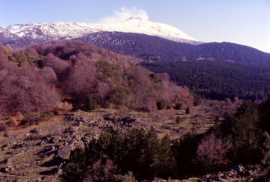
The discovery continues, 12-24 February 1998
Following
the splendid visit, together with a German television crew, to
the summit craters on 11 February 1998, I continued to discover
Etna's marvels during the remainder of that month. For the first
time I had the occasion to get acquainted with the northern flank
of the volcano, of which until then I had seen very little. On
18 February I was back to the summit craters, once more seeing
the Southeast Crater doing its show at sunset, and glimpsing the
southeastern vents of the Bocca Nuova, which had returned to life
violently one week earlier. Many of the photos taken during that
visit are fine documents of how Etna's upper southern flank and
summit area looked at the time, and are now of historical value:
these places were completely overwhelmed during the Southeast
Crater activity in the following years, and the flank eruptions
in 2001 and 2002-2003.
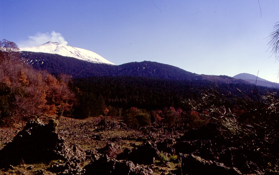
12
February 1998 round trip
|
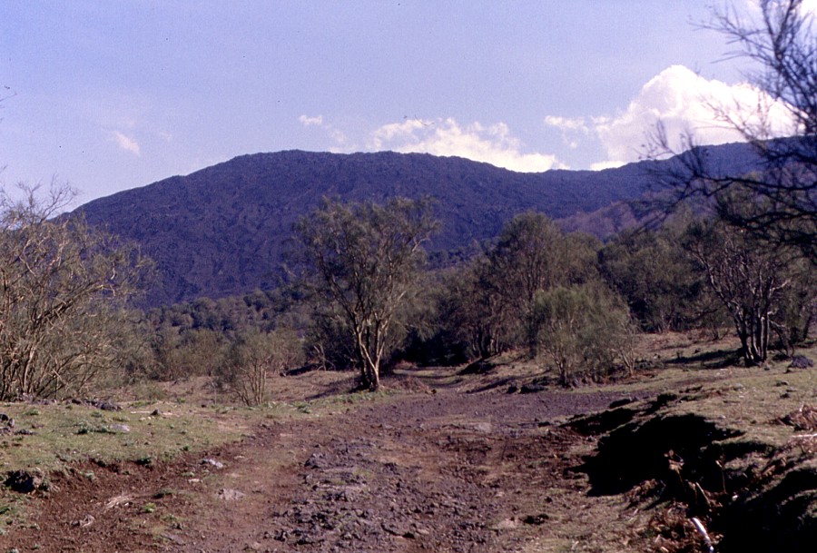
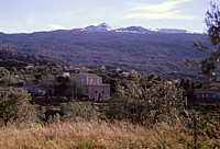
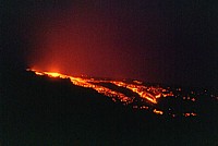
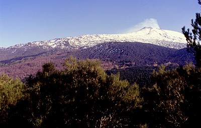
| Etna's
summit and upper eastern flank seen from the area immediately
to the north of the little village of Fornazzo, located
at about 800 m elevation on the eastern flank of the volcano,
on 12 February 1998. Dark material in the foreground is
lava of the 1971 flank eruption, which came from two fissures
higher up the slope in the middle ground. This lava flow
passed only 50 m from the nearest house of Fornazzo, 20
years after a lava flow coming from the Valle del Bove had
seriously threatened the same village, and eight years before
yet another lava flow came once more uncomfortably close
- actually none of the numerous towns and villages around
Etna have been so often suffered from Etna's assaults in
the past century as Fornazzo.
Behind the dark, irregular crest in the center of the image
lies the Valle del Bove, a vast 8 x 5 diameter collapse
structure on Etna's eastern flank whose origin is still
not fully understood. The upper western wall of the Valle
del Bove is seen below the summit crater complex, with numerous
lava flows erupted from the summit craters showing distinctly
with the low angle of incoming sunlight. The peak at right
is Pizzi Deneri, actually a series of peaks aligned on the
northern rim of the Valle del Leone (a side valley of the
Valle del Bove).
Seen from this direction, the summit crater complex appears
quite broad, with the Southeast Crater lying to the left
(note the symmetrical summit of the growing intracrater
cone looming over the rim of the Southeast Crater), the
central summit cone in the center, and the huge truncated
cone of the Northeast Crater to the right. |
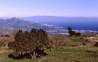 |
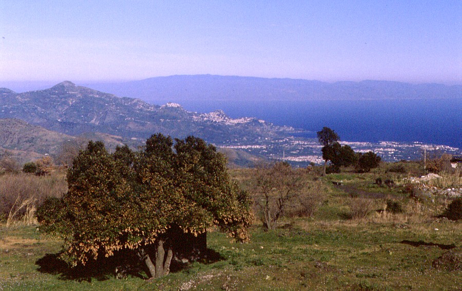
Left:
splendid clear view from Etna's northeastern flank over
Taormina (the town sitting on the hills in the center of
the image) to the huge doming mass of the Aspromonte, on
the southern tip of the Italian peninsula, 12 February 1998
Right: lush vegetation on Etna's northeastern flank, with
the snow-covered peak of the Northeast Crater in background |
 |
 |
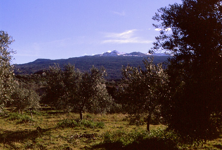
Left:
land houses amidst a beautiful scenery on Etna's lower northeastern
flank, in the background are the dark prehistoric cone of
Monte Timparossa and snow-covered Monte Nero (formed in
1646-1647), and the Northeast Crater in the distance
Right: snow-covered northwestern face of Etna seen from
the plain to the north of the town of Bronte |
 |
|
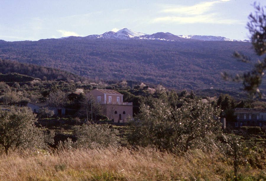
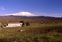
| The
impressive western face of Etna as it appears from the town
of Bronte (actually this view is limited only to the eastern
outskirts of the town, while its central and western portions
lie in a deep, amphitheater-shaped depression and from there
the volcano is not visible). Numerous lava flows, many of
them with beautiful lateral levees, can be discerned on
the snow-covered flank, and in the central part of the slope
there is a spectacular eruptive fissure that produced the
1843 flank eruption (this is better visible in the large
version of this photograph). Some of the numerous pyroclastic
cones that dot the lower western flank of the volcano can
be seen immediately to the left of the trees in the right
part of the image. Photograph taken on 12 February 1998 |
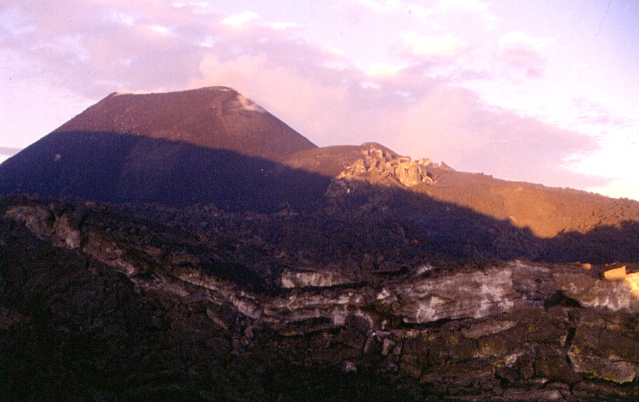
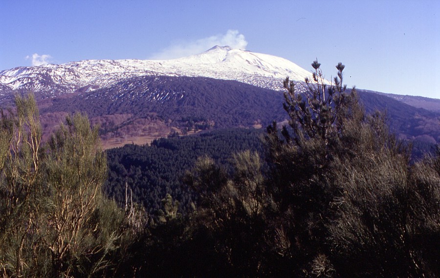
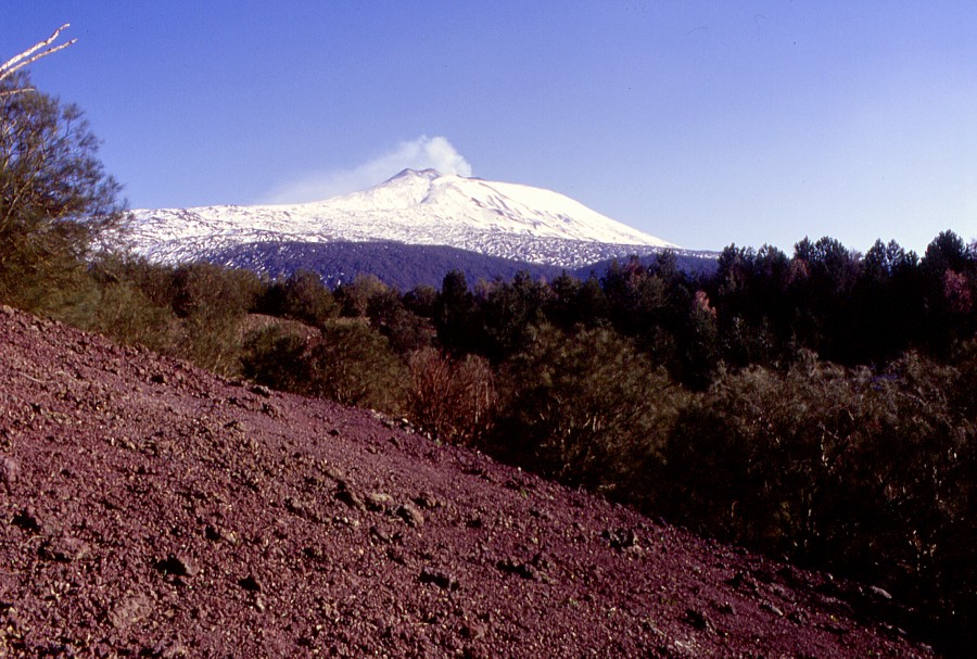
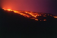
The
summit craters once more, 18 February 1998
 |
Left:
Looking from the upper part of the southern rim of the Valle
del Bove toward the summit craters on 18 February 1998.
The intracrater cone of the Southeast Crater is well visible
in this image
Right: southern flank of the Southeast Crater cone with
active lava flow, with levee showing finely due to low-standing
sun |
 |

|
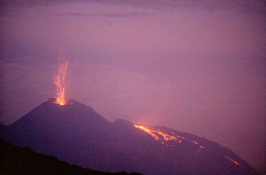
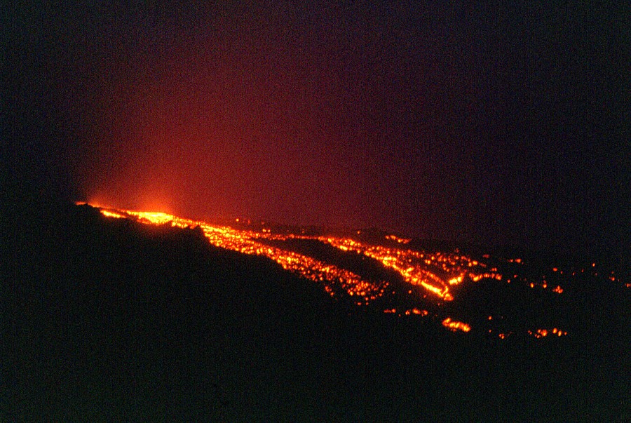
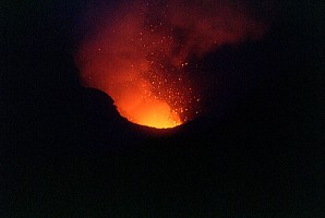
The
beautiful display of Strombolian activity and lava effusion
from the intracrater cone of the Southeast Crater seen at
sunset on 18 February 1998. The view is from the southeastern
rim of the former Central Crater, a nice lookout for the
Southeast Crater when it was still lower than that point,
and when its activity was still modest enough to be observed
at close range. It can be clearly seen how the explosive
and effusive activity are occurring at two distinct points,
which was characteristic for the activity at the Southeast
Crater in 1997-1998. Explosions occurred at the summit of
the intracrater cone, while lava issued from vents at its
base. Here it is seen how the effusive vents at times built
up to minor cones on their own |
 |
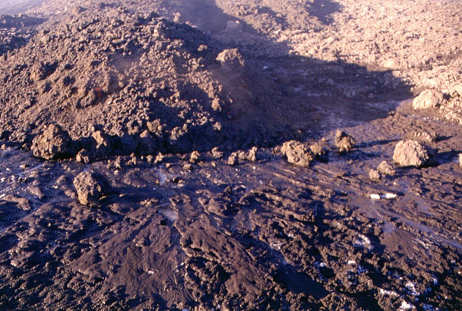
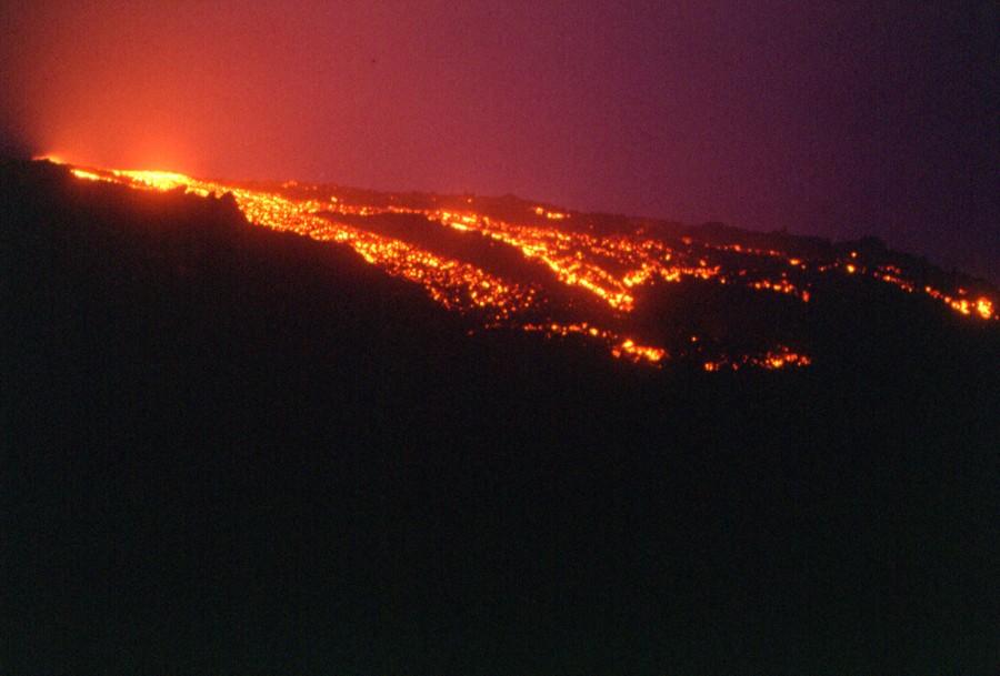
Unusually
voluminous surge of lava from the effusive vent at the southern
base of the intracrater cone within the Southeast Crater
on the evening of 18 February 1998 - unusual during that
period of activity at that crater. The lava forms numerous
branches, which spill over the south rim of the crater adjacent
to a flow emplaced earlier that day |
 |
 |
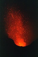 |
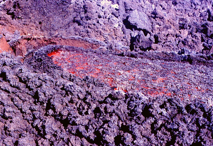
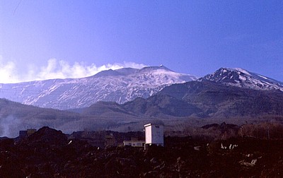
Vigorous
eruptive activity at the southeastern vents of the Bocca
Nuova, seen from the south rim of that crater on the evening
of 18 February 1998. Some bursts of incandescent bombs are
rising as high as the crater rim, about 70 m above the vents |
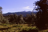
Landscapes
of Etna's north-northwestern flank, 24 February 1998
All
of these photographs were taken during a hike to the sites of
the 1981 flank eruption on the north-northwestern flank, which
seriously threatened the town of Randazzo and the nearby village
of Montelaguardia (some of the photos are available on the 1981
eruption page and not displayed here again). Most of them are
panoramic shots taken from the prehistoric twin cones of Monte
Spagnolo, about 1-1.5 km west of the 1981 fissure, and render
an idea of how varied the Etnean landscapes can be even in a relatively
restricted area.
|
This
is Etna's north-northwestern flank as seen from the summit
of eastern cone of Monte Spagnolo, about 6 km to the south
of the town of Randazzo. The large cone standing at the
summit is the Northeast Crater, which is actually the highest
point of the volcano (as of mid-2003), at 3318 m elevation.
What appears to be a nearly horizontal area to the left
of that crater is actually the morphologically conspicuous
Northeast Rift, which forms a prominent ridge. The dark
lavas in the central-right portion of the image are part
of a large lava field that was emplaced in 1764-1765. The
narrow stip of black lava is the uppermost portion of the
main lava flow of the 1981 eruption |
|
Etna
has four summit craters and more than 300 cones and craters
on its flanks, the larger of which have been given names,
and most of these are begin with "Monte" (Mount).
Topographic maps furthermore show a feature named Monte
Collabasso on the northern flank, at an elevation of 1632
m. Differently from nearly all other Monti on the flanks
of Etna, Monte Collabasso is not a pyroclastic cone, but
a huge lava shield formed above an ephemeral effusive vent,
that is, a vent fed by a lava tube which received the lava
from a true eruptive vent higher upslope. The lava was erupted
during the most voluminous and longest flank eruption of
Etna during historical time, which lasted from 1614 until
1624, and produced mostly pahoehoe lava, which is otherwise
quite uncommon at Etna. Much of the lava did not flow at
the surface, but was delivered through complex systems of
tubes, some of which are still present in the form of lava
caves, the Grotta del Gelo and the Grotta dei Lamponi being
the largest and most famous. The lava issued from vents
at the end of the tubes, and if the activity lasted long
enough, a lava shield built up around such a vent. Monte
Collabasso is one of them. The view in this image is from
the west, taken on 24 February 1998 |
|