
| Etna
index |
||
| Geology | Geological history | Cones and craters |
| Eruptive characteristics | Eruptions before 1971 | Eruptions since 1971 |
| Etna and Man | References | Web sites |
| Weather forecasts | FAQ | Latest news |
 |
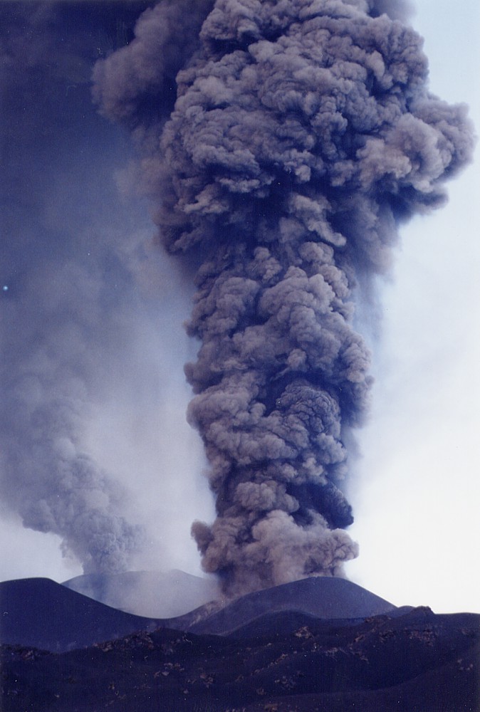
| Ash,
more ash, and still more ash. Throughout much of the three months
of the 2002-2003 eruption, areas around Etna suffered from recurring,
sometimes quite heavy ash falls, which severely hampered traffic
on the ground and in the air. During the first weeks of the eruption,
some ash falls were as heavy as to obscure daylight, as in this
photo taken by Giuseppe Scarpinati on 3 November 2002 in his home
town Acireale |
Etna
photo gallery: 2002
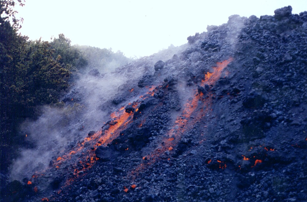
Etna on the move - the 2002-2003 eruption (2)
![]()
Lava flow on the northeastern flank, 1 November 2002
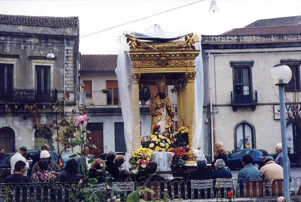 |
| Statue
of the patron saint of the town of Linguaglossa, Sant'Egidio,
posted at the margin of the town facing the erupting volcano.
Linguaglossa lies on the northeastern side of Etna, in full view
of the Northeast Rift eruption, and during the first days of the
eruption, lava flows advanced alarmingly fast in the general direction
of the town. On 1 November 2002, when this photo was taken by
Pippo Scarpinati, the activity at the Northeast Rift had markedly
diminished and all lava flows except one had stopped, and the
remaining active flow was advancing at a speed of a few meters
per hour. Nonetheless, Sant'Egidio was left guarding for another
few days |
 |
 |
 |
 |
 |
 |
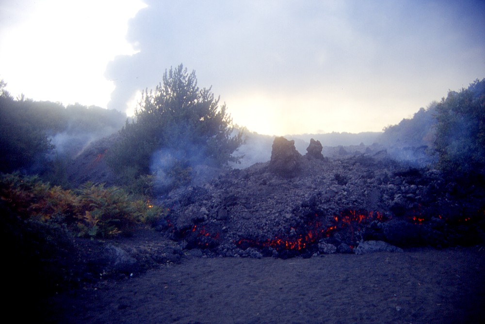
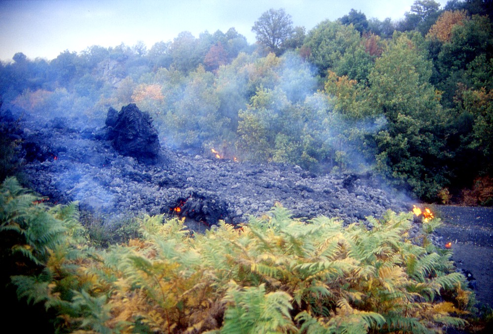
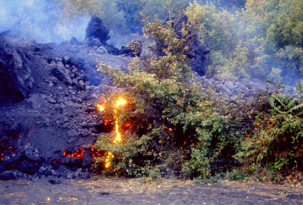
Although
the eruption on the Northeast Rift has significantly lost in strength,
the main lava flow is still advancing on the evening of 1 November
2002, heading northeast. It does no longer represent any threat
to inhabited areas further downslope, but continues to burn and
bury vegetation in one of Etna's most beautiful forests. The flow
is contained, on its northern side, by a steep slope, which is
actually the morphologically strongly expressed scarp of the Pernicana
Fault (visible at right in the top left image) |
||
Northeast flank, 2 November 2002
 |
 |
 |
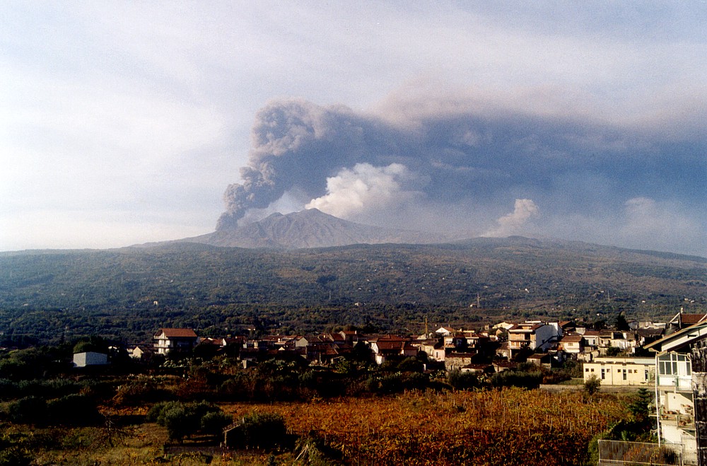
Views
of Etna from Linguaglossa on the morning of 2 November 2002, showing
voluminous ash production at the south flank vents (the shifting
wind is now driving the ash to the northwest, thus far spared
from ash falls of the eruption), gas emission but no longer explosive
activity at the summit craters, and much reduced eruptive activity
on the Northeast Rift (shown in detail in the right photograph) |
||
 |
 |
 |
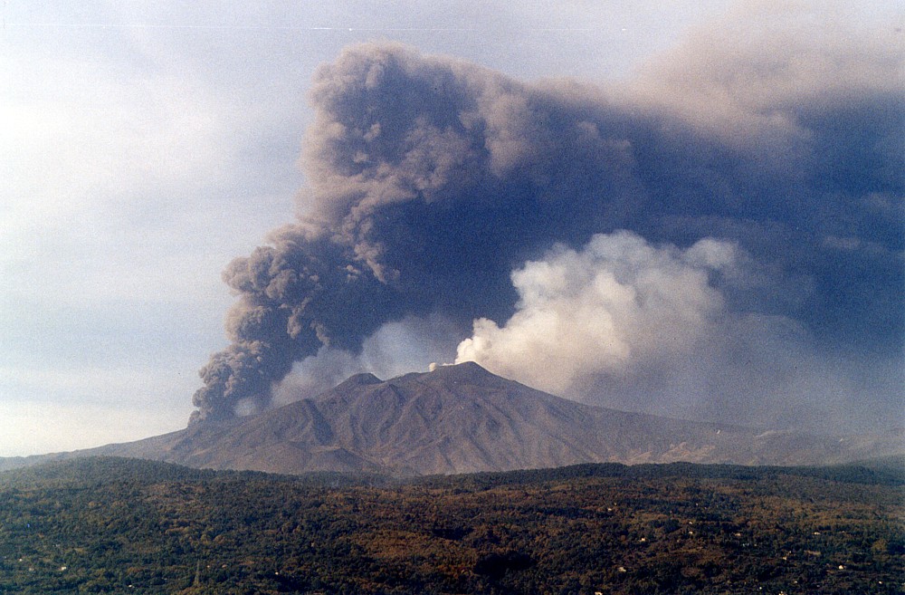
Left
image is a zoom on the summit area and the ash plume rising from
the explosively active vents on the southern flank (the vents
themselves are hidden behind the slope of the volcano). Note the
dense yellowish gas plume rising from the Northeast Crater (at
extreme right) and the slightly lower cone of the Southeast Crater
in the center of the image, which has remained absolutely inactive
during this eruption, in contrast with its involvement in the
2001 eruption. The photographs at center and right were taken
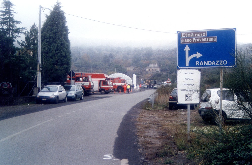
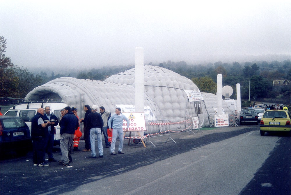
at the beginning of the "Mareneve" road near Linguaglossa,
where a roadblock had been placed, along with a remarkable temporary
hospital, which remained standing there for a couple of weeks
afterwards, although the Northeast Rift eruption ended three days
after these photographs were taken (2 November 2002) Nota bene: if you ever happen to come to Etna's northern flank, follow the indications given on the white sign in the center photograph (Pizzeria "Sciaramanica"). You will not find equally sized and tasty pizzas anywhere else on Earth, and surely none prepared for you by a true geologist! |
||
South flank, 2 November 2002
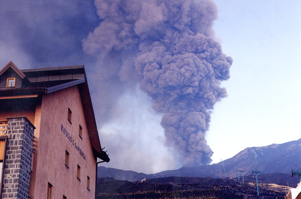 |
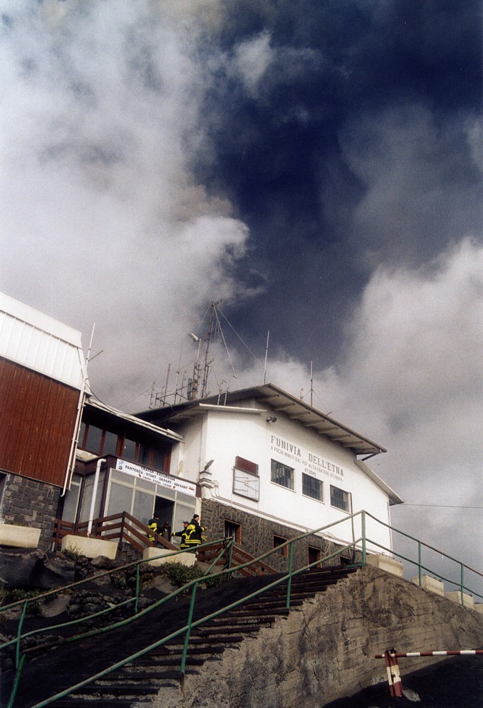
| Bad
signs in the sky: a dark column of ash is towering above the building
of the Rifugio Sapienza on Etna's southern flank on 2 November
2002. The building, which had been completely restructured and
was ready for re-inauguration in July 2001, had been seriously
threatened by the lava flows of the eruption of that year. Now,
little more than one year later, there's a new eruption under
way, not far away from the crater that sent out the menacing lava
flows in 2001. But so far this new eruption has produced only
a short-lived lava flow on the southern flank, which stopped three
days before this photo was taken by Pippo Scarpinati |
 |
 |
 |
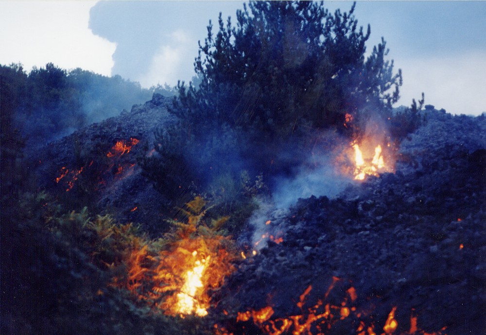
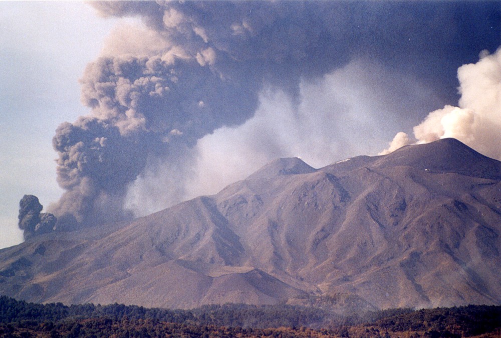
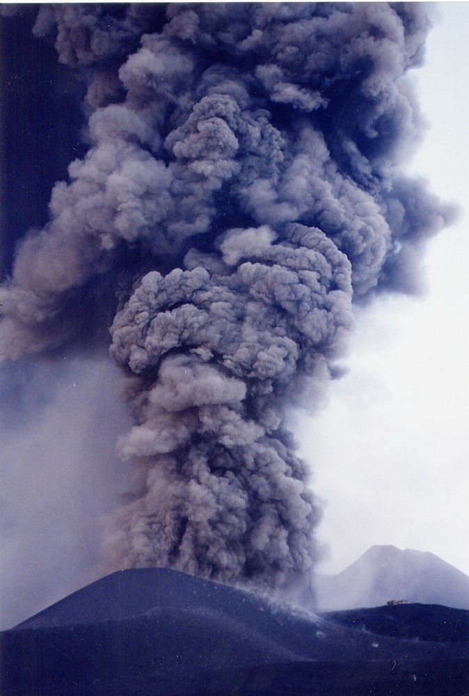
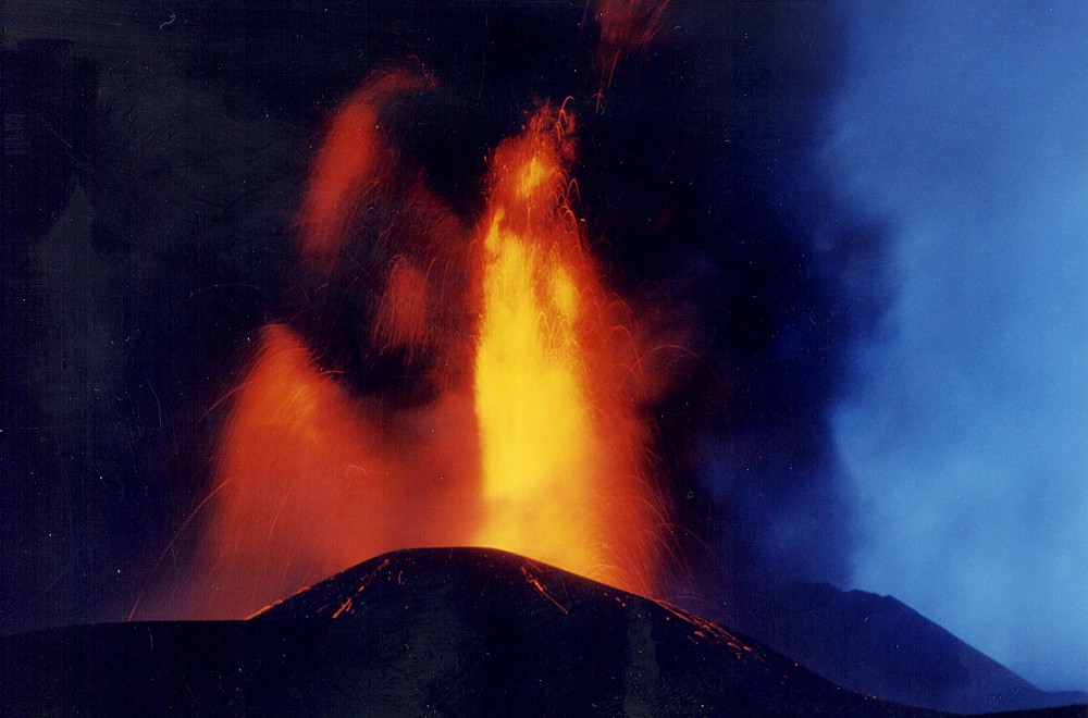
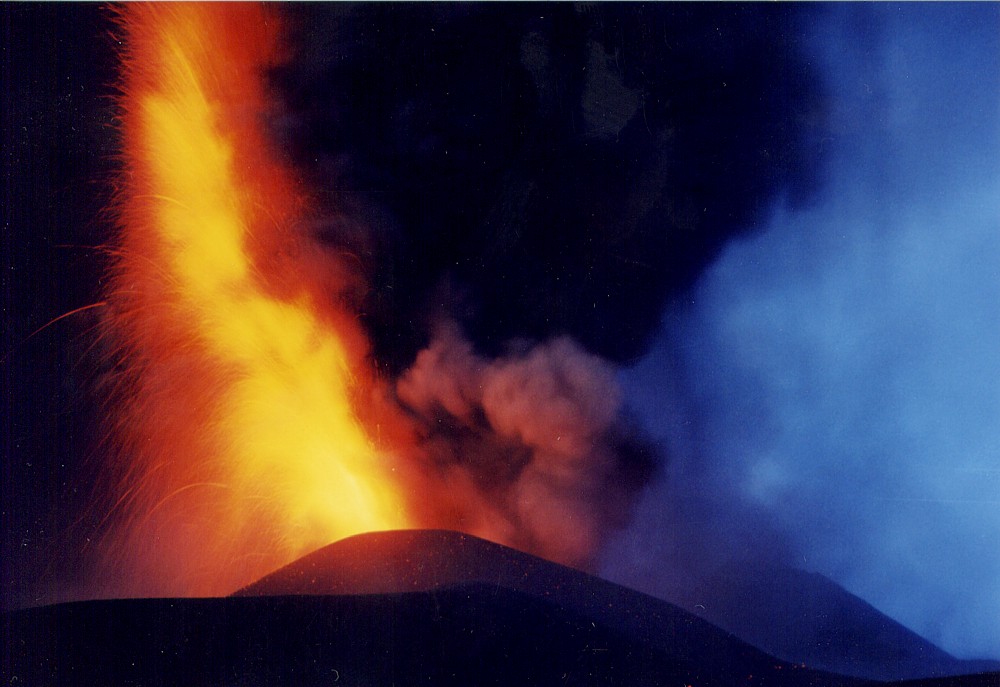
While
the eruption on the Northeast Rift is rapidly waning, it is vigorously
continuing without signs of abating on the southern flank, and
a huge new pyroclastic cone has begun to grow around the single
vent remaining in activity.On 2 November 2002, when these photos
were taken by Pippo Scarpinati, this cone was already as tall
as that formed only about 1 km further to the southeast in 2001.
Left photograph shows the inactive cone of the Southeast Crater
in the background, while a dark column of ash is seen rising from
the Bocca Nuova in the background of the center image. Right photograph
was taken at nightfall, showing that there was much more incandescent
material in the eruption column than the daylight view would have
suggested |
||
 |
 |
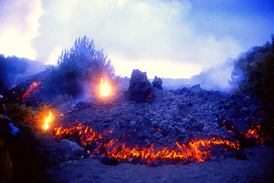
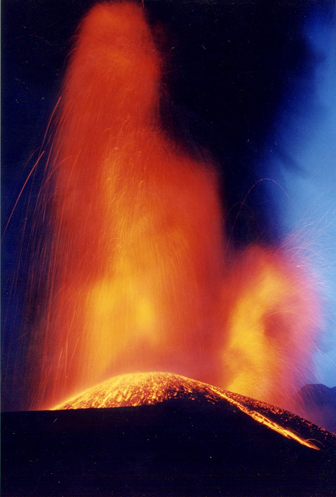
Fire
fountaining from the new pyroclastic cone at 2750 m elevation
(this is the elevation of the terrain in that place before the
eruption, not that of the cone itself) on the evening of 2 November
2002, photographed by Pippo Scarpinati |
|
South flank, 3 November 2002
 |
 |
 |
|
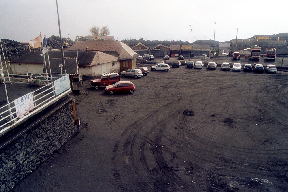
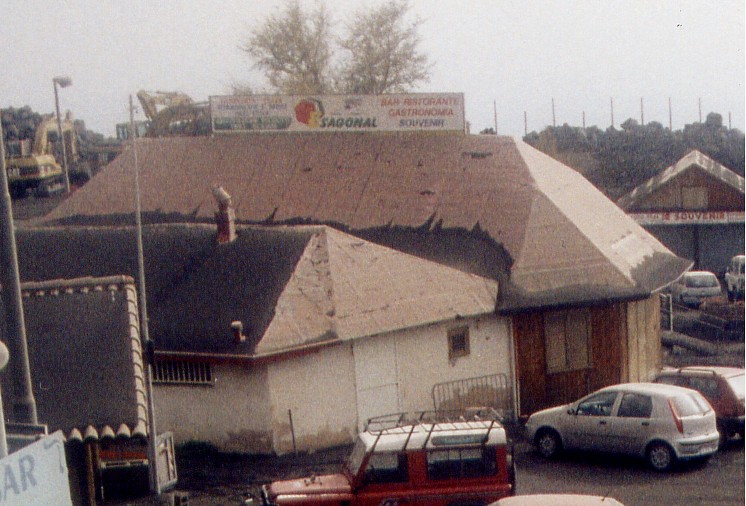
Scenes
from the tourist complex at the Rifugio Sapienza on the southern
flank of Etna, 3 November 2002. Top left shows the parking lot
lying below the departure station of the cable car, thickly covered
with ash of the eruption initiated one week earlier. The building
in left background of that image (shown enlarged below) is the
restaurant "Esagonal", which fell victim to the eruption
a few weeks later, when lava covered a fuel or water container,
causing an explosion. Flying debris from the incandescent lava
fell on the restaurant building, setting it ablaze. Top right
photograph shows the black ash plume from the upper south flank
vent darkening the sky above the departure station of the cable
car |
|
 |
 |
 |
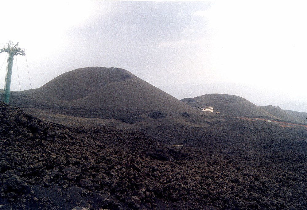
During
the hike to the new eruptive sites on the southern flank on 3
November 2002, there are few little but interesting things to
see. Left image shows the landscape so well known to thousands
of tourists who visit Etna in "normal" times: the large
scenic pyroclastic cones of the Monti Silvestri, formed during
an eruption in 1892 (which, judging from the size of those cones,
must have been pretty explosive as well, but back in 1892 the
ash falls did not strike a society as vulnerable as that of 2002).
In the foreground there is one of the lava flows of 2001, now
being buried by the ash of a new eruption, and a surviving pole
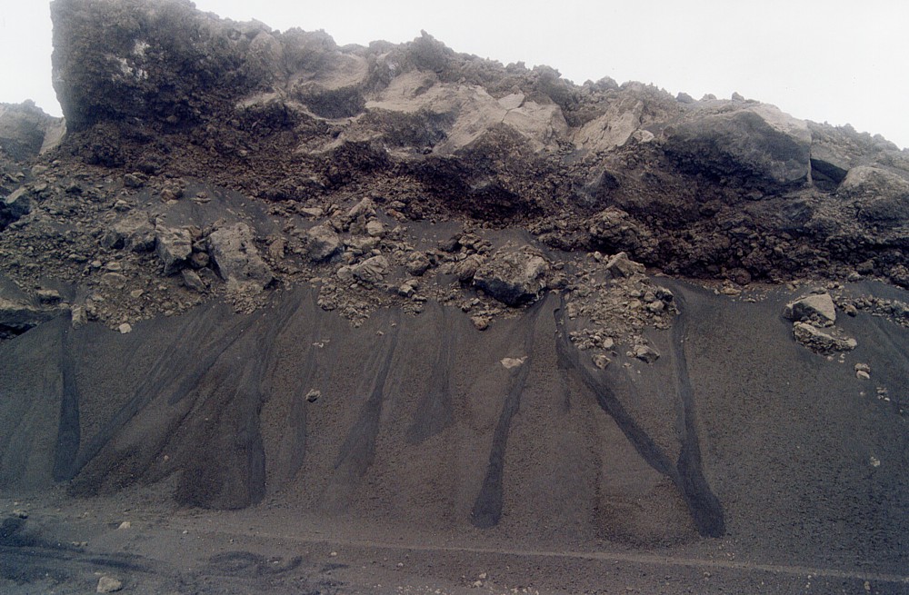
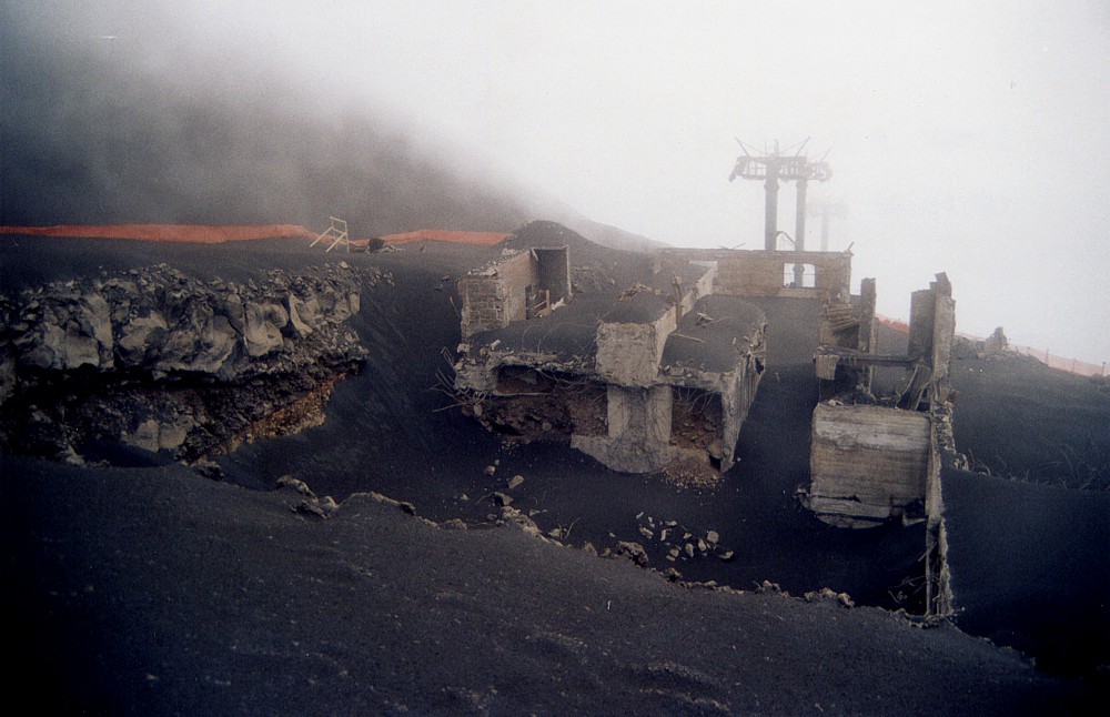
of the cable-car stands at left. Center image shows miniature slides in the fresh ash deposits covering a steep slope next to the dirt road leading upslope from the Rifugio Sapienza area. These slides are triggered by the rapid accumulation of ash on a steep surface, not by seismic activity or rainfalls (no rain has fallen on Etna since the beginning of the eruption one week earlier). There's quite some irony related to the photograph at right. It shows what remained of the arrival station of the cable car, which had been set ablaze by two small lava flows during the 2001 eruption and on this occasion transformed into an impressive ruin. For one year the ruin was a remarkable museum of destruction (see the post-2001 eruption photographs), and then, in September 2002, the company owning the cable car broke the ruin down, leaving only the foundations, which are still visible in the photograph at right. This was intended as the start of reconstruction, but before this could be effectively carried out, the new eruption began, and first the place was covered with ash. Then, at the end of 2002, lava flows from the new eruption covered the site for good, piling up to a thickness of 20 m. |
||
 |
 |
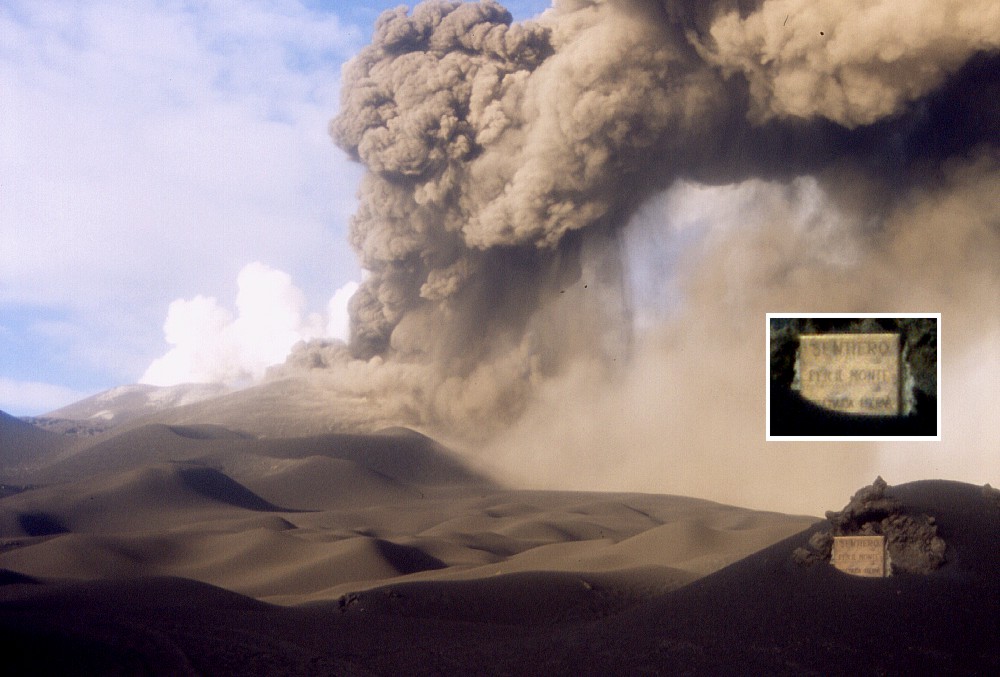 |
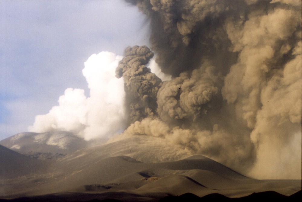
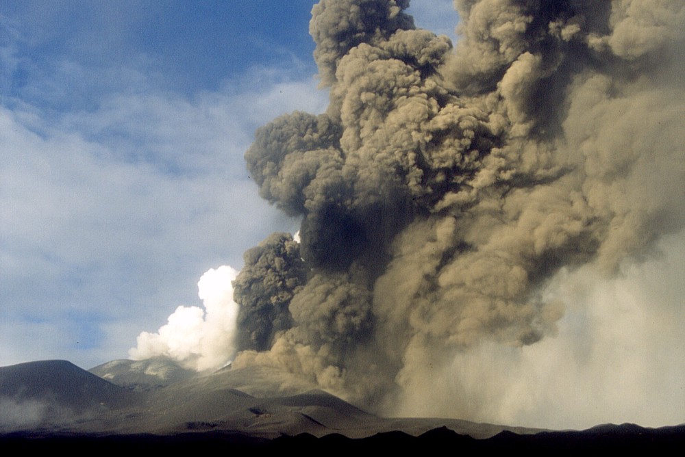
Vigorous
ash emission from the growing cone on the upper southern flank
on 3 November 2002, seen from south, with the summit craters in
the background. White vapor plume comes from the Bocca Nuova.
Left photograph shows three smaller, inactive pyroclastic cones
in front of the active one; these formed during the first days
of the eruption when a fissure with a total length of 1 km was
active. Dark cone at extreme left in center photograph is the
prehistoric Monte Frumento Supino; note that at the time these
photographs were taken it was still considerably higher than the
new cone - now, after the end of the 2002-2003 eruption it is
considerably lower. There's again some taste of irony in what the photo at right is showing. About one month before the beginning of the new eruption, in mid-September, a decision was made by the Etna Natural Park direction to give a name to the huge pyroclastic cone formed during the 2001 eruption in the place that was formerly known as the Piano del Lago. There had been much discussion about naming that cone, and proposals varied from "Montagnola 2" and "Cono del Lago" or "Cratere del Laghetto" to "Monte Tazieff". The decision that was eventually made surprised everybody. The name declared officially on 29 September 2002 was Monte Josémaria Escrivà (after a Spanish priest, founder of Opus Dei, who was to be canonized by the Pope a few days afterwards). On that day, a plate was fixed on a chunk of lava erupted in 2001, which at the same time symbolized the inauguration of a hiking path to the cone. The plate, visible in the lower right corner of the photograph at right and shown enlarged in the large version, says "Sentiero per il Monte Josémaria Escrivà" (footpath to Monte Josémaria Escrivà). Originally fixed at the height of an average person's head, the plate was about to be buried by the new ash when this photograph was taken, and now lies under lavas erupted later during the 2002-2003 eruption |
||
Return to the Etna photo gallery
Copyright © Boris Behncke, "Italy's Volcanoes: The Cradle of Volcanology"
Page set up on 3 August 2003