
| Etna
index |
||
| Geology | Geological history | Cones and craters |
| Eruptive characteristics | Eruptions before 1971 | Eruptions since 1971 |
| Etna and Man | References | Web sites |
| Weather forecasts | FAQ | Latest news |
 |
 |
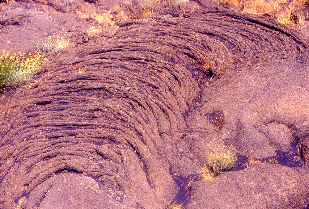
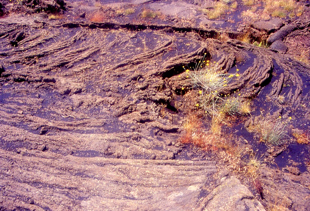
Wrinkled,
folded, ropy surface of the "Lava dei Dammusi", erupted
in 1614-1624 on the northern flank of Etna. This is one of the
few lava fields on this volcano that is largely pahoehoe, and
it is enormous. The "grainy" aspect of the lava, seen
in the right image (as well as in a number of those below) is
due to the presence of considerable quantities of plagioclase
phenocrysts |
|
Etna
photo gallery: 2003
Return to Etna
![]()
Part 3: July 2003
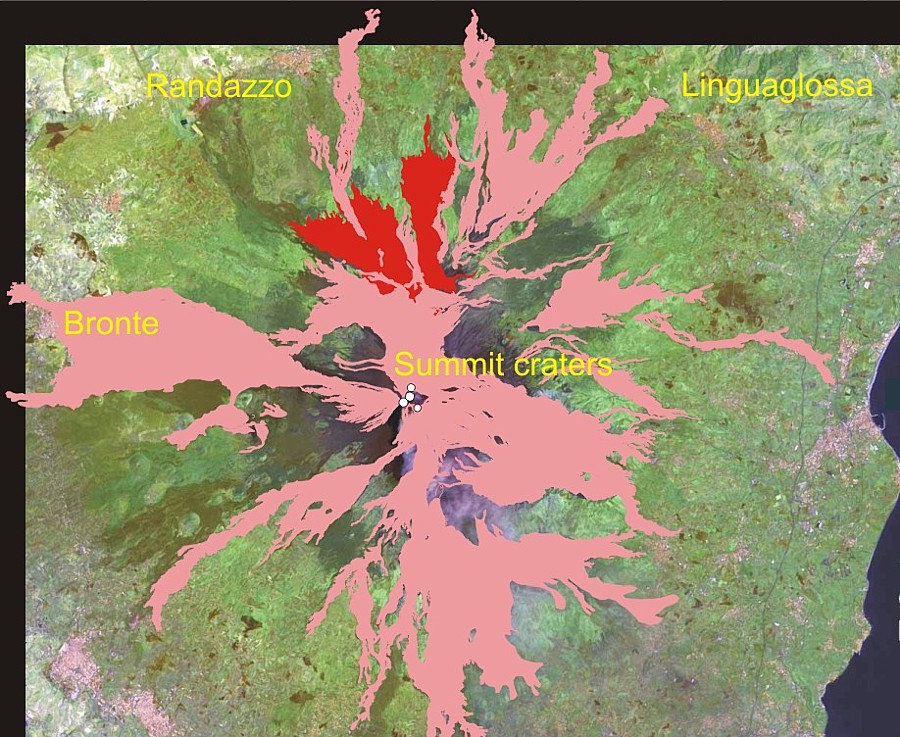
The most voluminous and longest-lasting flank eruption of Etna during the historical period began in 1614 in the upper portion of the Northeast Rift and lasted for ten years, until 1624. The volume of lava emitted during that event is estimated at 1-2 cubic kilometers (compare this to the 0.02 and 0.03 cubic kilometers of lava of the 2001 and 2002-2003 eruptions, respectively), a volume similar to that emitted during the first twenty years of the ongoing Pu'u 'O'o eruption of Kilauea volcano in Hawaii. Seen on the geological map of Etna, the 1614-1624 lava flow-field is seen to cover a large fan-shaped area on the northern flank of the volcano; however, none of the numerous distal lava lobes extended into the inhabited and cultivated areas on the lower northern flank, and the eruption is not known to have caused any significant damage. The area of the lava field is given by Romano and Sturiale (1982) as 21 km2 with a maximum flow length of 6.5 km.
 |
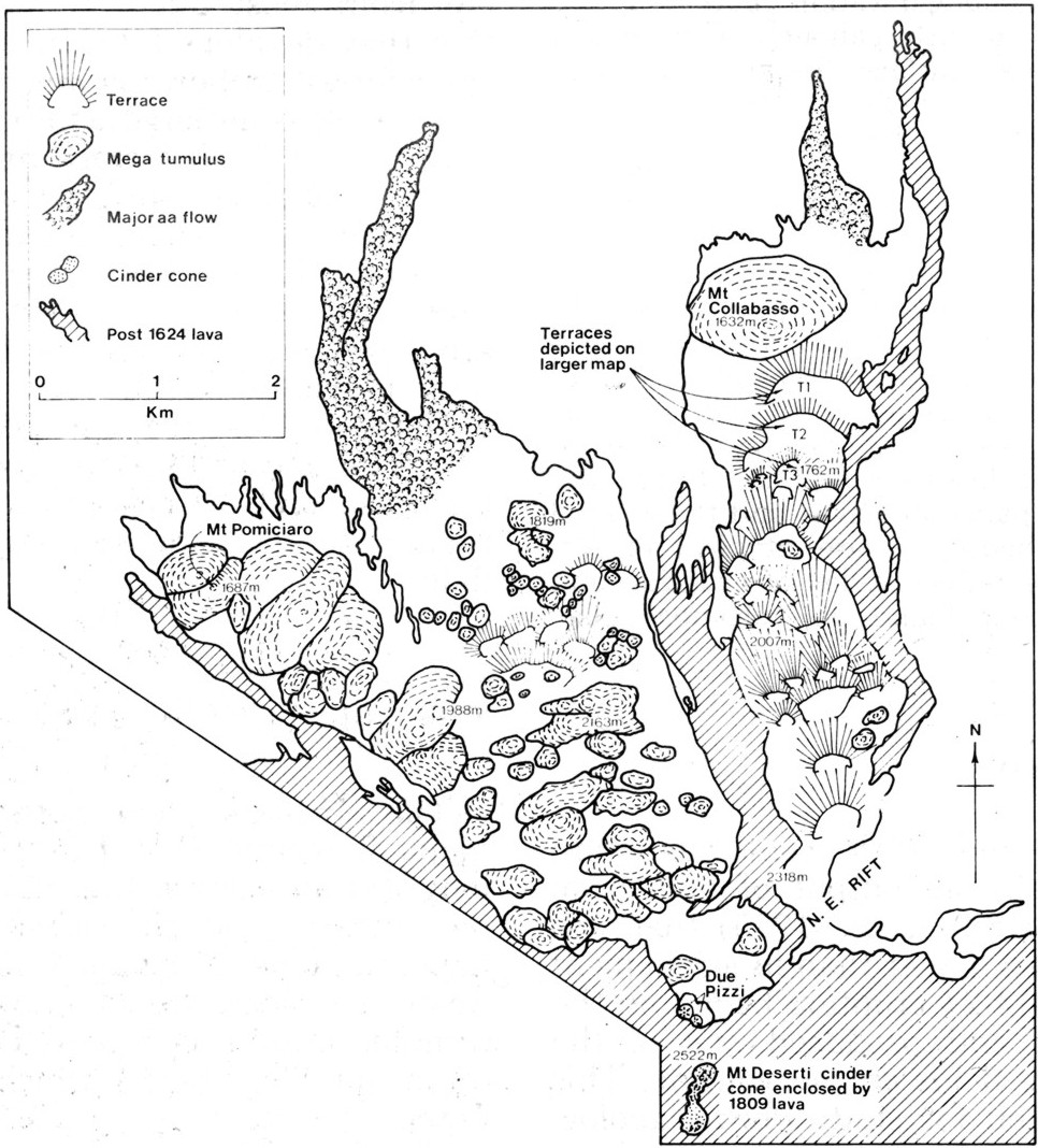 |
Maps
of the 1614-1624 lava field. Left map shows 1614-1624 lava flow-field
in red, and other lava flows erupted between 1600 and 2003 in
pink color. The flow maps are draped on a Landsat image taken
on 13 July 2001 and processed by Eurimage,
the copyright being of the European
Space Agency. Extent of the 1614-1624 lava flow-field is based
on the geological map of Etna (Romano, 1979). The map at right
is taken from Guest et al. (1984) and shows volcanologically relevant
structures on the 1614-1624 lava flow-field. Note that the extent
of the flow-field in this map differs slightly from the one in
the map at left |
|
Yet,
besides its sheer size, the lava field of that eruption is one of the
most interesting among the hundreds of distinct lava fields on Etna.
Firstly, it is largely composed of pahoehoe lava (a Hawaiian word meaning
"one can walk barefoot on it", applied to lavas with a smooth,
wrinkled, or ropy, surface), and this type of lava surface is quite
rare at Etna. Secondly, the lava field presents a variety of peculiar
morphological features that give indications about the styles of lava
transport and emplacement during that eruption (these have been the
subject of a publication by Guest et al., 1984). Thirdly, like all lavas
erupted at Etna between 1600 and 1669, these lavas are rich in large
phenocrysts of plagioclase, which have led to the Sicilian name "cicirara"
- roughly translated as "pea lavas" (see photo below). And
last but least, the lava field contains several lava caves, the largest
of which are the Grotta del Gelo and the Grotta dei Lamponi. These caves
are nothing else than lava tubes, through which lava was transported
at low heat loss from the eruptive vents to areas further downslope,
in some cases extending over distances of several kilometers.
The photographs below were taken during a field campaign with scientists
of the INGV Roma and from various universities in Italy on 24 July 2003,
some of these persons can be seen in a few of the images. Most of the
photographs are not captioned, since they talk for themselves. The "Lava
dei Dammusi" (the local name for the 1614-1624 pahoehoe lava field)
is one of Nature's grand masterpieces.
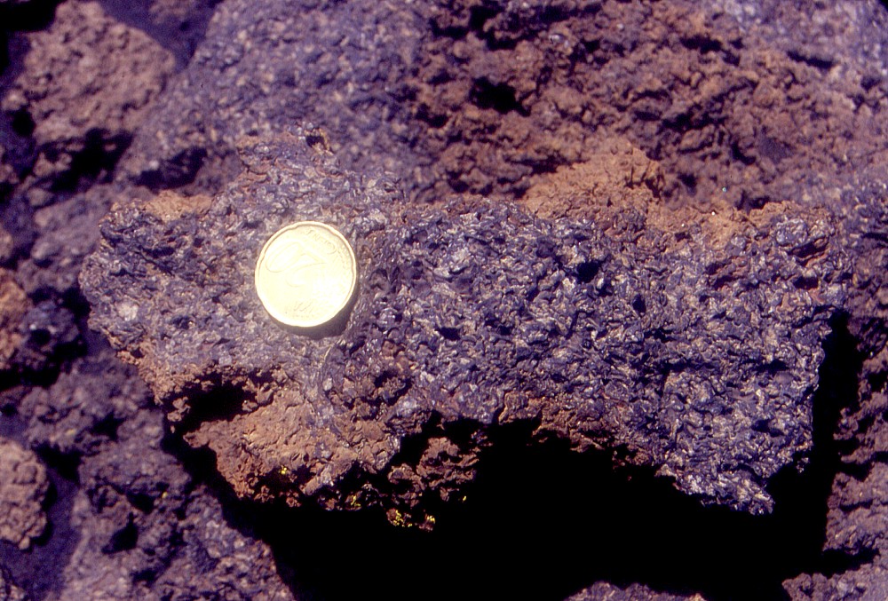 |
"Cicirara",
a Sicilian word that can be loosely translated as "pea lava",
is applied to lavas at Etna that are rich in sizeable plagioclase
phenocrysts. Such lavas have been produced repeatedly during the
geological history of the volcano and seem to reflect a set of
conditions of magma supply, storage and eruption different from
the present conditions. The last time that Etna produced "cicirara"
was in the 17th century. Not in just one eruption, but all eruptions
that occurred from 1600 until 1669, no matter on which side of
the volcano they occurred, and no matter how explosive they were.
This image shows a typical chunk of "cicirara", erupted
in 1610 on Etna's southwestern flank (coin is 2.2 cm in diameter) |
References:
Guest JE, Wood C, Greeley R (1984) Lava tubes, terraces and megatumuli on the 1614-24 pahoehoe lava flow field, Mount Etna, Sicily. Bulletin Volcanologique 47: 635-648
Romano R (editor) (1979) Geological map of Mt. Etna. S.EL.CA. Firenze (distributed with volume 23 of the Memorie della Società Geologica Italiana, 1982, but out of print long since!)
Romano R, Sturiale C (1982) The historical eruptions of Mt. Etna (Volcanological data). Memorie della Società Geologica Italiana 23: 75-97
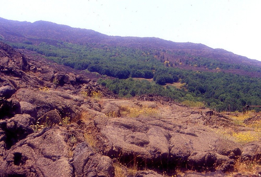 |
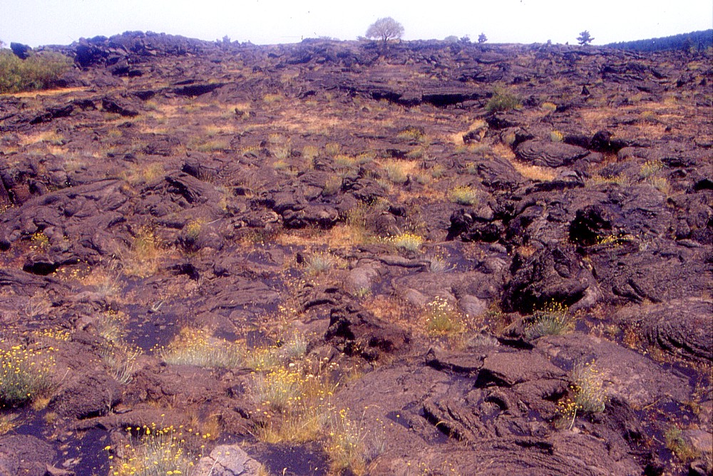
The
landscape around the Passo dei Dammusi, a spot at about 1700 m
elevation on the northern flank of Etna, looking west. The dark
lava in the background and the brownish lava in the foreground
both belong to the enormous 1614-1624 lava field |
 |
 |
 |
 |
 |
 |
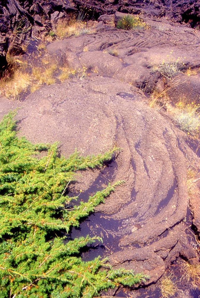
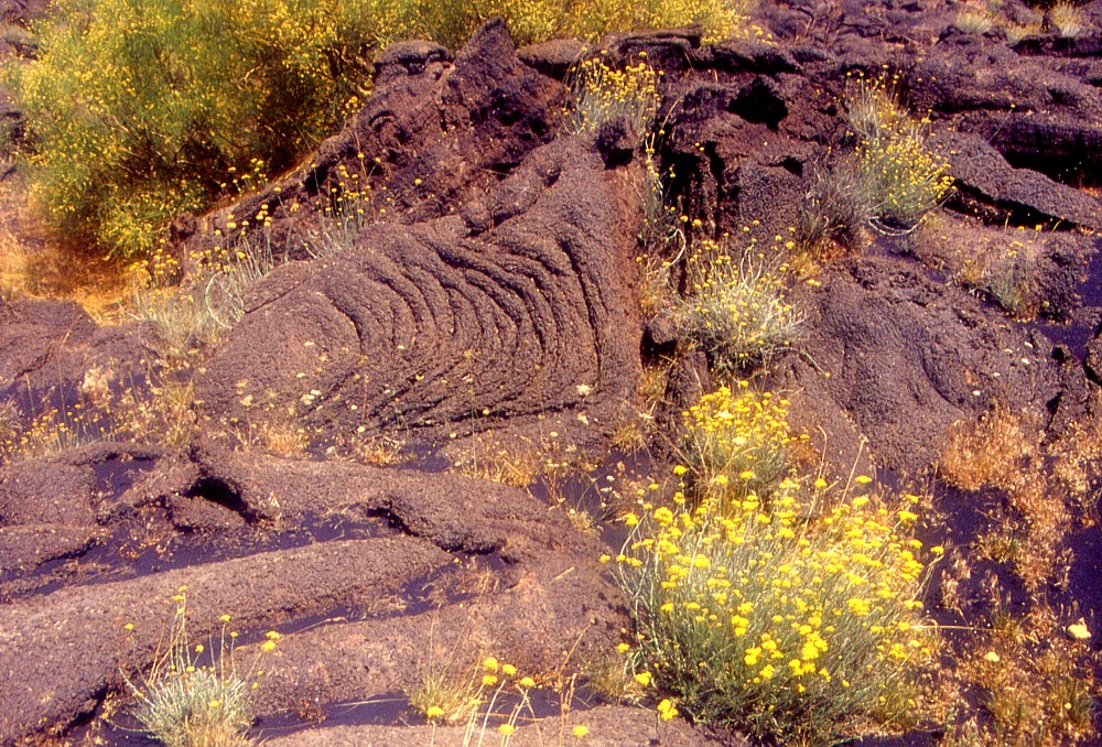
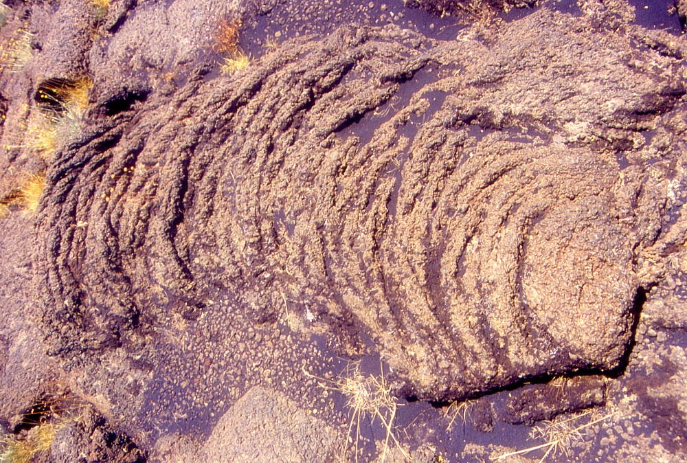
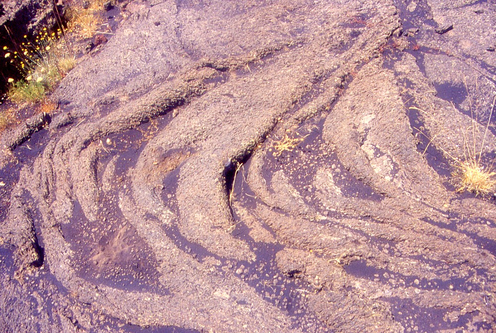
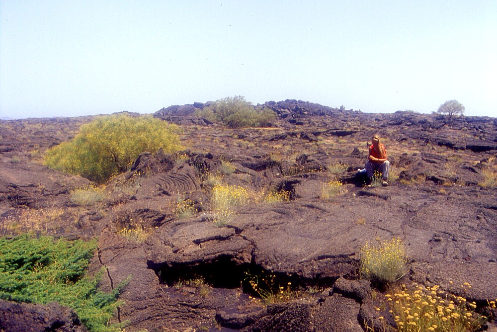
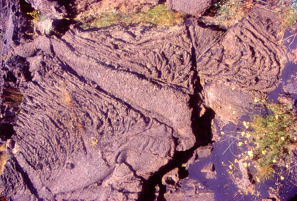
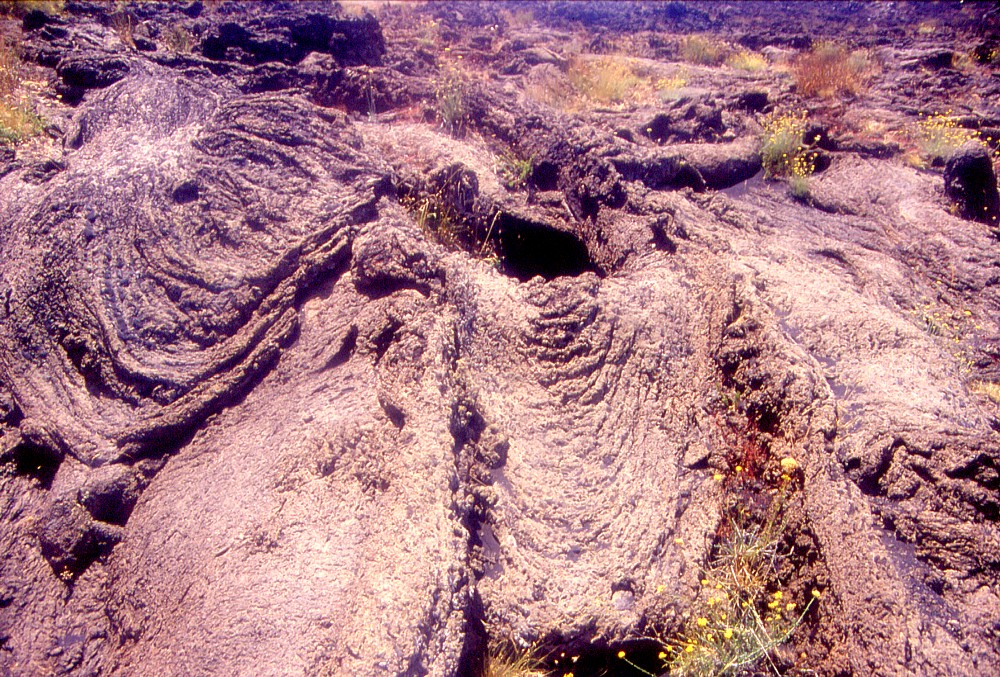
A
selection of the variety of shapes and forms of pahoehoe surfaces,
showing the interplay between volcanic products of different types
and ages, and vegetation. The dark material filling depressions
is ash from the 2002-2003 eruption |
||
 |
 |
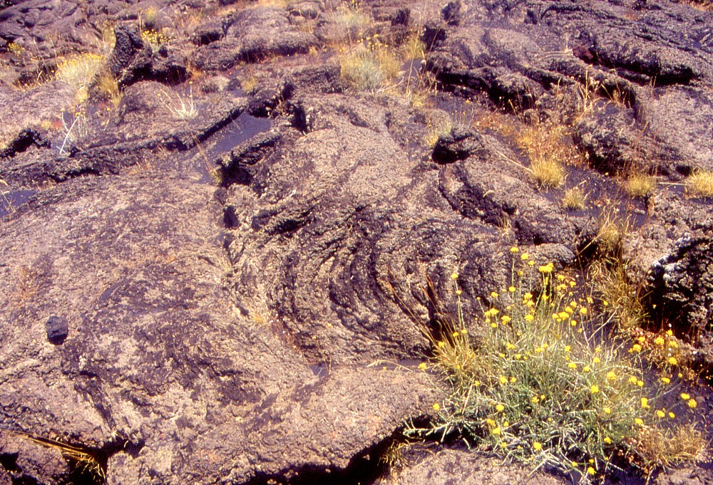
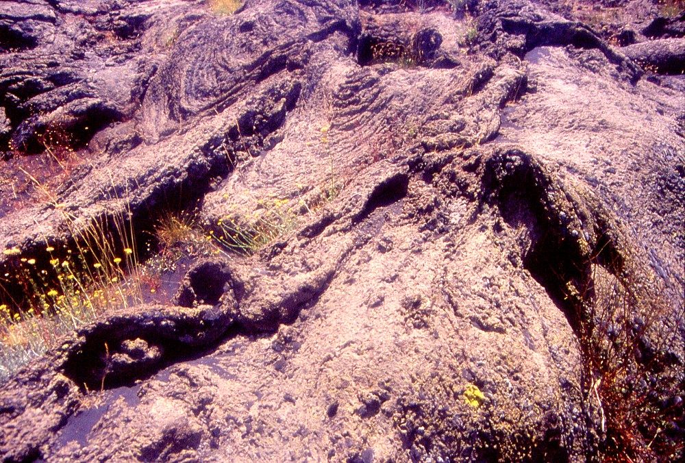
One
of the various "lava terraces" described by Guest et al.
(1984), named by them the "Inglesi Terrace", which lies
next to the locality Passo Dammusi. Note the flat morphology, interrupted
here and there by so-called tumuli (background of right photograph).
The terraces apparently held temporary lava lakes (perched lava
ponds). The photograph at left shows the subsided surface of such
a lava pond after the partial draining of the fluid interior of
the pond (which was evidently crusted over) following the cessation
of lava supply into the pond |
|
 |
 |
 |
 |
 |
 |
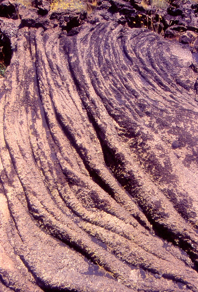
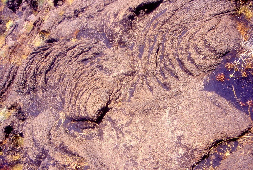
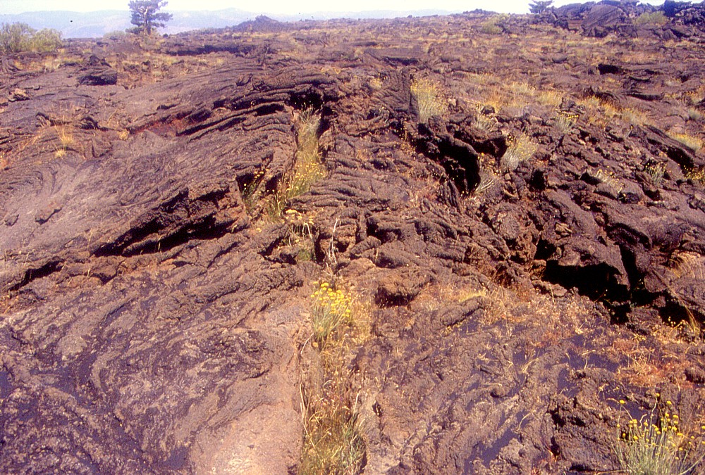
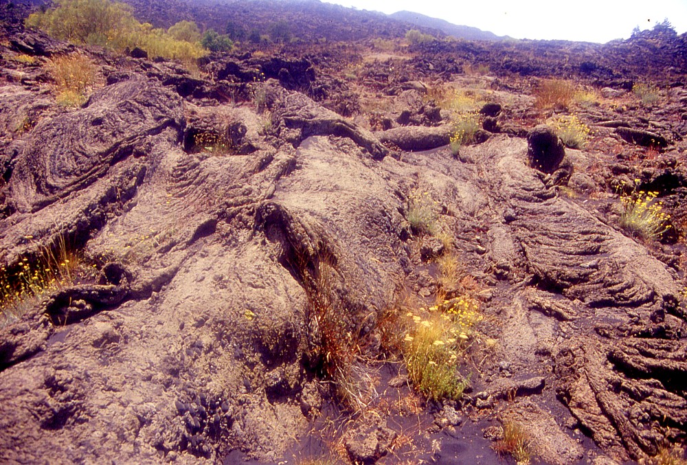
More
images showing the endless variety of pahoehoe forms. The lower
row of photos was taken on top of the Grotta dei Lamponi (Raspberry
Cave), where lava spilled out of many ephemeral vents piercing the
roof of the cave (which is actually a lava tube). They render an
impression of moments frozen in time, and of the lava being extremely
fluid at the time of emplacement, which probably was not the case.
The lava was rather a mush filled with considerable quantities of
plagioclase crystals, which moved at a relatively slow pace |
||
 |
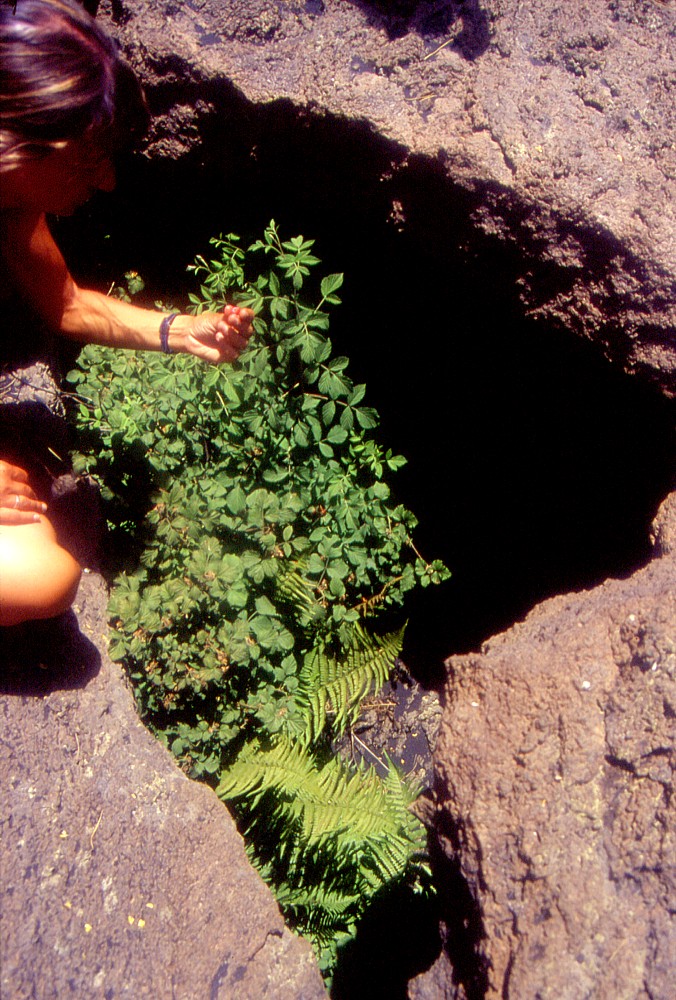 |
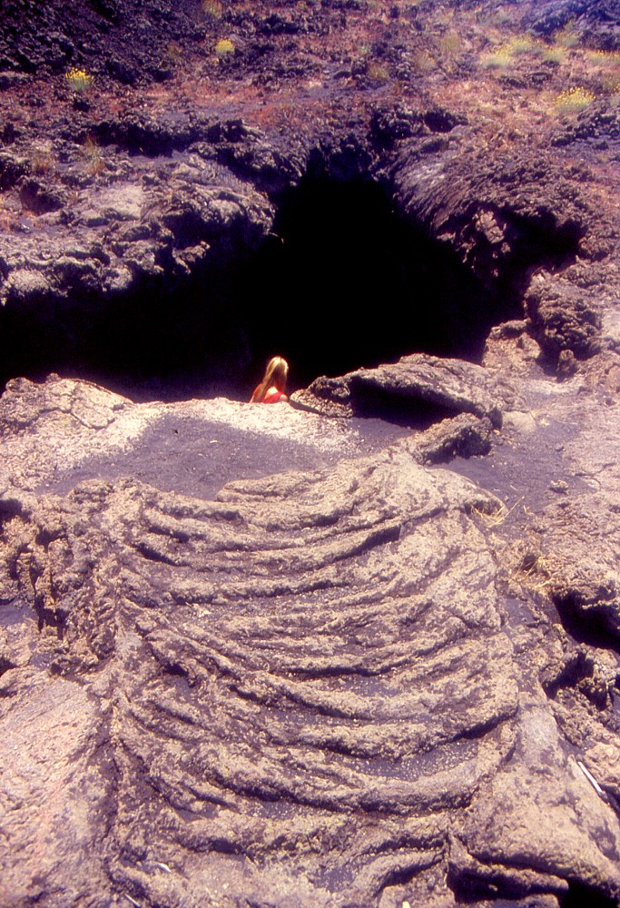
Left:
one of the two main entrances to the Grotta dei Lamponi lava tube,
lying some 200 m from the Forst Guard Road (pista forestale) near
Passo Dammusi. This hole was a so-called "skylight" piercing
the roof of the lava tube, and occasional rises of the lava level
within the tube caused lava to spill through the hole (like the
ropy lava in the foreground). Following such a rise, some of the
lava surrounding the skylight drained back into the tube, as can
be seen on background right margin of the skylight. Right: there are truly raspberries growing at the Raspberry Cave (Grotta dei Lamponi)! Rarely found in Sicily, this plant evidently enjoys the environmental conditions at 1700 m elevation on Etna's northern flank, and the quality of the raspberries, which were ripe right at the time of our visit, is extraordinary, like that of all that grows on this volcano |
|
Continue to September-October 2003
Return to the Etna photo gallery
Copyright © Boris Behncke, "Italy's Volcanoes: The Cradle of Volcanology"
Page set up on 11 June 2003, last modified on 11 August 2003