
| Etna
index |
||
| Geology | Geological history | Cones and craters |
| Eruptive characteristics | Eruptions before 1971 | Eruptions since 1971 |
| Etna and Man | References | Web sites |
| Weather forecasts | FAQ | Latest news |
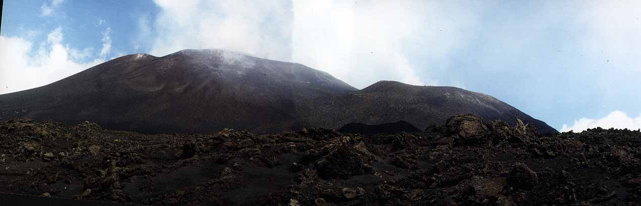
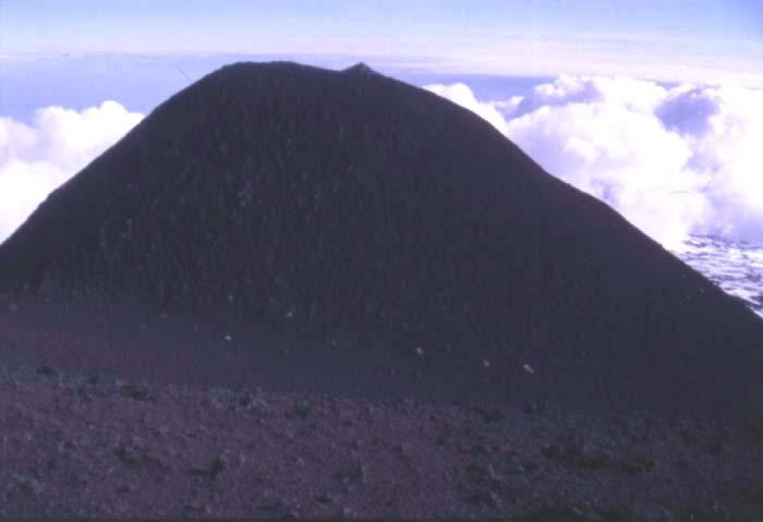
Main summit cone (left) and Southeast Crater, with small black 1971 cone in foreground (photographed from south in August 1991)
Morphologic features: Cones and craters
Mount
Etna is a highly complex volcano whose history has been characterized
by the construction of numerous volcanic edifices at shifting locations
and repeated catastrophic collapse of these structures. The recent and
currently active volcanic edifice (Recent Mongibello) has a summit cone
complex and hundreds of cinder and spatter cones, pit craters, and spatter
ramparts along eruptive fissures scattered over its flanks. The number
of individual flank eruptive centers is more than 300, with new such structures
added in almost each flank eruption, most recently in the winter of 2002-2003.
Summit activity occurs at four craters: the Voragine and the Bocca Nuova,
which lie in the area of the former Central Crater, and the Northeast
(NE) and Southeast (SE) Craters. The latter have built sizeable cones
- referred to as the Northeast and Southeast Crater cones - leaning against
the bulky main summit cone that hosts the Voragine and the Bocca Nuova.
Among the most remarkable features of Etna's eruptive behavior is the
capability of the volcano to erupt from many places from its flanks, while
activity in the summit area is essentially concentrated at the four summit
craters, which remain in stable positions since decades and are frequently
active.
In the following, first some remarks are made about flank vents before a longer section deals with the summit craters and their evolution and behavior. Eruptive histories of these craters as well as flank eruptions are treated in the chronologic section of the Etna pages.
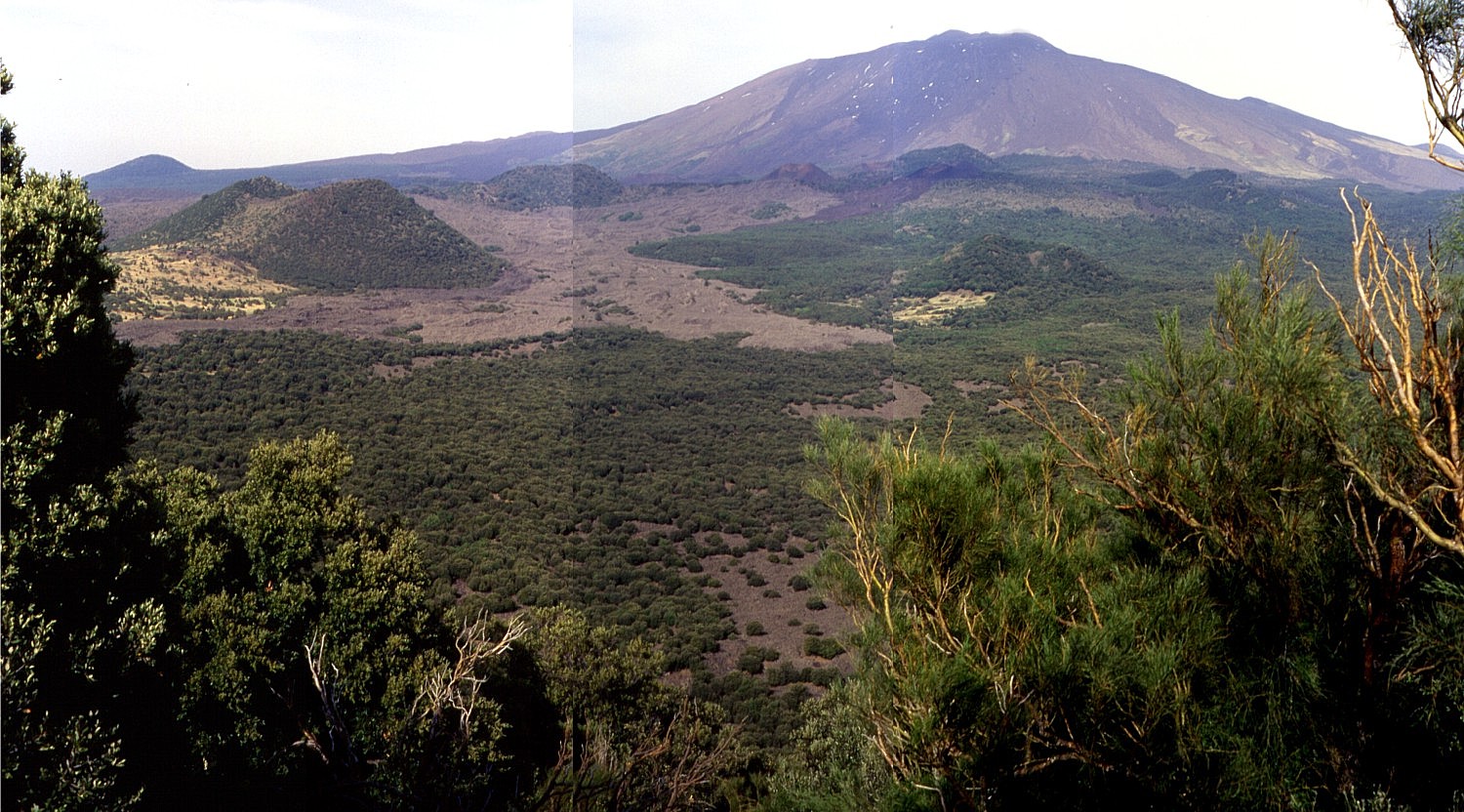 |
| Photo
mosaic of Etna's western flank as seen from the summit of Monte
Minardo, a large prehistoric flank cone (1304 m high). The upper
western flank of the volcano is seen in the background; only a few
months after these photographs were taken (17 May 1999), lava flows
emitted from the Bocca Nuova summit crater streamed down this flank
to the tree limit and remain strongly visible today. Numerous cones
from flank eruptions of different ages lie in the middle ground.
Light-colored lava flow in center left is of the 1763 eruption with
its source cone Monte Nuovo showing a slight reddish hue. The conspicuous
cone at left, and partly surrounded by the 1763 lava flow is Monte
Ruvolo. Behind it to the right is Monte Lepre. Dark flow at upper
right side of 1763 flow is of the January-March 1974 eruption from
the Monti de Fiore twin cones, behind which rises the cone of Monte
Rosso. In center right part of the image (immediately behind the
yellowish spot), lies the larger of the two Monti Tre Frati, with
the smaller cone lying behind it. The conspituous cone at the left
skyline is Monte Maletto |
Flank eruptive centers. The size of the flank cones varies significantly, as illustrated in the photos below, depending on the explosivity and duration of an eruption. Eruptions farther downslope tend to build larger and more isolated cones (such as the conspicuous Monte Rossi near Nicolosi, formed in the 1669 eruption) while rows or chains of cones, often of small dimensions, are constructed at eruptive sites at higher locations. One of the most impressive chains of eruptive cones is Monti Silvestri at the 1892 eruption fissure, close to the tourist facilities near Rifugio Sapienza, on the southern flank of Etna.
Many of Etna's flank cones have horseshoe-shaped craters, which are commonly open on the downslope side. While such a morphology can be due to the preferential accumulation of ejected pyroclastics on the leeward side - which will occur primarily during a relatively short-lived eruption that occurs during strong wind - most of the horseshoe-shaped cones owe their morphology to the outflow of lava from their vents on the downslope side. The more or less continuous outflow of lava prevents the accumulation of pyroclastics to build a high rim on this side. However, quite a significant proportion of the flank cones are symmetrical and not open on one side; in these cases lava effusion occurred from vents located on the lower flanks or at the base of the cones, as has also been observed at some of the cones formed during the 2001 and 2002-2003 flank eruptions. The large cones of Monte Minardo and Monte Ruvolo on the western flank and Monte Ilice and Monte Gorna on the southeastern flank are examples of this type. But even most of the more regularly shaped flank cones have several summit vents, which has led to the formation of more or less deep notches in the crater rims.
Etna's flank cones are not distributed regularly over the flanks of the volcano, but they tend to be clustered in certain areas pertaining to more or less defined rift zones (see map). The most conspicuous rift zone lies on the northeastern flank and is marked by the presence of numerous linear crater groups and gaping fractures. A less defined rift zone lies on the south flank between 2600 and 1600 m elevation; below 1600 m, this rift zone extends into a fan-shaped sector (on the lower southeastern flank of the mountain) with numerous large and isolated cones. This latter sector is the most densely populated areas on Etna, and the presence of several historical eruptive centers amidst this growing urban agglomerate is of great significance for volcanic hazard considerations at Etna.
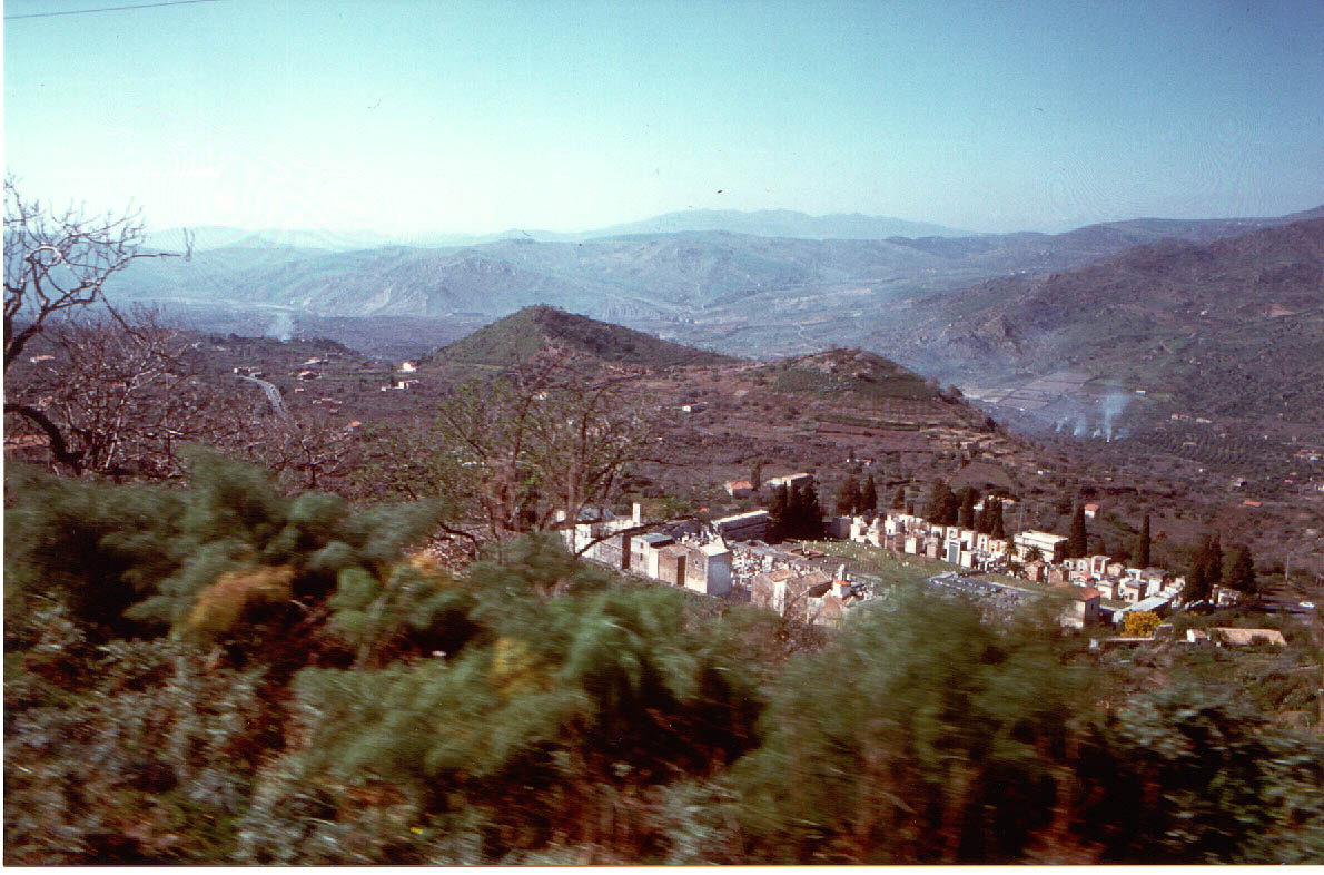 |
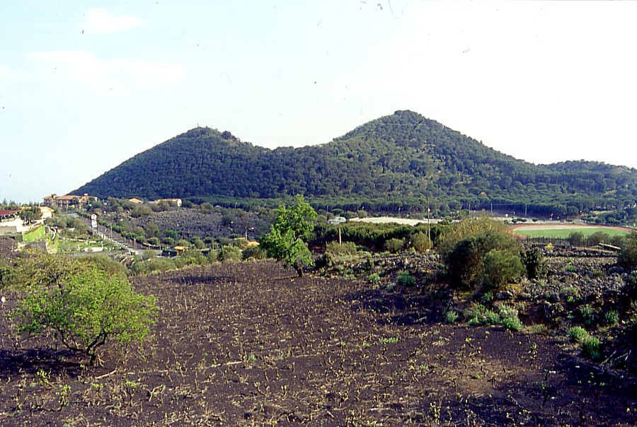
Monte
Barca, a flank cone near Bronte Lying south of the town of Bronte on Etna's western flank, Monte Barca is a remote flank eruptive center of the volcano, built on early Pleistocene marine sediments. The cone whose shape is reminiscent of a small boat is prehistoric (or, if it formed during historic times, its eruption and growth were not observed due to its remote location); however, its good preservation indicates that it is relatively young. The photo was taken on 2 March 1998. Note the cemetery of Bronte in the foreground |
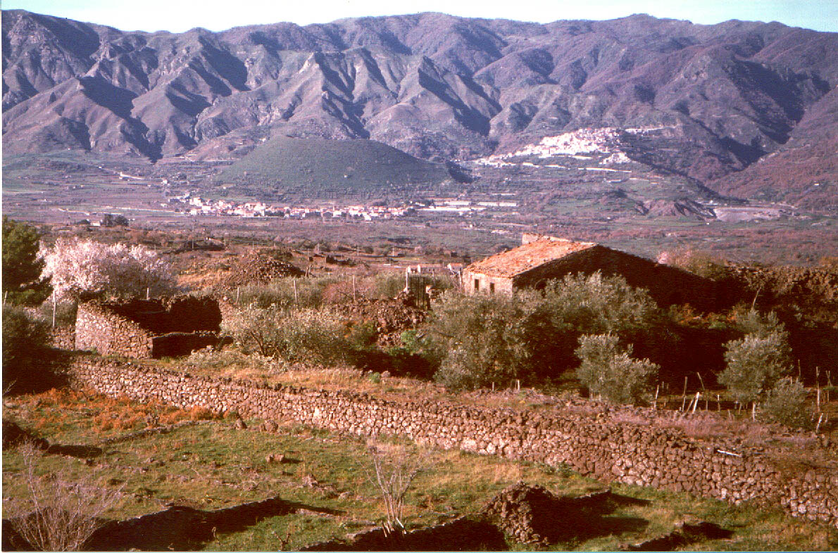 |
Monte
Moio, Etna's most remote flank cone View from the Passopisciaro-Solicchiata area on Etna's northern flank towards the village of Moio and the eccentric cone Monte Moio standing behind it, in February 1998. Monte Moio is composed of at least two overlapping cones with three craters. Although its age is not known precisely, the youthful shape of the cone indicates that it formed during the last few thousand years. A voluminous lava flow that extends almost 20 km eastwards to the Ionian Sea is tentatively attributed to the Monte Moio eruption, but more precise correlation is necessary. Although often described as a volcano on its own, it is just one of hundreds of Etnean flank cones, even though it is one of the most remote of them. It lies on the northern side of the Alcantara valley and is one of the few spots of Etna that belongs to the province of Messina (the bulk of Etna lies in the province of Catania) |
 |
Monti
Rossi, the cone of the 1669 eruption Panoramic view of Monti Rossi, the large cone formed at the main eruptive vent of the 1669 eruption on Etna's south flank, seen from about 1 km north. The cone is now a public park. Buildings of Nicolosi, including the complex of Hotel Gemmellaro are extending up the flank of Etna on the left side of Monti Rossi. The 1669 eruption devastated the town of Nicolosi completely, covering the site with tephra deposits several meters thick. A similar eruption today would cause destruction beyond imagination. Photo taken in May 2000 |
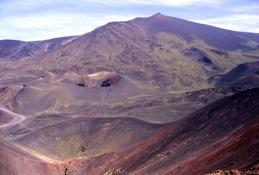 |
Monti
Silvestri, Monti Calcarazzi and Montagnola The middle southern flank of Etna is has some classic examples of Etnean fissure eruptions with eruptive cones aligned on it, due to frequent eruptions on what is considered the "south rift zone" of the volcano. Montagnola, the peak forming the skyline, is a large pyroclastic cone formed during the summer 1763 eruption; its lava flows formed a peculiar ridge visible in the upperr left of the photo. Three years later, another eruption built the Monti Calcarazzi crater row whose uppermost cones are visible in the right center. In 1892, a six-months long eruption led to the formation of yet another crater row, the Monti Silvestri, from the largest of which the photo was taken on 24 May 1998. Another 1892 crater is visible in the left center. Nonwithstanding the frequent eruptions in this area (another one occurred in 2001), the largest complex of tourist facilities (including the Rifugio Sapienza and the base station of the cable car) has developed immediately to the west of the Monti Silvestri |
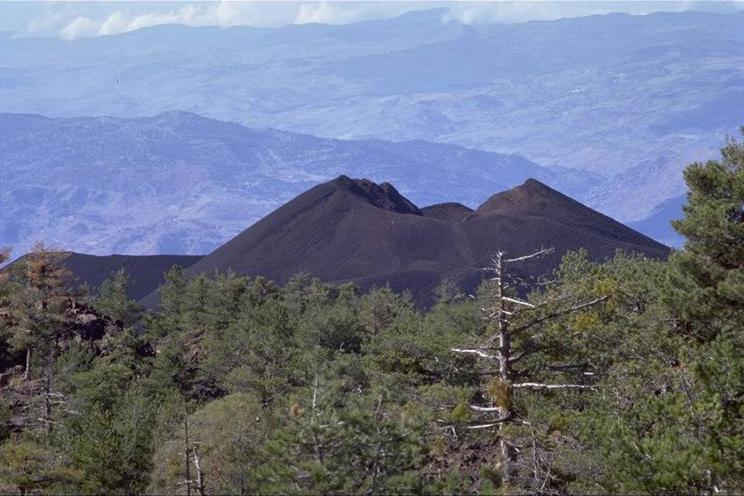 |
Monti
Di Fiore, cones of the 1974 eruption The western flank of Etna is another area of more pronounced volcanism, although eruptions occur much less frequently than on the southern and northeastern flanks and in the Valle del Bove. The most recent eruption prior to 1974 occurred in 1843, but the vents lay further north. An eruption in February 1763 (a few months before the Montagnola eruption) built two cones, Monte Nuovo and (possibly) Monte Mezzaluna. In January-March 1974, a similar eruption built two new cones, named Monti Di Fiore. The larger of these cones, lying at about 1650 m elevation, is seen from the east in this photo taken by Marco Fulle in October 1998 |
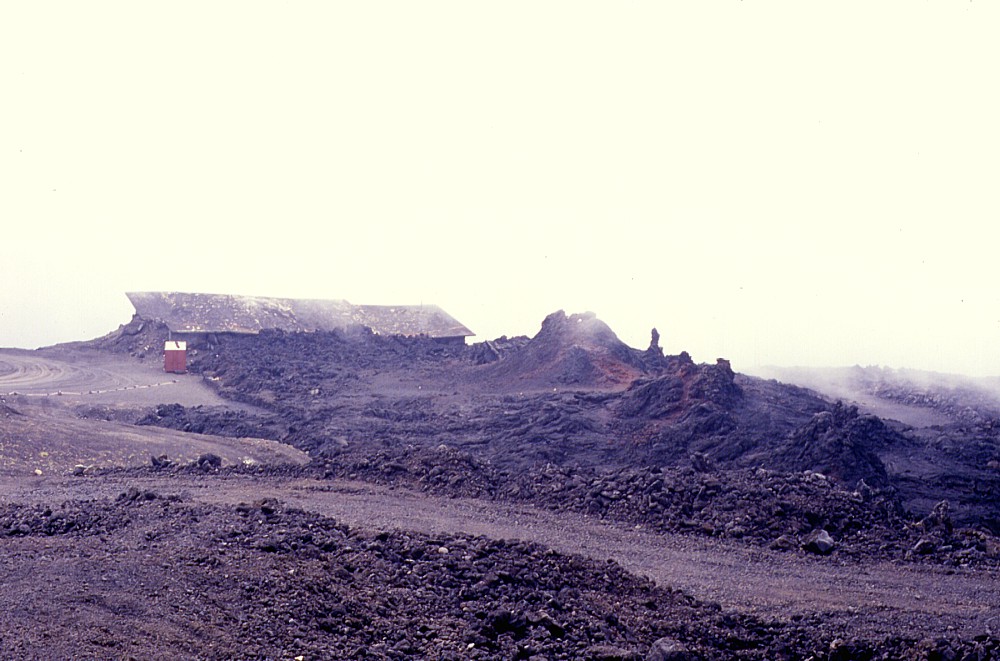 |
Eruptive
fissure of March 1985 at Piccolo Rifugio Contrasting with the sizeable cones in the preceding images, the March 1985 eruption center did not develop any significant cones. Only a line of "hornitos" or driblet cones grew on the eruptive fissure, reaching about 3 m maximum height. The fissure cut right through the building of the "Piccolo Rifugio", already damaged by a fracture formed two years earlier, and lava issued from below the building. The 1985 eruption site was at about 2300 m elevation on the south flank of Etna and was completely buried by lavas of the 2001 and 2002-2003 eruptions. Photo taken in September 1989 |
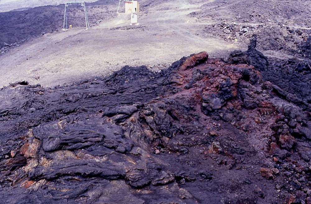 |
Eruption
vents and pahoehoe lava of the March 1985 eruption
Close-up view of the March 1985 eruption site (taken in September 1989), looking west. The eruptive vents developed several spiny hornitos and small lava shields. Note the abundant presence of pahoehoe lava at the vents. The main lava flow field is aa lava. During the eruption which lasted from 8 March until 13 July 1985, lava flowed on top of the much larger 1983 lava field and initially appeared to threaten the hotels and tourist facilities around Rifugio Sapienza, severely threatened and partially destroyed in 1983 |
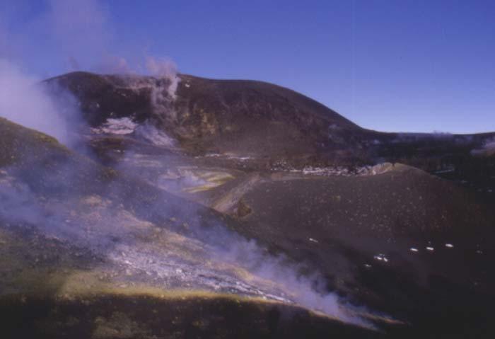
The
summit craters. Etna's
summit is occupied by a large cone complex including the original Central
Crater (now nearly substituted by the two craters Bocca Nuova and Voragine),
the NE Crater and the SE Crater. The latter two craters are relatively
recent features: the NE Crater first formed in 1911 and the SE Crater
was born in 1971. While previously being considered "subterminal"
vents by many authors, these two craters have become very large and high
structures in recent years, the summit of the NE crater being the highest
point of Etna between 1978 and 1986 and possibly again since 1996, so
they are now rather considered genuine summit craters.
The Central
Crater, the Voragine and Bocca Nuova. Before 1911, the central summit
cone was a broad structure 250 m high whose top was truncated by the 500
m-diameter Central Crater. Historical records indicate that this cone
formed within about one century following the collapse of a preceding
summit cone during the catastrophic 1669 eruption. Lava overflows from
the Central Crater or from vents on the flanks of the central summit cone
occurred frequently until 1869, and an eruption from the Central Crater
in July 1787 was among the most violent documented eruptions of Etna in
historical times, generating lava fountains up to 3000 m high and flows
that extended up to 5 km to SW and W.
During the late 19th and early 20th centuries, the Central Crater was a single deep pit with near vertical walls, with its depth varying between 150 and more than 200 m. Between 1916 and 1922 more or less continuous eruptive activity occurred at a cluster of vents in the NE part of the crater, building a large cone which became known locally as the "cono avventizio". The central portion of the crater was gradually filled with pyroclastics and lava flows, which formed a flat terrace. In mid-1922 this period of crater filling ended and a new collapse pit formed in the center of the terrace; collapse also removed nearly all of the "cono avventizio". A new period of rapid crater filling began in 1939, the main focus of eruptive activity once more lying at the site of the former "cono avventizio". Intermittent Strombolian and effusive activity built new cones and the central pit was filled with lava, so that no trace of it was visible by mid-1940. Renewed activity in the first half of 1942 added more lava and pyroclastics before a violent paroxysmal eruption on 5 July 1942 completely overwhelmed the topography of the Central Crater. A 30 m thick sheet of lava covered nearly all of the crater floor and obliterated any trace of the pyroclastic cone in its NE part. These conditions are clearly shown in an impressive aerial photo taken in 1943 which was published in Chester et al. (1985). A small collapse pit formed in the northeastern part of the Central Crater platform in late-October 1945, which became soon known as the Voragine, or "the Chasm".
Vigorous eruptions in the 1950's and early 1960's built large cones in the central and southern parts of the summit crater platform while the Voragine collapse pit in the NE part of the crater gradually enlarged. The culminating event, in 1964, was the growth of a two large cones - one around the Voragine, and another around a new vent (the 1964 crater) on its southern side- to several tens of meters above the summit platform. This cone raised Etna's summit to 3330 m, an elevation only to be surpassed by the NE Crater in the late 1970's. The Central Crater was filled completely during this period, and voluminous lava overflows in 1956, 1961 and most notably in 1964 extended up to 4 km towards N, NE, NW, W, SSW and SE.
In 1968, a small pit - the Bocca Nuova, the "new mouth" - opened on the W flank of the large cone formed in 1964 around the Voragine. While its initial diameter was only 8 m, collapse of its walls in the almost 30 years since have enlarged this pit to a gaping crater some 350 m across (as of late 1997). Most of the cones formed between 1955 and 1964 have been engulfed by the collapse of the walls of Boca Nuova, reducing the height of what remains of the main 1964 cone to about 3310 m elevation.
Since the growth of the last major structure on the summit crater platform in 1964, collapse of the Bocca Nuova and the Voragine have alternated with the partial infilling of both pits. In several cases magma rose within the Voragine pit almost to its lip (such as in the spring of 1980), and small cones and intracrater lava fields grew within the Bocca Nuova at various times. During the summer of 1997, a period of rapid filling of the Bocca Nuova and the Voragine began that continued, with interruptions, until late summer 1998. Meanwhile the septum separating both pits (the so-called "diaframma") partially collapsed, mostly during the 22 July 1998 eruption from the Voragine. Further collapse occurred there during another strong Voragine eruption on 4 September 1999. The latest chapter in the saga of these two craters is the nearly complete filling of the Bocca Nuova in October-November 1999, which led to the first overflows of lava from this crater onto the external slopes of Etna, and the burial of the "diaframma" under a large pyroclastic cone. Since the end of that eruption, two major pits are present within the Bocca Nuova, in the NW and SE of the crater. Activity within these pits in late-2000 and early-2001 repeated the history of the Bocca Nuova, with periods of filling alternating with collapse.
 |
The
Central Crater and the NE Crater in the 1920's Spectacular aerial view of Etna's summit, taken from the northeast at an unknown date, probably during the 1920's when a small cone grew in the initial collapse pit of the NE Crater (see also below) and lava spilled over its rim. The vapor-filled, 450 m-wide Central Crater is visible behind the plume from the NE Crater. The photo was published on postcards which are still for sale |
 |
The
Central Crater from the air in 1934 Aerial view from the northwest of Etna's Central Crater, taken possibly in 1934 (this is one of a series of photos published in the December 1934 issue of "Le vie d'Italia"). The relatively flat crater floor lies a few tens of meters below the rim and is perforated in its NE part by a fuming pit, site of all activity in the crater during the 1920's to 1940's. The Voragine formed in 1945 in the same area. The southern wall of the Valle del Bove is visible in the background |
 |
Intracrater
cones growing within the Central Crater, 1940 Steaming twin cones growing in the northeastern part of the Central Crater in 1940. Lava is issuing from vents at the base of the cones at right. The filling of Central Crater was proceeding rapidly in those years due to near continuous mild Strombolian and effusive activity, interrupted at times by more vigorous activity. By 1943, the Central Crater was almost completely filled with lava and pyroclastics. Photo is from a postcard no longer for sale |
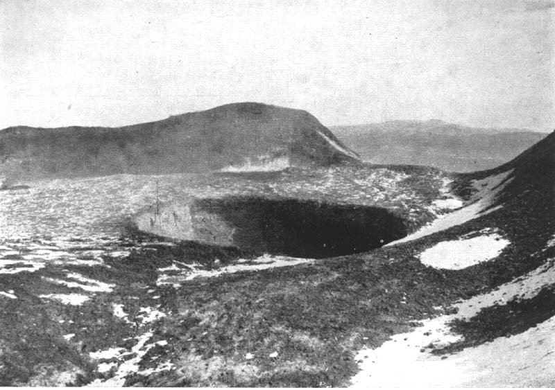 |
Initial
stage of the Voragine, 1947 A small collapse pit formed in the northeastern part of the Central Crater in October 1945; this pit was the site of frequent activity during the following decades, and gradually enlarged by collapse and/or explosive activity. It is now known as the "Voragine" or "Chasm", but many locals name it "Centrale". Note the flat crater floor around the new pit, and the notch in the northeastern crater rim (the NE Crater stood below that notch but was still too small to be visible from the photographer's position at the time this photo was taken by G. Cumin of the former Istituto di Vulcanologia of Catania University) |
 |
The
Voragine in January 1999 View across the Voragine towards northeast, from the crest of the "diaframma" (the septum separating the Voragine from the Bocca Nuova), on 21 January 1999, with the NE Crater in the left background. The vigorous activity of 1998 left the Voragine almost brimful with pyroclastics and lava. Some of the craters active in 1998 can be seen in the center and left parts of the photo. Activity declined in the autumn of 1998, permitting access to the crater, and the excursion to the "diaframma" rendered a sense of awe, mixed with the consciousness that this area had been one of the least accessible areas on Earth only six months before |
 |
The
Bocca Nuova in January 1999 Eruption of a cone in the northwestern part of the Bocca Nuova seen from the "diaframma" on the afternoon of 21 January 1999. The depth of the crater has decreased to about 60 m, compared to 150 m in 1995 when the current period of filling began. Initially a hole only about 8 m wide, the Bocca Nuova grew by collapse to a vast pit at least 350 m in diameter. The maximum depth was more than 700 m, observed in the mid-1970's |
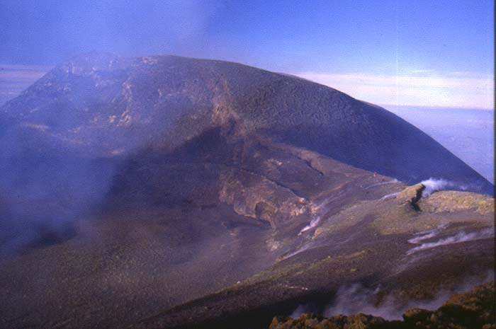
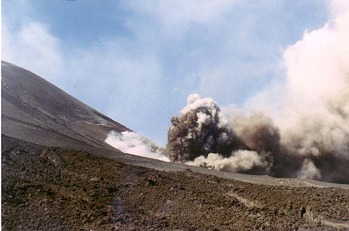
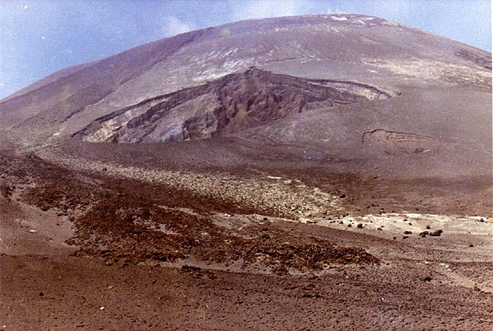
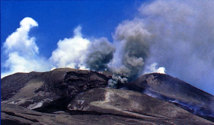
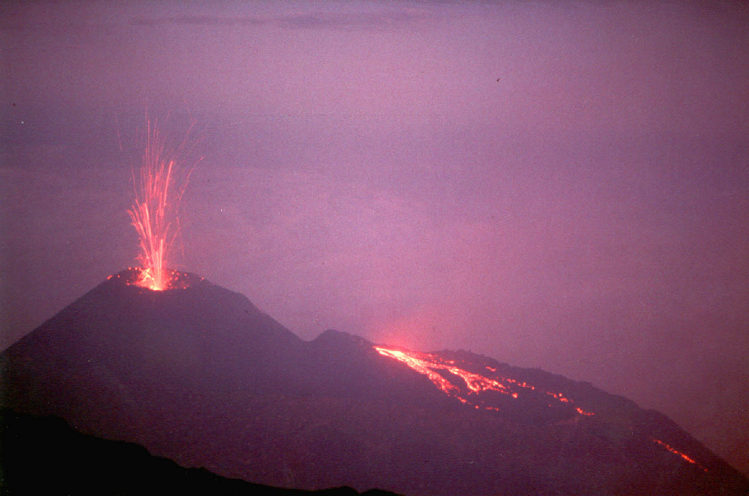
The NE and SE Craters. Both the NE and the SE Craters started in a very similar manner as collapse pits on the flanks of the main summit cone. In the case of the latter, the initial stages of its formation are well documented. The SE Crater started as a degassing pit during the late stages of the peculiar 1971 eruption and remained inactive thereafter until spring 1978. Since then, it has been the site of six major eruptions, some of which were closely related to eruptions on the upper flanks of Etna. The most significant events during the brief history of the SE Crater were the episodes of vigorous lava fountaining preceding and following the 1989 flank eruption, culminating in one of the most violent eruptions of Etna in recent decades, on 5 January 1990. Between late 1996 and July 1998, the crater showed continuous Strombolian and effusive activity characterized by relatively low eruption rates; from September 1998 until February 1999 it was again the site of 22 powerful eruptive episodes that built the cone to an unprecedented height of about 3260 m. Between 26 January and 29 August 2000, the SE Crater was the site of 66 (sixty-six) violent eruptive episodes, and sixteen further paroxysms occurred between 9 May and 17 July 2001. These events led to further growth of the SE Crater cone, which by early 2001 had reached 3300 m elevation.
The growth of the NE Crater was interrupted by repeated collapse throughout the 1950's, and it was only during that decade that a large cone began to develop within the collapse structure. This was accompanied by voluminous outflows of lava which created a vast lava apron around the base of the cone except on its S side, and lava extended far down the NW, N and NE flanks. Vigorous growth of the cone and the surrounding lava field occurred again from 1966 until 1971, a period characterized by what became famous as "persistent activity" with continuous Strombolian bursts and slow lava effusion, mostly from vents on the flanks or at the base of the pyroclastic cone. The largest of these formed in 1970 and was nicknamed "Nordestino" (little Northeast) by the local mountain guides.
In another eruptive period lasting from 1974 until early 1977, similar persistent activity was accompanied by effusion from boccas farther downslope on the N flank, but still related to NE Crater. In the summer of 1977, the crater changed its behavior, producing a series of short-lived but violent eruptions that ended in late March 1978. These were characterized by high lava fountains and voluminous lava effusion from the main vent with flows extending as far as 7 km downslope; the cone was eventually breached on its NW side during one of these episodes. Similar episodes of activity occurred in September 1980 and February 1981. The most violent eruption of NE Crater so far occurred in September 1986 and ended with the partial destruction of the cone after which there was little eruptive activity for the next nine years. Collapse of the internal parts of the crater occurred frequently during and after the large 1991-1993 eruption in Valle del Bove.
In late 1995, a new series of paroxysmal eruptions with high lava fountains started, followed by Strombolian and effusive activity in the summer of 1996. This activity and ensuing collapse completely altered the morphology of the crater. Another paroxysmal eruption on 27 March 1998 and mild Strombolian activity deep in the collapse pit in the summer of 1998 did not result in further significant morphological changes, but the powerful Voragine eruption on 22 July 1998 caused the collapse of the southern flank of the NE Crater cone and deposited several meters of pyroclastics on its summit. A new period of Strombolian activity within the central pit of the Northeast Crater between June and September 2002 led to the temporary filling of the pit to about 50 m below its rim, but subsequent collapse (related to the flank eruption in October-November 2002 on the Northeast Rift) enlarged the pit to the west rim of the crater and re-transformed it into a bottomless abyss.
The Southeast Crater has experienced a story very similar to that of the NE Crater which has already been summarized above. Its life began during the latest stage of the fascinating 1971 eruption when eruptive fractures opened across the upper western and northwestern part of the Valle del Bove, giving lava flows that caused serious damage to forests, fruit gardens, and isolated buildings uncomfortably close to the village of Fornazzo. While lava flowed quietly from the lowermost vents, outside the northern rim of Valle del Bove, a degassing pit formed on the southeastern base of the main summit cone, erupting steam and ash. This pit, later named Southeast Crater, remained silent for seven years after the 1971 eruption and then became the site of frequent eruptions that continue to the present day.
Some of the SE Crater eruptions were particularly violent, like those of early August 1979 and September 1989-February 1990 and especially those seen between late 1998 and mid-2001, and consisted of brief episodes of high lava fountaining accompanied by voluminous outflow of lava. Other eruptions, like one in 1984 and more recently, in 1997-1998, were characterized by mild Strombolian activity and slow lava effusion; these eruptions lasted months to years and were type examples of the "persistent summit activity" observed in the 1950's to 1970's at NE Crater.
 |
Early
cone growth at the NE Crater, 1923 View from the northeastern rim of the Central Crater towards a small cone in mild Strombolian activity, growing in the collapse pit of the NE Crater, 15 May 1923. Lava is flowing from effusive vents at the northern base of the cone towards north (the steaming area in the left background) and east. The early history of the NE Crater is characterized by the repeated growth and succesive collapse of small pyroclastic cones, accompanied by lava overflows, but no permanent cone formed until the mid 1950's |
 |
The
NE Crater in late 1998 A view across the eastern part of the Voragine (in the foreground) towards the cone of the NE Crater on 1 November 1998. The summit of that cone is now one of the highest points on the volcano. Note the collapsed southern flank of the cone in left part of the photo, an effect of the 22 July 1998 eruption from the Voragine. Photo was taken by Carmelo Monaco |
 |
Birth
of the SE Crater, 1971 Steam and ash emission from a degassing pit at the southeast base of the main summit cone (at left) in mid-May 1971, during the latest stage of the spectacular eruption from numerous vents near the summit and on the eastern-northeastern flanks that began on 5 April 1971. This pit evidently served as a "pressure valve" for the extensive fissure system that propagated from here to the northeast across Valle del Bove, with degassed lava issuing from the lowermost vents. This pit remained inactive for seven years after the end of the 1971 eruption, but in 1978 it reawakened to become known as the Southeast Crater, site of most of Etna's summit activity since then. This photo of Carmelo Sturiale, probably taken in late May 1971 from a point about 1 km south of the newly formed crater, shows lava from the 1964 summit eruption in the foreground |
 |
The
SE Crater after the 1971 eruption Another shot by Carmelo Sturiale, taken in August 1971 when activity at the newly formed SE Crater and from the lower eruptive fissures had subsided. This photo shows neatly the location of the new crater on the lower SE flank of the main summit cone as seen from the "Belvedere" area on the rim of Valle del Bove. The front of one of the lava flows erupted in July 1964 from the Central Crater is visible in the foreground |
 |
The
growth of the SE Crater - 1978 (?) Ash emission and lava flows from the SE Crater are visible in this photo probably taken in 1978 when a series of eruptions occurred at this crater and at fissures extending radially from it into various sectors of Valle del Bove. While the initial collapse structure has enlarged to engulf a major portion of the SE slope of the main summit cone (in the background), a low mound is building in its eastern part. Photo scanned from a postcard |
 |
The
growth of the SE Crater - February 1998 For twenty months, between November 1996 and July 1998, mild Strombolian activity built a small cone within the crater formed during the early 1990 activity of the SE Crater, and lava issuing from vents on the flanks and at the base of this intracrater cone led to the gradual filling of the 1990 crater. In this photo, taken on 18 February 1998, the intracrater cone (at left) has grown tens of meters above the 1990 crater rim, and lava is overflowing onto the southern flank of the SE Crater cone |
 |
The
SE Crater in late 1998 View of the cone of the SE Crater from the southeast rim of the former Central Crater on 1 November 1998, photographed by Carmelo Monaco. The cone has grown with striking velocity during the preceding six weeks and is standing only about 20 m below the observation point, at about 3230 m elevation, fifty m higher than it had been in July 1997. A part of the pre-1997 crater rim is still visible at the right side of the cone's steep upper part. After this photo was taken, growth of the cone continued vigorously into early 1999 |
 |
The
SE Crater in early 1999 Same view as in previous photo, but two and a half months later, 21 January 1999. Ten eruptive episodes have caused considerable growth of the cone, both laterally and vertically. The huge blocks (ejected in January 1990 from the SE Crater) in the saddle between the SE Cone and the main summit cone that served as landmarks for a long time have been buried by new material, and it is no longer possible to look down into the crater of the growing cone because it is nearly as high as the viewing point |
Copyright © Boris Behncke, "Italy's Volcanoes: The Cradle of Volcanology"