
| Stromboli
home page |
||
| Eruptive history | Volcanic hazards | References |
| Eruptive characteristics | Geophysical monitoring | Web sites |
| Latest news | ||
Vesuvio Gallery, 1631-1944
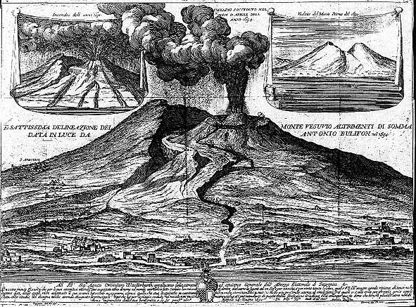 |
Rebuilding
itself after the catastrophic 1631
eruption, Vesuvio is seen here during its major eruption
in April 1694, the first well-documented event after 1631. A new
cone has formed within the vast 1631 crater but is still significantly
lower than Monte Somma (to the left of the active cone). For the
first time, lava overflows the rim of the 1631 crater and spills
down a narrov ravine on the W flank of the volcano without reaching
inhabited areas. This illustration is from Bulifon and shows small
and sketchy views of the 1631 eruption as well as of the mountain
after that event.
|
||
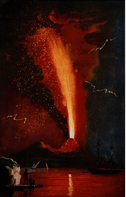 |
Vesuvio
in eruption, August 1779. This eruption was a typical subcycle-closing
event, characterized by the ejection of spectacular lava fountains
rising several km above the summit, and devastating tephra falls
in the northeast sector of the volcano. Image was taken from Alfano
and Friedlaender 1928.
|
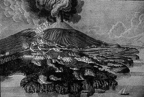 |
The
1794 eruption, one of the most devastating since 1631, destroyed
the town of Torre del Greco almost completely. The devastating lava
flow extended out into the Gulf of Napoli forming new headland shown
in this impressive woodcut. Vesuvio is shown in the background during
the culminating explosive phase after cessation of lava emission.
Image from Alfano
and Friedlaender 1928.
|
|
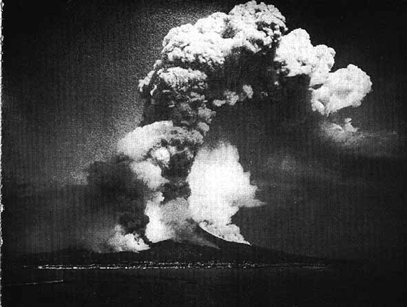
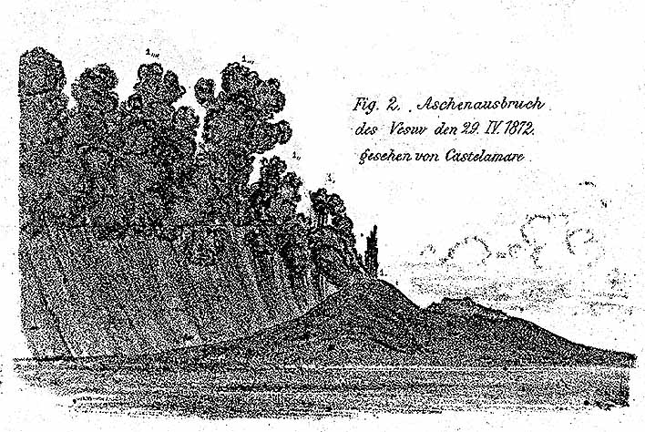
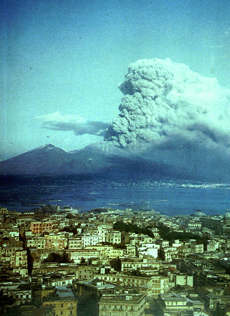
One
of the earliest photos ever taken of a volcanic eruption, this spectacular
image shows Vesuvio during the culminating phase of its 1872 eruption,
on 26 April. A dense ash column rises about 6 km above the summit
while steam trails mark the paths of lava flows on the NW flank.
This photo is one of a series taken by A. Sommer.
|
 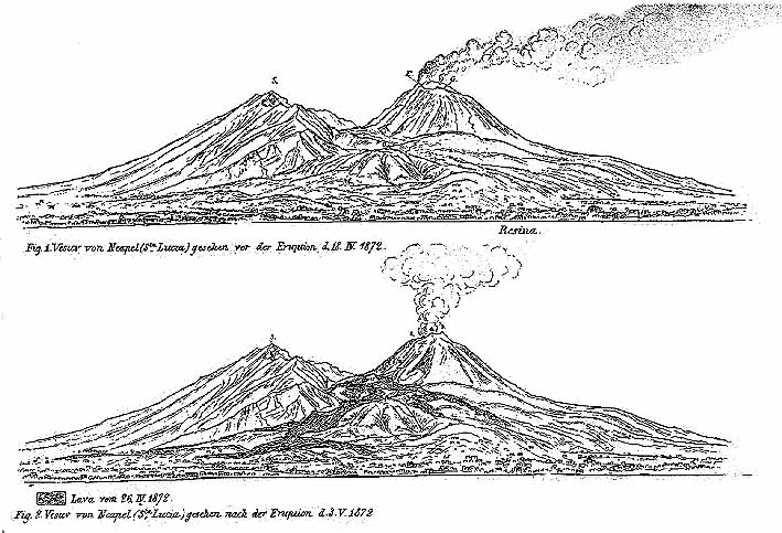 |
During
the waning stage of its 1872 eruption, Vesuvio emitted jets of black
ash every 10 seconds or so, as illustrated neatly in this drawing
by Heim
(1873) of 29 April 1872. Still later, the emitted ash
assumed a whitish color which was taken by the local population
as evidence that the eruption had ended.
|
 |
 |
 |
 |
|
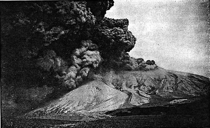
Outer
left: Shortly after the climax of the violent 1906 eruption, Vesuvio
emits dense but weak plumes of grayish ash that are driven northwards.
The destruction of the summit is already evident. Vesuvio lost more
than 100 m in height during that eruption which was its largest
since 1631. Photo by Perret
(1924), taken on 10 April 1906.
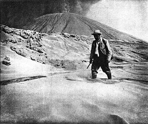
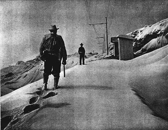
Inner left: Person wading through deep, uncompacted volcanic ash on the base of erupting Vesuvio, 9 or 10 April 1906. The ash had a thickness of about 0.3 m in this area (on the W side of the volcano) but much heavier tephra fallout occurred on the N and NE sides where several villages received up to 1.5 m of pyroclastics and almost all roofs caved in. Several hundred people died as a result of this disaster. Inner right: Going up to the Vesuvian observatory along the funicular railway during the April 1906 eruption. The landscape is deeply buried with light-colored ash. Outer right: Vesuvio decapitated after the 1906 eruption, May 1906. The mountain lost at least 115 m in height, having reached its maximum ever measured elevation of 1335 m in May 1905. During the years after the 1906 eruption, collapse of the crater walls led to further diminuition in the height of the active cone. The photo was taken from Monte Somma (a part of which is visible in the left foreground, by Perret (1924), looking south. |
|||
 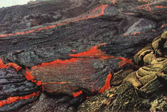 |
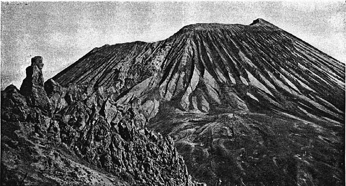
Towards
the end of the 1913-1944 subcyle, the 1906 crater was completely
filled with lava and a minor amount of pyroclastics. The photos
at left are rare color shots of the typical intracrater activity
during that period, taken in 1941 or 1942. In the upper photo, incandescent
pahoehoe lava tongues are seen at the base of the partially snow-covered,
steaming central intracrater cone (named "il Piccolo") in the background.
This cone, site of persistent Strombolian activity, eventually had
become the highest summit of the volcano. Lower photo shows more
detail of pahoehoe lava flowing across the floor of the 1906 crater.
|
||
|
Top:
Night view of Vesuvio during the increasing phase of its March 1944
eruption. Fire fountains rise from the crater and a tremendous display
of lightning illuminates the eruption column. The photo was taken
by Giuseppe Imbò, then director of the Osservatorio Vesuviano.
Note the large incandescent boulders at the base of the active cone.
Photo was taken on the evening of 22 March 1944, published in Imbó
(1949). |
  |
||
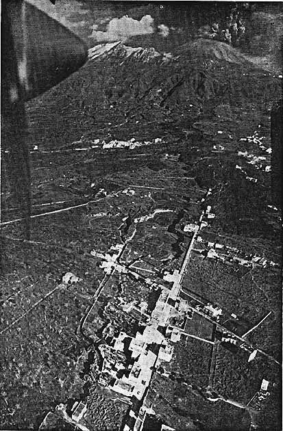  |
Top:
During the first stage of its 1944 eruption, Vesvio produced major
volumes of lava at a greatly increased effusion rate. In this aerial
view taken from N on 23 March 1944, two lava lobes are seen moving
towards the villages of Massa (at left) and San Sebastiano (at right).
A small branch of lava has just started moving towards Cercola which
is visible in the center foreground. The Somma-Vesuvio complex is
visible in the background with the Somma ridge covered with snow
and the active cone in the stage of vigorous lava fountain ejection.
Photo from Imbó
(1949) |
||
|
Top:
Sequence of aerial views of hot avalanches descending the erupting
cone of Vesuvio during the 1944 eruption. The avalanches were described
by Imbó
(1949) as "glowing clouds". They reached only the base
of the active cone and left conspicuous tongue-shaped lobes (see
the photo at the bottom of this page). View is from the W on 24
March 1944.
Bottom: Aerial view of the Somma-Vesuvio complex from the SW, taken no more than 10 years after the 1944 eruption. The 1944 crater gapes at the top of the historically active "Gran Cono" while the major lava flow of the 1944 eruption is visible in the upper left corner, at the base of the steep caldera wall of Monte Somma. Note the numerous tongue-shaped features on the left base of the cone, these are lobes of pyroclastic avalanches that came down during the 1944 eruption. They have been interpreted as seismically triggered by Hazlett et al. (1991). |
  |
||
Copyright © Boris Behncke, "Italy's Volcanoes: The Cradle of Volcanology"