Italy's Volcanoes: The Cradle of Volcanology

Etna index

   
Geology Geological history Cones and craters
Eruptive characteristics Eruptions before 1971 Eruptions since 1971
Etna and Man References Web sites
Weather forecasts FAQ Latest news


The 1983 S flank eruption


Map of the 1983 lava flow-field

1983 lava flow map

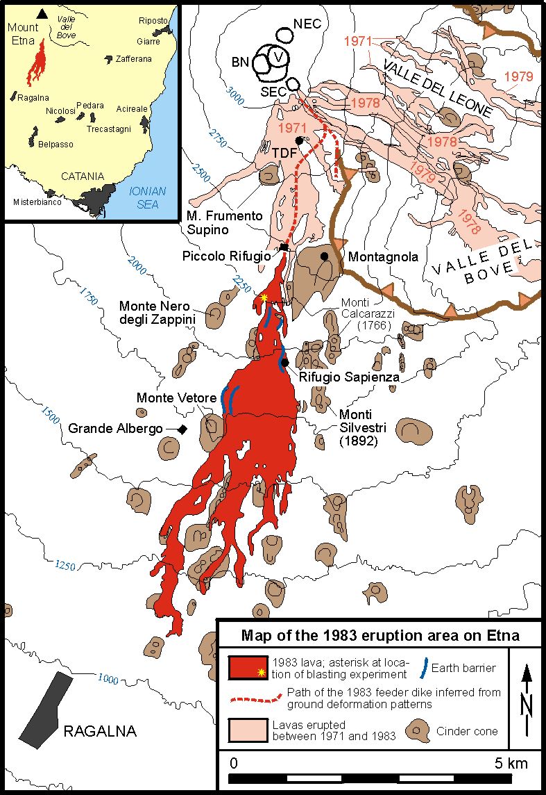
This map shows the area affected by the March-August 1983 eruption on the S flank of Etna, and sites where operations to divert the lava flow or prevent it from extending laterally were carried out (yellow asterisk marks the location where the levee of the main lava flow channel was blasted in order to force the lava into an artificial bed; earth barriers erected parallel to the flow margins are shown in blue color). Ground deformation monitoring allowed the reconstruction of the path of the subterranean dike departing from near the SE Crater and leading to the 1983 eruption site immediately below the "Piccolo Rifugio". Inset at upper left shows the 1983 lava field and locations of various towns on Etna's S, SE and E flanks. The blasting operation was carried out because the lava was reported to threat Nicolosi and Belpasso - even if the flow fronts had advanced further, they would have bypassed Belpasso, and the farthest flow front stopped about 6 km from the N margin of Nicolosi (see inset at upper left). Nonetheless, Italian and international mass media carried the news that even the distant city of Catania was threatened by the lava flow


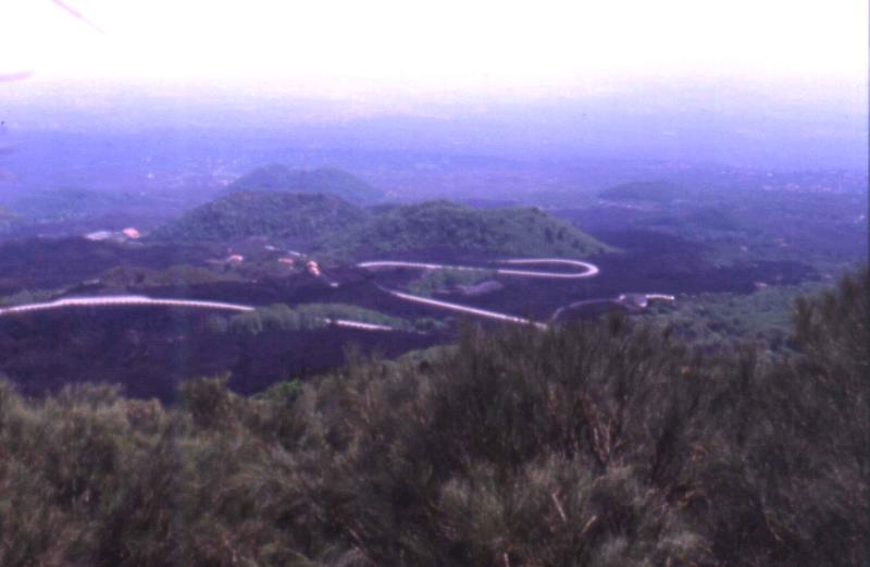
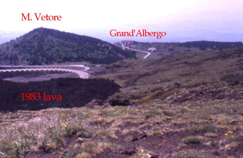
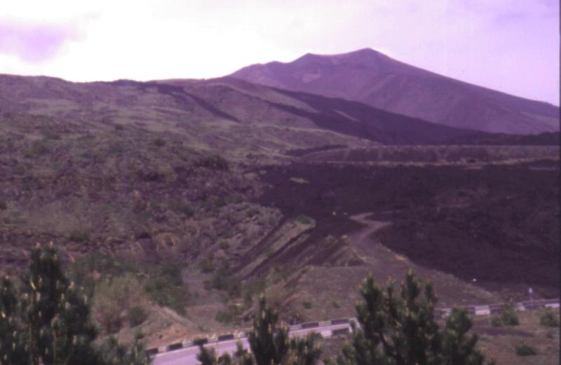
Photos of the 1983 eruption and lava flow

1983 eruption

On the first evening of the eruption, the lava flow reaches the large touristic complex around the Rifugio Sapienza, at about 1900 m elevation on the S flank of the volcano. Among the first buildings to be destroyed is the Casa Cantoniera, a restaurant about 200 m to the W of the Rifugio Sapienza. Photo by Giuseppe Scarpinati, 28 Marchh 1983.

1983 eruption

Two photos made by Scarpinati on the evening of 2 April 1983 at the mildly explosive vents of the 1983 eruption. The eruptive fissure lay on the W base of the Montagnola, of which part is visible in the background in the right photo.

1983 eruption
1983 eruption 1983 eruption 1983 eruption

Photos taken by Giuseppe Scarpinati during an early stage of the 1983 eruption, probably during the first days of April 1983.
Left: A broad lava flow has buried a portion of the road that connects the area of the Rifugio Sapienza with Nicolosi to the south, and with Zafferana to the east. This flow has also destroyed or damaged many of the buildings of the large touristic complex around the Rifugio Sapienza
Center: A view from above of the touristic complex near the Rifugio Sapienza and the base station of the cable car. Large building in left central area, partly surrounded by lava, is the Rifugio Sapienza, which had a narrow escape from destruction. Craters in left background are the Monti Silvestri, formed during a large flank eruption in 1892
Right: Scarpinati and companions camping near the vents of the 1983 eruption, around which a chain of beautiful hornitos have built during the first days of the eruption. The hill in the background is the Montagnola

1983 eruption 1983 eruption 1983 eruption

Photos taken by Giuseppe Scarpinati in early April 1983.
Left: Emission of dense white vapor from the eruptive fissure of the 1983 eruption after all explosive activity at the newly formed hornitos (in the background) has ended. Lava continued to flow from the fissure for about 4 months
Center: Beautiful lava flow channel, partially roofed over in the background, in the upper part of the 1983 lava flow-field. It was in this area that the first attempt was made, on 14 May 1983, to divert the lava flow by blasting the W side of the main flow channel. The intention was to force the lava out of its natural bed into an artificial channel, but only about 20 per cent of the lava eventually was diverted into that channel
Right: A suggestive night view of spectators at the main lava flow channel

1983 eruption

Left: Detail of the 1983 hornitos, which built around the skilift leading to the Montagnola skiing area
Right: Bifurcating lava flow in the upper part of the 1983 lava flow-field. Photos by Scarpinati

1983 eruption
1983 lava flow Lava threatens hotel Earth barriers

Photos taken by Boris Behncke in the 1983 eruption area on the S flank of Etna on 24 May 1998.
Left: View southwards from the summit of Monte Vetore, about 1.5 km SW of the Rifugio Sapienza. Black lava in middle ground is of the 1983 eruption which buried forests, cultivated land, many isolated buildings and restaurants, and cut the Nicolosi-Rifugio Sapienza road in numerous places. The road, of which several bends are visible in this photo, was reopened only in 1985
Center:
This photo shows the delicate situation that developed during the 1983 eruption when a lava flow (in the left foreground) threatened to surround the northern flank of Monte Vetore (left background) and reach the area of the Grand'Albergo dell'Etna (center background). The artificial earth barriers shown in the right photo prevented the flow from taking this dangerous course
Right:
Among the more successful efforts to alter the course of the 1983 lava flow was the construction of earthen barriers to prevent the lateral spreading of the lava which was threatening a major hotel and an astronomical observatory. One barrier, with some minor black flows that spilled over its crest, is visible in the lower central part of the photo. The large cone in the right background is the Montagnola

Continue with
THE 1984 SE CRATER ERUPTION

Copyright © Boris Behncke, "Italy's Volcanoes: The Cradle of Volcanology"

Page set up on 1 January 2000, last modified on 7 March 2000


Hosted by VolcanoDiscovery