Italy's Volcanoes: The Cradle of Volcanology

Etna index

   
Geology Geological history Cones and craters
Eruptive characteristics Eruptions before 1971 Eruptions since 1971
Etna and Man References Web sites
Weather forecasts FAQ Latest news


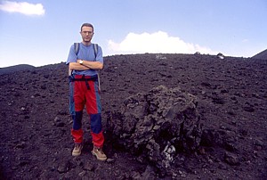
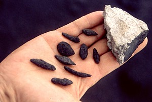
Big bomb of the 2001 eruption... ...and tiny lava drops of the 2001 eruption
Etna is a world of striking contrasts, and the products of the 2001 eruption are no exception. Huge, meter-sized bombs were thrown out of the large cone (later named Monte Josémaria Escrivà) and fell hundreds of meters away (left photo, with Giuseppe "Pippo" Scarpinati for scale). But the same cone produced also the tiny, graceful objects that can be seen in the right photograph (Scarpinati's hand serves as scale in this case), which are droplets of lava. The light-colored, larger chunk of rock in upper right corner of the image is a block of sedimentary rock that formed an inclusion within the lavas emitted at the two lowermost vents of the 2001 eruption (note the draping of lava on the lower right side of the specimen). Sedimentary inclusions, also called xenoliths, were extremely frequent in the products of the lower vents on the southern flank of Etna in 2001 and reappeared in the products of the south flank vents in 2002-2003; they were rare or absent in the lavas of the other vents of both eruptions

Etna photo gallery: 2002
Before the mountain moved - January to October 2002


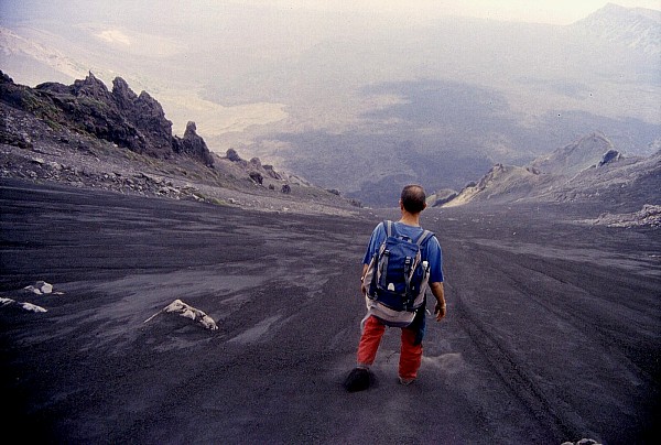
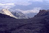
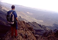
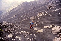
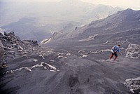
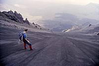
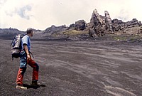
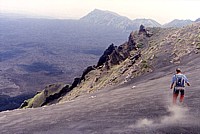
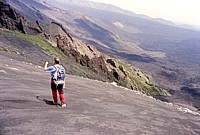
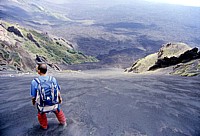
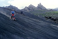
Mid-June 2002 was a good occasion to do an excursion that few visitors to Etna will ever do, if they do not happen to stay a bit longer or know a mountain guide who offers this type of excursion: the descent into the Valle del Bove on the so-called "Sabbione della Montagnola" (loosely translated as "the Big Sand"). The descent starts at the Montagnola and goes down 700 m of vertical relief on a scree made of loose sand - just sand at the angle of repose. The enormous quantities of pyroclastics ejected in the 2001 and 2002-2003 eruptions have made the whole thing still more pleasant, since now there is not only sand on the slope, but much of the lavas which make up the floor of the Valle del Bove are also covered with tephra, which makes walking much easier. While the descent is simply an enormous quantity of fun, the Valle del Bove itself is one of the most suggestive areas on the volcano, and one of the least known. The following photographs were taken in mid-June 2002 and do not need much commenting except in a few cases. I thank Giuseppe Scarpinati for his company and for sharing his Etna-related experience; his presence in most of these photographs render, in my opinion, a better idea of the steepness of the descent and of the sheer dimensions of the surrounding landscape

Big, big fun: the descent into the Valle del Bove, June 2002

Descent into the Valle del Bove, June 2002
700 m of vertical relief to go, this is no good idea if you suffer vertigo, but extreme fun if you don't. The look from the top of the slope known as "Sabbione della Montagnola" down into the Valle del Bove is breathtaking. However, to do this adventure, one must be very familiar with the place, and choose a day of stable weather. It cannot be done during the winter because the slope is covered with ice, and people have died when venturing on this slope during the winter
Descent into the Valle del Bove, June 2002 Descent into the Valle del Bove, June 2002 Descent into the Valle del Bove, June 2002
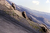
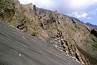
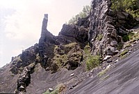
Upper portion of descent. The photographs in the lower row show some nice examples of the countless dikes that crop out in the walls of the Valle del Bove. These dikes are nothing else than magma that solidified within fissures cutting the flanks of a part of the volcano that does not exist anymore. Many of these fissures probably fed flank eruptions. It is interesting to note that the trends of these fissures are practically identical to that of historical flank eruptions, indicating that the stress field within the former edifices (which have been partially removed during the collapse of the Valle del Bove) was the same that exists within present-day Etna
Descent into the Valle del Bove, June 2002 Descent into the Valle del Bove, June 2002 Descent into the Valle del Bove, June 2002
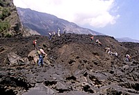
Lower portion of the descent, and more and more dikes are seen cutting the walls of the Valle del Bove. At the base of the descent, progress is slowed by the terminal portion of a lava flow of late July 2001, which came down through a neighboring ravine and spread out fanwise at the flat bottom of the Valle del Bove. The lower right photograph shows a group of hikers struggling their way across the frontal lobe of the 2001 lava

Two months after the Valle del Bove excursion I was back on the hiking tracks of Etna, following a number of hikes on the Aeolian Islands (I worked as a guide for an adventure travel agency). This time it was a three-day hike all around Etna's southwestern, western, nortwestern, northern and northeastern flanks, following the "Forestale" (forest guard) dirt road, with overnight stays in mountain huts that do not have services. It is not exactly a walk in the park, but it brings you to places of stunning beauty, and if weather conditions are good, Etna can be seen in all its grandeur.

"Grand Tour" of Etna, August 2002

August 2002 August 2002
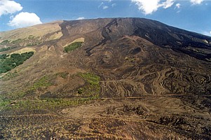
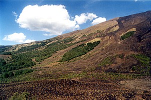
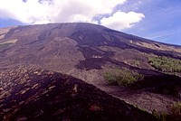
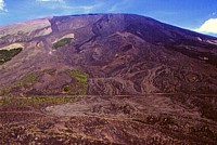
Etna's massive western to northwestern flank is seen in these two photographs (for aesthetical reasons they have not been placed in the inverse order) taken on 17 August 2001 from the summit of Monte Nunziata, a large pyroclastic cone formed in 1832. There are not many other areas where the flanks of Etna show such a variety of colors. Most of these are due to different ages and thus grades of weathering and colonization by vegetation of lava flows. The dark lava flows visible in the upper right part of the slope in the left photograph were formed by the voluminous overflows from the Bocca Nuova, one of the summit craters, in October-November 1999. Below them, still in the left-hand photograph, there is a conspicuous row of pyroclastic cones aligned along an eruptive fissure that was active in 1843; the peculiar meandering lava flows in right foreground were emitted from those vents during that eruption. In the lower left center of the image is another cluster of cones, half-covered with vegetation (the fresh light green bushes), which constitutes the upper portion of the 1832 eruptive fissure
The right photograph shows an area that actually lies to the left of that shown in the left photograph. Here there are less recent lavas, and more vegetation; furthermore there is one very narrow eruptive fissure that seems to have erupted only very briefly, and densely vegetated prehistoric pyroclastic cones are seen at extreme left
August 2002 August 2002 August 2002
Western flank of Mount Etna, showing dark lava flows that were emitted during the October-November 1999 Bocca Nuova eruption (in my opinion that was the most beautiful eruption I've seen at Etna so far, including the 2001 and 2002-2003 eruptions!). Top left photograph shows the "Monte Palestra" mountain hut in the foreground. Top right photograph shows the most advanced lobes of the 1999 Bocca Nuova lavas, at more than 4 km distance from their source, and some of the numerous pyroclastic cones that dot Etna's western flank in the background. Photos in bottom row were taken from Monte Nunziata, left-hand image shows the place where the "Forestale" (forest guard) road has been covered by the longest of the 1999 Bocca Nuova lava flows
August 2002 August 2002
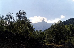
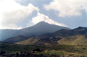
I did not get to see much of the summit activity that occurred between June and September 2002, mostly at the Northeast Crater, because I was rarely at Etna during that period. On 18 August, though, I caught a glimpse of the typical Strombolian activity persisting at that crater. At night, there were small incandescent bursts, during daylight one would see small puffs of grayish ash (left photograph). Ash-free plumes were emitted the next day (19 August), seen in the right photograph with the phantastic landscape of the Northeast Rift in the foreground
Monte Nero, August 2002
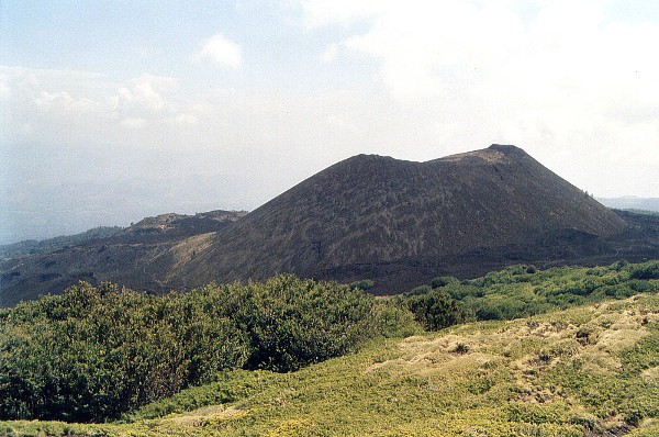
One of the most conspicuous of Etna's numerous flank cones, Monte Nero (Black Mountain) formed during a large, and strongly explosive, eruption in 1646-1647 in the lower portion of the Northeast Rift. This area is a volcanic wonderland, with countless cones and craters of different size, color, form, and age. Darker, more recent lavas that can be seen at the near base of the 120 m-tall cone were erupted in 1911 and 1923. Still more recently, after this photograph was taken, the Northeast Rift erupted again, and the most easy access routes to this area were cut by lava flows. Monte Nero and its surroundings are presently one of the most remote places on Etna. Photograph was taken 19 August 2002

Continue (next page)

Return to the Etna photo gallery


Copyright © Boris Behncke, "Italy's Volcanoes: The Cradle of Volcanology"

Page set up on 11 August 2003

Hosted by VolcanoDiscovery