
| Etna
index |
||
| Geology | Geological history | Cones and craters |
| Eruptive characteristics | Eruptions before 1971 | Eruptions since 1971 |
| Etna and Man | References | Web sites |
| Weather forecasts | FAQ | Latest news |
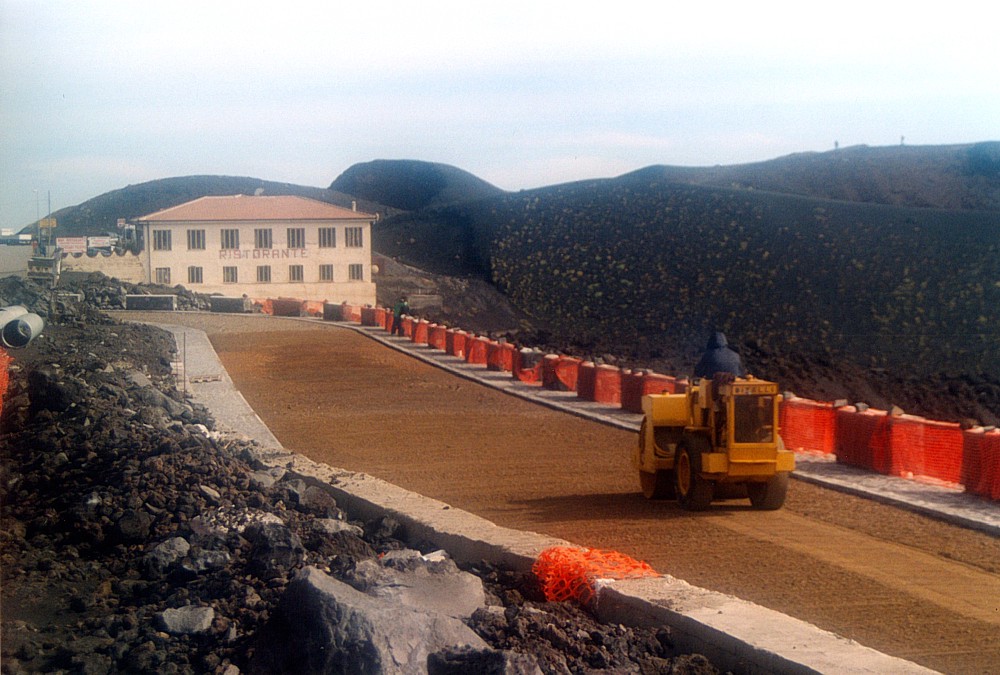 |
One
year after the latest eruption, reconstruction in the Rifugio
Sapienza area on Etna's south flank is in full swing. This is
a view of the Provincial Road 92, which was interrupted repeatedly
by lava flows during the summer 2001 and winter 2002-2003 eruptions.
A new road is being constructed exactly in the same spot where
press photographs pictured the first tongue of lava crossing the
road on 18 July 2001; the restaurant (Ristorante Corsaro: thanks
to those folks for being such kind people) in the background narrowly
escaped from destruction. The dark hills in the background belong
to the Monti Silvestri, formed during an eruption in 1892. Photograph
taken on 31 October 2003 |
Etna
photo gallery: 2003
Return to Etna
![]()
Part 4: September-October 2003
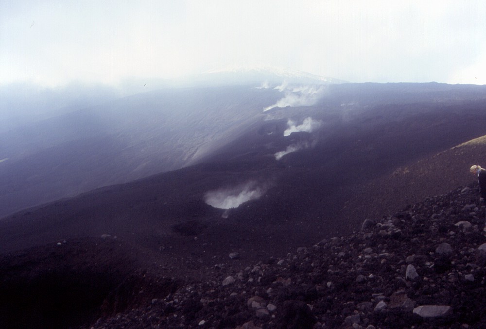
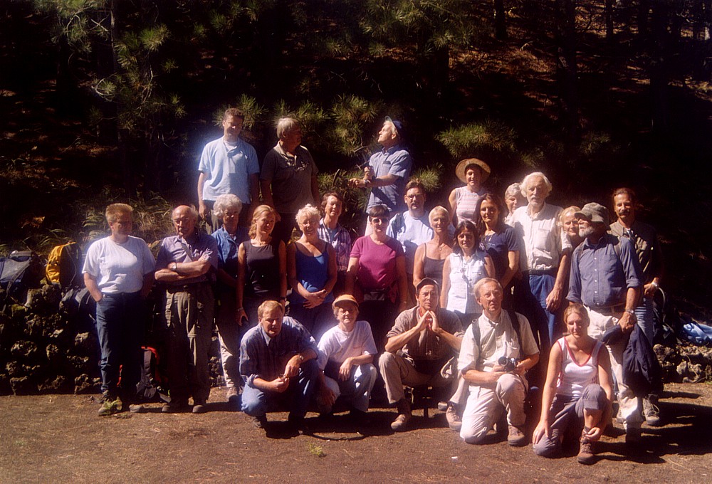
In late-September 2003 I finally had the chance to visit a portion of the impressive fissure opened during the Northeast Rift eruption in October 2002, which I had not seen before - the upper-central part. This section of the fissure consists of dozens of small to medium sized craters, many of them being simple pits. In the lower part of this part of the fissure, the first lava flows were emitted on the fateful day of 27 October 2002. The visit was made together with an excursion group from the University of Utrecht (Netherlands), which had been organized by the faithful Boudewijn t'Hart who has visited Etna every year since 1998. Weather conditions were not all too favourable, there was a high degree of relative humidity hampering visibility, but due to this humidity, vapor was seen escaping from many of the vents.
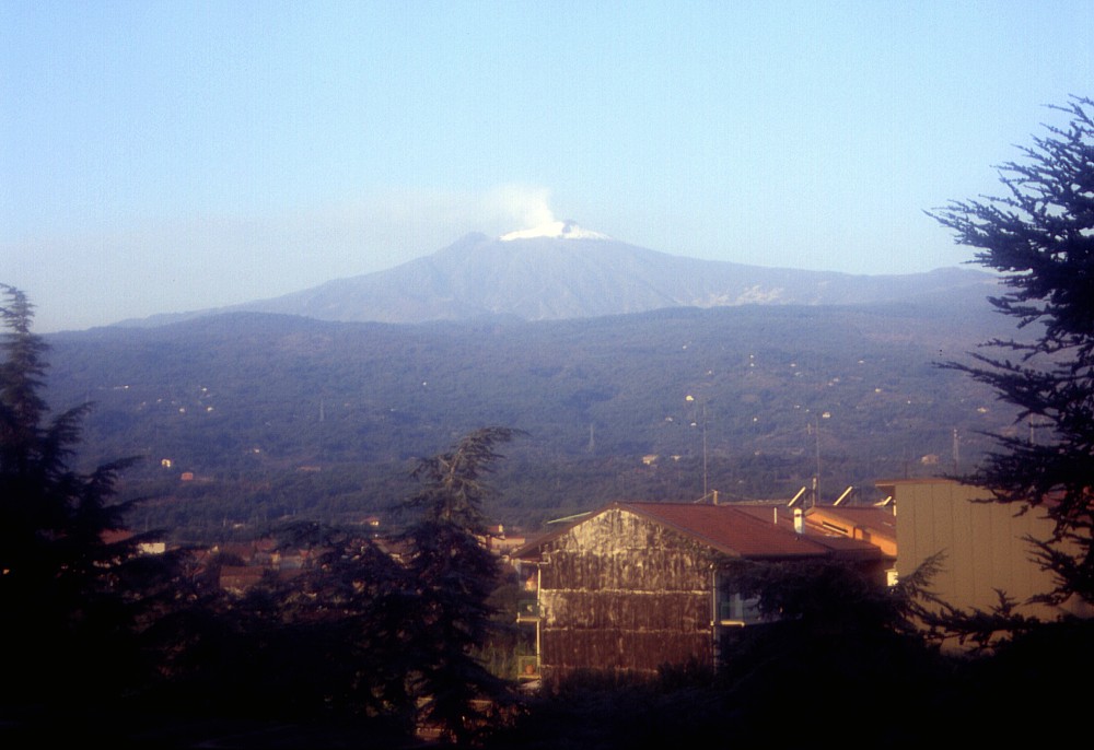 |
A
splendid morning view of Etna seen from Linguaglossa, mid-September
2003. The first snow has fallen in the summit area but has melted
on the cone of the Southeast Crater (the dark peak to the left of
the snow-covered, degassing Northeast Crater) |
 |
 |
 |
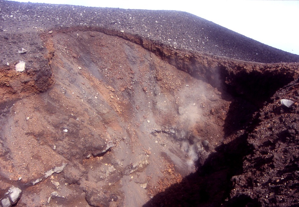
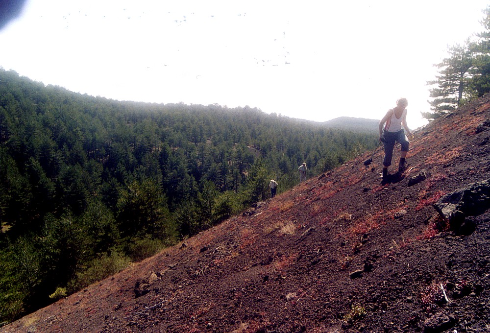
Left:
a view downslope from the uppermost vents of the 2002 fissure, showing
vapor escaping from many of the small vents that opened at the very
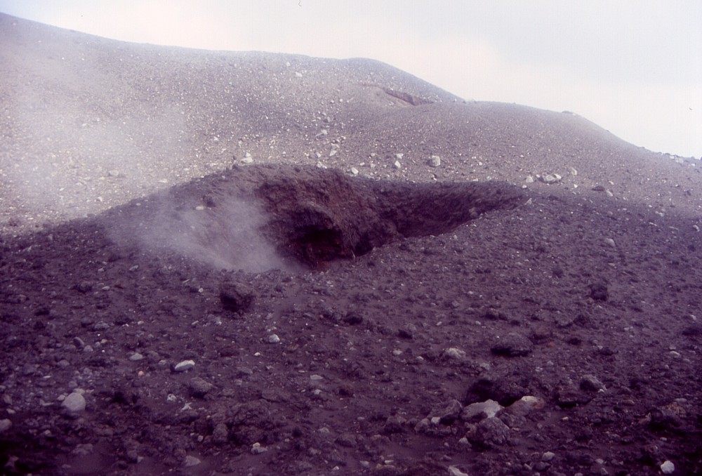
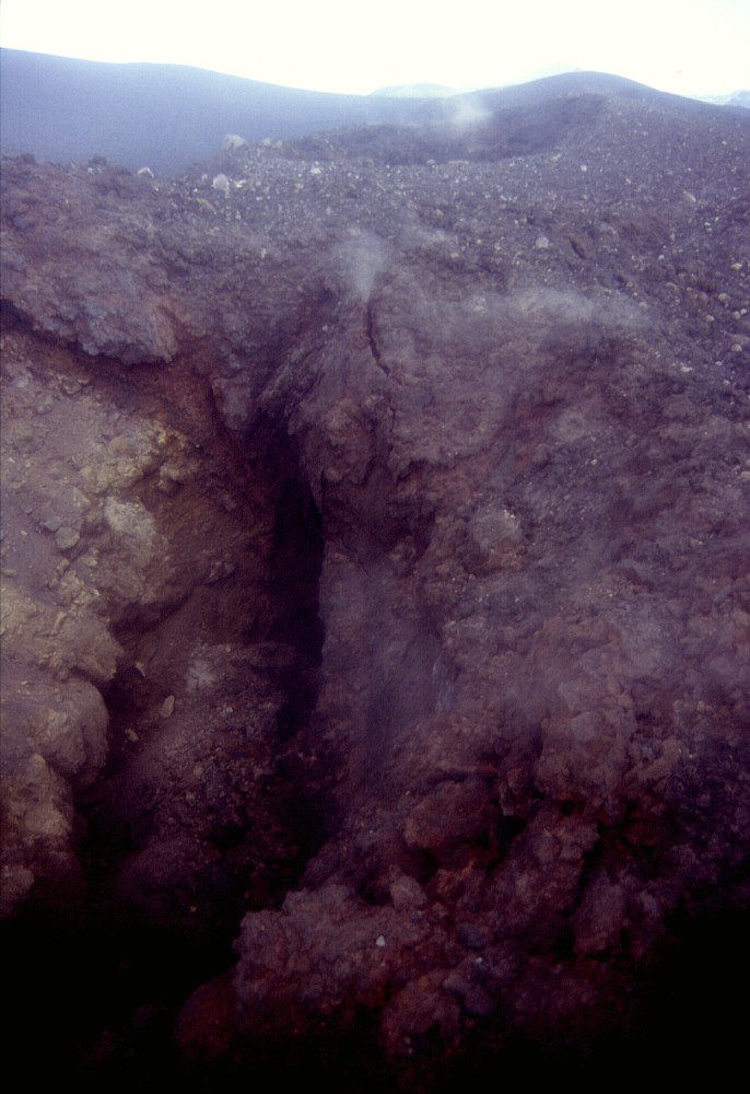
beginning of the NE Rift eruption on 27 October 2002. Center: excursionists struggling their way across chaotic terrain surrounding some of the small vents in the upper portion of the October 2002 fissure. Right: a small crater, less than 10 m wide, emits a diffuse plume of vapor. This crater formed at about sunrise on 27 October 2002 and was one of the first vents on the new fissure to eject largely magmatic material (the uppermost vents emitted nearly exclusively fragmented old rock) |
||
 |
 |
 |
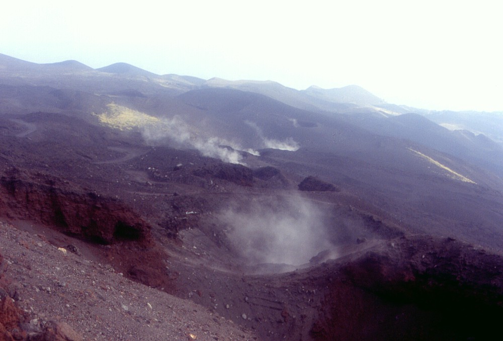
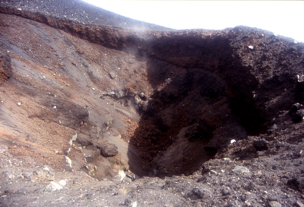
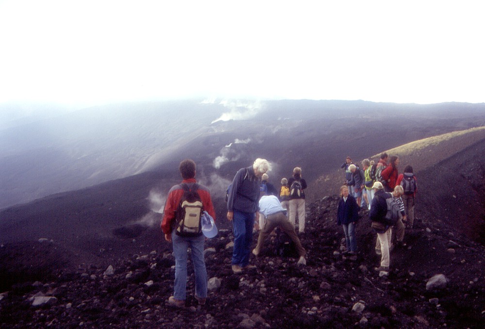
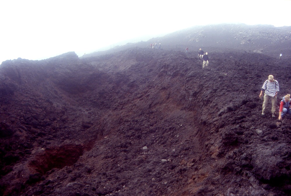
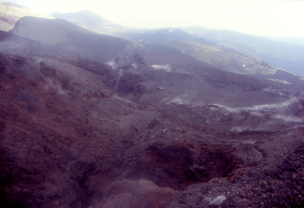
Three
views of the upper portion of the eruptive fissure of 27 October
2002, with numerous vents emitting vapor on a humid September morning,
eleven months after the eruption. Members of the Dutch excursion
group are seen scrambling up a steep slope consisting of loose blocks
in the center photograph |
||
 |
 |
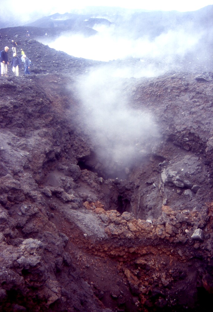
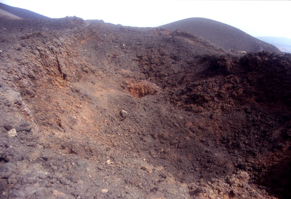
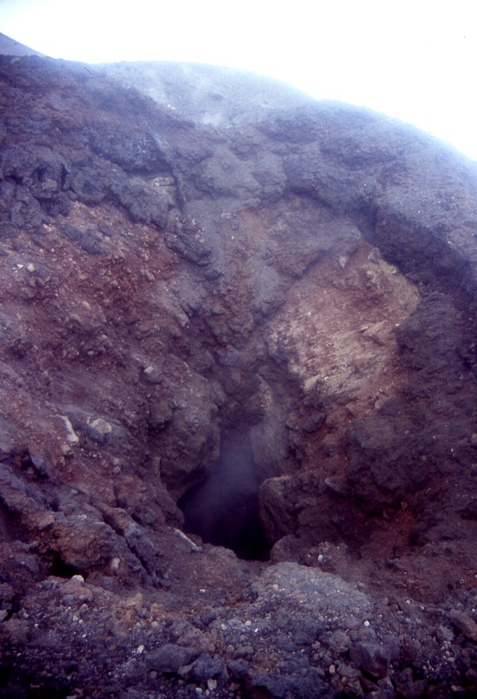
The
first somewhat larger crater to open during the propagation of the
eruptive fissure of 27 October 2002 lies on the eastern side of
a low cone formed during the 1809 eruption. This crater is about
30-40 m wide and emitted fresh magmatic bombs along with blocks
of old lavas and pyroclastics pierced by this new crater. Minor
amounts of vapor are seen rising from the bottom of the crater |
|
 |
 |
 |
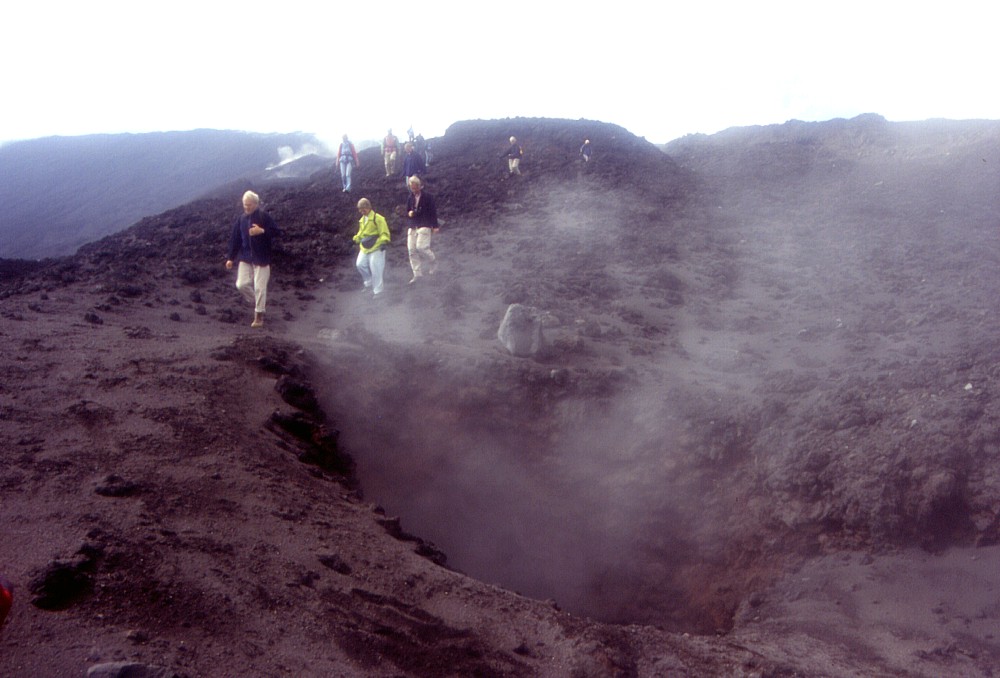
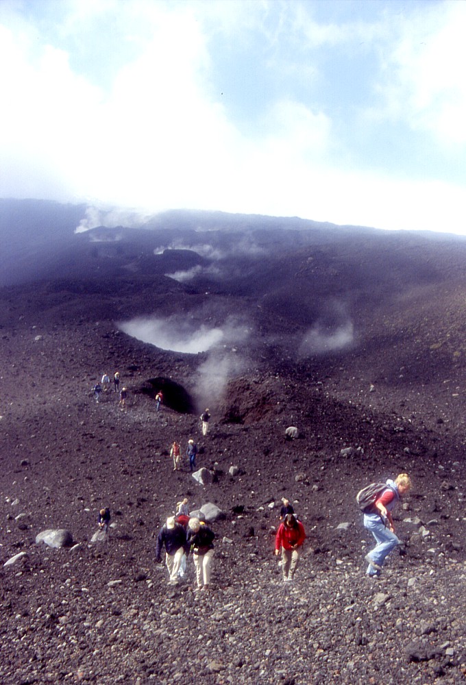
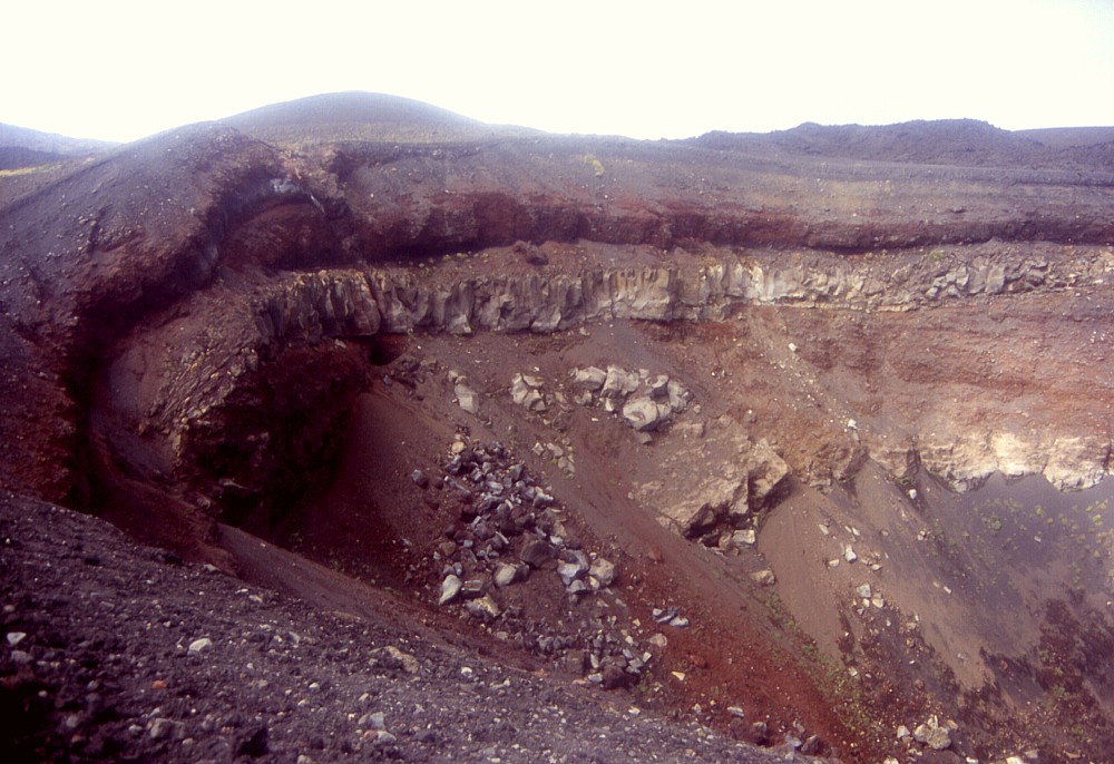
Left:
the largest and most spectacular of the 1809 craters, visited by
numerous tourists before the 2002-2003 eruption. Large blocks have
detached from a 17th century lava flow exposed in the crater wall
during the earthquakes that occurred during the opening of the 27
October 2002 eruptive fissure. Center: Dutch excursion group taking a rest on a panoramic spot on the rim of the 1809 crater, with steaming vents on the 27 October 2002 fissure in the background. Right: upper portion of the October 2002 fissure with vapor rising from numerous vents |
||
 |
 |
 |
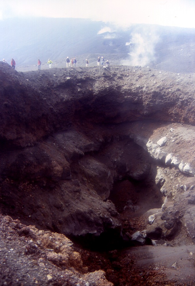
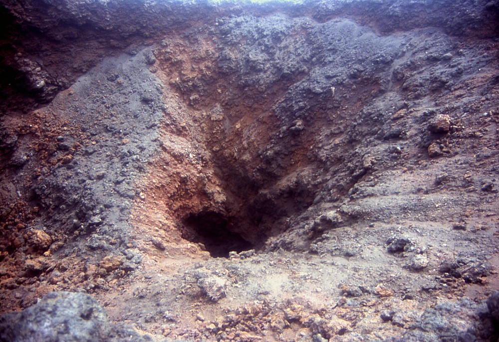
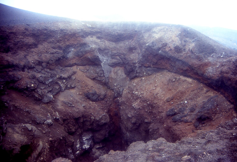
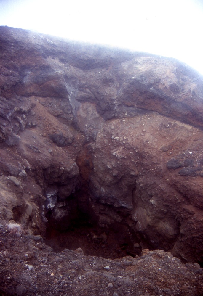
Left:
open pit (3-5 m in diameter) on the bottom of one of the craters
in the upper-central portion of the October 2002 fissure. Center and right: different views of the central portion of the October 2002 fissure. These vents emitted the first lava flow on the forenoon of 27 October 2002 and cut across the dirt road leading from Piano Provenzana to the summit area |
||
 |
 |
Looking
into two of the October 2002 vents lying next to the Piano Provenzana-summit
dirt road, with the eruptive fissure being exposed in their walls |
|
 |
 |
 |
|
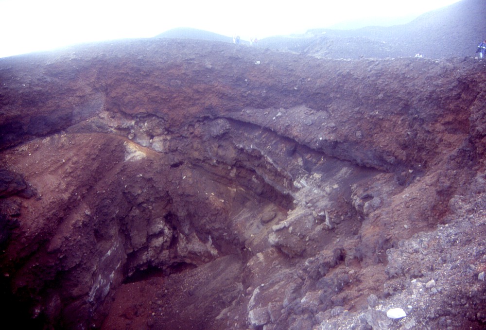
One
of the most spectacular craters of the central portion of the October
2002 eruptive fissure is seen in these photographs. The north wall
of this crater clearly shows the trace of the dike that cut through
the surface on the morning of 27 October 2002 (left and center photographs).
South wall of the crater is seen in right photograph |
||
 |
The
chaotic landscape seen in this photograph is actually the crater
(or cluster of vents) which emitted the first lava flow that descended
toward Piano Provenzana at about noon on 27 October 2002. Intense
lava fountaining was seen at this vent for several hours before
the eruptive fissure propagated further downslope (background) |
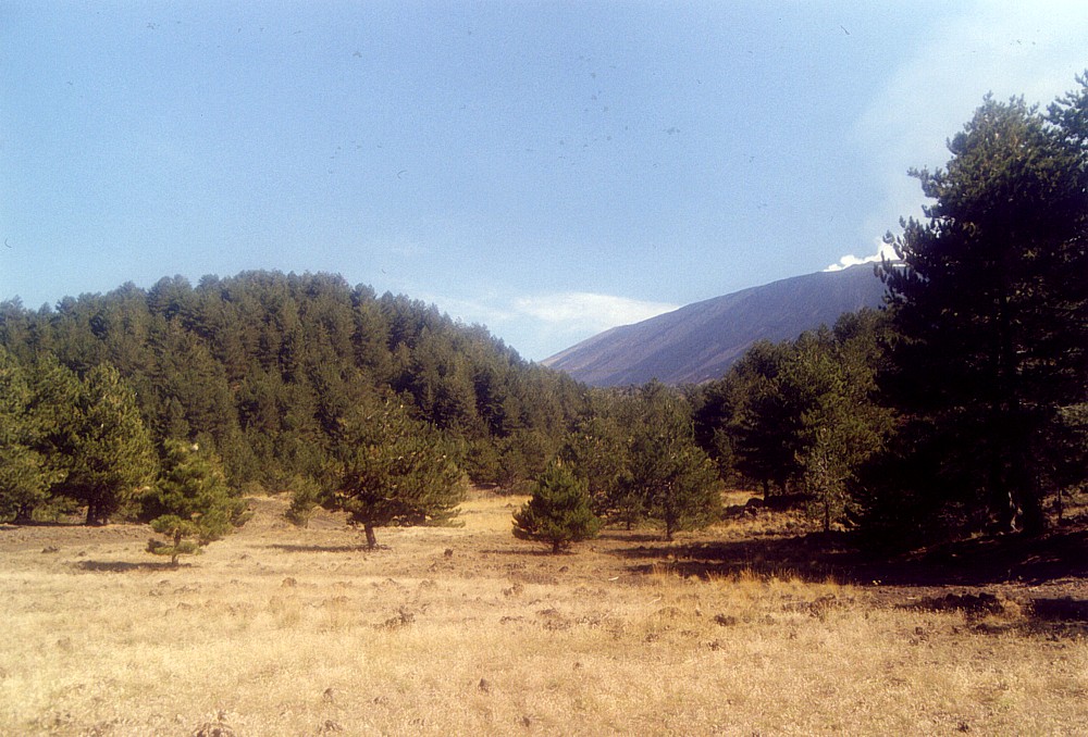
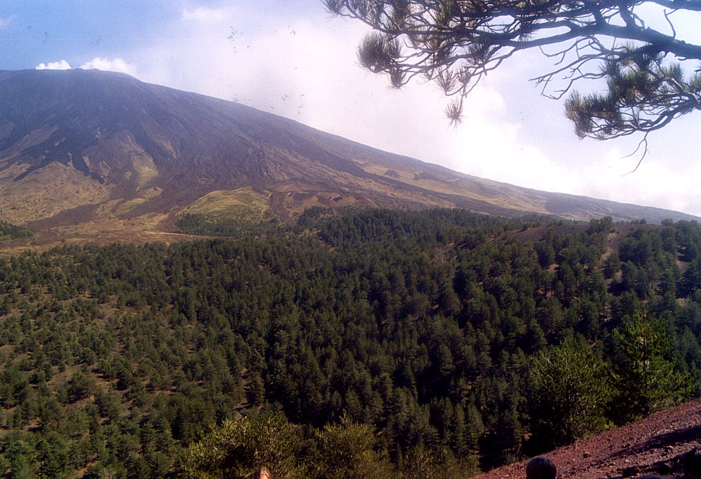
The verdant west flank, September 2003
During the same excursion with the Utrecht University group, we visited also the area of the Monti De Fiore (1974 eruption) on the west flank. This visit provided a striking contrast to the dark-toned impressions of the 2002 eruptive fissure on the Northeast Rift the day before. Much of the area surrounding the Monti De Fiore is covered with lush forest, thanks to the efforts of the Forestale (forest guards) of Etna. This is Etna's friendly side, where the volcano and its destructive potential seem to be far away - even though this landscape owes its existence to eruptions as does the somber landscape of the Northeast Rift.
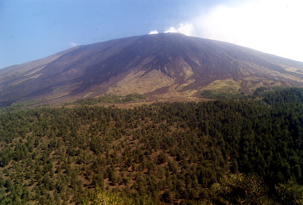 |
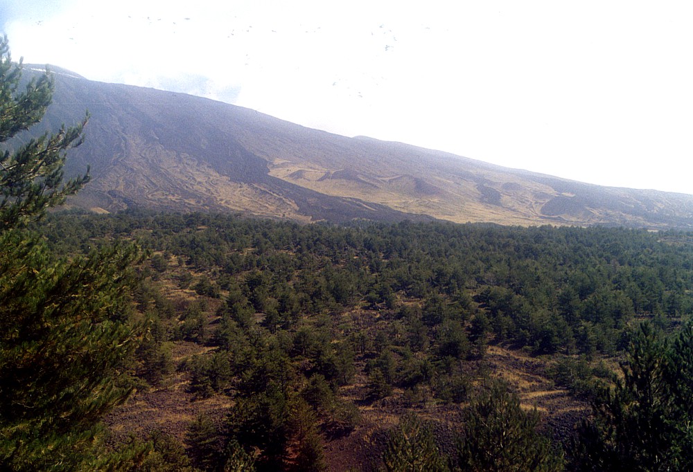
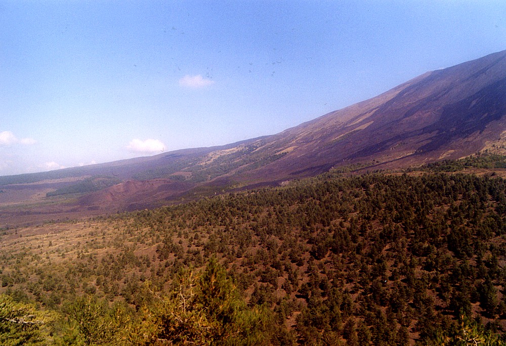
The
massive western face of Etna seen from the summit of Monte Rosso,
a large prehistoric pyroclastic cone rising to a height of 1873
m. Dark tongues of lava extend from the summit of Etna down the
upper west flank, the most recent (and darkest) of which result
from the spectacular overflows from the Bocca Nuova in October--November
1999 |
 |
 |
 |
Left:
the forested cone at left is Monte Leporello, a prehistoric pyroclastic
cone rising to 1748 m height on Etna's west flank (the main cone
of Etna is seen in the right background). The flat area in the foreground
is constituted by a lava flow that was erupted only a few centuries
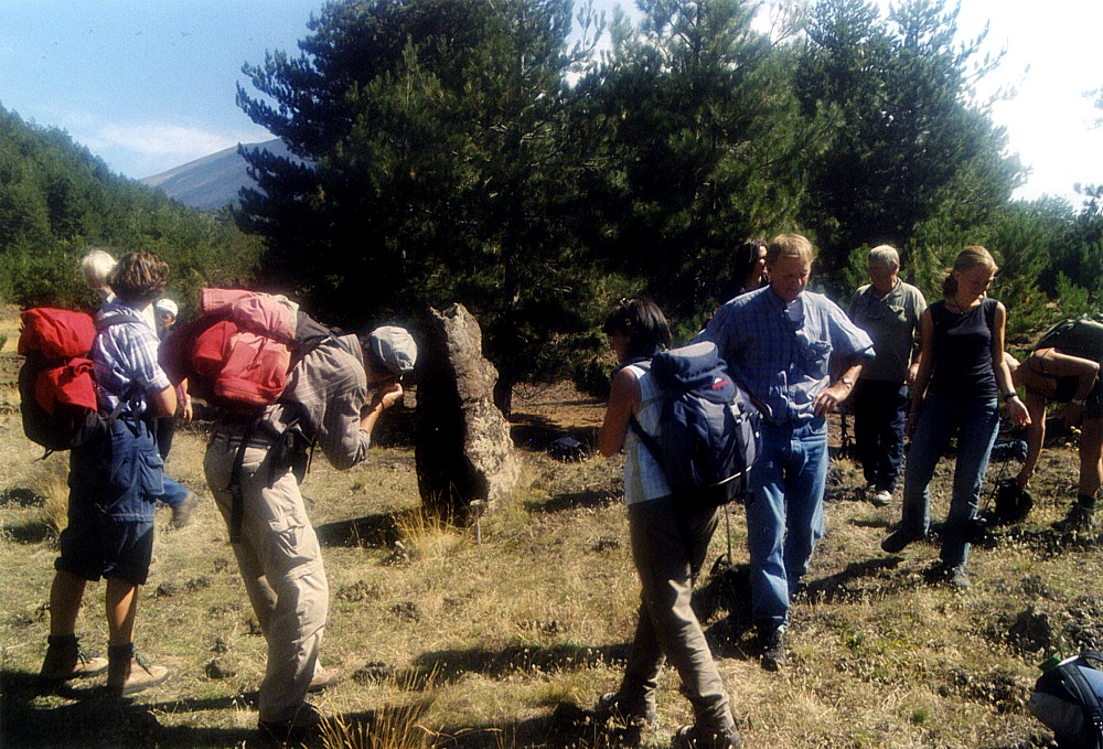
ago Center: members of the Utrecht University group marvel at a "lava tree mold" standing in the lava flow shown in the photo at left, which indicates that this lava flow was emplaced rapidly and remained active only for a short time Right: panoramic view from the summit of Monte Leporello (photo at left) toward southeast. Older lava flows and pyroclastic cones are seen on the flank of the main edifice of Etna in the background. The prominent lava tongue in the center of the image flowed down from the summit area in the 18th century, possibly during a large summit eruption in 1787 |
||
 |
 |
 |
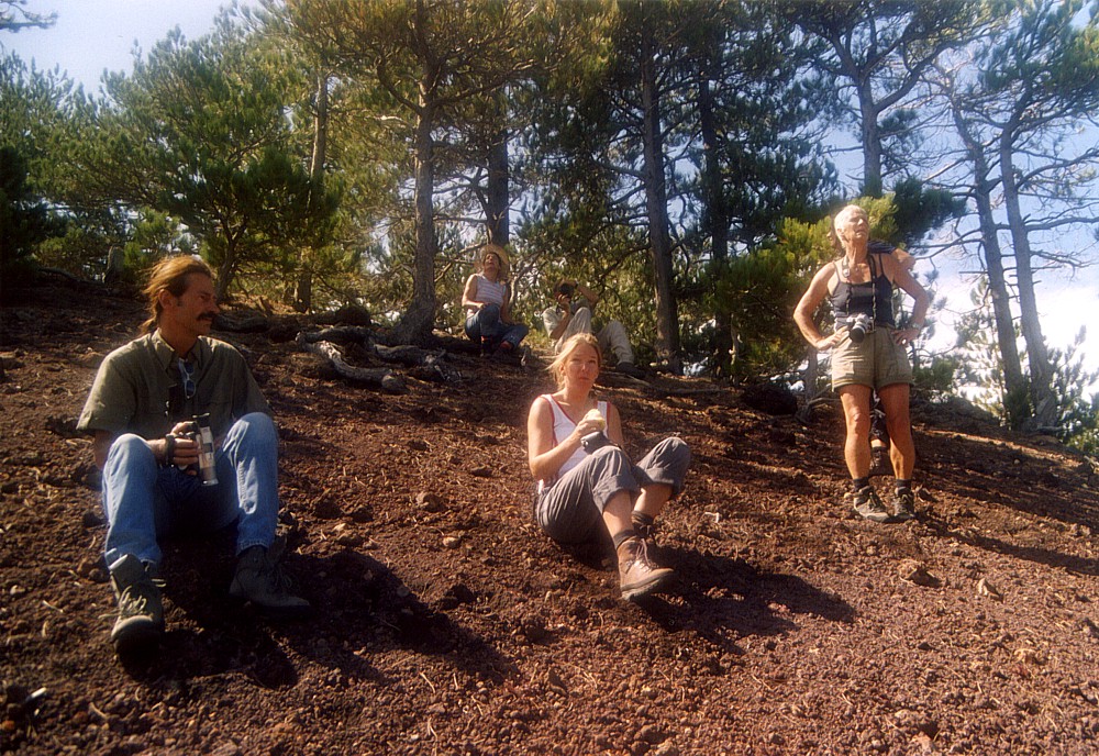
Left:
climbing up the steep flank of the large cone of Monte Rosso - this
is quite an enterprise (the cone is nearly 100 m high above its
eastern base), but climbers are rewarded with some of the most impressive
panoramas that can be obtained in this area Center: members of the Utrecht University excursion group enjoy a moment of relax and the breathtaking view from the summit of Monte Rosso Right: panoramic view from Monte Rosso toward northeast, showing the northwestern flank of Etna's main edifice and the dark lavas of the 1999 summit eruption extending to near Monte Nunziata, a large crater formed during a flank eruption in 1832 |
||
 |
 |
 |
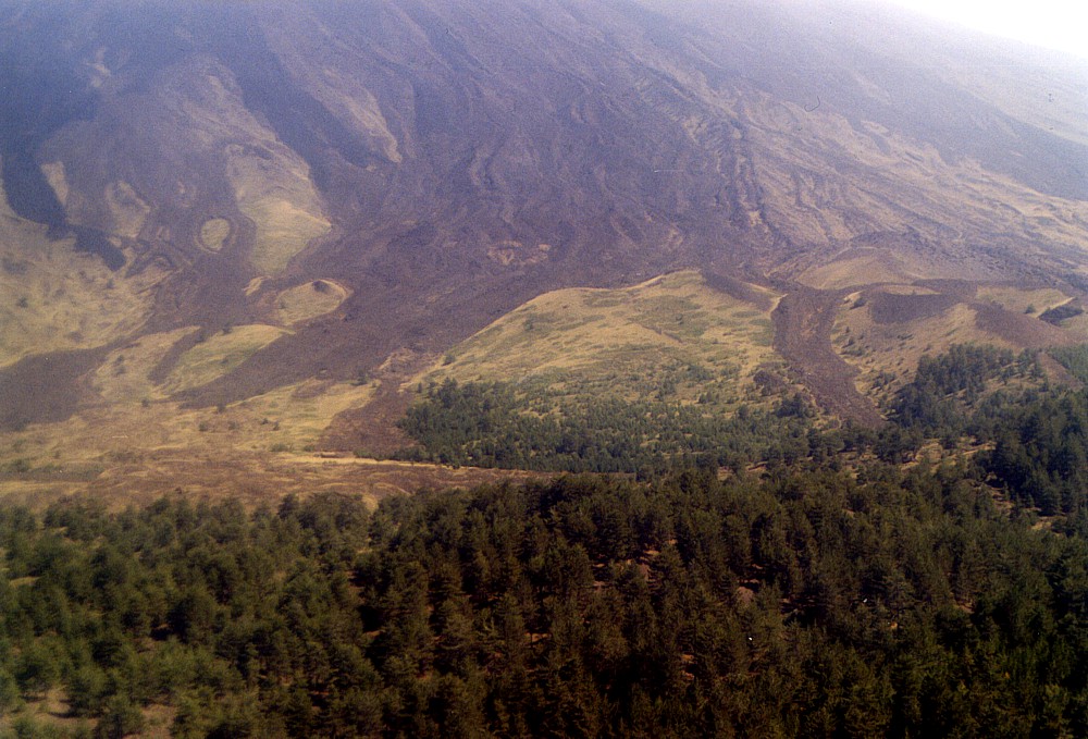
Left:
zoom from Monte Rosso on the Monte Palestra area (the cluster of
pyroclastic cones seen in the center-right half of the photograph),
which lie about 1.8 km distant. The lava tongues behind Monte Palestra
are of the 1787 summit eruption, one of the largest summit eruptions
on record. The subhorizontal line seen in lower left center corresponds
to the Forestale Road, and a small but nice mountain hut (Rifugio
Monte Palestra) lies next to it Center: another view from Monte Rosso, this time looking WSW and showing some smaller pyroclastic cones in the right foreground (partly hidden by dense vegetation). The nearest cone (at center right) is Monte Capre; behind it lie Monte Fornetto and Monte Palestra Right: zoom on Monte Capre, which rises a few meters higher than Monte Rosso, and whose poorly vegetated crater rim can be distinguished amidst the dense pine forest |
||
 |
 |
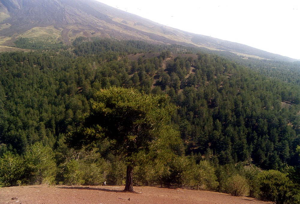
Left:
the dark cone of the Monte De Fiore I, born in January-February
1974, is seen in the center of this image, in a view from the W
side of Monte Rosso. The second cone of the same eruption, formed
one month later, is largely hidden by its larger companion. The
large cone in the background is Monte Minardo, to the left of it
lies Monte Peloso and before that, Monte Tre Frati. Monte Ruvolo
is seen at extreme right. Burnt forest in the foreground is not
a result of the 1974 Monti De Fiore eruption but of a much more
recent forest fire Right: the small, horseshoe-shaped cone of Monte Mezzaluna lies on the lower north flank of Monte Rosso and is generally attributed to an eruption in February-March 1763. Recent studies by Tanguy and others show that the composition of the Monte Mezzaluna products is different from that of the other products of that eruption (Monte Nuovo), which led these scientists to assume a different (though recent) eruption date for Monte Mezzaluna |
|
 |
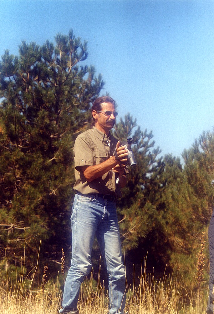 |
Left:
excursion group of the Utrecht University, photographed at the base
of the lower of the Monti Nespole (west flank of Etna) Right: Henk Bisschop, whom I first met during the 2001 flank eruption of Etna and who is the only person to my knowledge who managed to obtain an authentical soundtrack of the powerful explosions of the large Piano del Lago cone during that eruption - seen here in action on the summit of the lower Monte Nespole |
|
Return to the Etna photo gallery
Copyright © Boris Behncke, "Italy's Volcanoes: The Cradle of Volcanology"
Page set up on 25 January 2004