
| Etna
index |
||
| Geology | Geological history | Cones and craters |
| Eruptive characteristics | Eruptions before 1971 | Eruptions since 1971 |
| Etna and Man | References | Web sites |
| Weather forecasts | FAQ | Latest news |
The 1971 summit and flank eruption
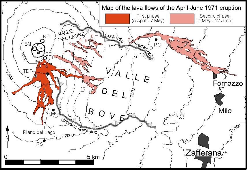
Map of the 1971 lava flows
|
Eruptive fissures of the first phase of the eruption are labeled a, b, c, and d; fissures of the second eruption phase are numbered 1 through 7. NE=NE Crater; V=Voragine; BN=Bocca Nuova; SE=SE Crater (degassing pit of the second eruption phase); TDF=Torre del Filosofo; MO= Montagnola; RS=Rifugio Sapienza; RC (south of largest phase 2 flow)=Rifugio Citelli. Click on image to get large version. |
Before
the 1971 eruption |
 |
|
Stage
1: Activity from new vents on the SSE and SE base of the main summit
cone,
5 April to 7 May 1971
The following series of b/w photos was taken by Carmelo Sturiale (+1988), at that time volcanologist at the University of Catania. The photos were kindly provided by his son, Giovanni, now at the Dipartimento di Scienze Geologiche of the University of Catania. Many of these photos have never been published before.
 |
 |
||
|
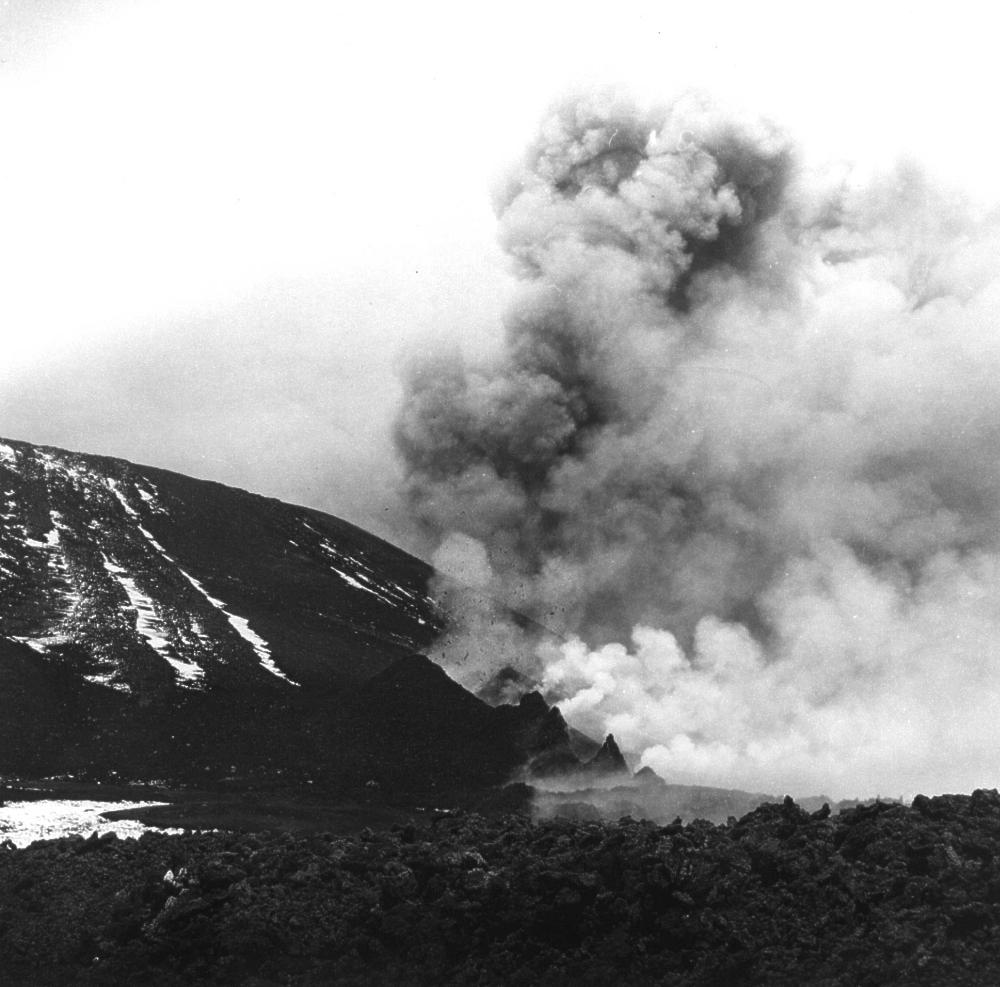
Left:
Eruptive activity at the "Eastern vents" at the southeastern
base of Etna's main summit cone (visible at left), in April 1971.
A number of small scoria cones and hornitos are building at the
eruptive vents. |
|||
 |
 |
 |
|
|
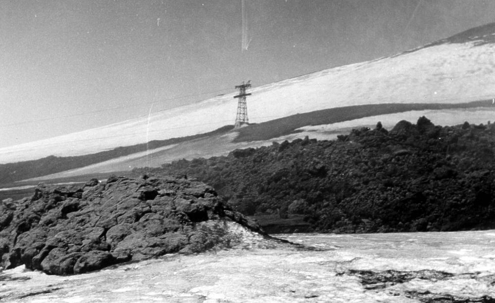
Left: One of the main cone clusters formed during the first stage of the 1971 eruption, named "Observatory vents". It was the lava from this cone cluster that buried the old Etna Observatory which lay a few hundred meters downslope. - Center: Another view of the "Observatory vents" in Strombolian activity. - Right: A lava tongue is moving down Etna's southern flank. In the center background one of the poles of the first Etna cable-car can be seen; many of these poles and the middle and upper stations of the cable-car were later destroyed by the lava of the same eruption. |
|||
 |
 |
 |
|
|
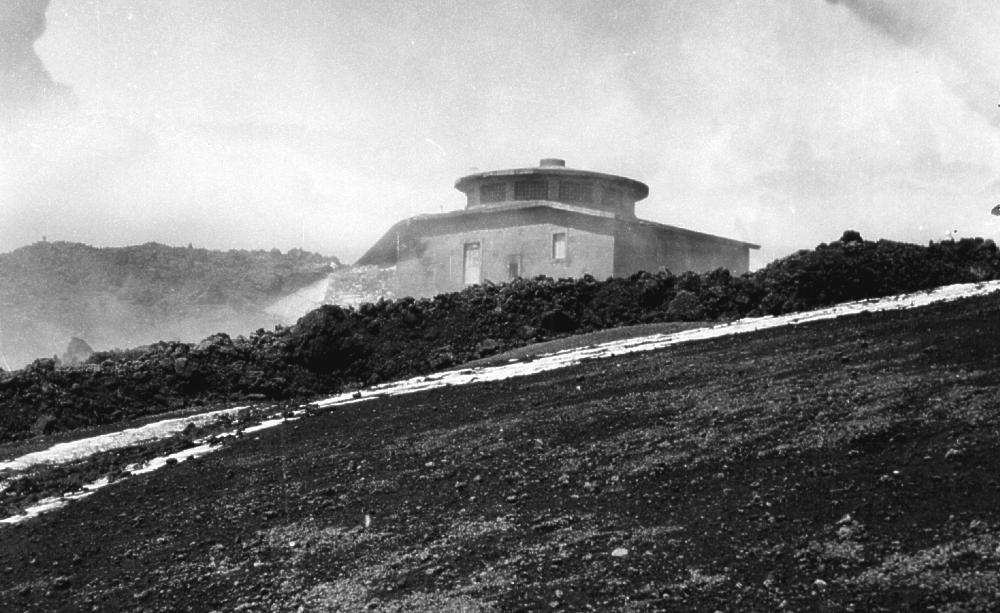
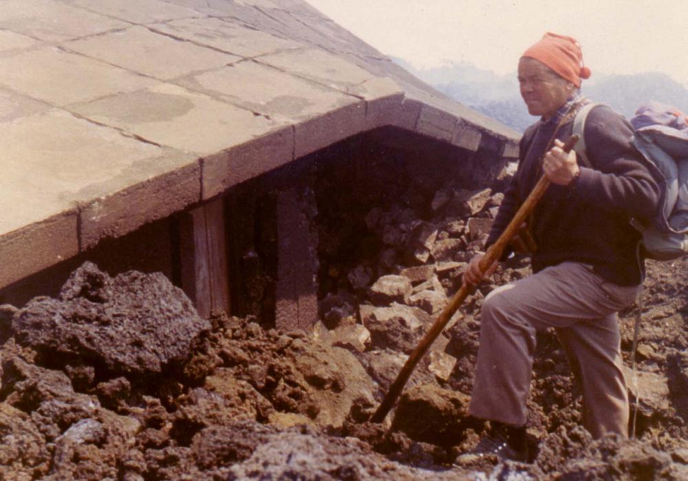
These photos show the slow death of the Etna Observatory. It can be seen that, although a part of the building was crushed under the lava, the massive central portion was simply buried by lava that gradually piled up higher and higher around the building. Unfortunately the negatives of these photos had some bad scratches which show as white lines in the photos. |
|||
 |
 |
||
|
Two more photos showing the burial of the Etna Observatory under the lava of the 1971 eruption. Person in the photo at right is Cucuzza-Silvestri, at that time Professor of Volcanology at Catania University. |
|||
The following photographs, taken by Carmelo Sturiale, were in part published in the report on the 1971 eruption by Romano et al. (1972) that appeared in the Atti dell'Accademia Gioenia di Scienze Naturali in Catania. The scans were made from the original prints of the photos.
| |
|
|
||
|
Left:
Ash billowing from the Voragine during the first phase of the 1971
eruption. View is from SE flank of the main summit cone |
||||
| |
|
|
||
|
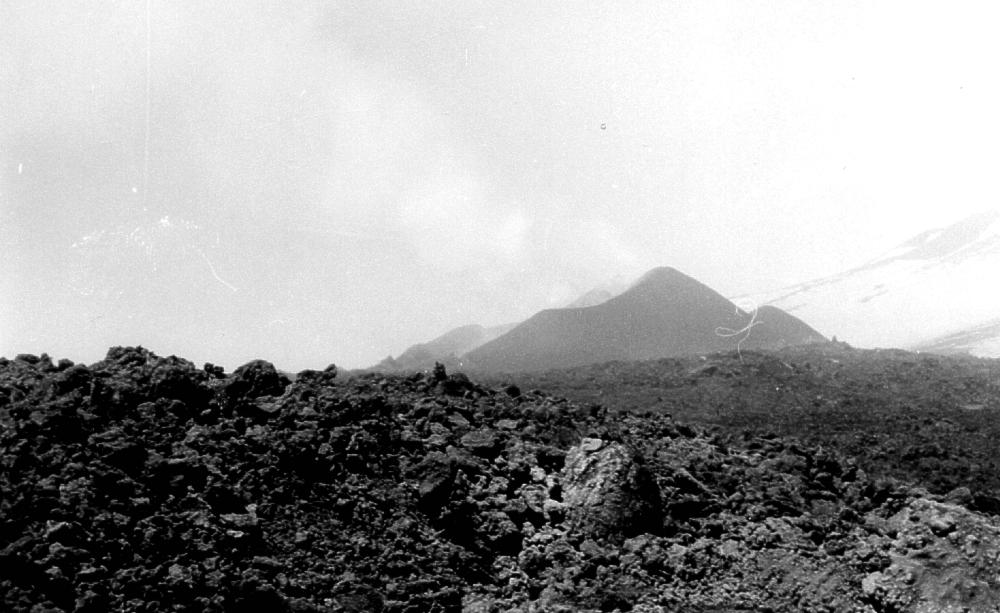
Left:
Eastern vents after the cessation of eruptive activity. Part of
the main summit cone is visible in the upper left part of the photograph;
the cone of the NE Crater is visible at the far right |
||||
| |
|
|
||
|
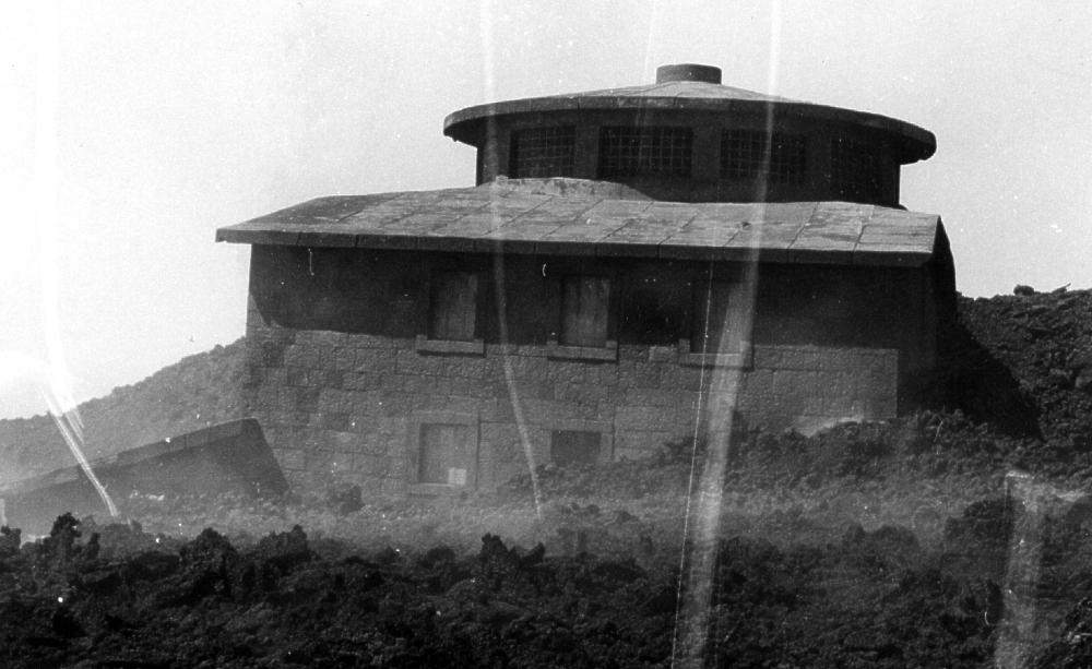
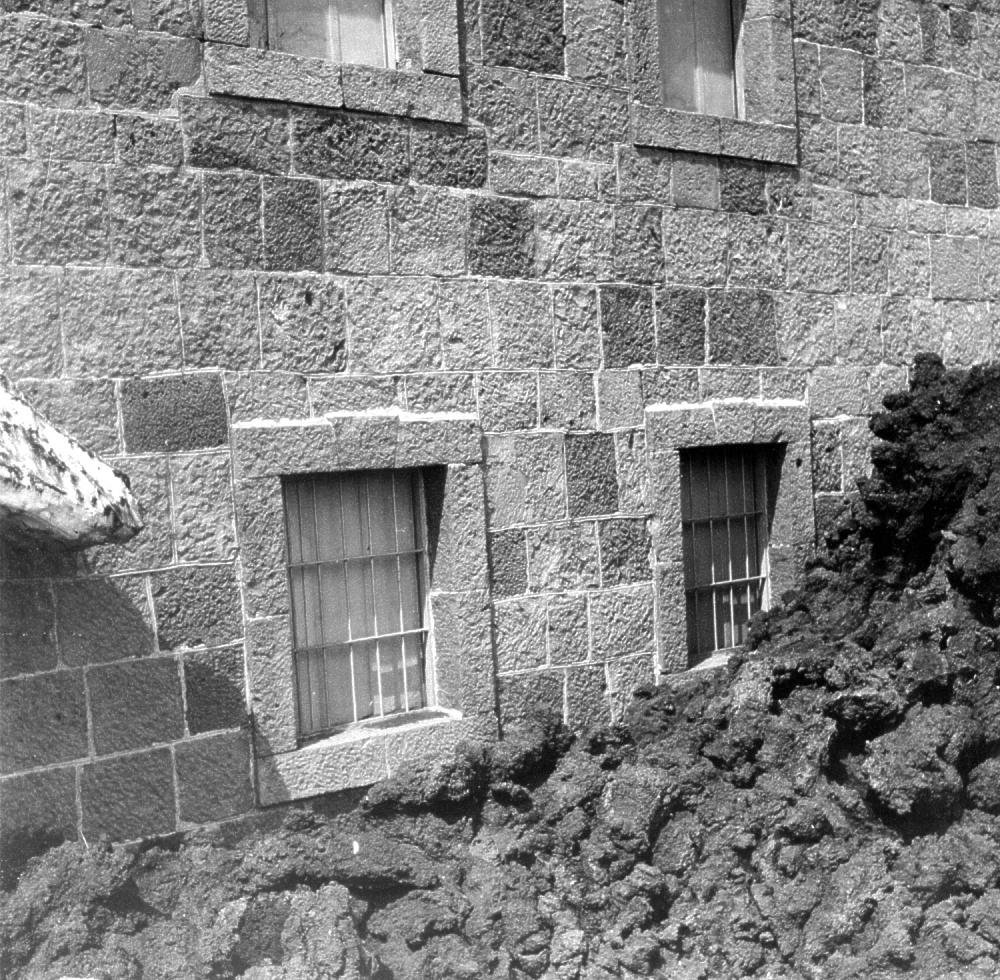
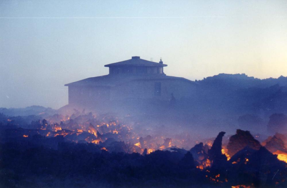
Left:
Only the cupola of the Observatory is protruding from the lava which
piles up around the building |
||||
The next three photos are from the photographic collection of Carmelo
Sturiale and show a later stage of the initial phase of the 1971 eruption.
 |
 |
 |
|
|
Left: The "Observatory vents" in mild activity, with part of Etna's main summit cone in the background. People at right give scale. - Center: Lava flows on the southeastern side of the main summit cone, and the "Eastern vents" are visible in the right background. - Right: Burial of the Observatory is almost complete, only the roof is still protruding from the relentless lava. |
|||
The four photos below were taken by Giuseppe Scarpinati, Italian member of the Paris-based Association Volcanologique Européenne (LAVE), who climbed Etna hundreds of times since the 1950's and documented most eruptions since the 1960's photographically.
 |
 |
 |
|
|
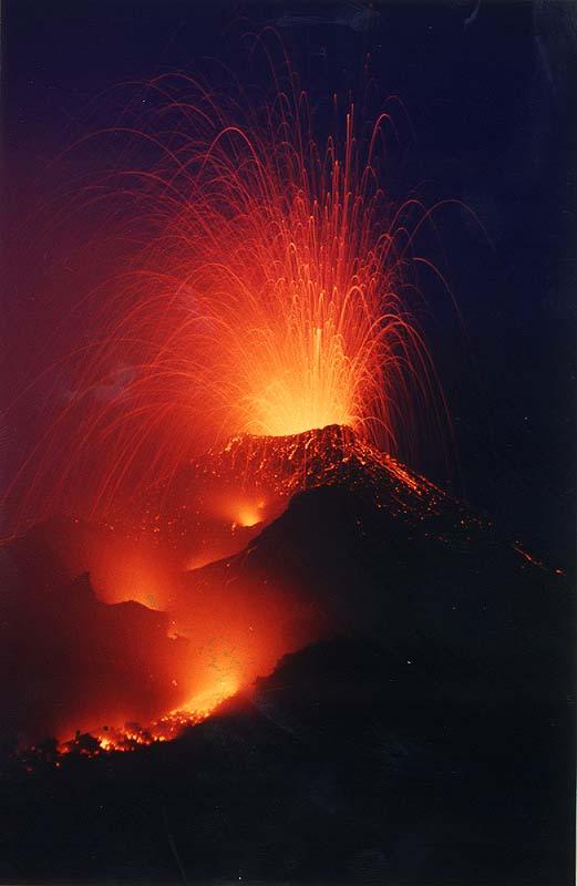
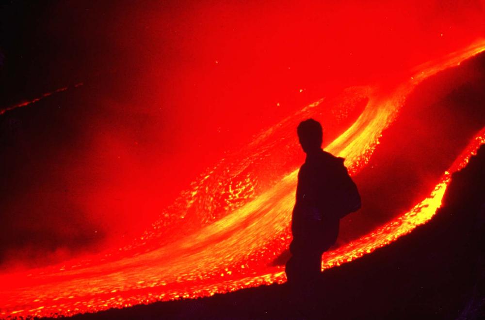
Left: A bright orange glow below the main summit cone lights the upper southern flank of Etna on the evening of 8 April 1971, three days after the beginning of the eruption. Lava flows down the slope close to the cable car and has already destroyed several of its poles. The hill to the right is part of the rim of the "Piano caldera", probably formed during a violent Plinian eruption in 122 BC. On its top stands the Torre del Filosofo mountain hut. - Center: Lava is gradually enveloping the old Etna observatory; the building is gradually building by overlapping lava flows. This photo was taken by Scarpinati on 15 April 1971. - Right: A suggestive shot taken by Scarpinati at the newly formed cones near the buried Observatory on 24 April 1971. The outline of the main summit cones appears through the Strombolian fountains. |
|||
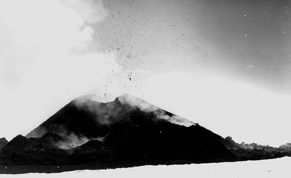
 |
A cluster of cinder and spatter cones ("Observatory vents") is growing during the first phase of the 1971 eruption near the southeastern base of the main summit cone. Photo was taken in mid-April 1971 by Giuseppe Scarpinati |
|
 |
 |
 |
|
Photos
taken by Carmelo Sturiale after the end of the 1971 eruption, showing
the lava flows emitted during the first phase of the eruption and
other effects of the activity in the summit area. |
||
Stage
2: Activity from fissures in the W part of the Valle del Bove
and at Contrada Serracozzo, near Rifugio Citelli (ENE flank)
|
The
two photos at right were taken by Carmelo Sturiale during the second
phase of the 1971 eruption. |
 |
 |
During the second stage of the 1971 eruption, eruptive fissures propagated downslope northeastwards across Valle del Bove and beyond, into the Contrada Serracozzo. In mid-May, while the flank eruption seriously threatened villages and cultivated land on the eastern flank, a new vent opened on the SE base of the main summit cone (visible at left in both photographs), apparently serving as a degassing valve to the flank eruption. The activity at this vent ejected only old fragmental material. Seven years later, in April 1998, magmatic activity occurred at the same site, initiating the vigorous life of what became the SE Crater (or SE Cone). These photos were taken by Carmelo Sturiale. |
|
 |
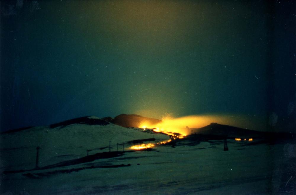
Two spectacular nocturnal views of the lava flows issuing from the eruptive fissure near the Rifugio Citelli, taken by Giuseppe Scarpinati |
 |
 |
 |
 |
|
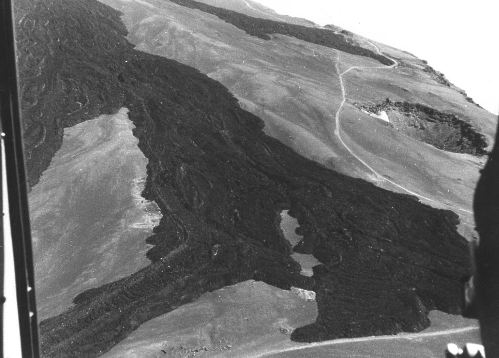
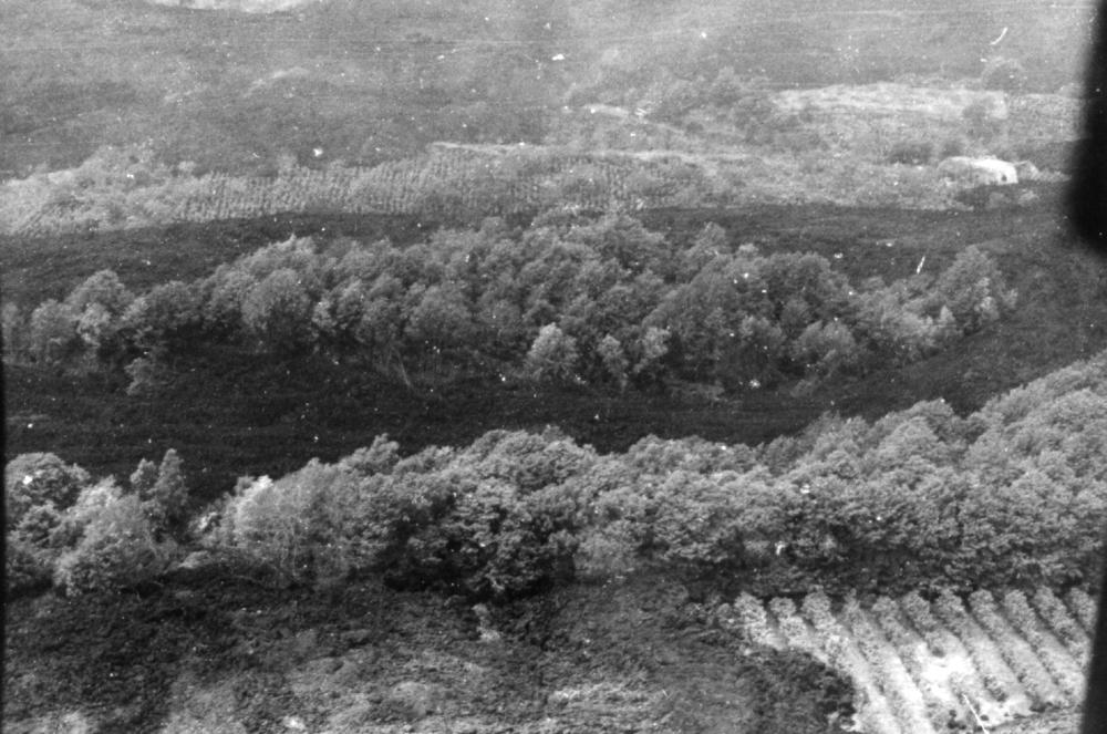
Aerial views (by Carmelo Sturiale) of lava flows extending from the Contrada Serracozzo/Citelli vents towards the populated and agricultural areas near Fornazzo and Sant'Alfio. The lava has eaten through dense forests (left and center). Right photo shows the northern margin of the village of Fornazzo at lower left, and the lava flows, which have narrowly missed the village, extending through the narrow stream-cut gorge of the Vallone Cava Grande. One arm of lava has cut the road leading from Fornazzo to Sant'Alfio (lying outside the photo at right) |
||
 |
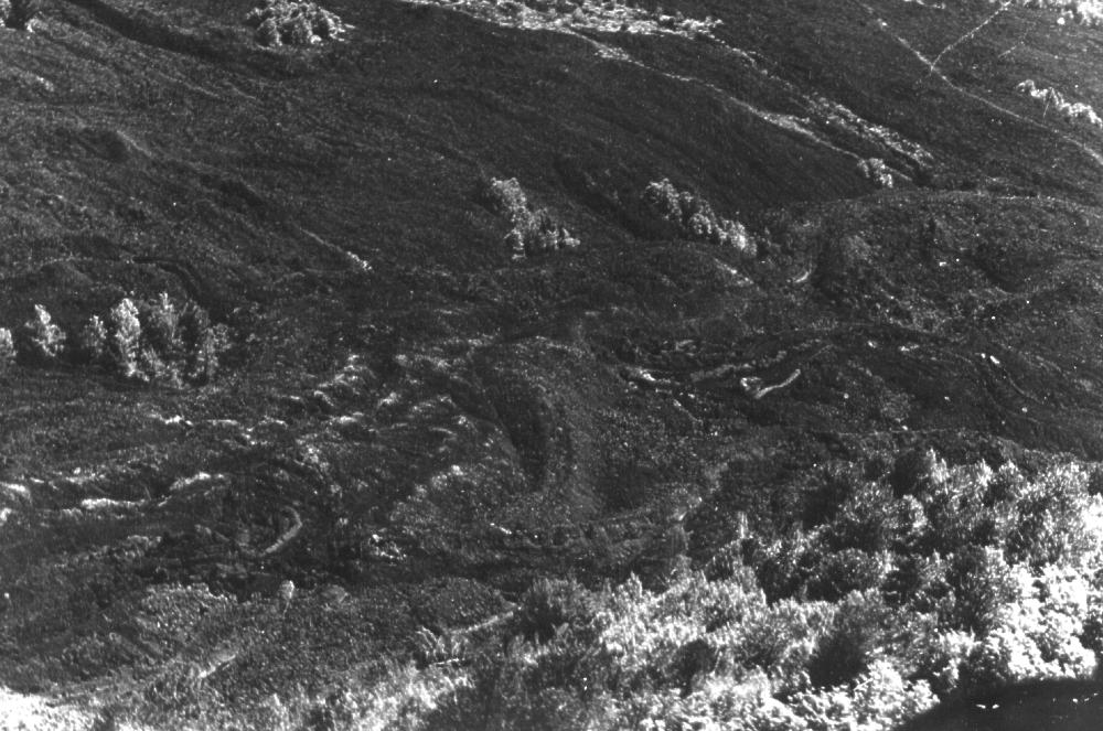
Aerial view of the ENE flank of Etna after the end of the eruption. N rim of Valle del Bove (Contrada Serracozze) is in the foreground, culminating at right in the Pizzi Deneri. W slope of Valle del Bove is in center-left part of the photo, with dark lava flows emplaced at the beginning of the second stage of the 1971 eruption, before activity migrated out of the Valle del Bove to near Rifugio Citelli (out of photo at right). Summit cone complex has the main summit cone at left, and the smaller NE Crater cone, with the "Nordestino" (a large hornito active in 1970) at right. Photo Sturiale |
|
|
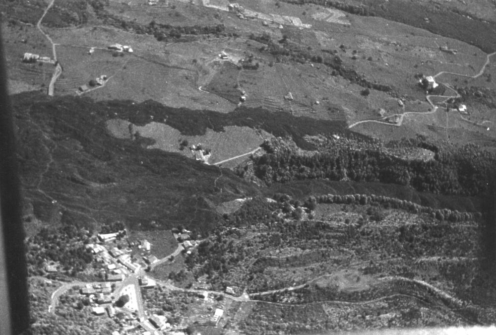
Aerial view taken by Sturiale after the end of the 1971 eruption, showing the eruptive fissures at the Contrada Serracozze which delivered the destructive lava flows of the second phase of the eruption. Lava effusion occurred from two fissure segments indicated as white bars. Behind the crest of the Contrada Serracozze, in the upper third of the photo, lies the Valle del Bove, on whose floor several dark lava flows erupted during the initial stage of the flank eruption are visible. View is towards SW |
 |
|
Continue
with
THE 1971-1973 SUMMIT
ACTIVITY
Copyright © Boris Behncke, "Italy's Volcanoes: The Cradle of Volcanology"