
| Etna
index |
||
| Geology | Geological history | Cones and craters |
| Eruptive characteristics | Eruptions before 1971 | Eruptions since 1971 |
| Etna and Man | References | Web sites |
| Weather forecasts | FAQ | Latest news |
|
|
The
first and larger of the two pyroclastic cones formed during the
January-March 1974 eruption on the west flank of Etna, Monte De
Fiore I, seen from north. Lavas produced by the same eruption are
in the foreground. Note irregular shape of the cone, and depression
formed above lava source on near side (above the single tree). Another
effusive vent forms a small knob on the south (right) base of the
cone. The lower flank of the second cone, Monte De Fiore II, is
seen at extreme right. Photo taken in mid-October 2002 |

The 1974 W flank eruption, its cones and lava flows
Following a series of earthquakes that were registered
by the seismic network created after the 1971 eruption, a new vent became
active on the afternoon of 30 January 1974 at about 1670 m elevation on
the west flank of Mount Etna. This vent immediately became the site of
strong explosive activity, and a cone began to grow rapidly. Lava was
extruded from vents shifting frequently in shape and location, mostly
at the base and on the flanks of the growing cone. This lava was seen
to be unusually viscous for Etnean lavas, although at the same time it
was rather mafic and virtually devoid of phenocrystals, which is unique
in the recent history of the volcano. These peculiarities were due to
the fact that this was an eccentric eruption - that is, a flank eruption
not fed from the central conduits, as most other flank eruptions). Such
eruptions are generally more explosive since the magma feeding them does
not lose any of its gas content before erupting. The 1974 eruption was
the only eccentric eruption during the 20th century.
The first eruptive phase of the 1974 eruption lasted from 30 January until
16 February, and the cone built up during this phase stood about 70 m
above the former surface. Lavas had extended from as many as six effusive
vents mostly south, southwest, north, and northwest, reaching a maximum
length of 1.5 km from their sources. One peculiar flow extended over a
short distance to the north; this flow is unusually thick (up to 10 m)
and shows marked ogive structures on its surface. But lava did not only
issue from these vents on the flank and base of the cone, it also oozed
through the base of the cone, forming a steep-sided "collar"
around the eastern base of the cone, which is up to 10 m high.
After 22 days of calm, a second crater became active about 200 m to the
west of the earlier cone, at about 1650 m elevation. This crater also
showed strong explosive activity, and lava flowed through an open breach
in the western side of the growing cone, forming a field of overlapping
lobes little more than 1 km long. The activity at this cone, which was
named Monte De Fiore II, lasted until 29 March.
The volume of lava produced by this eruption was unusually small, amounting
to 4.5 million m3
(2.4 million
m3 of the first and 2.1 million
m3 of the second phase). However, the amount
of pyroclastics was relatively great in comparison, amounting to more
than 3 million
m3 (two-thirds of these were erupted
during the first phase), testifying to the high degree of explosivity.
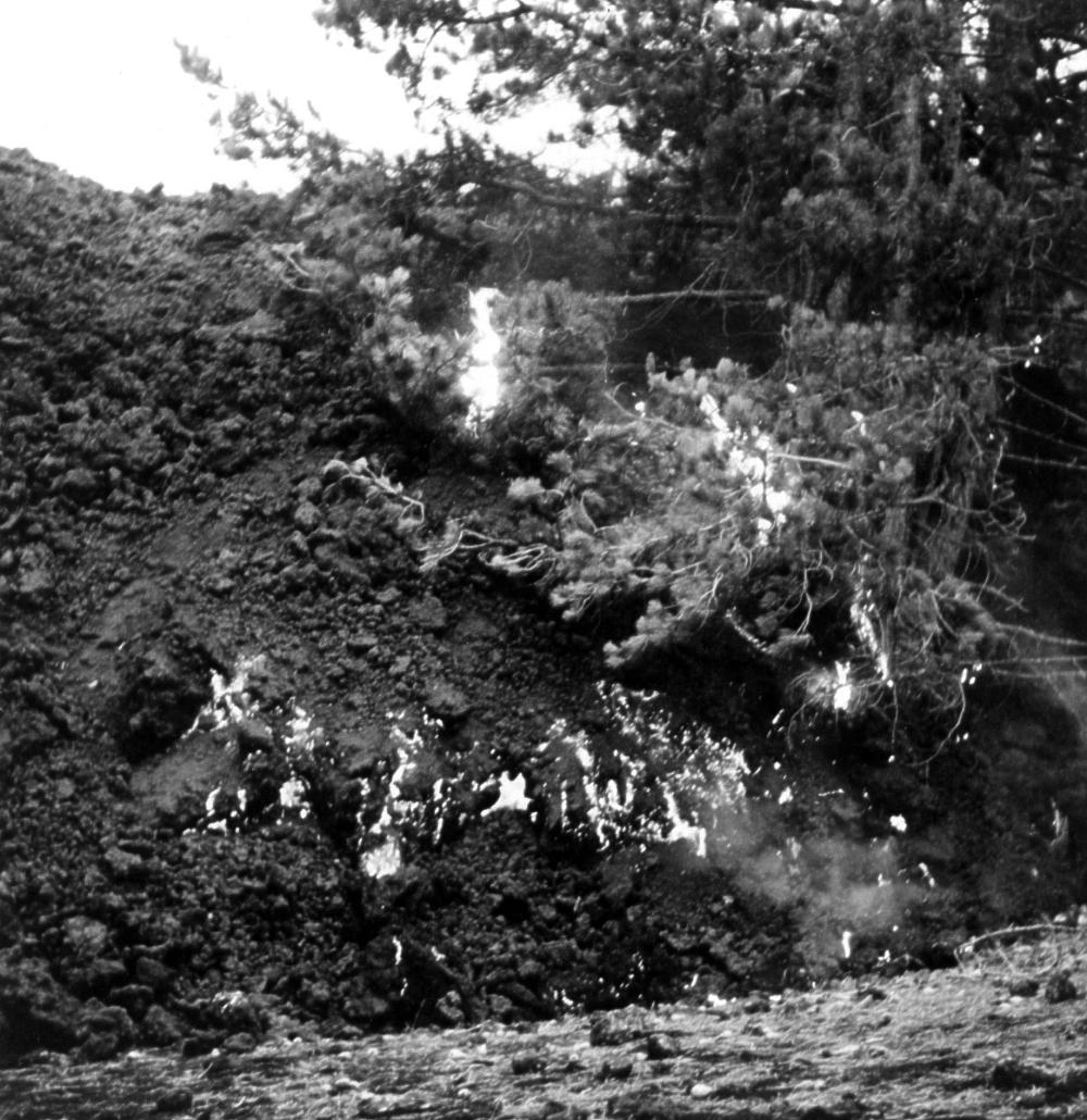
Today, the two cones of the Monti De Fiore remain largely barren, and
only lichens have grown on their lavas. The remains of pine trees burned
by the eruption thirty years ago are slowly rotting. The colorful landscape
of the Monti De Fiore are one of the most popular attraction to local
hikers, although to most people it is virtually unknown, and very few
of the thousands of daily visitors to Etna get to know it. It is not easy
to find the few, and insufficiently marked trails leading to the place.
The best way to reach the Monti De Fiore is by car from Adrano to Monte
Intraleo, and then on foot on the Forest Guard roads to Monti Nespole,
Monte Leporello, and Monte Grosso, where a small, and largely overgrown
path leads down to the Monti De Fiore. The return can be made starting
southward from Monte De Fiore II (there is no footpath) in the direction
of the Monti Nespole, but this includes about 150 m across lava from the
1974 eruption, which is not pleasant to walk on.
Maps of the 1974 lava flows
|
|
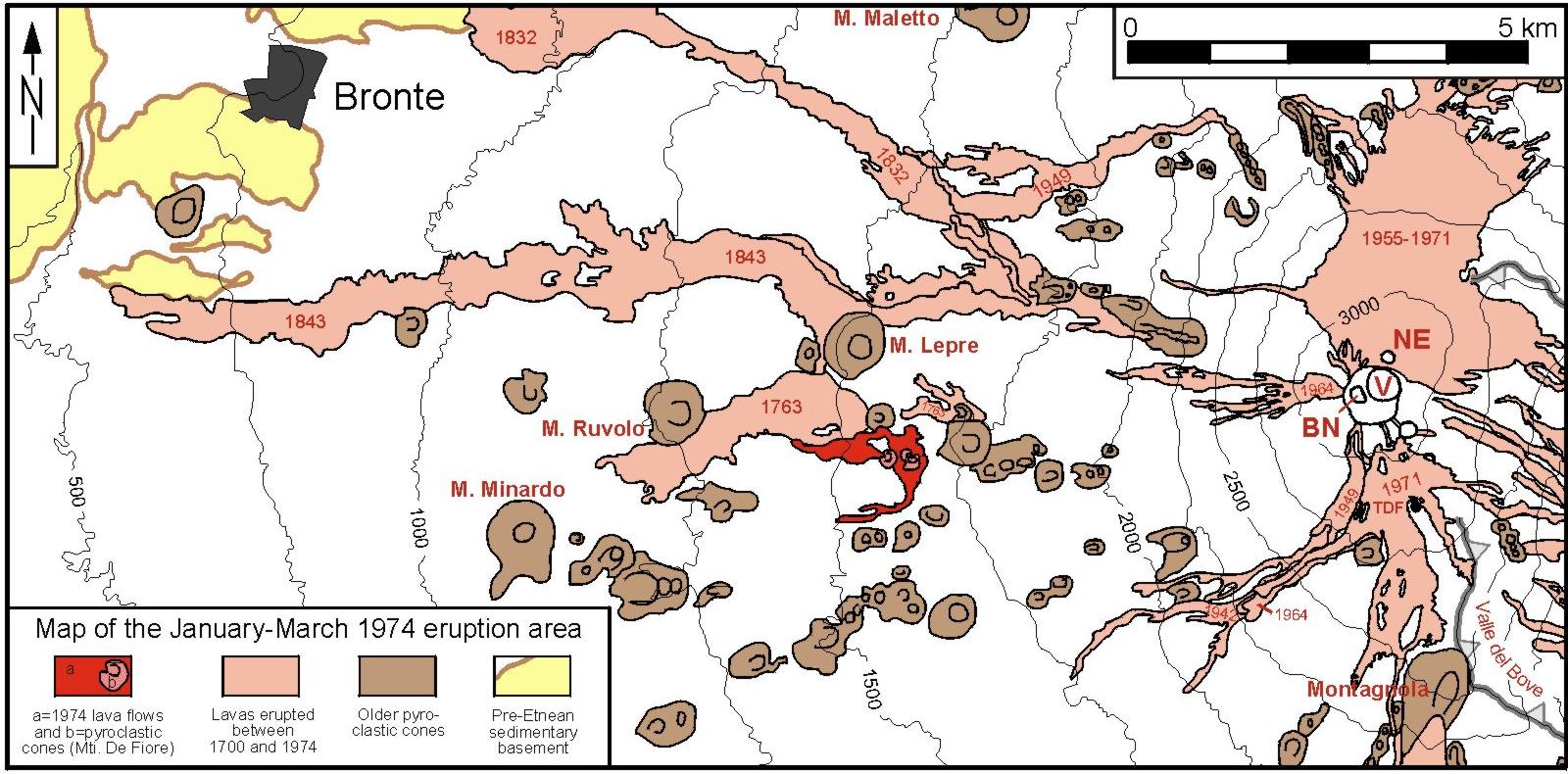
Overview
map of the location of the 1974 eruption area and the 1974 lava
flows (shown in red color). Summit craters are in right central
part of the map (NE = Northeast Crater; V = Voragine; BN = Bocca
Nuova. The Southeast Crater was only a small collapse pit at the
time of this eruption), and lava flows of the previous eruptions
(after 1700) are shown in pink color, the dates of the most important
of these flows are also displayed. Some of the names of older pyroclastic
cones are shown as well. TDF = Torre del Filosofo |
|
|
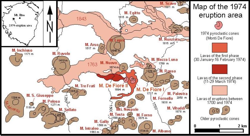
More
detail is visible in this map. The flows of the first and second
phases of the eruption are distinguished, and older pyroclastic
cones on the western flank of Etna are labeled |
Photos of the 1974 eruption
 |
 |
 |
||
|
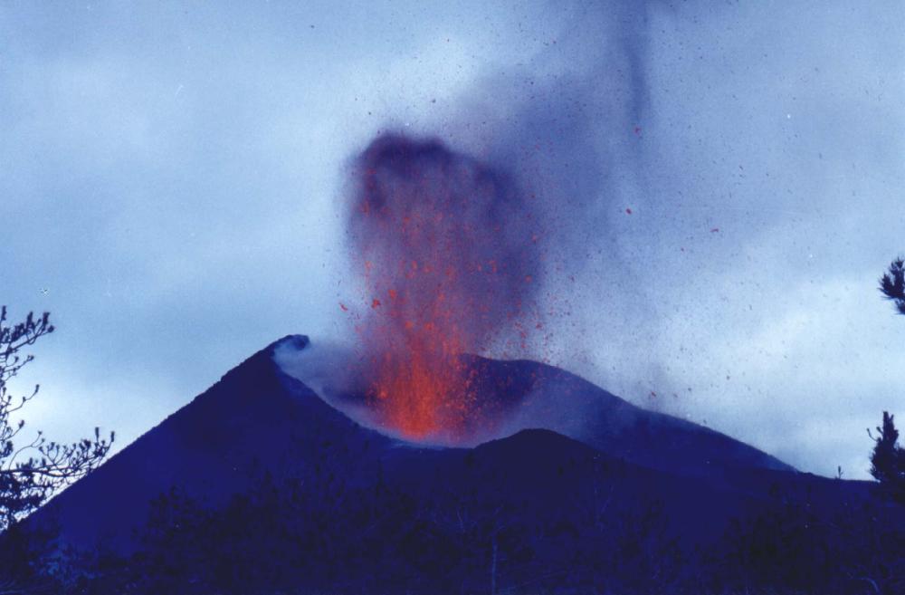
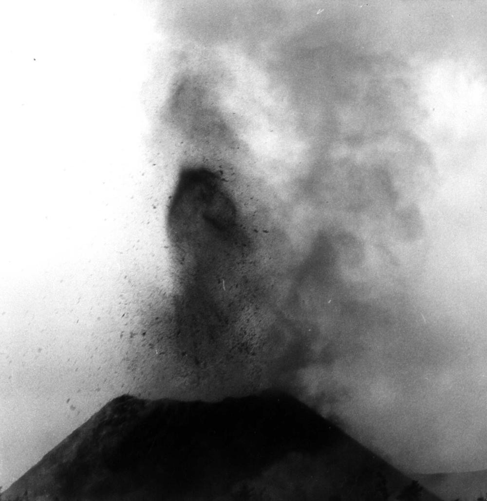
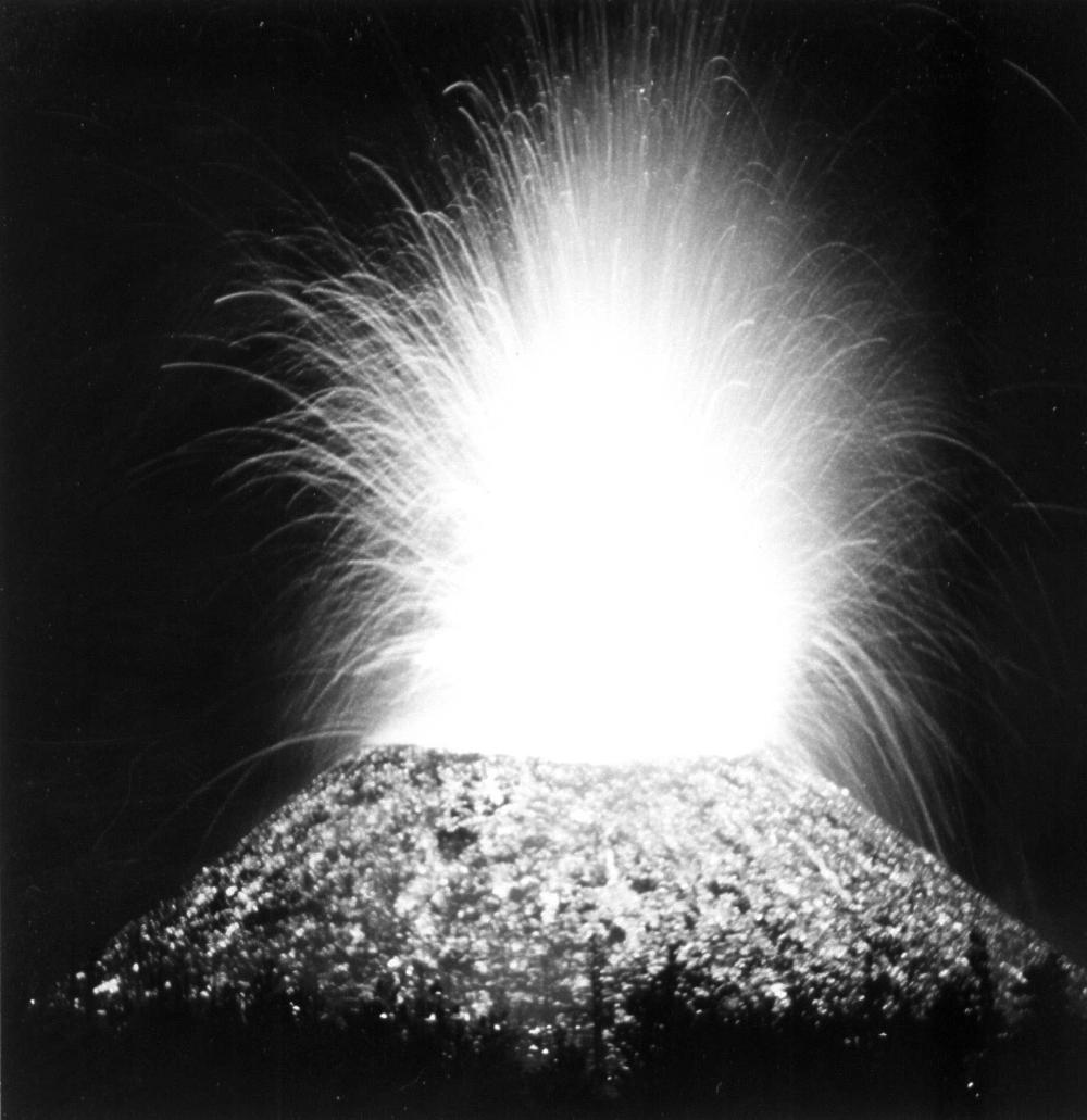
Left
and center: Vigorous explosive activity at the actively building
Monte De Fiore I during the first days of the 1974 eruption. These
photos were taken by Giuseppe Scarpinati on 2 February 1974, three
days after the beginning of the eruption |
||||
 |
 |
 |
 |
|
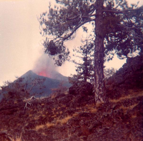
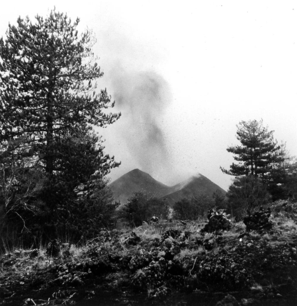
Photos of the first phase of the 1974 eruption, taken by Renato Bernardini - now a researcher at the Medical Department of Catania University who at that time was a boy with an amateur camera. These images distinctly show the new cone (Monte De Fiore I, the first of two cones to grow during the eruption) built by Strombolian activity amidst a forest on the western flank of Etna. |
|||
 |
 |
 |
 |
 |
 |
 |
|
|
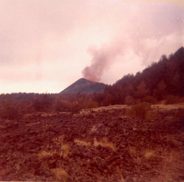
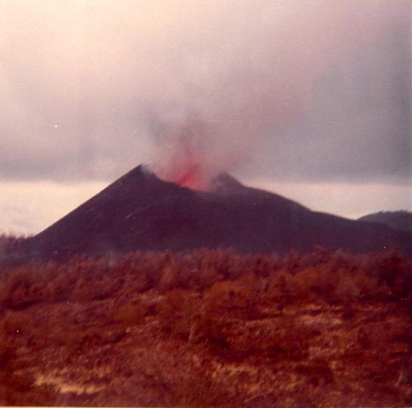
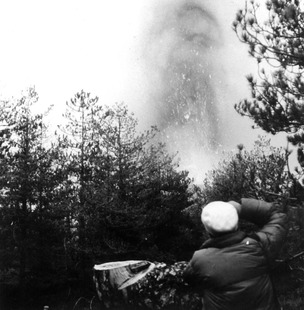
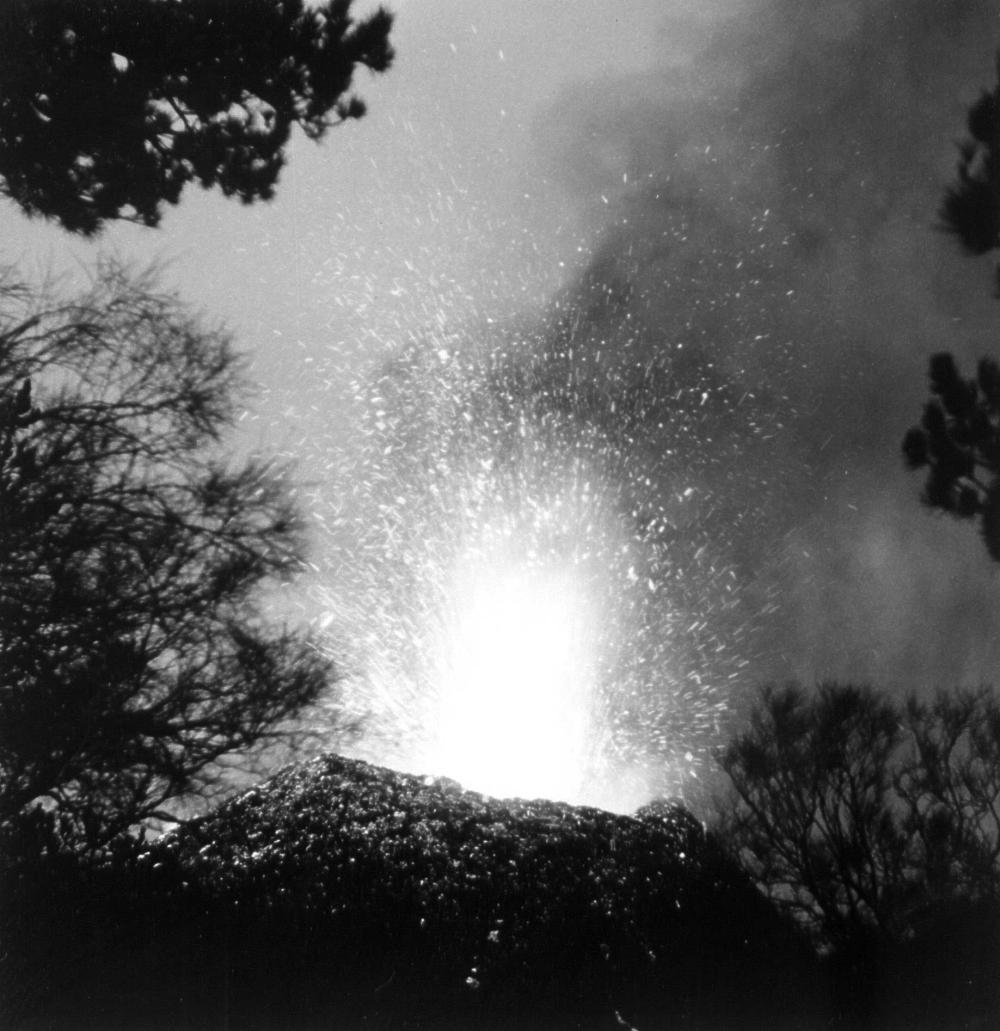
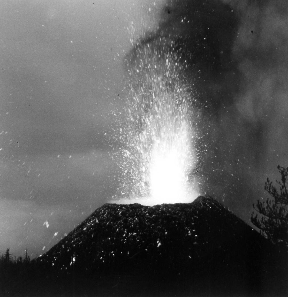
Early
stage of the first phase of the eruption (early February 1974).
These photos were taken by Carmelo Sturiale, volcanologist at the
University of Catania (+1988), and they clearly show the strong
explosivity of the eruption. Note the breach in the eastern crater
rim of Monte De Fiore I visible in the second photo. |
|||
 |
|||
|
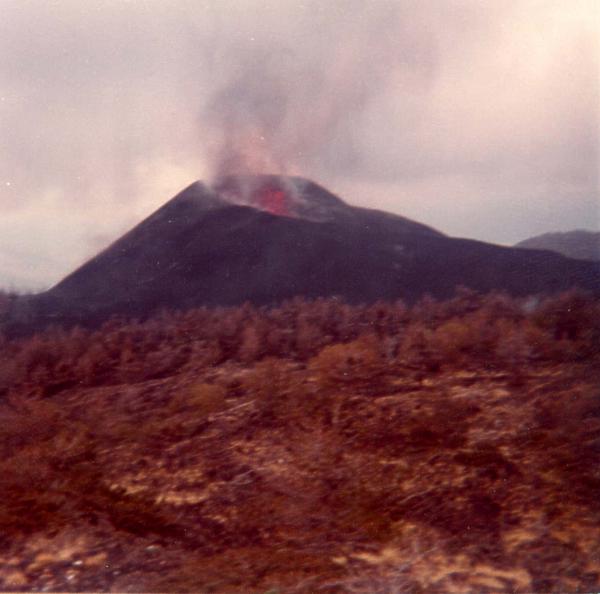
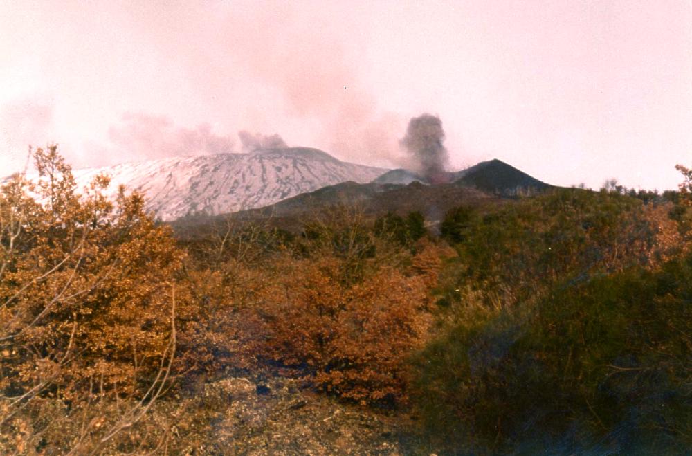
A rare photograph of the second phase of the 1974 eruption (this took place between 11 and 29 March 1974), taken by Carmelo Sturiale looking eastwards. The cone built during this phase (Monte De Fiore II) is seen in mild explosive eruption, and the snow-covered bulk of Etna's cone is visible in the background, with the fuming main summit cone sitting on top of it. The reddish hue of the photo is due to to the ageing of the print. |
|||
 |
|||
|
Another photograph of Monte De Fiore II in activity, taken in March 1974 by Carmelo Sturiale. This view is from the south-southwest, showing Monte De Fiore I (which grew during the first phase of the 1974 eruption) to the right of the active cone, and Etna's snow-covered main cone in the right background. |
THE MONTI DE FIORE TODAY (photo gallery)
Continue
with
THE 1974-1978 NE
CRATER ERUPTIONS
Copyright © Boris Behncke, "Italy's Volcanoes: The Cradle of Volcanology"