
| Etna
index |
||
| Geology | Geological history | Cones and craters |
| Eruptive characteristics | Eruptions before 1971 | Eruptions since 1971 |
| Etna and Man | References | Web sites |
| Weather forecasts | FAQ | Latest news |
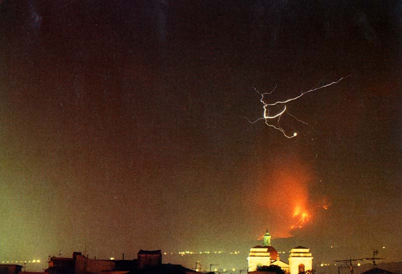
"Scassau 'a muntagna",
the mountain has broken to pieces - the old phrase yelled by the population
of the villages on the slopes of Etna when flank eruptions broke out,
is vividly depicted by this photograph taken on 3 or 4 August 1979.
It shows lava fountains rising from new eruptive fissures in the Valle
del Bove, and lava flows rapidly advancing towards inhabited areas (in
the foreground). Lightning is seen in the main eruption column rising
from the SE Crater, a rare phenomenon during Etnean eruptions.
This photo was originally published in the Italian
magazine "Airone" of May 1984; it is posted here for its expressive
power and the rarity of the phenomenon shown
The 1979 SE Crater and Valle del Bove flank eruption
Map of the 1979 lava flows
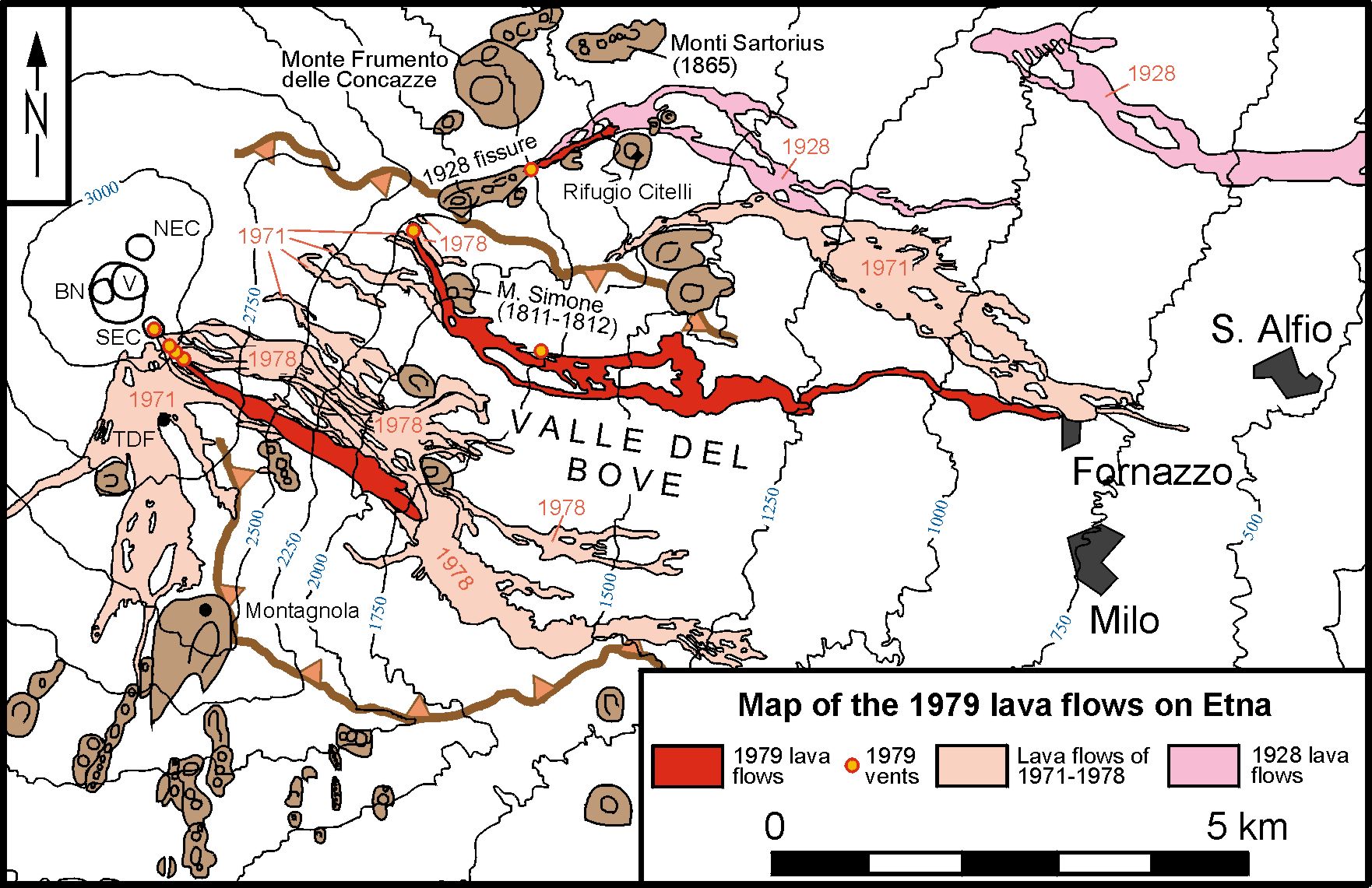
Map
of the eastern flank of Etna, showing the lava flows produced by the
early August 1979 eruption at the SE Crater, in the Valle del Bove,
and near the Rifugio Citelli. Vents active during the eruption are indicated
by yellow dots with orange colored rims. Lavas produced by eruptions
between 1971 and 1978 are shown as well as the lavas of the 1928 flank
eruption, whose uppermost fissure reactivated at a late stage of the
August 1979 eruption
|
Photos
of the 1979 eruption
Photographer: Giuseppe Scarpinati, Acireale |
||
|
|
 |
|
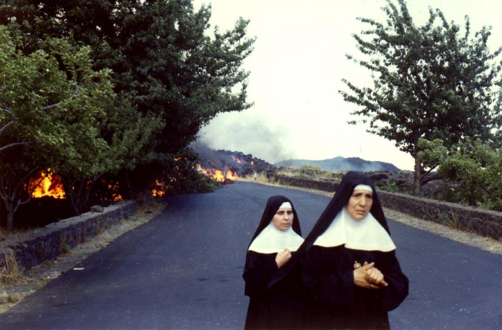
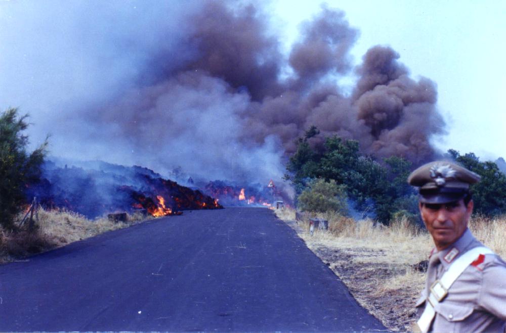
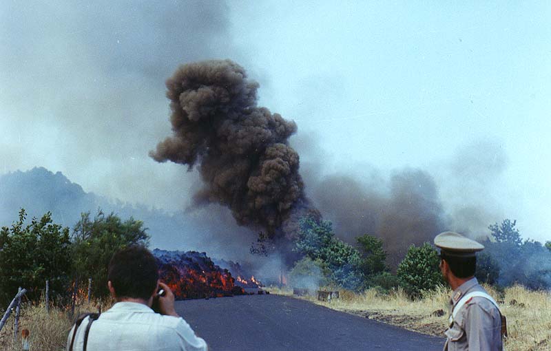
Lava flowing from vents in the northern part of the Valle del Bove has interrupted the "Mareneve" road near the village of Fornazzo on 4 August 1979 and continues its relentless advance through fertile areas. The tension of these dramatic hours is written in the faces of the persons visible in these photos - but maybe the prayer expressed in the left image did help a bit: the lava flow did not destroy the village of Fornazzo. Photo at right shows black smoke rising from fires caused by the lava flow which, after cutting the "Mareneve" road, is invading areas of cultivated land near Fornazzo |
||
|
|
 |
|
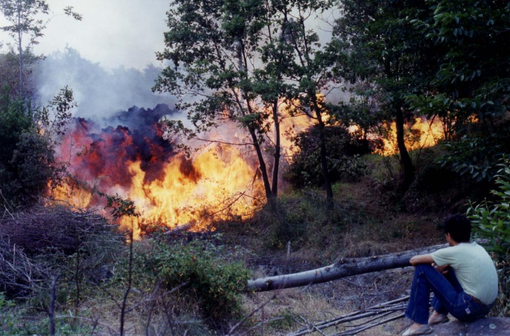
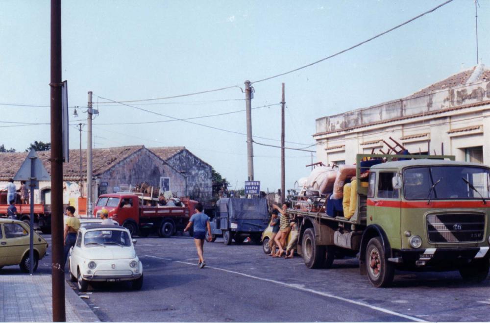
As the lava rapidly eats through forests and fruit gardens (left), the threatened village of Fornazzo is evacuated (center). Fortunately, the lava stops only 50 m from the northern margin of the village. However, isolated buildings near Fornazzo are consumed by the lava flow (right). Photos were taken on 4 August 1979 |
||
|
|
 |
|
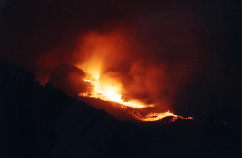
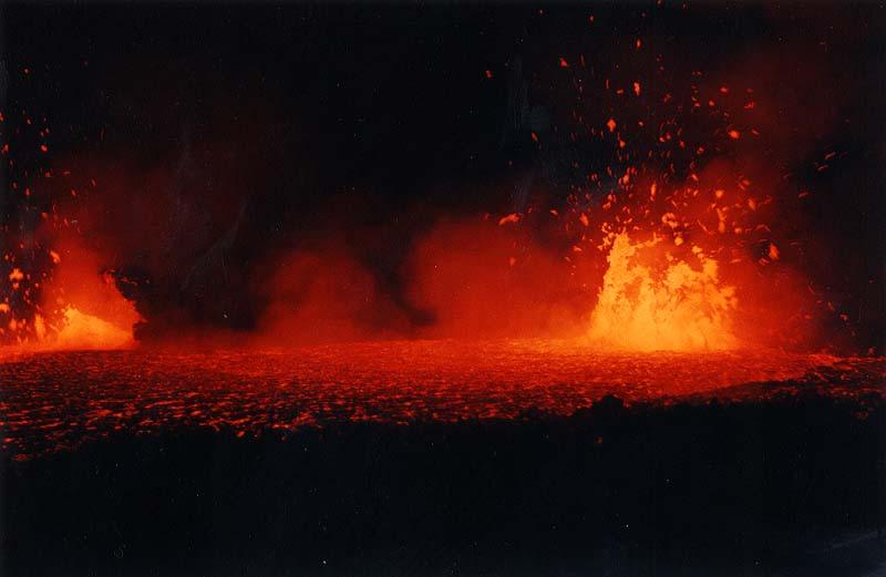
Left: Night view of the eruptive fissure in the northern part of the Valle del Bove, taken from the Pizzi Deneri area on the early morning of 5 August 1979. These vents are feeding the lava flow which is threatening the village of Fornazzo. Right: After descending into the Valle del Bove, Scarpinati waits for daybreak near the eruptive vents in the Valle del Bove on 5 August 1979 (center and right). Small fountains of very fluid lava are playing from several vents, and lava continues to flow eastwards, towards Fornazzo |
||
|
The following
photos were taken by Carmelo Sturiale
|
||

|

|
 |
|
Three views of the Southeast Crater in eruption on 4 August 1979, when the activity had diminished to forceful ash emissions. The day before, the same crater had produced spectacular lava fountains and a major pyroclastic column. The photo at left was taken while ascending towards the Torre del Filosofo area (the building of the same name is visible to the left of the base of the ash plume), while the two other photos show the summit cone complex from SE, near the Valle del Bove rim. Cone at far right is the NE Crater, which has remained quiet since March 1978 |
||

|
||
|
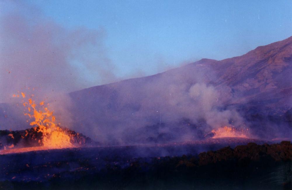
A panoramic, though hazy, view of the northern part of the Valle del Bove from its SW rim, probably on 4 August 1979. A steaming eruptive fissure lies on the Valle del Bove floor (the same as that shown in some of Scarpinati's photos above), between the cinder cone of Monte Simone (at left) and the conspicuous rock named "Rocca Musarra" at the extreme right. This fissure is the source of the lava flow menacing Fornazzo and its surroundings |

|

|
 |
|
Photos of the main lava flow near Fornazzo on 4 August 1979. Left photo shows lava advancing through fruit gardens, while the center photo is a view from N of the lava flow interrupting the "Mareneve" road that connects Fornazzo with the Rifugio Citelli and Piano Provenzana, on the NE and N flanks of Etna. Right photo shows lava burning vegetation near Fornazzo |
||
|
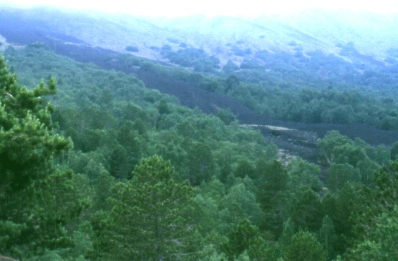
During a late stage of the August 1979 eruption, lava begins to flow from a fissure close to the Rifugio Citelli. The flow is only short-lived and destroys a small section of forest. This photo was taken by Boris Behncke 20 years after the eruption, in 1999 |
|
Copyright © Boris Behncke, "Italy's Volcanoes: The Cradle of Volcanology"