
| Etna
index |
||
| Geology | Geological history | Cones and craters |
| Eruptive characteristics | Eruptions before 1971 | Eruptions since 1971 |
| Etna and Man | References | Web sites |
| Weather forecasts | FAQ | Latest news |
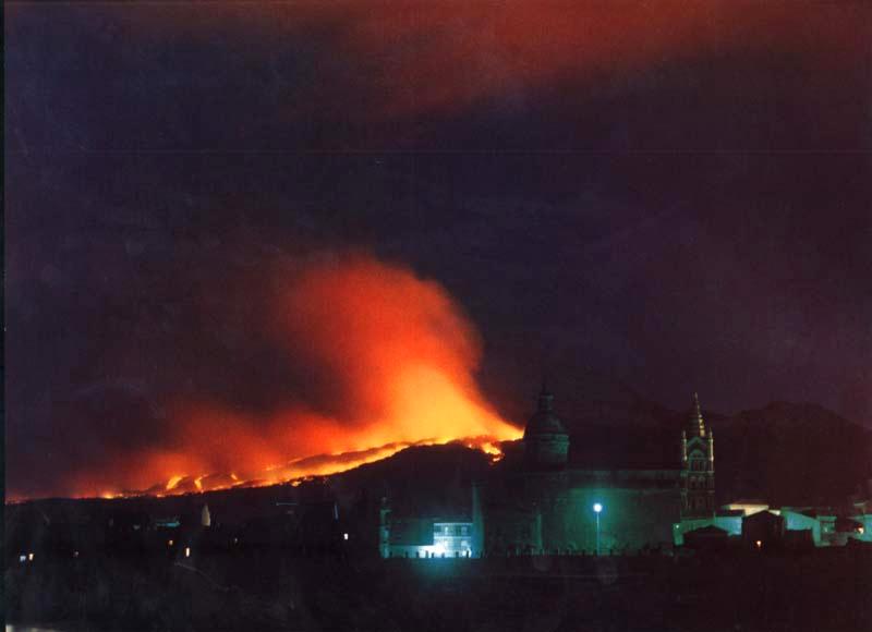
Fire near Randazzo, much too
close and extremely fast: as this photo was taken on the second night
of the March 1981 eruption, the main lava flow had barely missed the town,
but a smaller flow headed directly for the town - it was luck that it
soon lost vigor and its front stagnated only 2.5 km from the outskirts
of Randazzo. Photo was scanned from a postcard.
The 1981 NNW flank eruption
One of Etna's most dramatic and destructive eruptions of the 20th century occurred between 17 and 23 March 1981 on the north-northwestern flank of the volcano. The beautiful town of Randazzo with its medieval center narrowly excaped destruction. The eruption was particular for the length of the eruptive fracture system, its high effusion rates and for the sector of the volcano affected - no eruptive vents had opened there for many centuries and maybe up to 1000 years. Eruptions like that of 1981 are of great relevance for hazard evaluations at Etna since they leave practically no time for any kind of preventive measures and render efforts to modify the advance of the lava flows near to impossible.
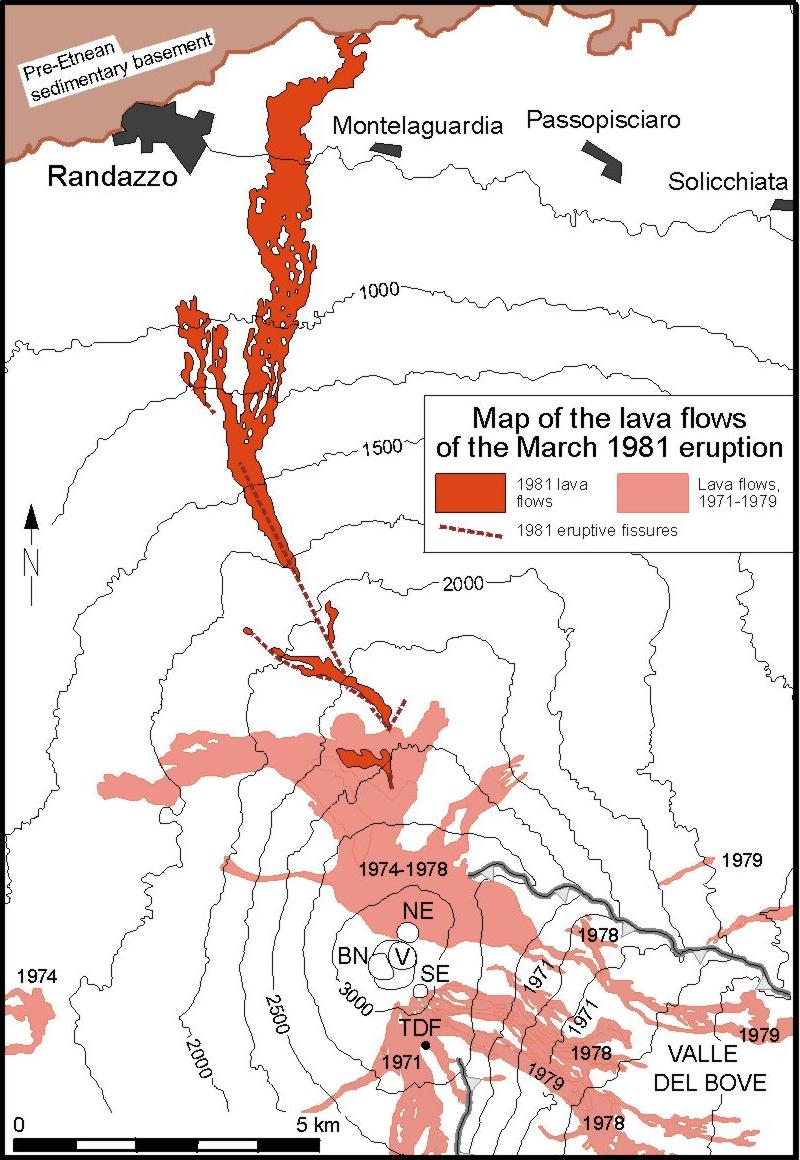
MAP OF THE 1981 LAVA FLOWS
The 1981 lava is shown in
red color. Some lava flows erupted after 1971, and before the 1981 eruption,
are shown in pink color, dates are indicated. NE=NE Crater; V=Voragine;
BN=Bocca Nuova; SE=SE Crater; TDF=Torre del Filosofo. Click on image to
get large version.
During the six months preceding the eruption, four episodes of paroxysmal activity had occurred at Northeast Crater (on 1, 6 and 26 September 1980, and again on 5-7 February 1981). These were essentially similar to the series of eruptive paroxysms between July 1977 and March 1978 at the same crater. All four episoded produced minor lava flows (up to 4 km long on 1 September 1980, 2 km long on 5-7 February 1981), and lava fountains several hundred meters high.
Premonitory seismicity began on 14 March, with epicenters in the higher part of Valle del Bove (Kieffer 1982), soon culminating in a swarm of about 500 earthquakes whose epicenters migrated towards the northern flank. Based on this seismic activity, an eruption was forecast by local volcanologists on the northern flank. In fact, at the beginning of the anticipated eruption, volcanologists from the Istituto Internazionale di Vulcanologia were in a helicopter right over the area where the first fissures split open.
| The eruption | |
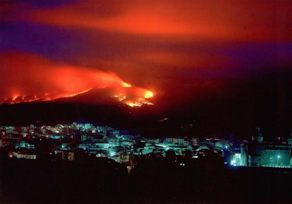 |
Dramatic view of the town of Randazzo and eruptive fissures emitting lava flows that move towards the town, on 18 March 1981. This was one of the most vigorous eruptions of Etna in recent decades, but fortunately the activity weakened significantly after only two days, and the lava flows stopped before reaching Randazzo. The main flows produced by this eruption passed a few hundred m east of the town, destroying farmland, fruit gardens, and dozens of isolated buildings. The photo is available on postcard in the Etna region. |
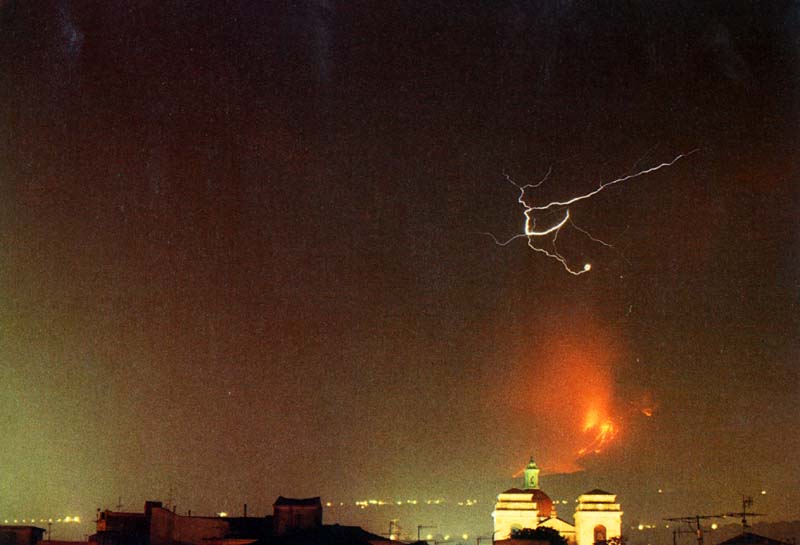
|
Mild eruptive activity at the lowermost cone of the 1981 eruption, only a few kilometers south of Randazzo, photographed by Giuseppe Scarpinati on 21 March 1981. Activity had diminished significantly after the first two days of the eruption, but continued weakly at the lowermost fissure segment for another five days. Only minor lava flows were emitted during this late stage, causing no further damage. |
The eruption was very similar to the intial stages of a typical Hawaiian eruption. As a dike propagated radially away from the summit area, eruptive fissures opened progressively at lower and lower elevations. The first vents opened at about 2550 m elevation at 1337 h local time, and lava fountains rose 100-200 m high while lava moved northwestwards. Three more fissure segments opened between 2350 and 2000 m elevation in the course of 4 hours, one of these segments being orientated west-northwestward (N60W), with an isolated vent lying more than 1 km away from the main axis of the eruptive fissure system (N25W). By 1855 h, the front of the opening fracture system arrived at 1800 m elevation where another large fissure began to open, emitting a voluminous lava flow that rapidly moved downslope. This was to become the main flow of the eruption. During the first twelve hours of its movement, it advanced about six km, seriously threatening the village of Montelaguardia (250 inhabitants) which lies about 3 km east of Randazzo.
During 18 March, this flow passsed right midway between Randazzo and Montelaguardia and entered into the bed of the Alcantara river. On its course, it interrupted several major roads, the Circumetnea railway and the Italian State railway (FS) as well as power lines, causing a temporary blackout in Randazzo that left its inhabitants in anxiety. When arriving at the Alcantara river, the flow had already slowed considerably, and there was only little movement until the flow eventually stopped on 20 March.
The eruptive fissures still propagated further downslope on early 18 March, reaching an elevation of 1300 m and emitting minor lava flows that slowly advanced in the direction of Randazzo. On the late afternoon of that day, still more vents opened down between 1200 and 1150 m elevation, and sluggish lava flows spread downslope towards Randazzo. By this time, however, the eruption had significantly diminished in vigor, and no evacuation of Randazzo was ordered, although many residents readily prepared for evacuation. In fact, mild explosive activity continued at the lowermost vents until 23 March, and the lava fronts above Randazzo kept advancing very slowly until that day, stopping 2 km from the southern margin of the town.
| The 1981 fissure revisited, 22 February 1998 | ||
 |
Photo
1 (left).
View of the main 1981 lava flow from the western flank of Monte Spagnolo,
a prehistoric cone standing some 5 km south of Randazzo, 22 February
1998. The dark streak visible in the middle ground is the lava flow
that advanced some 8 km downslope as far as the valley of the Alcantara
river. View is to the southeast Photo 2 (right). Central part of the 1981 eruptive fissure, showing spatter ramparts and closely spaced eruptive vents. The view is upslope (to the southeast), and the dimensions of the main eruptive fissure are evident. |
 |
 |
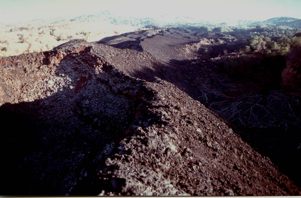
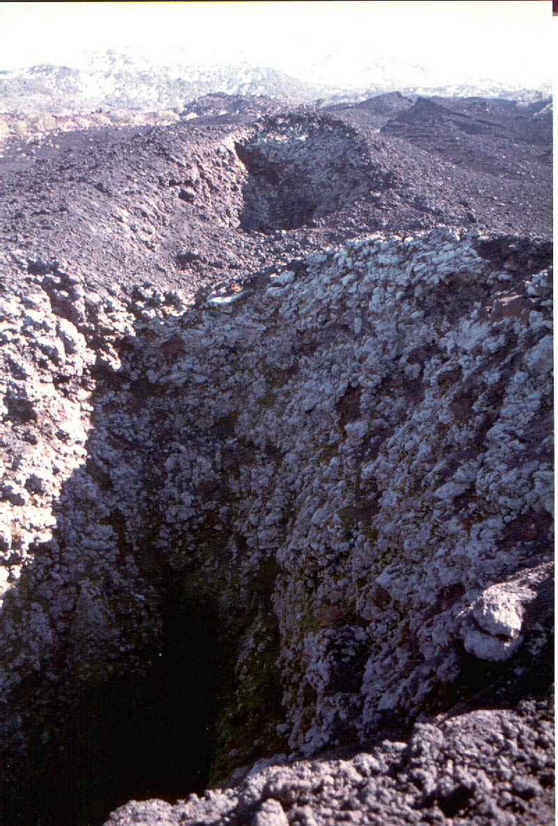
Photo
3 (left).
The largest vents in the central part of the 1981 fissure, looking
downslope (to the north-northwest) with the town of Randazzo seen
in the background. Most of the lava was erupted from these vents which
are now traversed by the "Forestale" dirt road, a scenic excursion
route. Photo 4 (right). Closely-spaced eruptive vents along the central part of the main 1981 eruptive fissure. Many of these vents with diameters of 2-5 m are still open to a depth of 10 m or more; very weak fumarolic activity is visible in some of them. Activity in this area lasted only two days. View is upslope (to the south-southeast). Note abundant lichen growth on the vent walls. |
 |
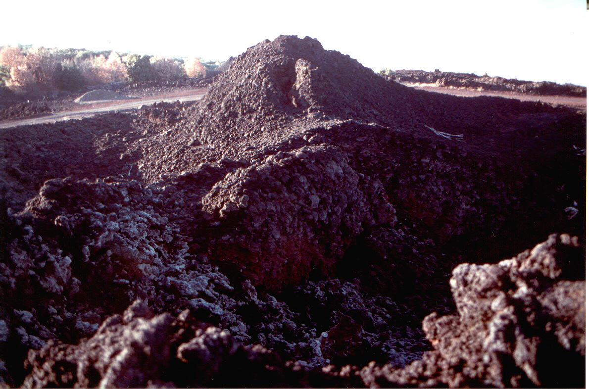 |
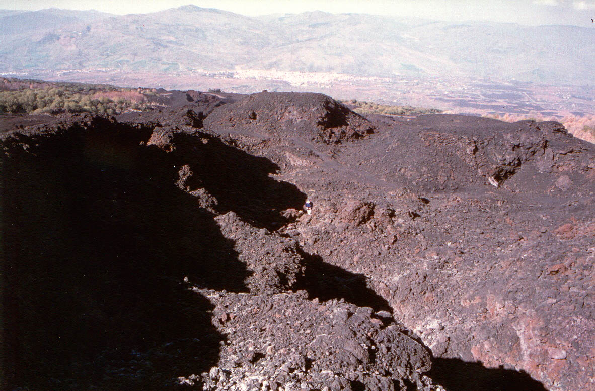
Photo
5 (left).
Lowermost vents and spatter cones on the central part of the main
1981 eruptive fissure. Cones are 5-10 m high and often steep-walled.
View is downslope, to the north-northwest. Photo 6 (right). Lava flow front only about 2 km from the southern outskirts of Randazzo (photographed on 2 March 1998), with the town in the background. This flow was erupted from the lowermost part of the 1981 eruptive fissure but fortunately was of small volume and activity at its feeding vents was weak. The flow surrounded but did not destroy the small building in the middle ground. |
 |
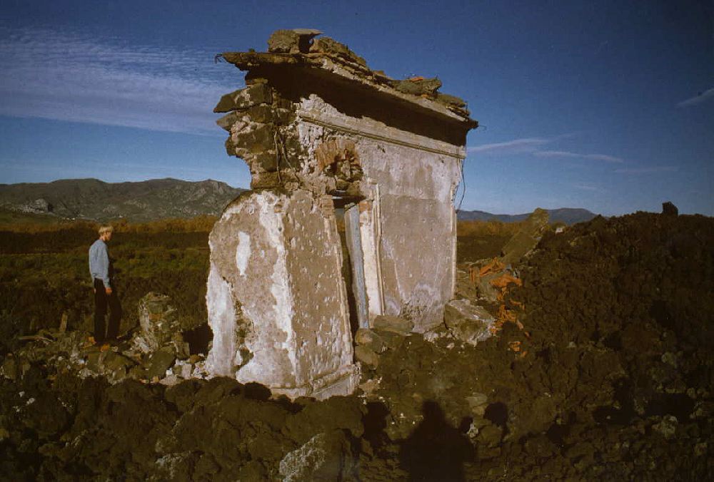 |
Photo 7. Ruin of a home destroyed by the main 1981 lava flow in the area between Randazzo and Montelaguardia, a village to the east of Randazzo. Although major settlements escaped destruction, hundreds of isolated buildings and vast areas of cultivated land were devastated by the lava flows, and roads and two railroad lines were interrupted. | |
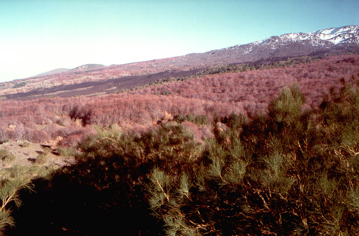
Today, the eruptive fissures and lava flows above Randazzo still give a feel of the 1981 drama to visitors. Although the lava is already covered with lichens, some of the vents on the fissure still emit vapor. Burnt and fallen trees cover the lava flows along their margins, and there are many spectacular lava tree molds; in some places, the remains of buildings loom out of the frozen river of black rock. The lower part of the main lava flow is used as a garbage deposit. Life in Randazzo and its surroundings is particularly peaceful, and people of the area hope that like before the 1981 eruption, many centuries will pass until the volcano erupts again in this area.
Continue
with
THE 1983 S FLANK ERUPTION
Copyright © Boris Behncke, "Italy's Volcanoes: The Cradle of Volcanology"