
| Etna
index |
||
| Geology | Geological history | Cones and craters |
| Eruptive characteristics | Eruptions before 1971 | Eruptions since 1971 |
| Etna and Man | References | Web sites |
| Weather forecasts | FAQ | Latest news |
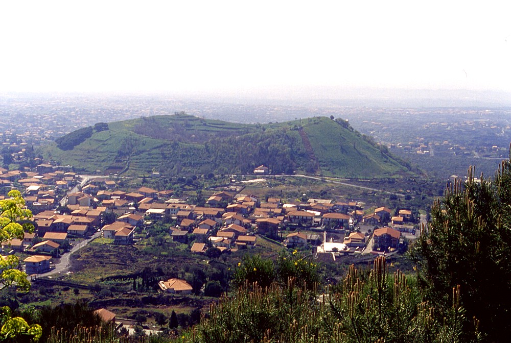 |
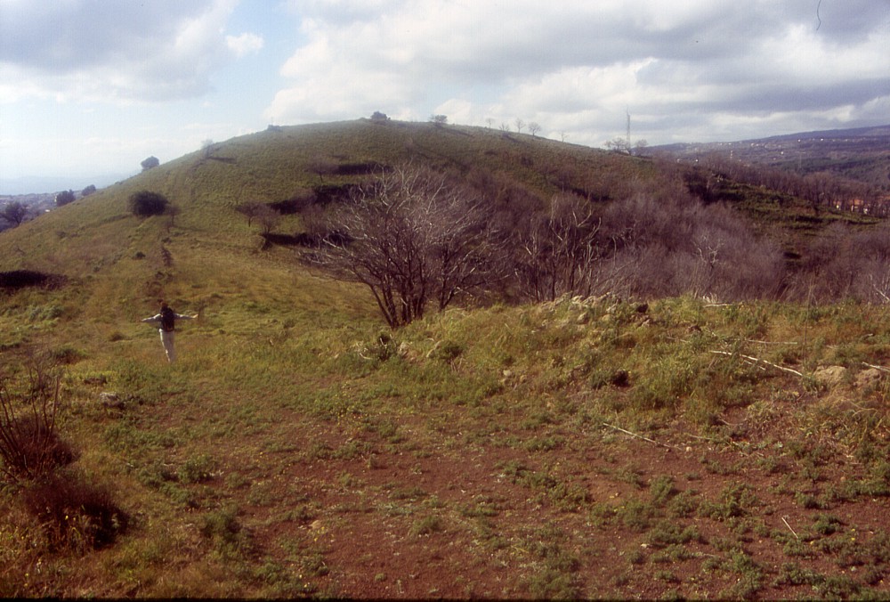
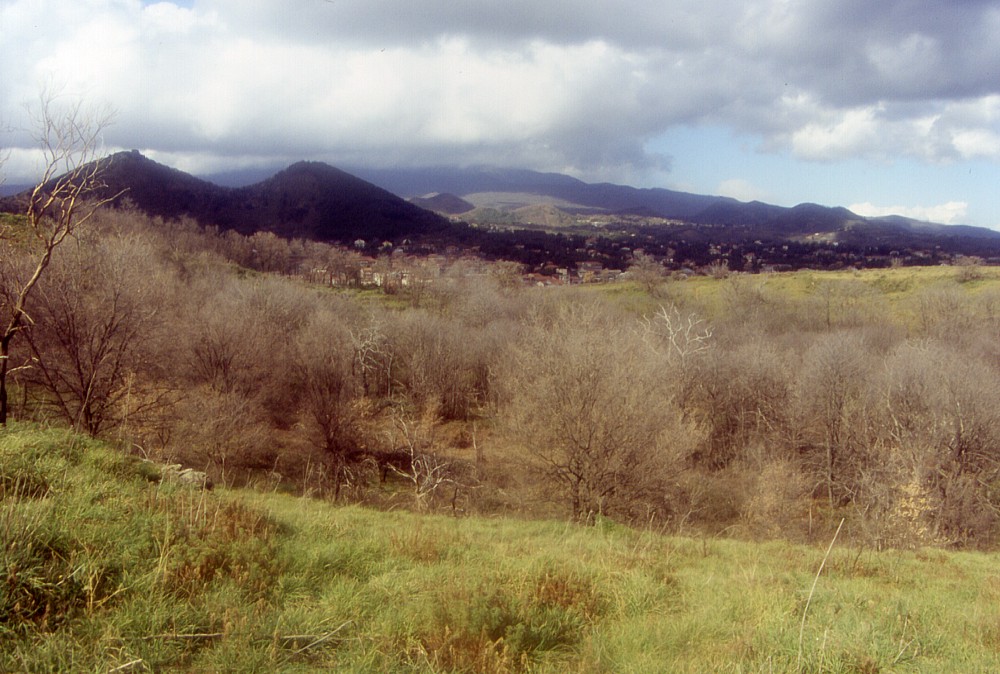
The
broad cone of Mompilieri seen from the Monti Rossi, about 1.4
km to the NNW, April 2001. On this side, the low point on the
near crater rim lies only about 35 m above the base of the cone,
but on the opposite side the cone is more than 100 m high, and
the highest point of the crater rim (west side, at right) stands
about 130 m above the south base of the cone. The buildings in
the foreground, which occupy the space between the Monti Rossi
and Mompilieri, are a recently constructed part of the town of
Nicolosi. They were built on the lava produced by the 1669 Monti
Rossi eruption |
Mamma
Etna's countless children
Mompilieri (or Monpilieri)
S flank, 15.015656° E, 37.605481° N
summit elevation: 770 m (W rim of crater)
![]()
Mompilieri
(also written "Monpilieri" on some maps) is a relatively youthful
pyroclastic cone lying about 1.5 km to the SSE of the Monti Rossi, on
the southwest margin of the town of Nicolosi. Some sources report that
it formed during an eruption in around 695 B.C.; the lava flow attributed
to this eruption on the 1979 Geological Map of Etna is probably of prehistoric
age. A broad crater 250 x 350 m in diameter truncates the summit of the
cone, forming a saucer-shaped depression now occupied by a small chestnut
forest, whose bottom lies approximately 50 m below the highest point of
the crater rim.
Like at most of Etna's flank cones, the relative height of the Mompilieri
cone varies strongly. The northern rim of its crater lies only about 35
m above the base of the cone on this side, whereas on the south side the
lowest point of the crater rim is more than 100 m above the base, and
the height of the highest point of the crater rim above the south base
is more than 130 m. Mompilieri is thus a sizeable cone, although it is
dwarfed by its younger and much larger neighbor, the Monti Rossi cone
formed in 1669. Terraces on the outer flanks and on the inner crater walls
indicate that much of the cone was once agriculturally used, but agricultural
activity has been abandoned and the cone is now largely grassland, with
a few pine trees growing on its eastern side and a small chestnut grove
on its crater floor. At its base, it is completely surrounded by the lava
of the nearby 1669 eruption; one effusive vent of that eruption is even
reported to have opened at the south base of Mompilieri, where there is
actually a small fissure-like feature occupied in its lower portion by
something that might be a tumulus formed at an effusive vent. A quarry
lies at the southwestern base of the cone, where both pyroclastics of
Mompeloso and lavas of the 1669 eruption have been extracted; this activity
seems to be continued now only at at very minor scale. The section thus
created in the side of the Mompeloso cone shows black scoria and bomb
deposits in the lower portion of the outcrop, followed upsection by a
thick succession of lapilli-sized, strongly altered, light-gray clasts
set in a yellowish matrix. This upper succession might result from phreatomagmatic
activity in a late stage of the Mompilieri eruption; similar deposits
are also seen in outcrops at the Monte Barca and Monte Moio flank cones
on the western and northern base of Etna, respectively.
Mompilieri is one example of those places that you pass nearby on countless
occasions without ever stopping there and taking a closer look. I probably
passed within less than 1 km of Mompilieri about 150 times but first photographed
it in 2001 (12 years after my first climb on the Monti Rossi cone, 1.5
km away) and first climbed it on 28 February 2004.
 |
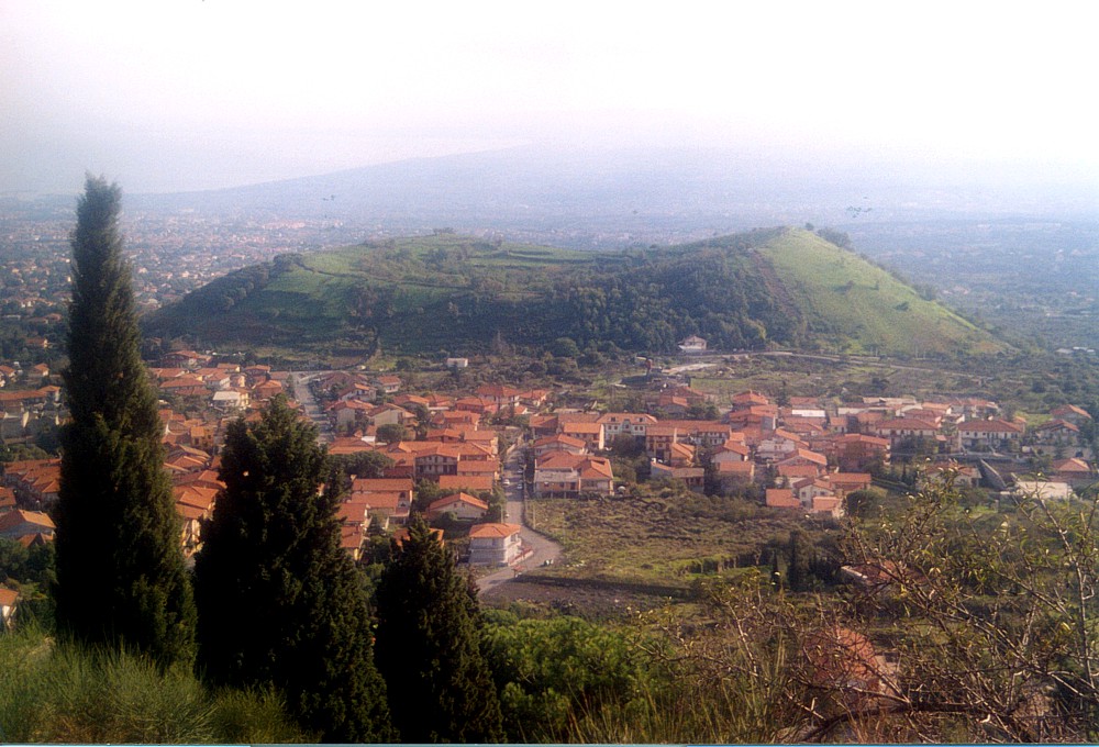 |
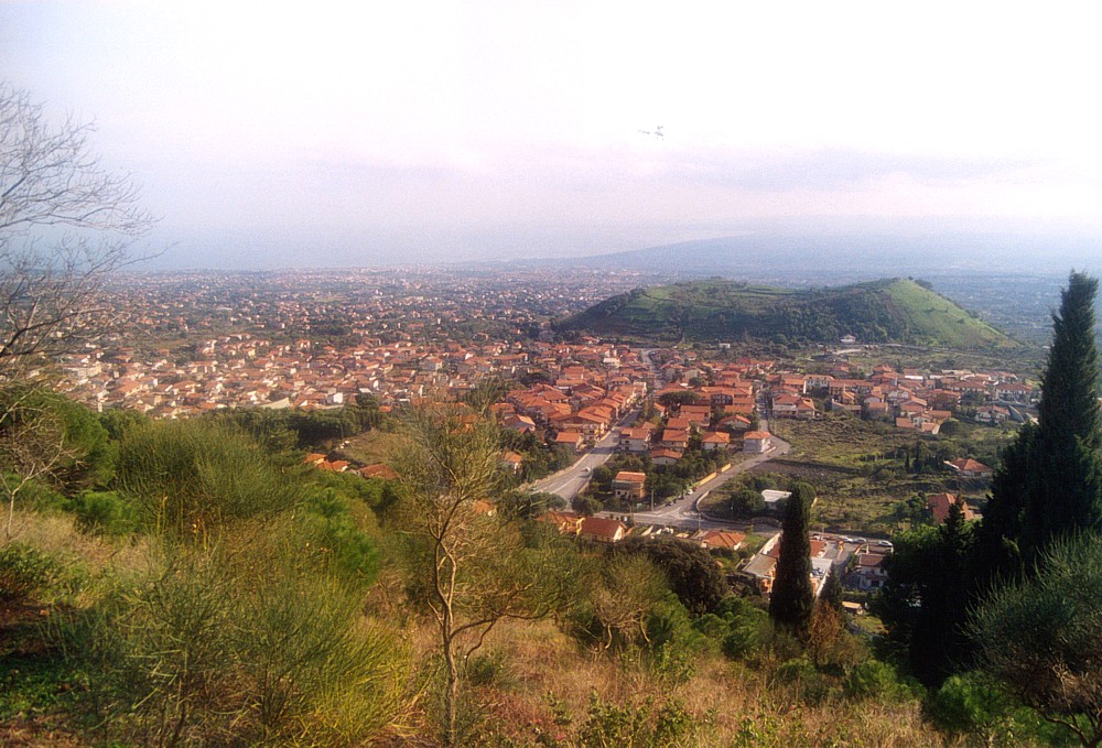
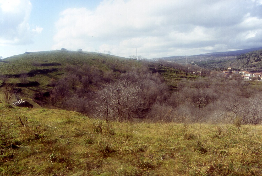
Two
views of Mompilieri from the south flank of the nearby Monti Rossi
taken on 31 October 2003. These photographs show impressively how
close new residential areas of the town of Nicolosi have advanced
to these two cones, one born in 1669 and the other possibly in early
Classical Age. The Bay of Catania is seen in the background in both
images |
|
 |
 |
 |
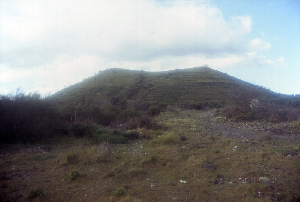
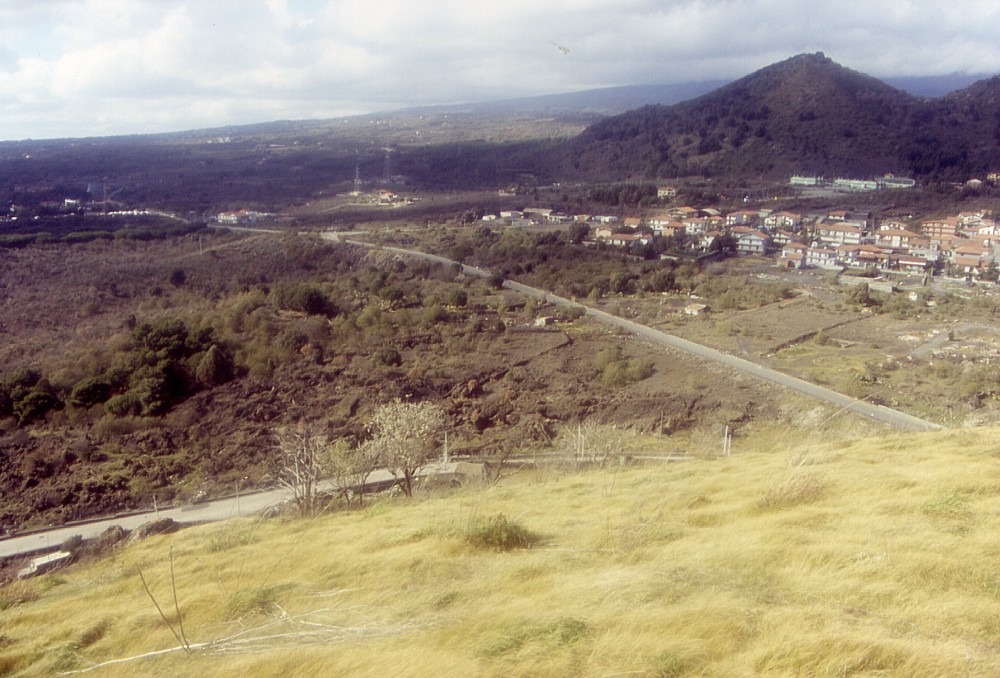
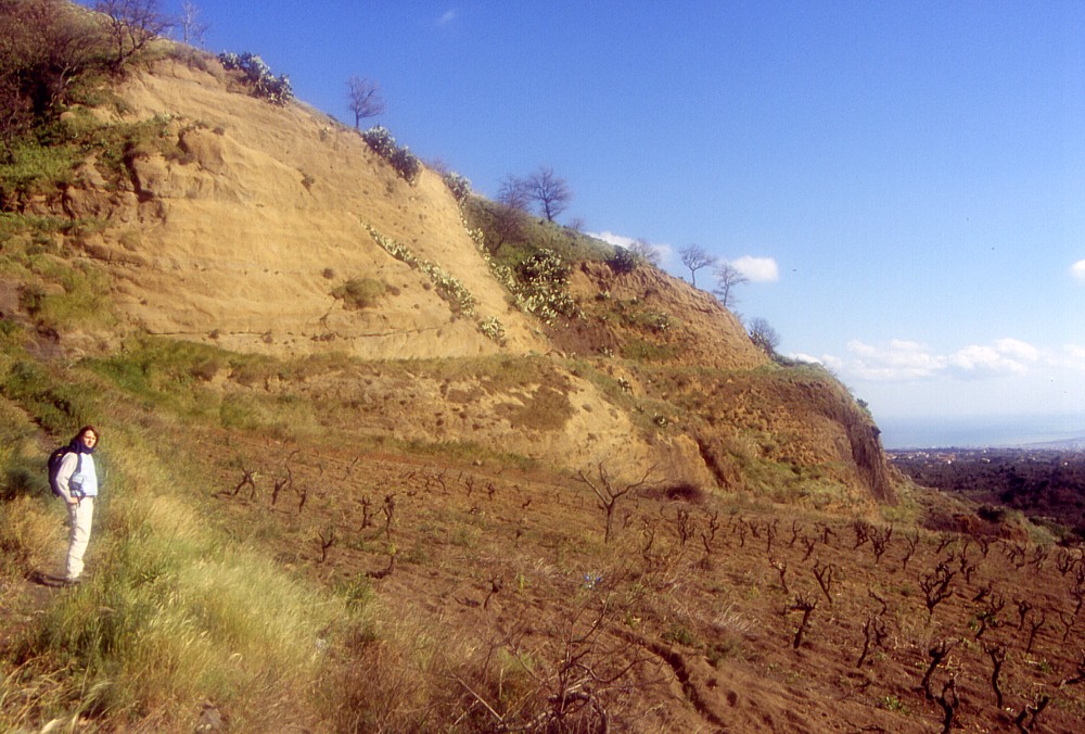
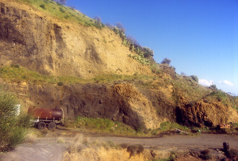
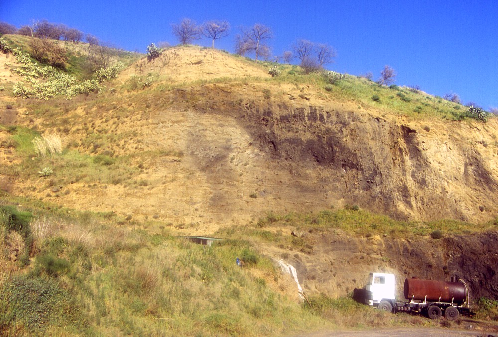
Left:
Mompilieri's south face, seen on a cloudy afternoon (28 February
2004). In the foreground lies a wasteland of 1669 lava covered with
sparse vegetation and used as a (non-authorized) waste discharge
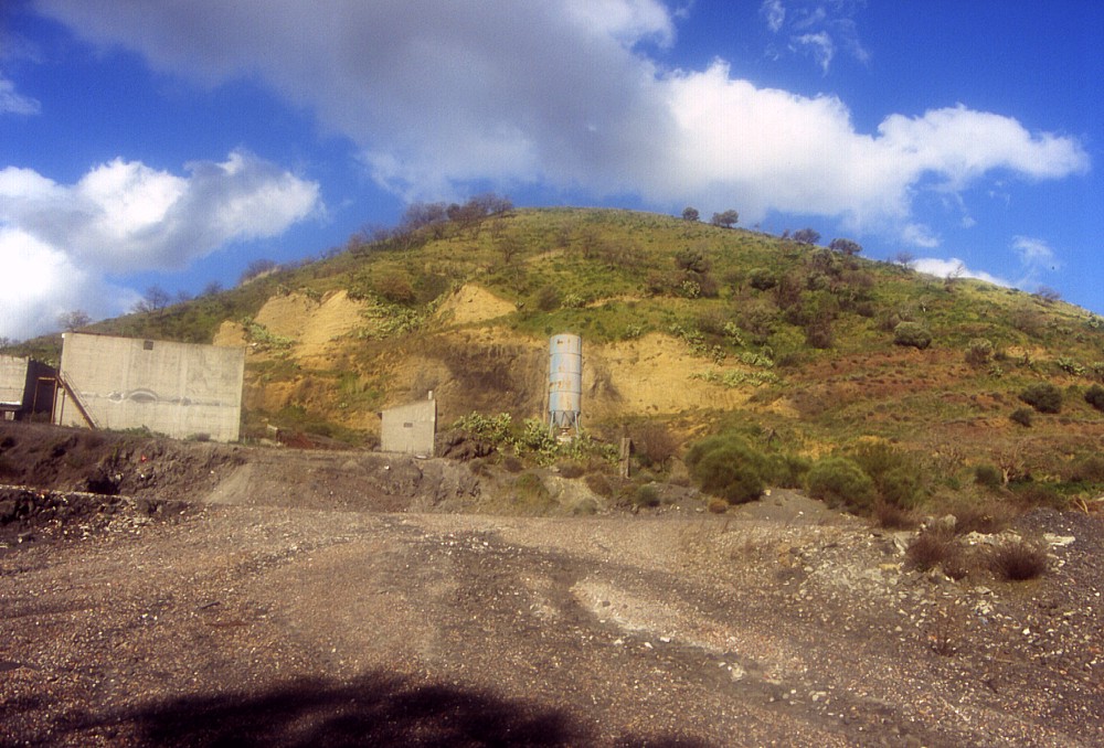
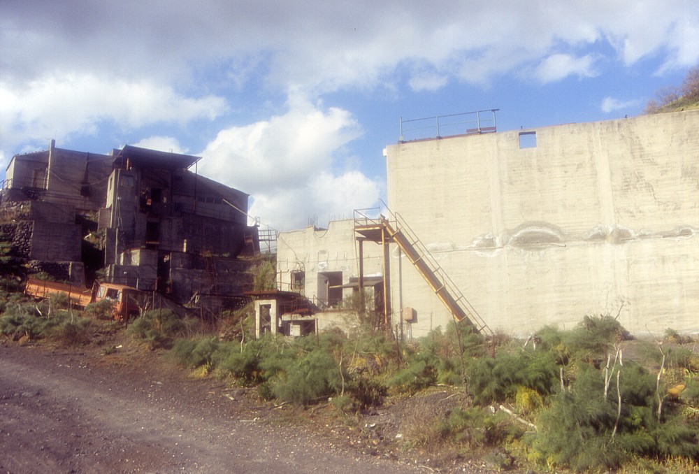
by local people Center: quarry on southwest flank of Mompilieri, allowing interesting insights into the inner structure of the cone and possible inferences on eruptive dynamics during its formation. The yellow colored deposits are strongly altered and possibly were deposited by phreatomagmatic activity. Photo taken 28 February 2004 Right: largely abandoned facilities within quarry at southwest base of Mompilieri, one of the countless cases of concrete monsters left amidst a charming landscape at Etna |
||
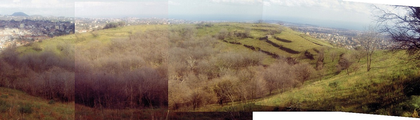 |
Photomosaic
of the broad crater of Mompilieri, taken from its west rim on 28
February 2004, during a gale-force storm that nonetheless brought
exceptionally clear visibility. The cone in the distance at extreme
left is Monte Gorna, before it lies
the town of Nicolosi |
 |
 |
 |
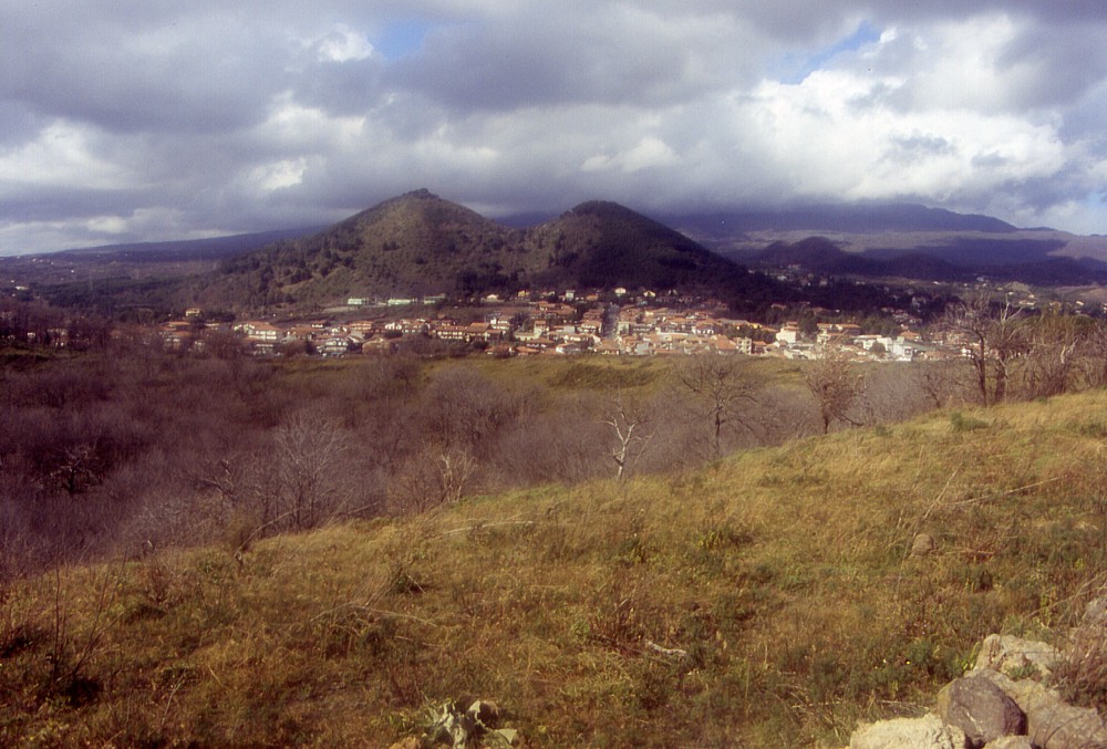
Details
of the crater of Mompilieri, seen from the southeast crater rim
(looking north in left image and northwest in center and right images)
on 28 February 2004. The huge twin cone of the Monti
Rossi (1669 eruption) is visible
in the background of the left image, and still further in the distance
lies Monte Serra Pizzuta. Note
abandoned terraces on inner crater wall in center and right images |
||
 |
 |
 |
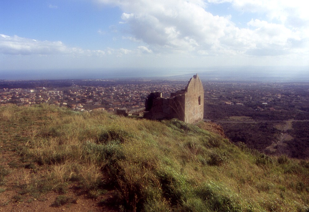
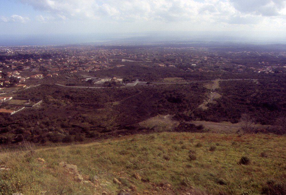
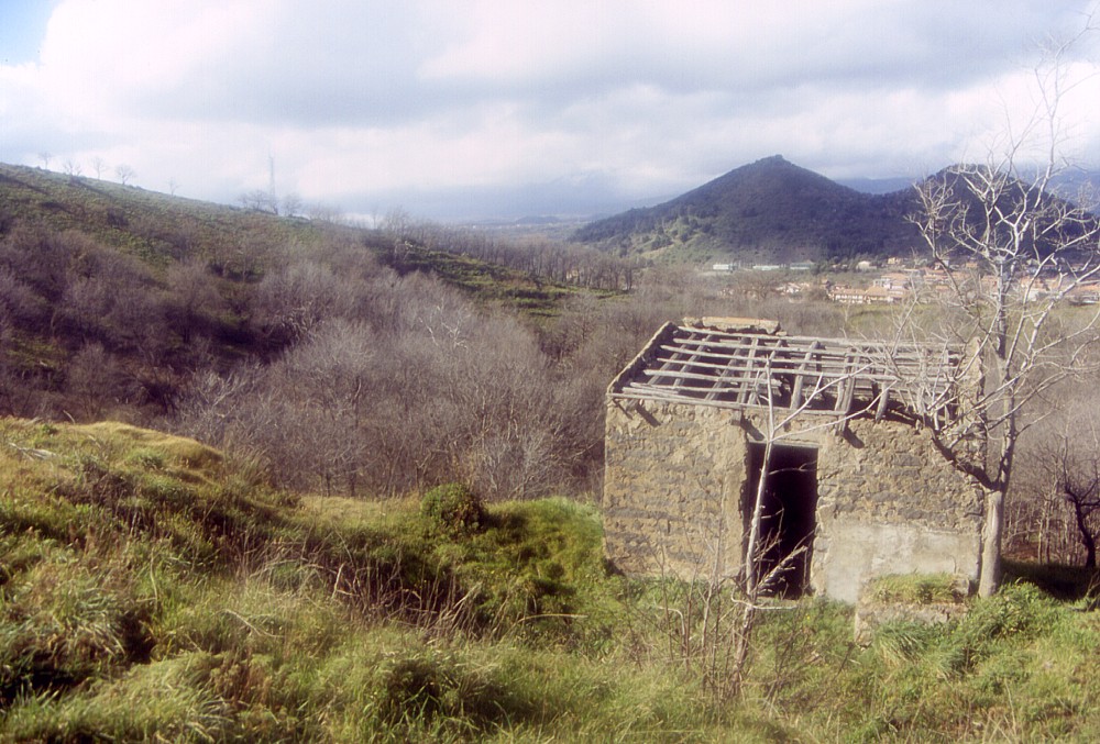
Left:
small abandoned building, largely collapsed under the weight of
time, standing on the southeast rim of the crater of Mompilieri,
and in the background the densely populated lower south slope of
Etna with the gorgeous blue Ionian Sea in the Catania bay in the
distance Center: looking down from the south crater rim of Mompilieri on the 1669 lava at the southern base of the cone, one of the few areas where this lava has not yet been covered by new buildings (but instead this area is used as an illegal waste discharge) Right: view from the southwest crater rim of Mompilieri across the tree-filled crater and the dark cone of Monti Rossi in the background. Photos taken 28 February 2004 |
||
 |
 |
 |
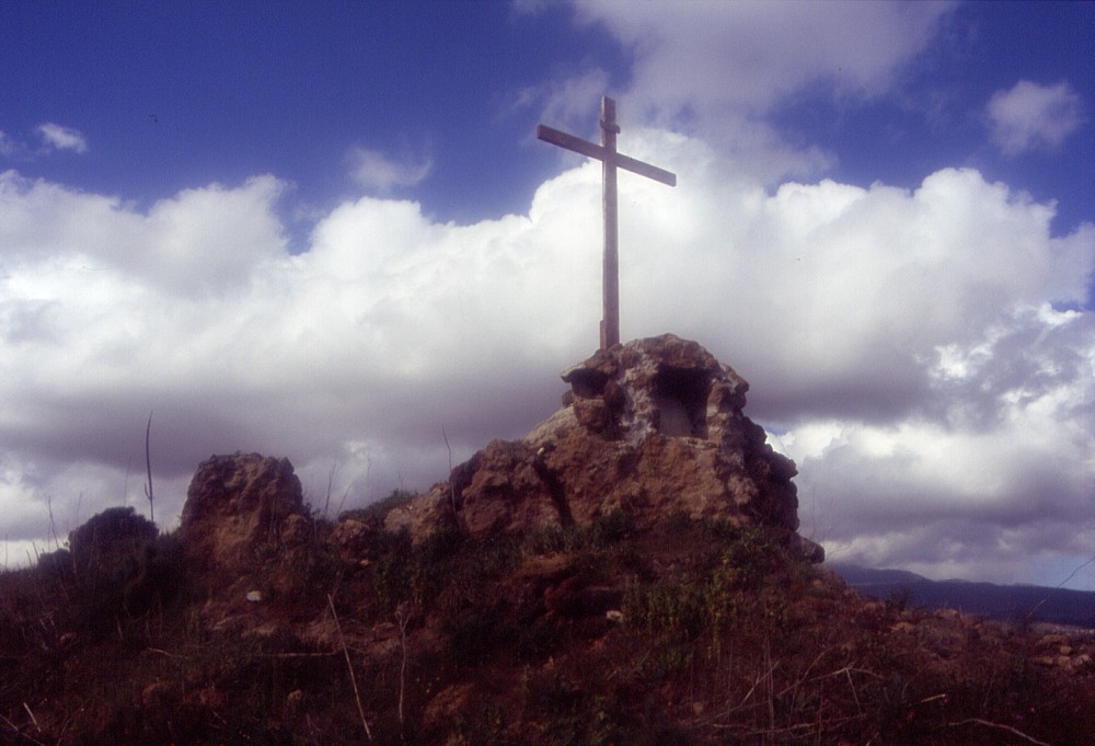
Left:
cross standing at the summit of Mompilieri, on its western crater
rim. This cross once bore a statue of Christ, but this statue
is no longer there Center: view from the western crater rim of Mompilieri onto the 1669 lava field at the northwest base of the cone. This lava still bears little vegetation, but a residential area of the town of Nicolosi (at right) has been constructed on it recently. Dark cone of Monti Rossi, the main vent of the 1669 eruption, looms in the right background Right: abandoned and collapsed house lying immediately below the southeast crater rim of Mompilieri, and again the Monti Rossi cone is seen in the background. Photos taken 28 February 2004 |
||
 |
 |
 |
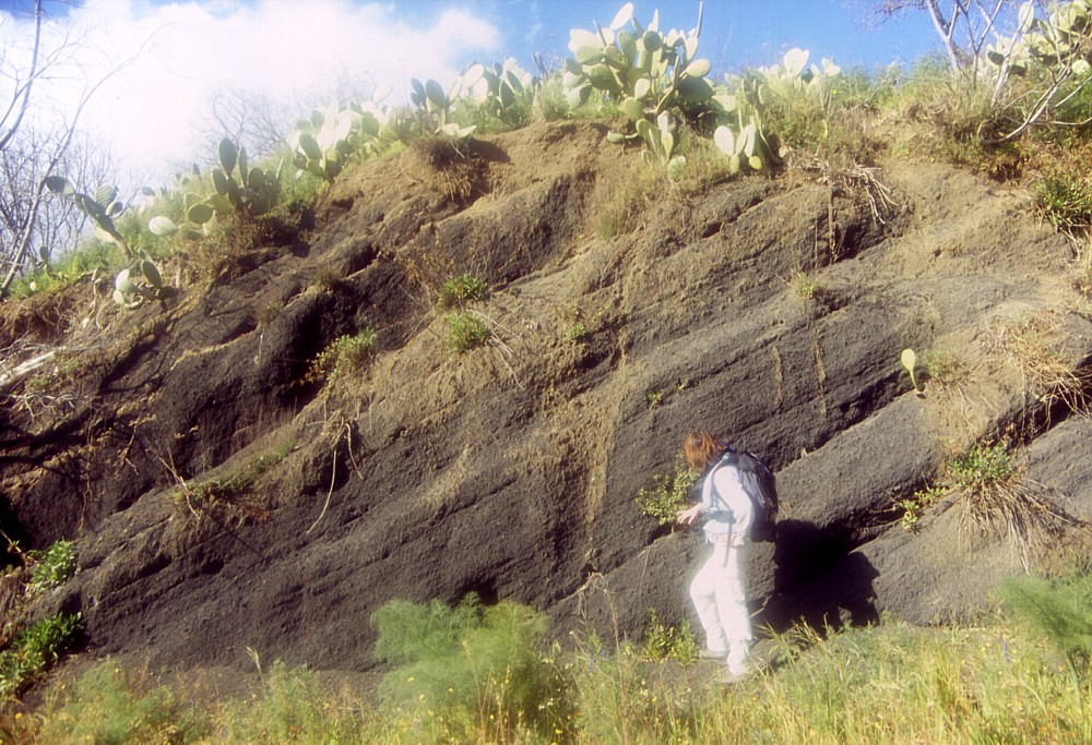
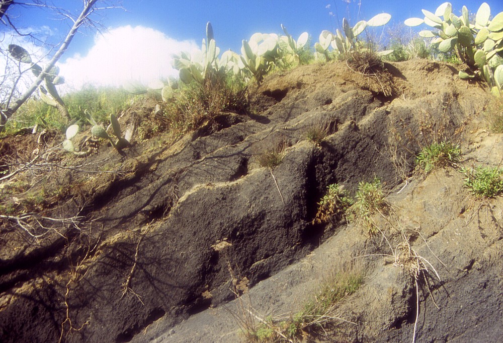
An
impressive section through the outer flank of Mompilieri is seen
in a largely abandoned quarry at the southeast base of the cone.
At the base of the section there are deposits of brownish to black
scoriae mixed with large bombs, typical for pyroclastic cones like
Mompilieri. These are overlain, along a highly irregular contact,
by a yellow-colored deposit of strongly altered lapilli, possibly
the result of phreatomagmatic activity in a late stage of the Mompilieri
eruption. Photos taken 28 February 2004 |
||
 |
 |
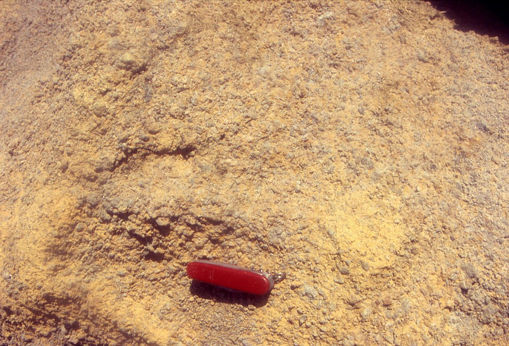 |
Left
and center: bedded deposits of black scoriae at northern end of
abandoned quarry on the base of Mompilieri, evidence for magmatic
activity during the first phase of the Mompilieri eruption. In the
upper part of this unit there are thin layers of strongly altered,
yellowish material (center photograph), which may be the result
of short bursts of phreatomagmatic activity toward the end of this
phase Right: typical aspect of the yellow altered, and possibly phreatomagmatic, lapilli deposit (Swiss knife, 9 cm long, placed to indicate scale). Photos taken 28 February 2004 |
||
Continue to the Monti Rossi (of the 1669 eruption)
Copyright © Boris Behncke, "Italy's Volcanoes: The Cradle of Volcanology"
Page set up on 29 February 2004, last modified on 14 March 2004