
| Etna
index |
||
| Geology | Geological history | Cones and craters |
| Eruptive characteristics | Eruptions before 1971 | Eruptions since 1971 |
| Etna and Man | References | Web sites |
| Weather forecasts | FAQ | Latest news |
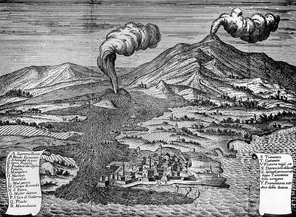
Spectacular reproduction
of a fresco in the Cathedral of Catania, showing the 1669 eruption
of Etna whose lava flow caused significant damage in Catania and
destroyed numerous villages. |
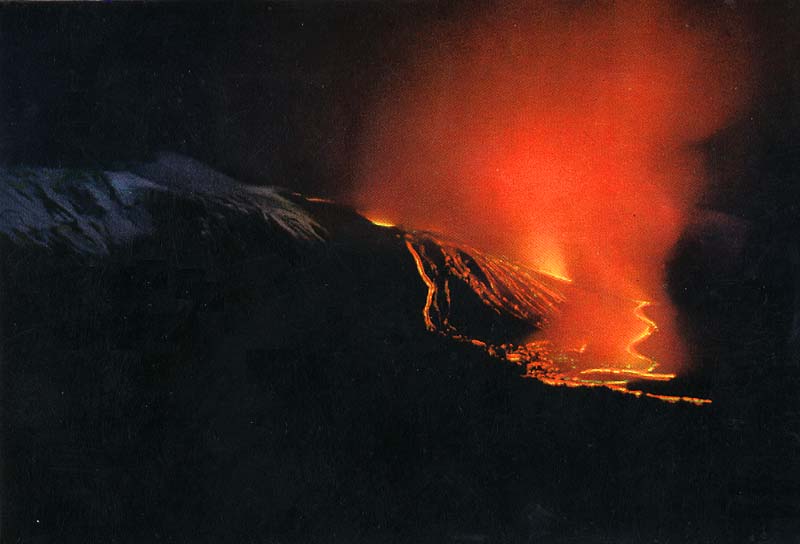
Eruptions
of Mount Etna
(A) Before Etna
erupts: Magma storage and ascent
(B) Types and styles of eruptions at Etna
(C) Historical eruptions: Part
1 (before 1971) -
Part 2 (since 1971)
This section consists of three parts. The first provides information about the way magma moves into the volcano and where it comes from, and describes the complex relationship between eruptive activity and flank instability; the second gives a general description of the various styles of activity and eruption types observed at Etna. The third, chronological part leads to a series of pages dealing with some of the more important eruptions during the historical period until early 1971, ending just before the major eruption initiated in early April 1971. Among the events discussed is the 1669 eruption that threatened Catania and destroyed 16 villages, the 1928 eruption that destroyed the village of Mascali, and all eruptions since 1971. These latter are treated in a separate section, since they represent a unique period in the history of Etna, both for the variety and frequency of eruptive activity and for the enormous progress made in the studies of Etna and its dynamics.
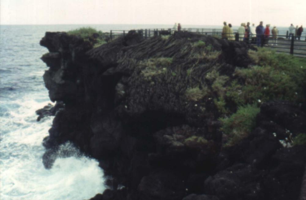 The coast at Ognina, the easternmost part of the town of Catania, has spectacular outcrops of lava which is of an eruption in the 12th century (often cited as "1381 eruption"). Much of this lava has ropy pahoehoe surfaces. At the time of the eruption,the area was fortunately uninhabited, but a similar eruption, were it to occur today, would have devastating consequences. |
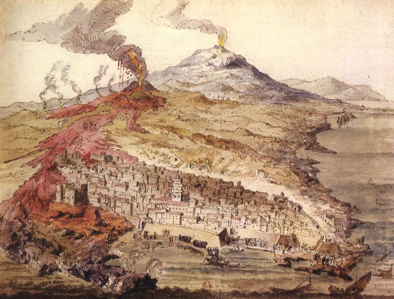
 An old sketch showing Etna and Catania during the 1669 eruption. In this bird's eye perspective the view is towards NNW, showing the fuming summit of Etna in the background while an eruption column is rising from a crater on the S flank, now called Monti Rossi, shown in the middle ground. This crater is feeding a large lava flow which has reached, and partly surrounded, the city of Catania, in the foreground. |
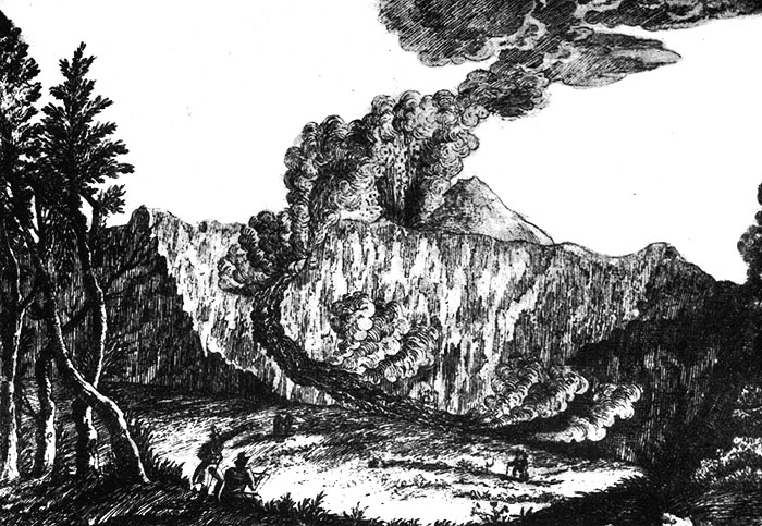 Eruption in the Valle del Bove in 1819. This sketch neatly shows an upper explosive vent, at the SE base of the main summit cone, and a lower fissure in the upper Valle del Bove, similar to the vent alignment during the 1991-1993 eruption in the same general area. This sketch was drawn by C. Maravigna, author of a contemporaneous description of the eruption. |
|
Copyright © Boris Behncke, "Italy's Volcanoes: The Cradle of Volcanology"