
| Etna
index |
||
| Geology | Geological history | Cones and craters |
| Eruptive characteristics | Eruptions before 1971 | Eruptions since 1971 |
| Etna and Man | References | Web sites |
| Weather forecasts | FAQ | Latest news |
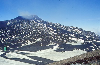 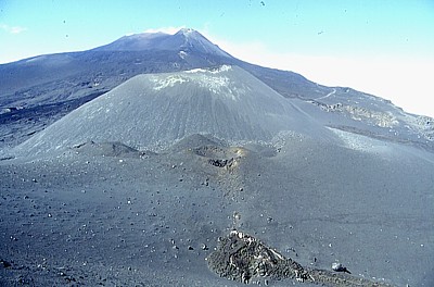 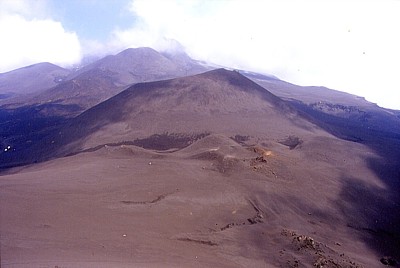 |
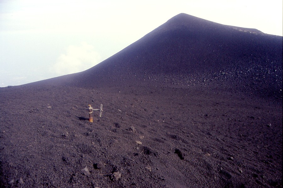
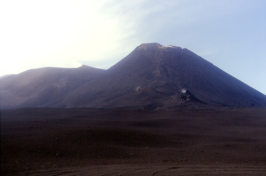
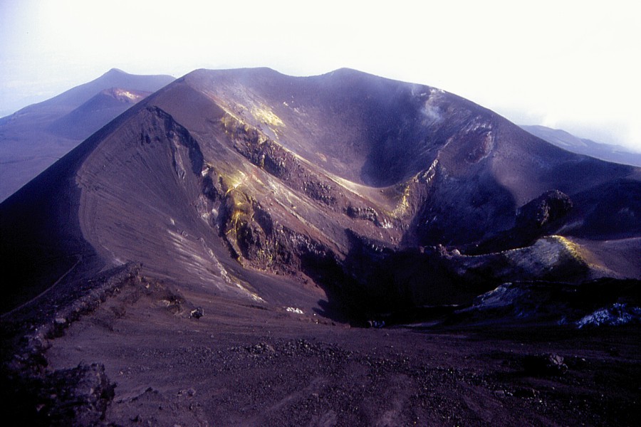
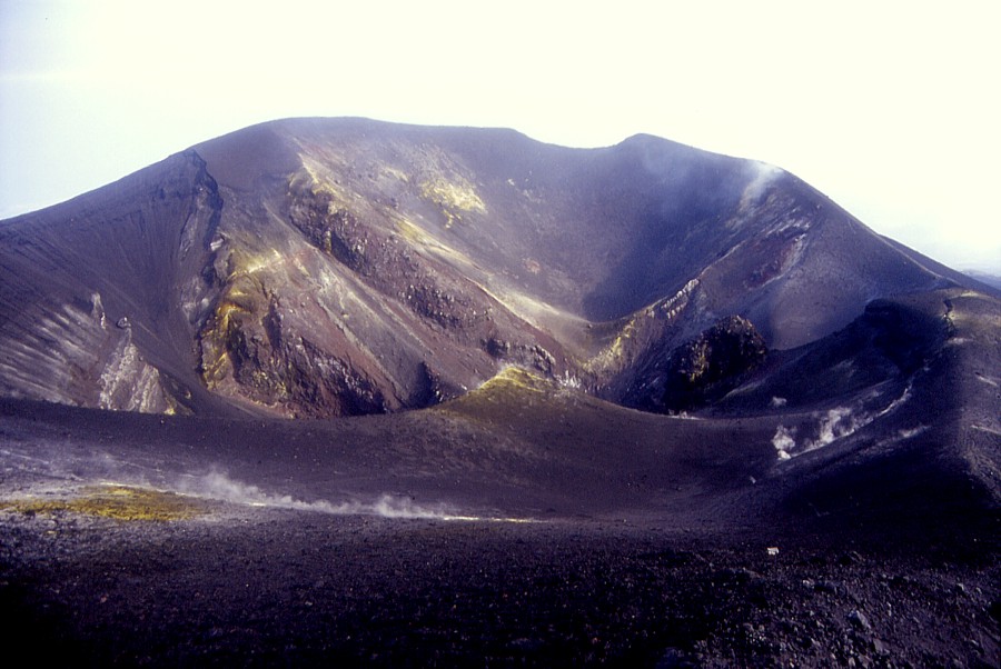
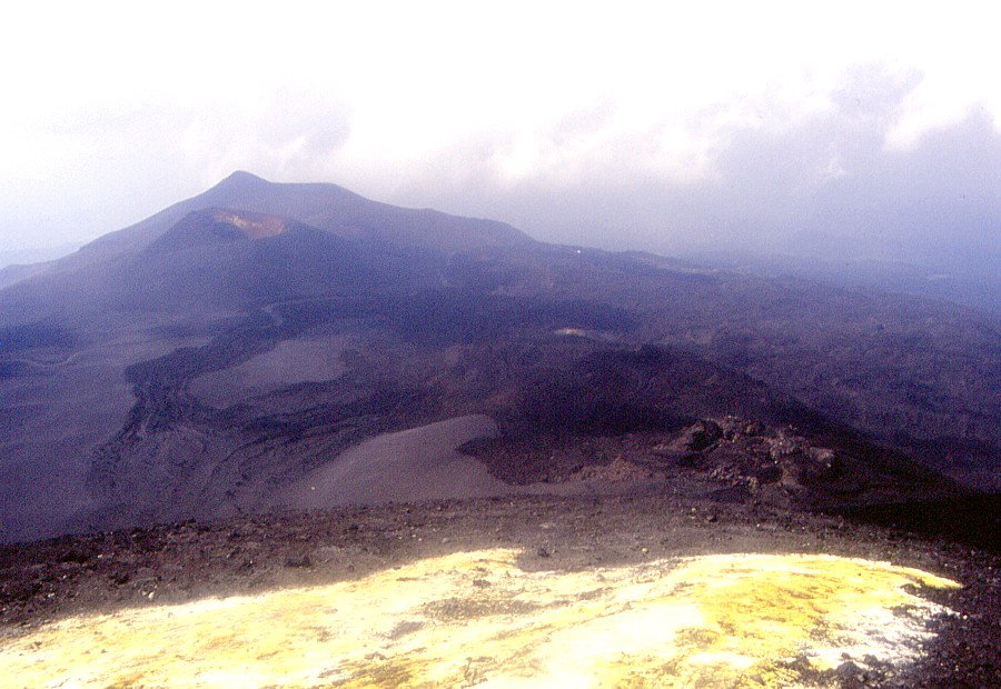
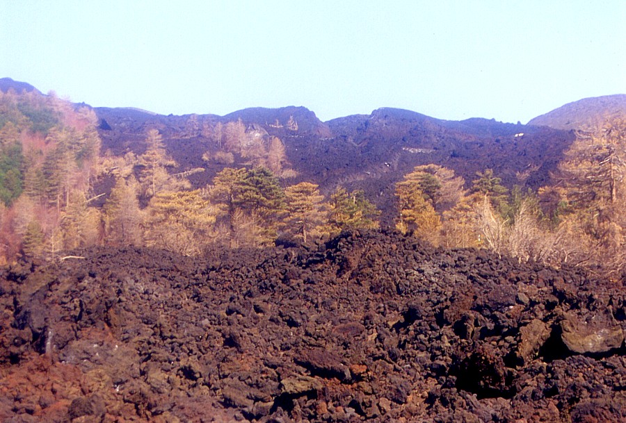
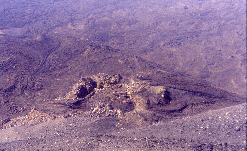
| The
incredible morphological changes brought by the latest two eruptions
(in 2001 and 2002-2003) on the upper southern flank can be appreciated
in these three photographs, all taken from the summit of the Montagnola
looking north. The relatively flat, gently sloping area in the foreground
of the top photo was, until 2001, known as the "Piano del Lago",
since during the spring snowmelt in many years a temporary lake
formed there. There will surely never ever be a lake again in that
area, because during the 2001 eruption a new cone was built up there,
which is well visible in the center photo. With the 2002-2003 eruption
the area has once more undergone a profound change: the bottom photograph
shows, behind the 2001 cone, a new twin cone, half hidden in cloud,
each of the "twins" being twice as tall as the cone of
2001! N.B. The photographs were taken in May 2001, September 2001
and June 2003, respectively. |
Latest photos of Etna and Stromboli (June 2003)
![]()
The photographs
on this page were taken on 7 June 2003 (Stromboli) and during five visits
to Etna on 9, 13, 18, 22, and 26 June 2003, and represent a "new
generation" of images on this site, due to replace all low-quality
scans that appear on many of the pages today. Scanning of slides has been
difficult most of the time because no special slide scanners were available,
and during the past two years no scanner was available at all. This has
changed now. I have acquired a scanner capable of producing reasonably
high-quality scans from slides, photographs and negative strips, and thus
all images on this site can soon be seen in much better quality than before.
The images below are a foretaste; they will later be incorporated into
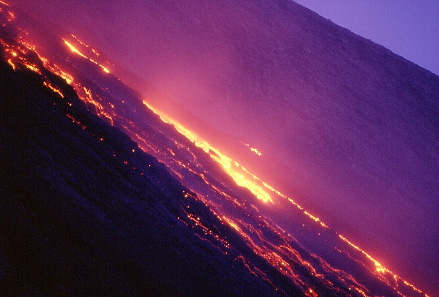
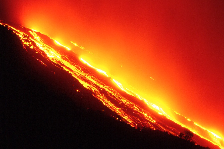
the respective sections of this site. They show the ongoing effusive activity
at Stromboli, where lava flows descend the "Sciara del Fuoco"
(see more on the Stromboli pages) since late December 2002; the effusion
rate has increased somewhat over the past few weeks and thus renders more
spectacular flows. The Etna photos show some of the dramatic morphological
changes that have resulted from the latest eruption, between October 2002
and January 2003, on the upper southern flank and on the northeastern
flank, near Piano Provenzana.
|
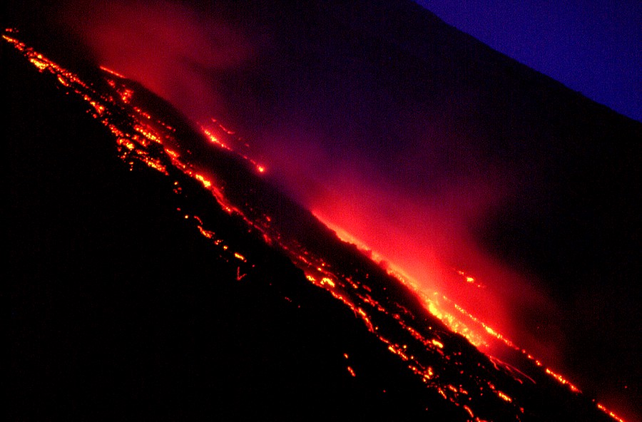
The visit was made in the evening, lasting from before sunset well into the night. Activity consisted of lava effusion without any explosive manifestations; the effusion rate at that time was higher than during the previous two months and incandescent rockfalls from flow fronts and margins were continuous
|
|||||||||||||

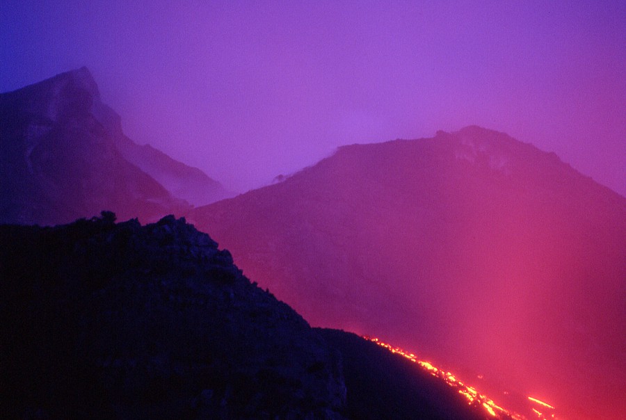
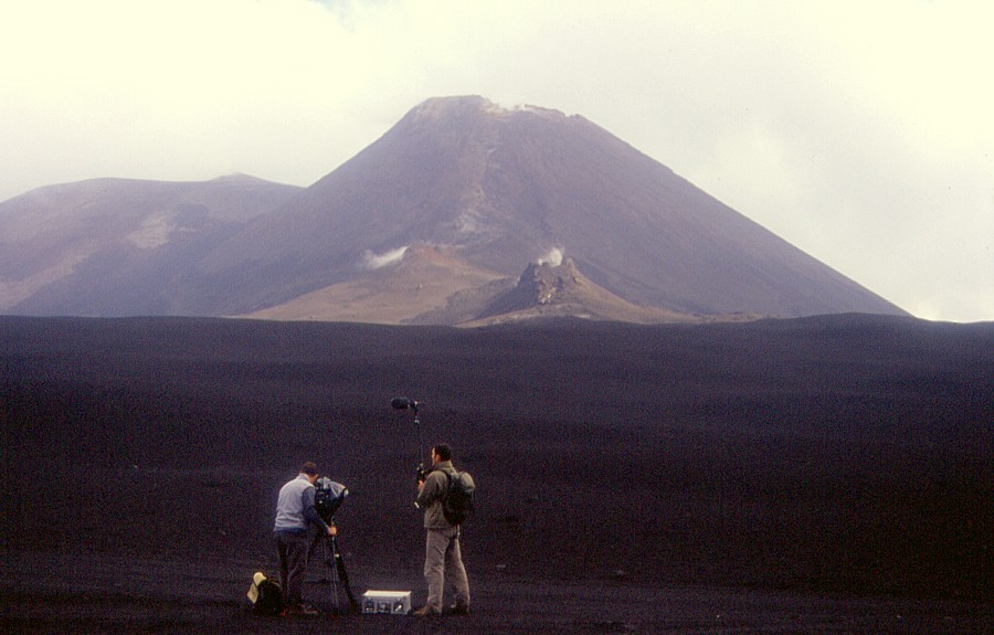
Etna,
upper southern flank, 9 June 2003
The visit was made during the late afternoon, with some weather clouds casting shadows on the terrain, which explains why some of the photographs are rather dark and low in contrast. It was possible to stay only briefly on the rim of the lower of the two newly formed (2002-2003) craters; a tour around this crater was made four days later (see next series).
 |
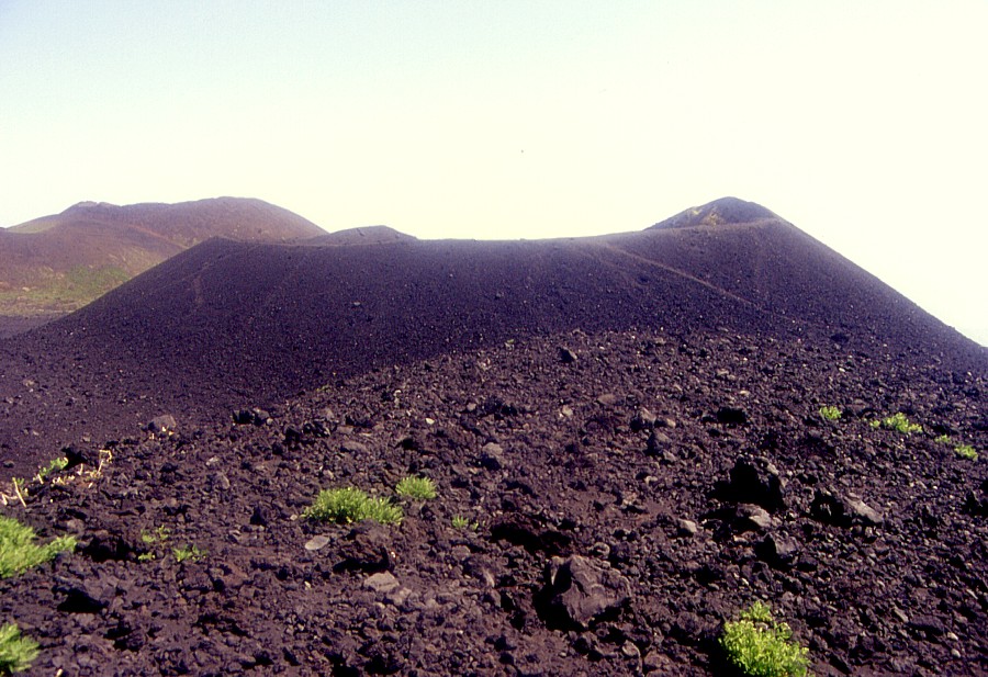
Left:
nameless but enormous, the lower of the two new cones of the 2002-2003
eruption looms above what was once Piano del Lago |
 |
 |
Left:
the top of an antenna poking through the 2002-2003 pyroclastic deposit
is all that remains of Torre del Filosofo |
 |
 |
Left:
four north-south aligned vent lie on the bottom of the upper new
cone, one of which still gives off hot steam |
 |
 |
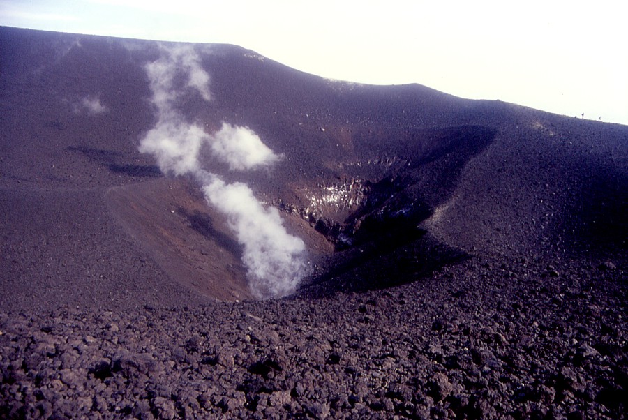
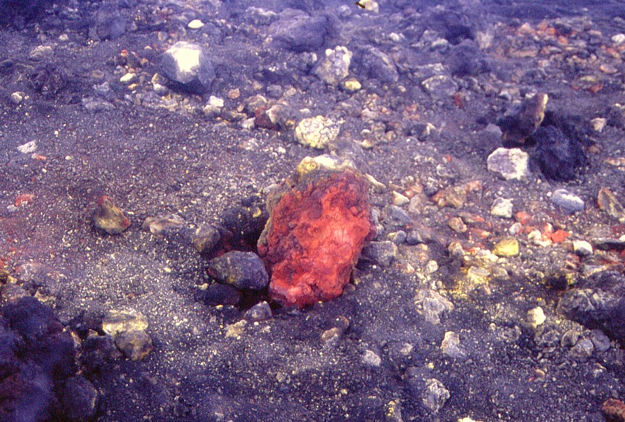
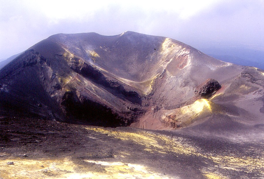
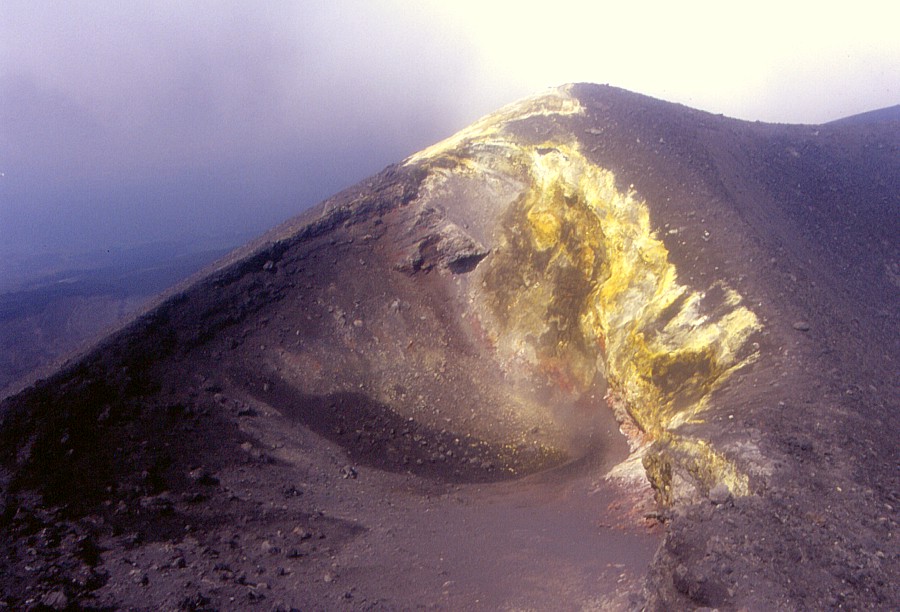
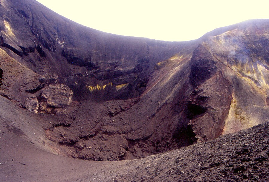
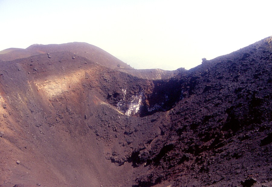
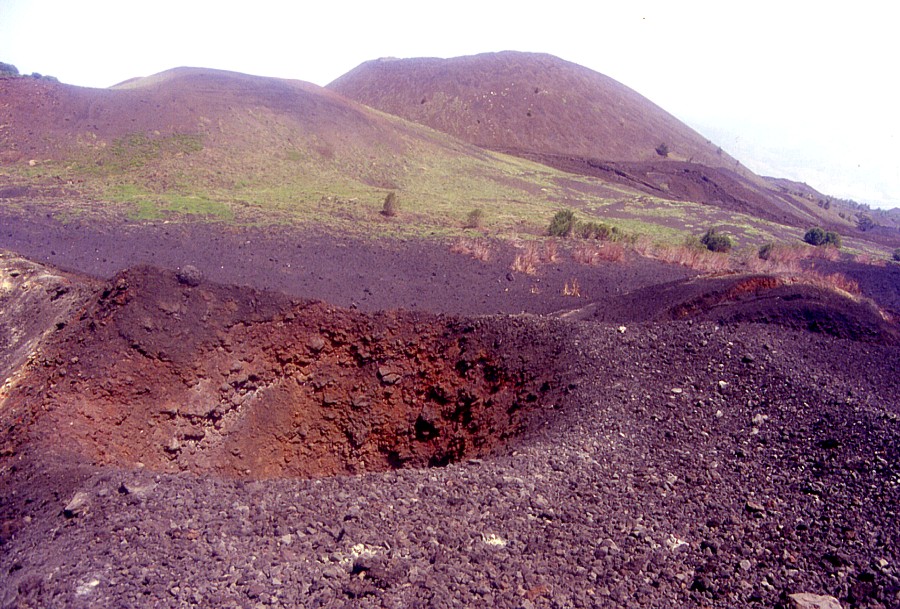
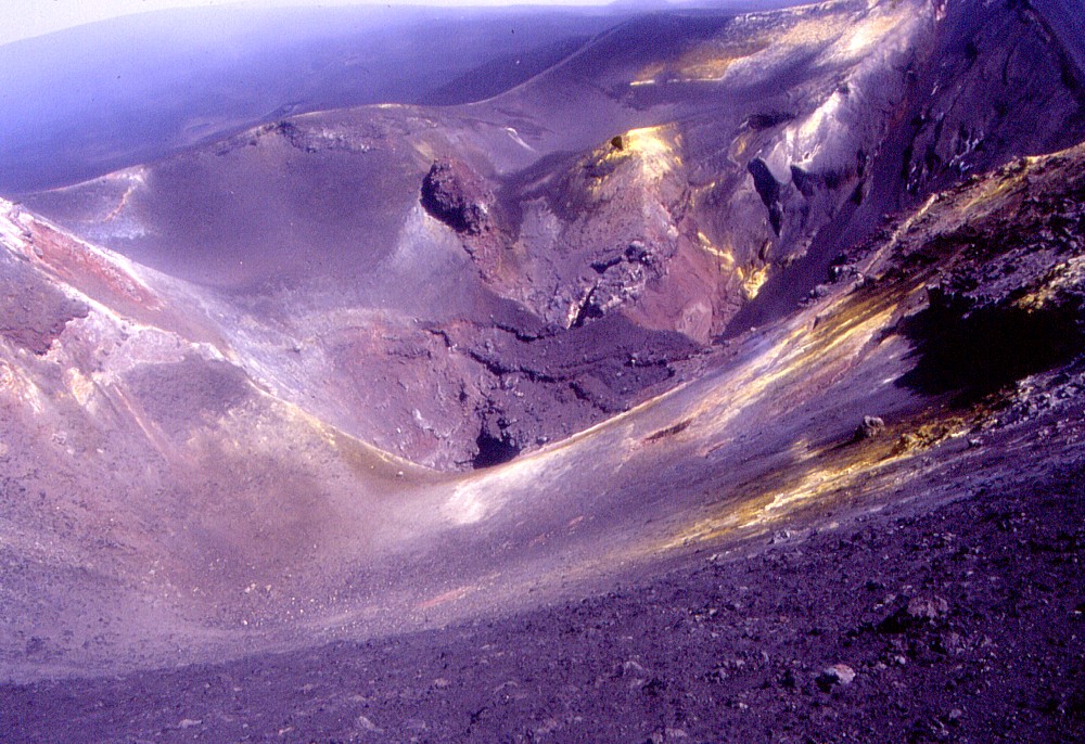
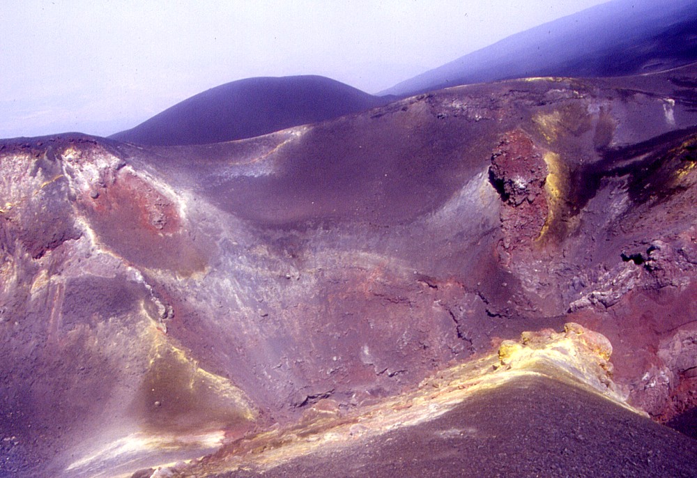
Two views of the crater of the lower new cone from slightly different angles. This crater contains at least six irregularly spaced vents and displays spectacularly colorful sulfur deposits |
 |
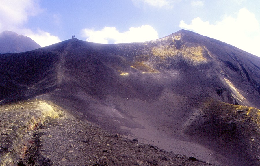
Etna, upper southern flank, 13 June 2003
Lighting conditions are quite different compared to the previous (9 June) series as the visit was made during the early morning, but clouds often covered part of the scene. This time it was possible to do a near complete round trip around the lower of the two newly formed (2002-2003) craters, allowing to portray it from different viewing angles.
 |
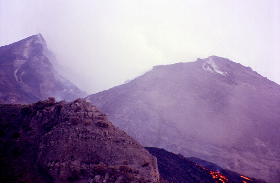
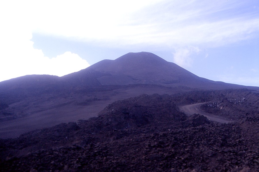
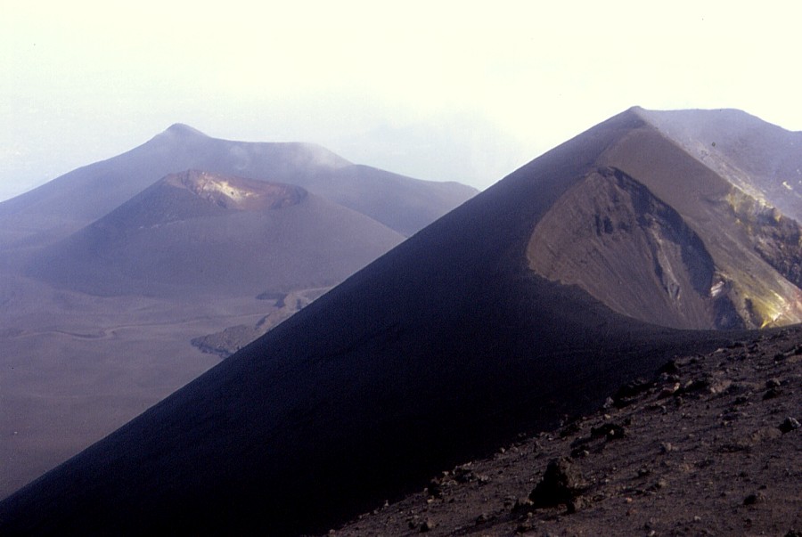
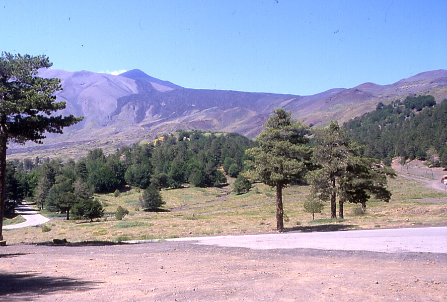
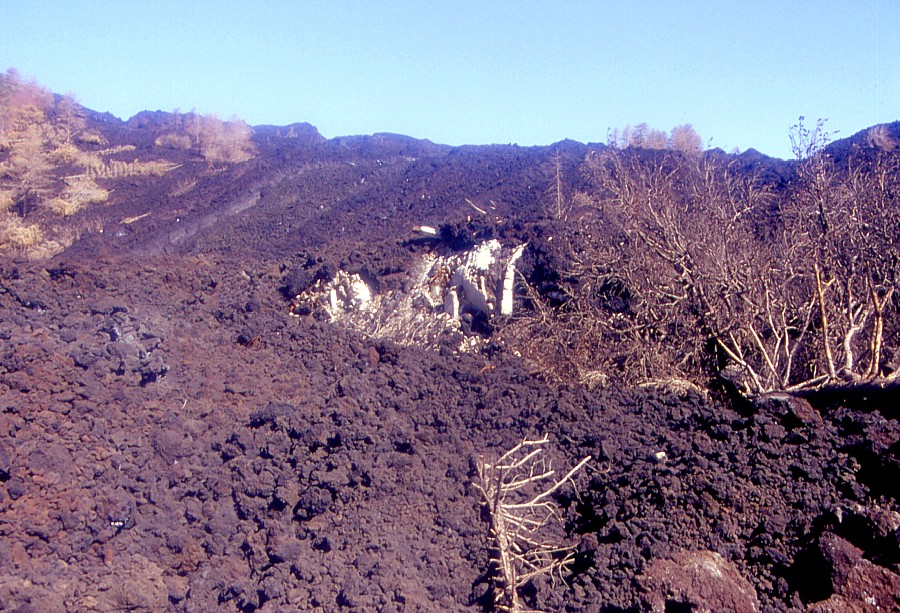
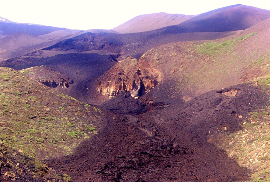
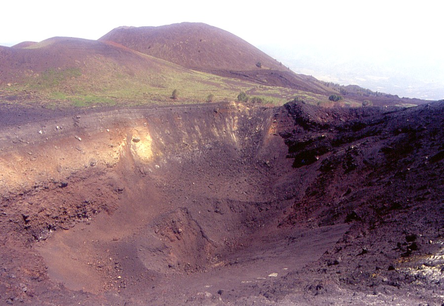
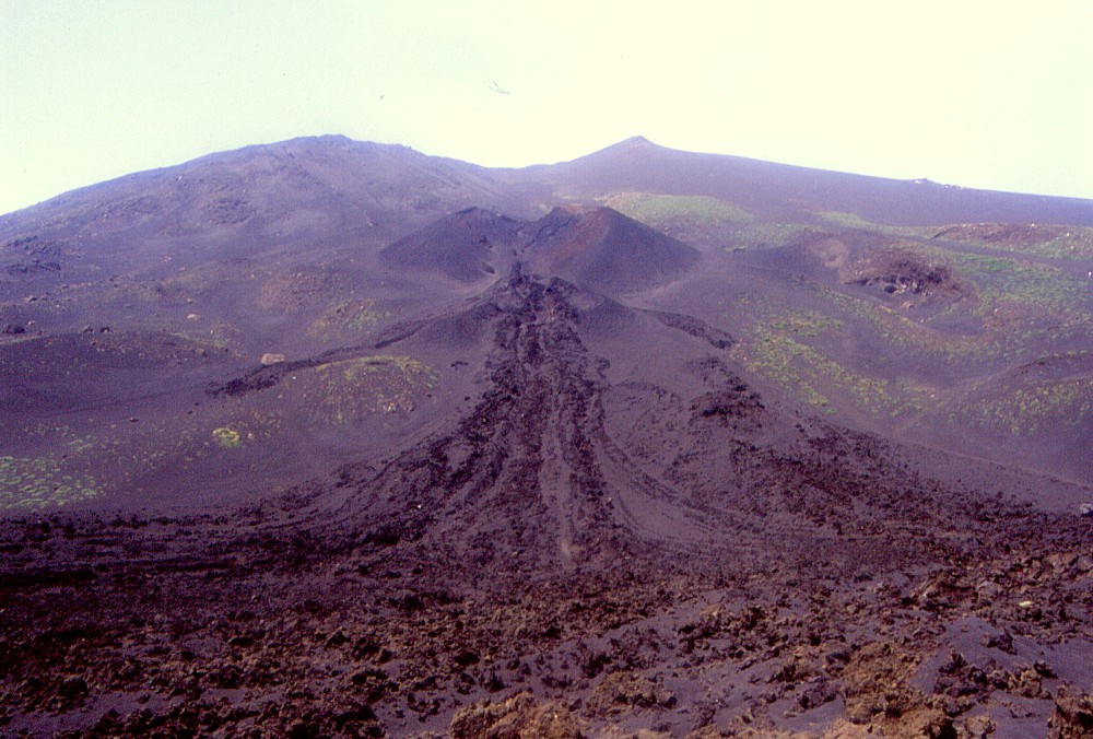
| The place seen here is what on maps is called "Piano del Lago", which means "Plain of the Lake". It was a gently sloping, flat area extending from the Montagnola (the sharp peak seen in the distance) at about 2600 m elevation to the base of the summit crater complex. Only one prehistoric cone, Monte Frumento Supino (which is out of the picture to the right) lay in this area until 2001. During the eruption of July-August 2001, a large new cone formed just to the north of the Montagnola (the gaping crater seen in the distance in front of the Montagnola). The eruption of October 2002-January 2003 led to the growth of two much larger cones, and all lavas seen in the middle ground were erupted from several vents at the base of the more southerly of these cones. The photograph was taken from the southern side of the same cone, looking south |
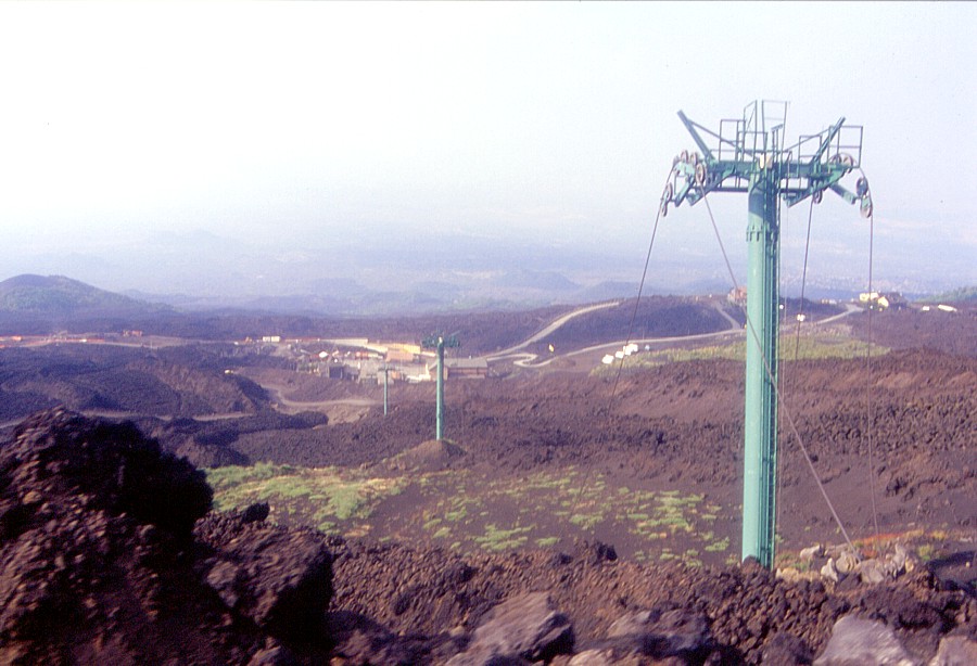 |
Left:
some of the poles of the cable-car survived both the 2001 and 2002-2003
eruptions |
 |
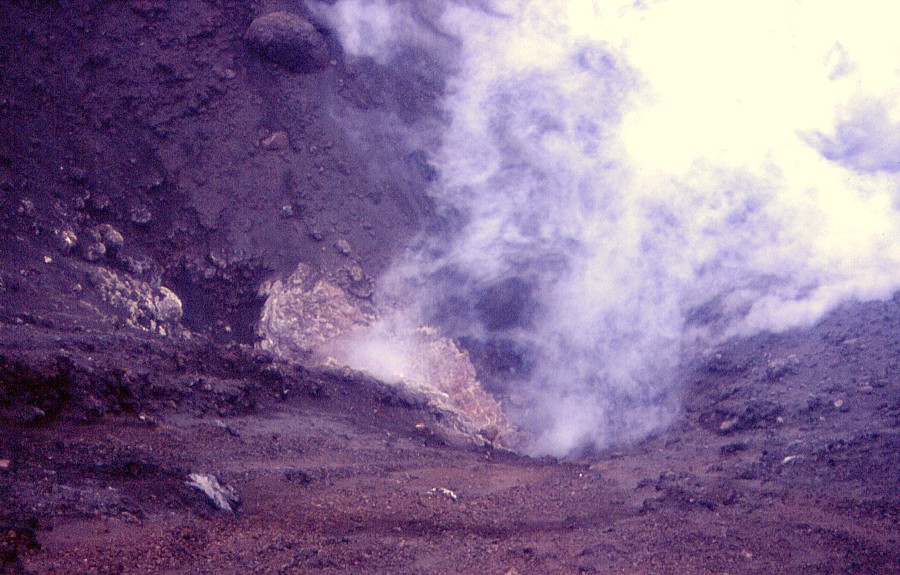 |
Left:
fuming pit at the bottom of the northermost vent within the upper
of the 2002-2003 craters |
 |
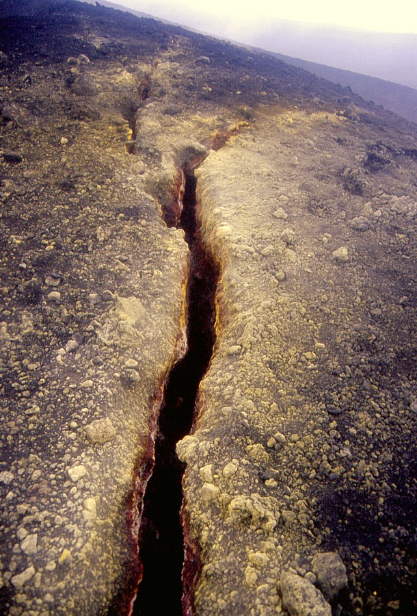 |
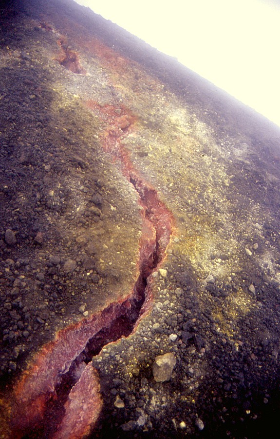
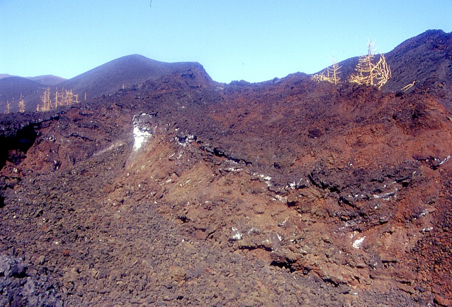
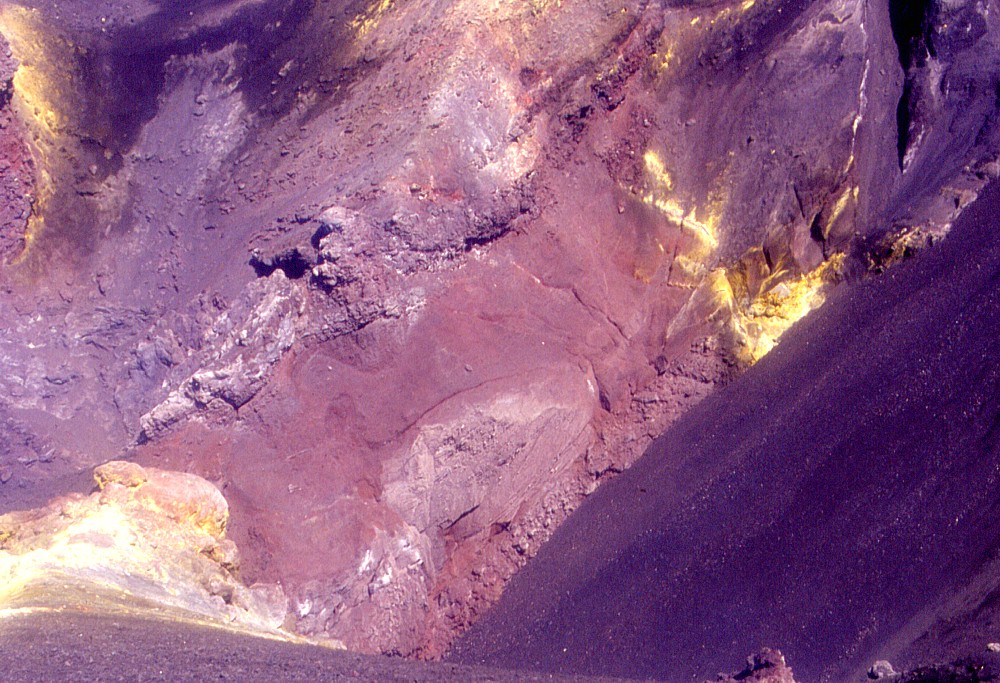
These
two photographs show an impressive, colourful crack that extends
over a distance of several tens of meters on the western rim of
the lower of the two newly formed craters. Formed not by eruptive
activity but by the slow settling of the rapidly accumulated pyroclastics
constituting the cone, the intense colors are due to sulfur precipitation
and oxidation due to hot gases still exiting the crack. The yellow
stuff is elementary sulfur deposits, while the red color marks strongly
oxidized zones |
 |
 |
Left:
the lower of the two new craters seen from its high northeastern
rim, similar to photo taken on 9 June but different light |
 |
 |
Left:
panoramic view taken from southern rim of the lower new crater looking
north, with the Southeast Crater in the background |
 |
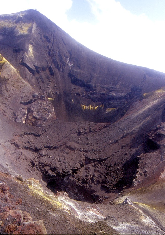 |
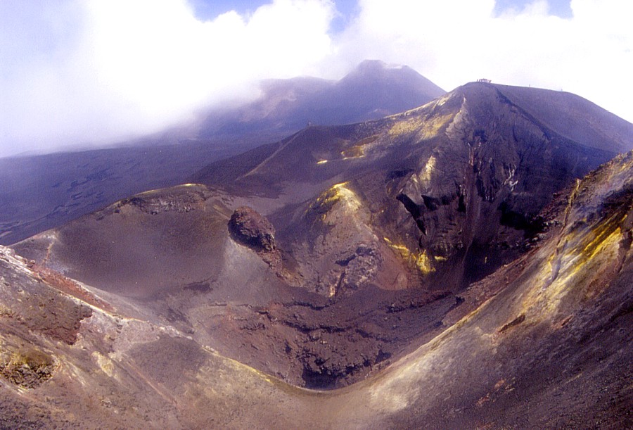
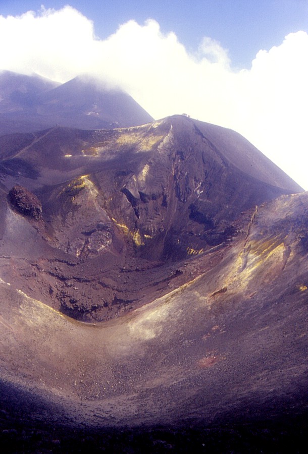
The spectacular world generated by the 2002-2003 eruption. These two photographs show portions of the interior of the upper of the two new craters, with numerous vents of various dimensions, which lie scattered in various locations within the crater and near its rim. Left view is from the southwestern crater rim, while that at right was taken from the southern rim. The Southeast Crater, partially hidden in cloud, lies in the distance. People standing on the high point on the far rim of the new crater indicate scale |
 |
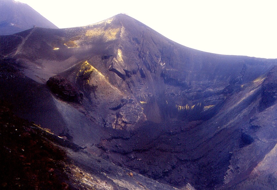 |
Left:
view of the northeastern portion of the upper new crater from its
southwestern rim |
 |
Etna, Piano Provenzana and Northeast Rift, 18 June 2003
Piano Provenzana and the eruptive vents that brought so much destruction during the first days of the 2002-2003 eruption were visited during the early morning of 18 June 2003, with the sun standing still low, which resulted in the strong reddish hue visible in may of these photographs.
 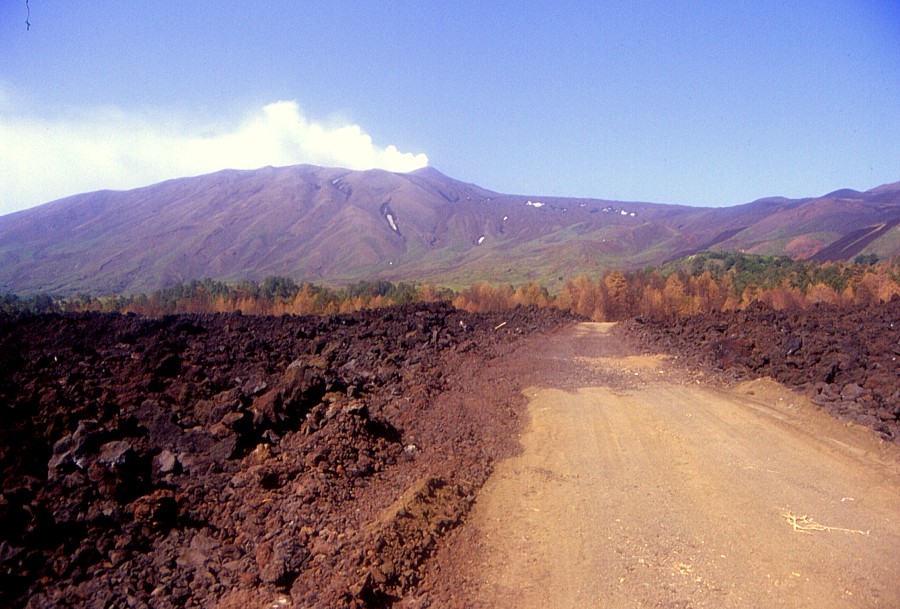 |
| Piano Provenzana, located on the north-northeastern flank of Etna at about 1850 m elevation, appeared to be the most peaceful spot on the volcano until that fateful morning of 27 October 2002. Within twenty-four hours the once verdant plain (photo above, taken in July 1999), the entire tourist complex it hosted, and large sections of the single access road were transformed into a desert of blocky lava. A new dirt road leading to the devastated place was constructed in March-April 2003 (photo below), but yet needs to be paved. |
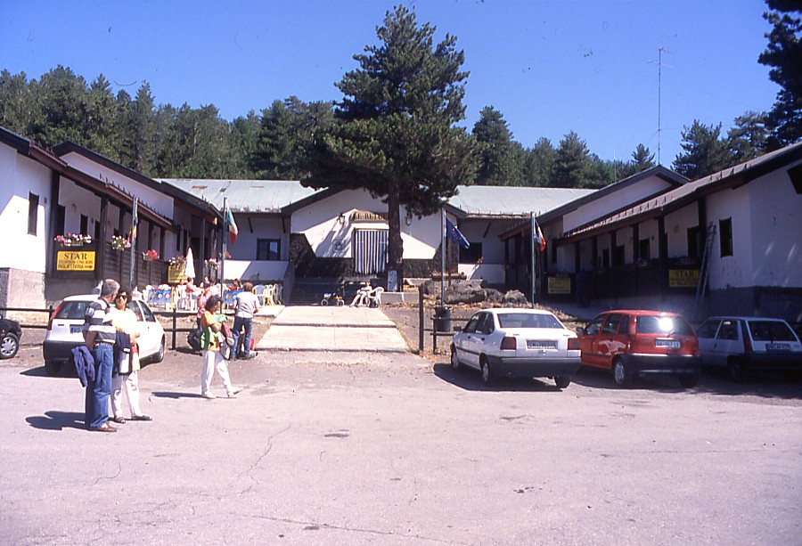 |
The largest of the tourist structures at Piano Provenzana, the hotel "Le Betulle", seen before the 2002-2003 eruption (left) and after (right). All that remains of this building is a few chunks of concrete mixed with lava |
 |
 |
Left:
another bit of the former hotel "Le Betulle": this was
the main entrance section, seen in the center of the photo above
at left |
 |
 |
The
second lava flow which covered the remaining part of Piano Provenzana
after 27 October 2002 came through a tremendous lava channel (left)
and spilled down the slope immediately above the hotel "Le
Betulle" (right) |
 |
 |
Left:
miniature vent lying on a grassy slope; lava flow that passed through
the valley in front of it came from higher upslope |
 |
 |
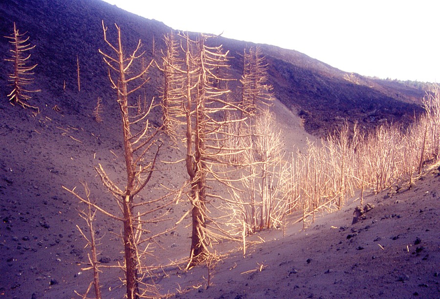
Two views of some of the larger vents of the Northeast Rift eruption in October-November 2002. A cone about 15-20 m high has formed around the main twin vent. Large cone in left background is Monte Nero, which erupted in 1646-1647. Note rapid return of vegetation |
 |
 |
Looking into the craters of the twin cone shown in previous photographs. The more northerly of these craters is seen at left, the more southerly at right. Note embryonal cone formed at the crater bottom in right photograph |
 |
 |
Left:
looking north along lowermost portion of the 2002 fisure |
 |
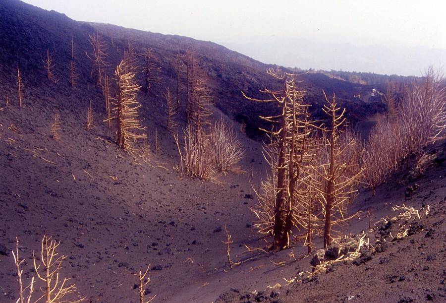 |
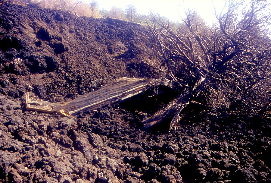
The "artistic" side of devastation: burned pine trees lying near some of the main vents of the 2002 Northeast Rift eruption above Piano Provenzana |
 |
Etna, Piano Provenzana and Northeast Rift, 22 June 2003
A second visit to Piano Provenzana and the nearby eruptive vents of the early phase of the 2002-2003 eruption (October-November 2002) was made on 22 June 2003, and some of the eruptive vents were studied in more detail. Differently to the visit four days earlier, there was stronger fumarolic activity in some sites. Furthermore it was possible to visit the main vent of the eruption, from which much of the lava which devastated Piano Provenzana was erupted. The lava flowed through a deep channel, resembling the "barrel of a gun" from which the lethal shot onto the tourist complex was fired.
 |
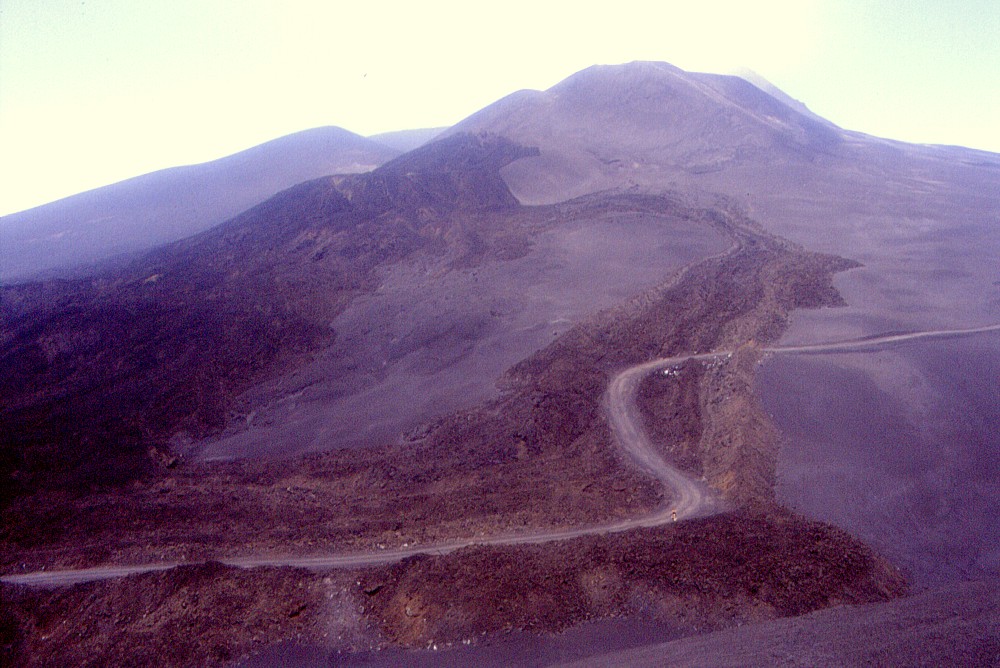
| Looking down at the site which once hosted the tourist facilities of Piano Provenzana, 22 June 2003. The view is from the ridge above the plain, which actually is the crest of a normal fault on the eastern margin of the Northeast Rift. Much of the plain is covered with lava from the first phase of the latest eruption, October-November 2002. New dirt roads have been laid across the lava field and are planned to represent the backbones of a new tourist complex, yet to be built |
 |
Left:
a closer look at the remains of the hotel "Le Betulle" |
 |
 |
Left:
steam issues from the rim of a small vent of the 2002 eruptive fissure.
Cones in the background are Monte Nero (left) and the largest cone
formed in 2002 |
 |
 |
"The barrel of a gun": this tremendous chasm was the vent which fed the main lava flow that destroyed Piano Provenzana, which issued through a deep lava flow channel |
 |
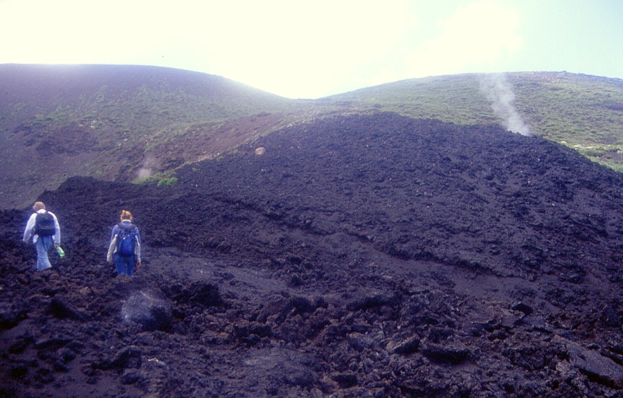
Etna, southern flank, 26 June 2003
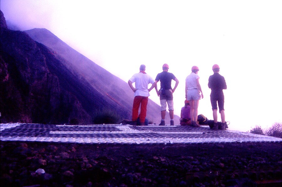
Like the 22 June visit to the Piano Provenzana area, the 26 June 2003 excursion to the craters of the 2001 and 2002-2003 eruptions on the southern flank was made together with a group of students from the Gymnasium Heidberg, near Hamburg, Germany. This was organized by Geology teacher Wolfgang Fraedrich, who had made similar excursions in the past five years, which I had the pleasure to accompany and support logistically as well. During the week between 22 and 28 June, we visited many areas on and around Etna, including the two major hikes at Piano Provenzana and on the southern flank. The group was highly motivated and enthusiastic, and remarkably apt to moving around in the often hostile terrains on the volcano. The 26 June excursion started at the huge craters formed during the 2002-2003 eruption and led to the "Belvedere" lookout, the large cone formed during the 2001 eruption (Monte Josémaria Escrivà), the Montagnola, and the 2001 vents at 2100 m elevation.
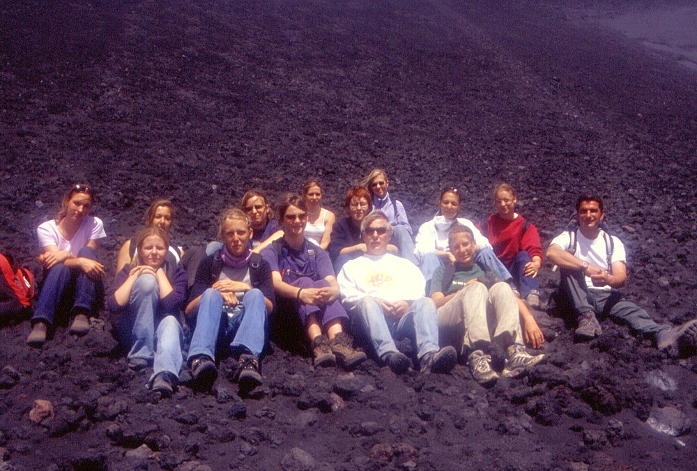 |
| Excursion group from the Gymnasium Heidberg, Hamburg, Germany, at the eastern base of the huge pyroclastic cones formed during the 2002-2003 eruption. Mountain guide Andrea Mazzaglia is at right, Geology teacher Wolfgang Fraedrich in the center. Thanks to all of you for making this a truly memorable hike! |
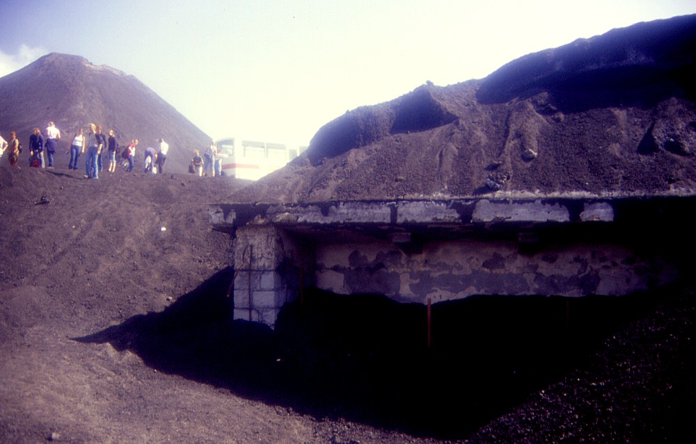 |
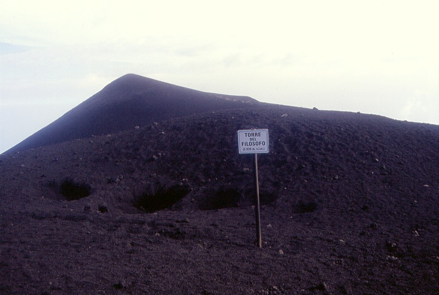
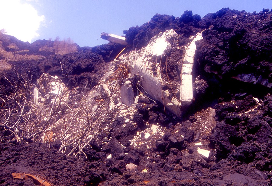
Left:
recent excavations have revealed a corner of the Torre del Filosofo
mountain hut, which had been completely buried by pyroclastics during
the 2002-2003 eruption |
 |
 |
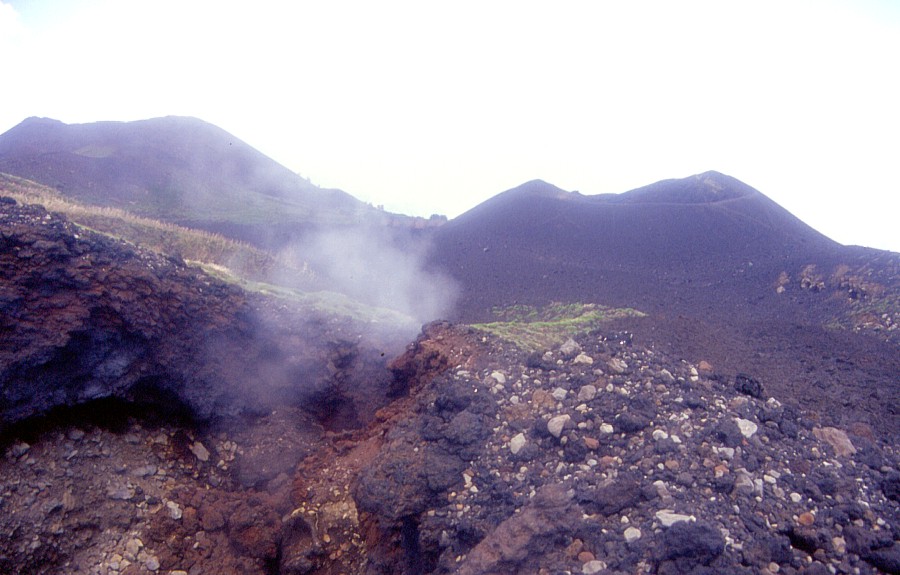
Left:
effusive vent on southern side of the complex pyroclastic cone formed
during the 2002-2003 eruption. View is from southern rim of the
lower of the new craters |
 |
 |
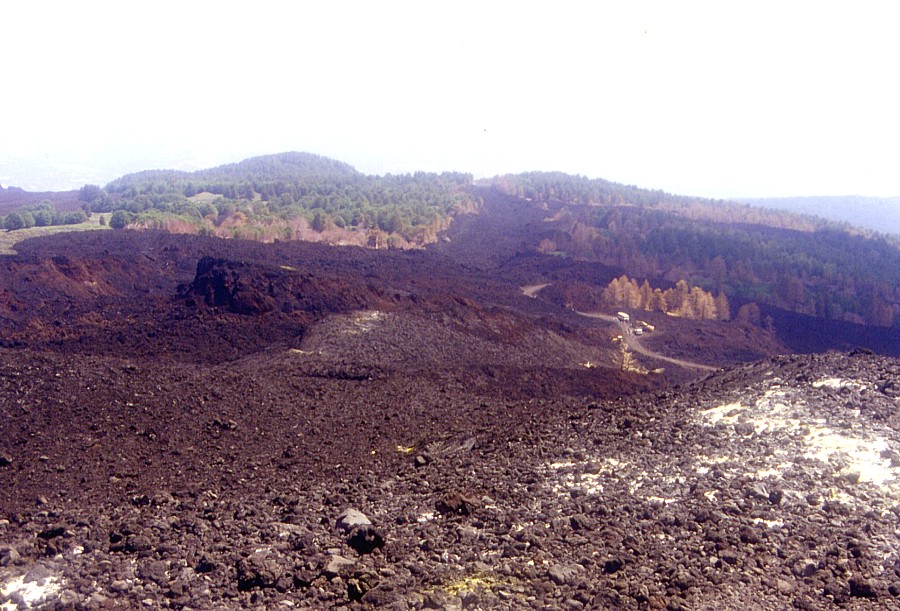
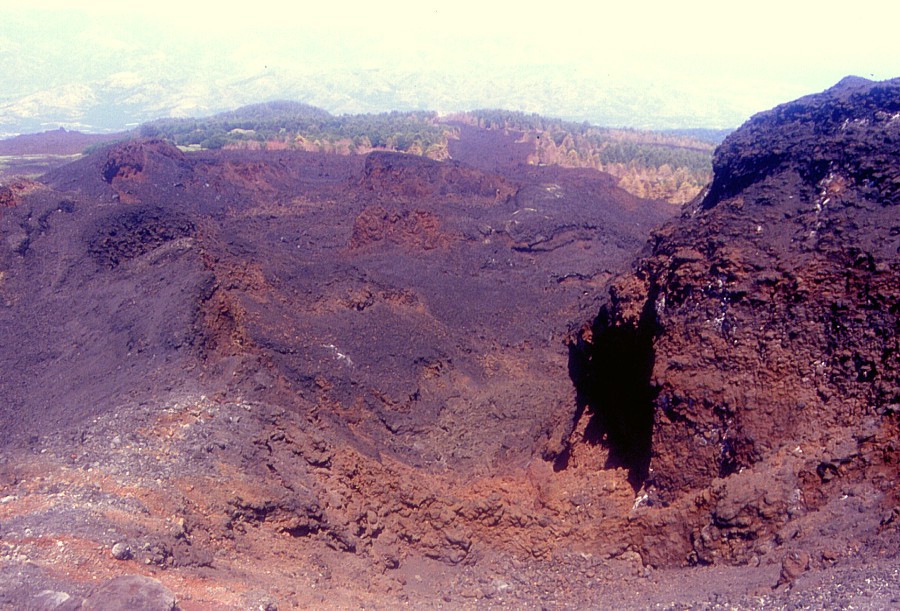
Two more views of the incredibly colorful world of the lower of the two craters formed during the 2002-2003 eruption. View is from east to west. Right photograph shows prehistoric cone of Monte Frumento Supino in the background |
 |
 |
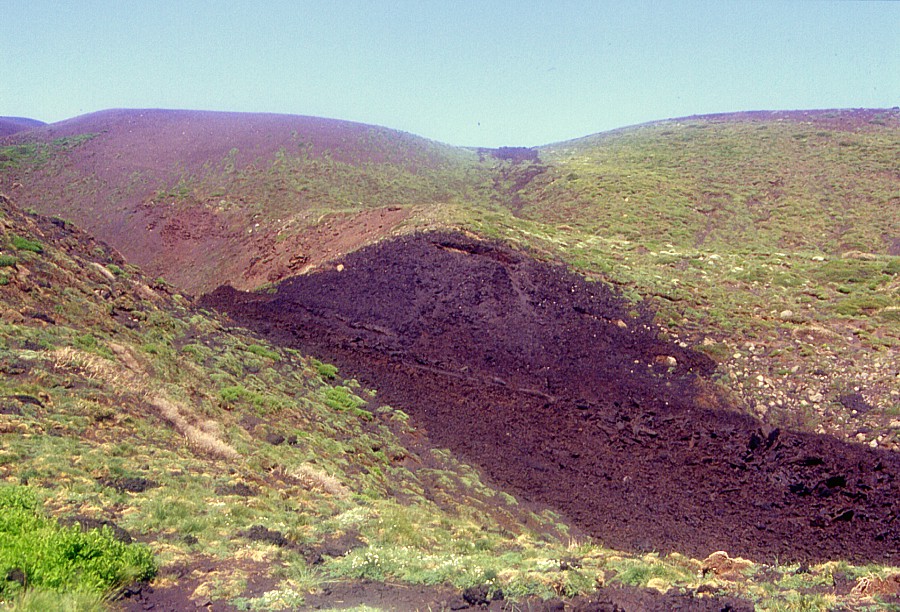
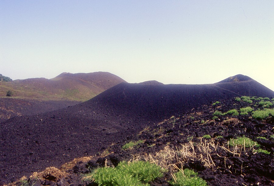
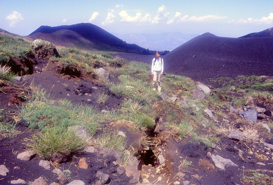
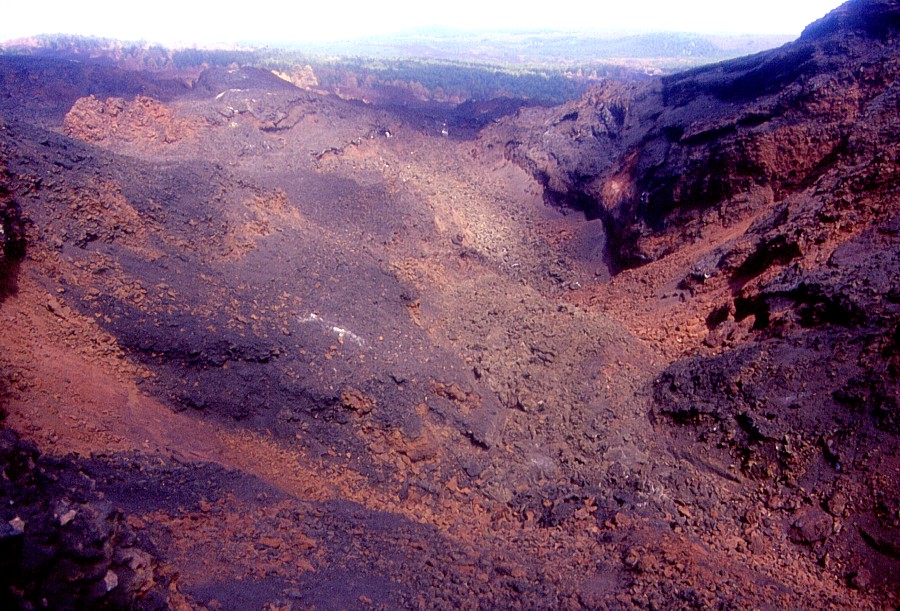
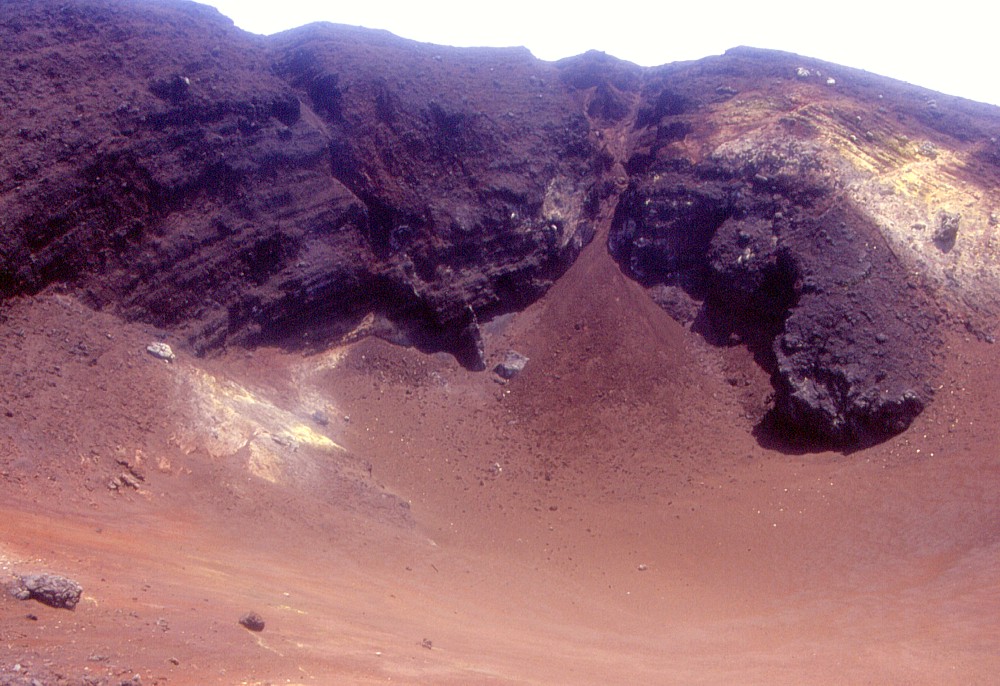
During the 2001 eruption, a large pyroclastic cone grew at about 2570 m elevation on the southern flank. Left image is a view from that cone toward the new, still larger cones formed in 2002-2003 and their lava flows. Right image shows the crater of the 2001 crater, filled with large amounts of 2002-2003 pyroclastics |
 |
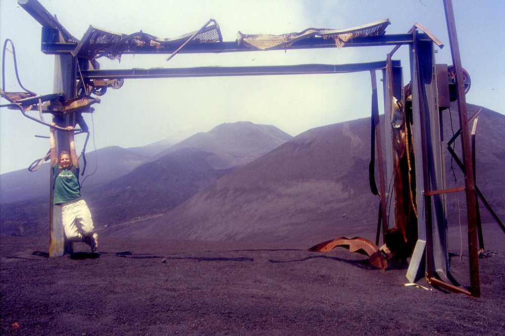 |
Left:
the suggestive ruin of a ski lift near the Montagnola, destroyed
by heavy pyroclastic bombardment in 2001 and covered with more tephra
in 2002-2003 |
 |
Copyright © Boris Behncke, "Italy's Volcanoes: The Cradle of Volcanology"
Page set up on 11 June 2003, last modified on 29 June 2003