
| Etna
index |
||
| Geology | Geological history | Cones and craters |
| Eruptive characteristics | Eruptions before 1971 | Eruptions since 1971 |
| Etna and Man | References | Web sites |
| Weather forecasts | FAQ | Latest news |
 |
One
of the most remote of Etna's flank cones, Monte Moio lies about
18 km from Etna's summit to the north, on the far side of the
Alcantara river. Monte Moio is the largest in a small cluster
of cones, of which the second largest lies to the right (north)
of the main cone. In spite of its youthful morphology, Monte Moio
is older than 6000 years. The view in this photograph, taken in
late June 1998, is to the ESE; the main edifice of Etna lies out
of the view to the left |
Mamma
Etna's countless children
Monte Moio
N flank, 15.047027° E, 37.909097° N
Summit elevation: 703 m (W crater rim)
![]()
Approximately
95 per cent of Etna fall into the province of Catania, and only a small
fraction belongs to the neighboring province of Messina, to the north.
This includes one of Etna's more than 300 flank cones, Monte Moio, which
is also the only one of Etna's eruptive centers to lie on the northern
side of the Alcantara river. Monte Moio is one of the most distant flank
cones of Etna, lying approximately 18 km from the summit. It is a quite
sizeable cone that rises almost 150 m above its south base and seen from
south it appears quite symmetrical. On its northern side, however, there
lies a second, lower cone with an ill-defined crater that results from
the same eruption that created Monte Moio. The crater of Monte Moio itself
is perfectly circular and about 250 m in diameter; a deep notch is cut
into its northern rim. The eruption that created Monte Moio and the smaller
northern cone is by some sources referred to an eruption in 396 B.C. but
stratigraphic work by Branca (2003) has shown that it is older than 6000
years. A lava flow travelled from Monte Moio for a few kilometers along
the Alcantara valley, blocking the river and causing flooding upstream.
An abandoned quarry at the eastern base of the cone yields interesting
insights into the eruptive dynamics during the formation of the cone.
Besides a main unit composed mainly of reddish scoriae there are numerous
units, especially at the top of the pyroclastic sequence, which consist
of lighter-colored material that contain abundant lithic fragments and
possibly were deposited during phreatomagmatic activity. The close proximity
of Monte Moio to the Alcantara river makes a scenario of phreatomagmatic
activity quite realistic, as the ascending magma probably interacted explosively
with groundwater.
At the southern base of the cone lies the village of Moio Alcantara, whose
inhabitants, with some pride, consider the nearby volcanic edifice their
own proper volcano and not just one of the more than 300 craters of Etna.
A second village, Malvagna, lies about 1 km to the NNE. The riverbed of
the Alcantara lies no further than 1.5 km to the south. Today Monte Moio
is something like a small public park, with a trail leading up to the
crater; unfortunately this trail is not well maintained and overgrown
by rapidly expanding vegetation. The smaller northern cone is used for
gardening, whereas the main crater bears only a few trees and bushes along
with grasses. The view from the summit across the Alcantara valley to
the distant main edifice of Etna is impressing, as is the view toward
the much nearer Monti Nebrodi.
I first visited Monte Moio in the spring of 1998, and returned in May
2002 and June 2003. The photographs on this page were taken during the
first and latest of these visits.
 |
 |
 |
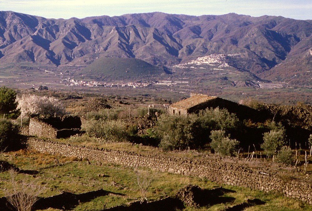
Left:
View from the Solicchiata area toward the cone of Monte Moio,
approximately 6 km to the northwest, in February 1998, with the
Nebrodi Mountains in the background. The village of Moio Alcantara
lies in front of the cone that is covered with green vegetation,
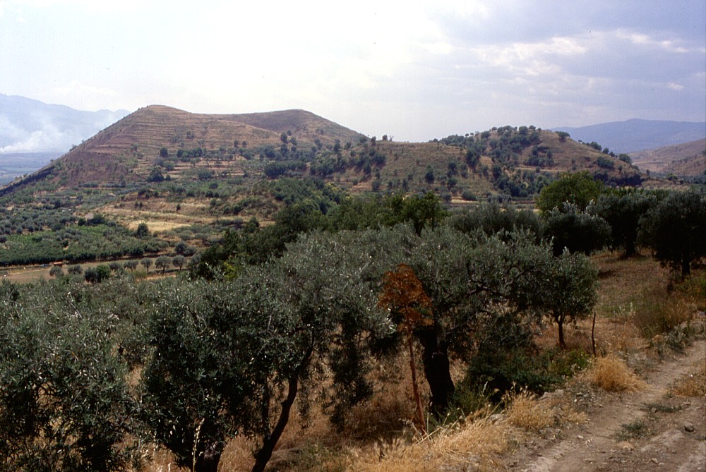
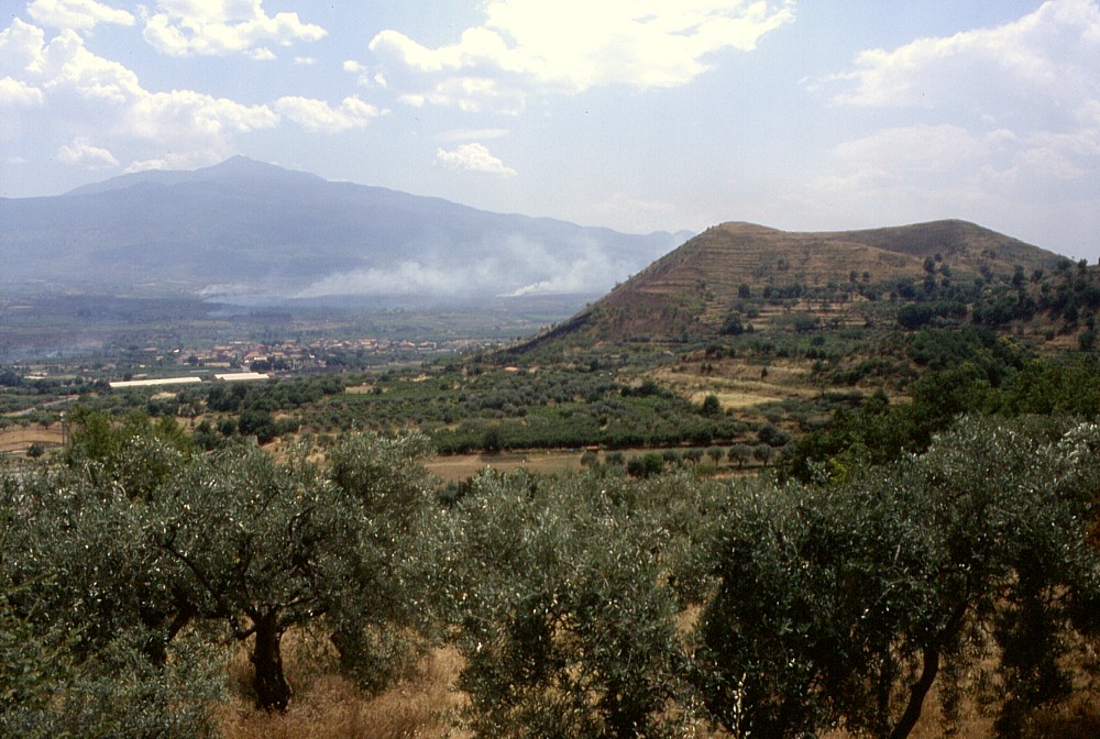
and behind the cone to the right lies Malvagna Center: Monte Moio (right) and the huge main edifice of Etna in the left background in late June 1998, seen from north. Smoke plume in middle ground is from forest fires, not volcanic activity Right: Monte Moio seen from SSE, with the village of Moio Alcantara lying before it and Malvagna behind it to the right, and the Nebrodi Mountains in the background. Photo taken in late June 1998 |
||
 |
 |
 |
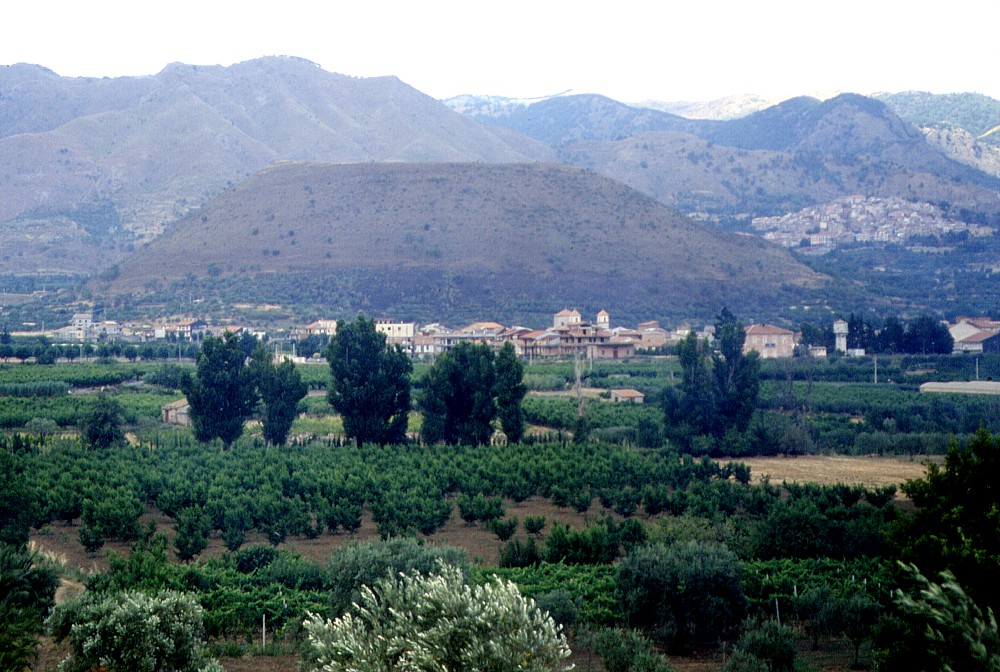
Left:
view across the crater of Monte Moio toward northwest, showing steep
slopes of the Monti Nebrodi in the background. Photo taken in June
2003 Center: the main edifice of Etna seen from the summit of Monte Moio in June 2003. The summit of the volcano lies about 18 km away Right: outcrop of pyroclastic deposits making up the main cone of Monte Moio, on the lower eastern flank of the cone, June 2003 |
||
 |
 |
 |
Outcrop
on eastern lower flank of Monte Moio (this is an abandoned quarry)
showing the complex stratigraphy of the pyroclastic deposits making
up the cone. The main unit, seen in the center an right photographs,
consists mainly of reddish oxidized scoriae of fairly uniform grain
size (lapilli), but in its lower half several lighter-colored layers
enriched in lithic blocks indicate possible brief phases of phreatomagmatic
activity. The top sequence, seen in left photograph, consists of
alternating reddish scoria and light-colored layers, the latter
becoming predominant upward in the sequence. This indicates a strong
phreatomagmatic component in the waning stages of the Monte Moio
eruption. Interaction of magma with groundwater in this eruption
appears quite plausible, since the cone lies close to the Alcantara
river. Photos taken in June 2003 |
||
Copyright © Boris Behncke, "Italy's Volcanoes: The Cradle of Volcanology"
Page set up on 22 February 2004