
| Etna
index |
||
| Geology | Geological history | Cones and craters |
| Eruptive characteristics | Eruptions before 1971 | Eruptions since 1971 |
| Etna and Man | References | Web sites |
| Weather forecasts | FAQ | Latest news |
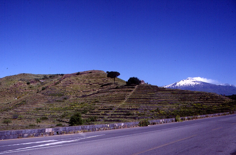 |
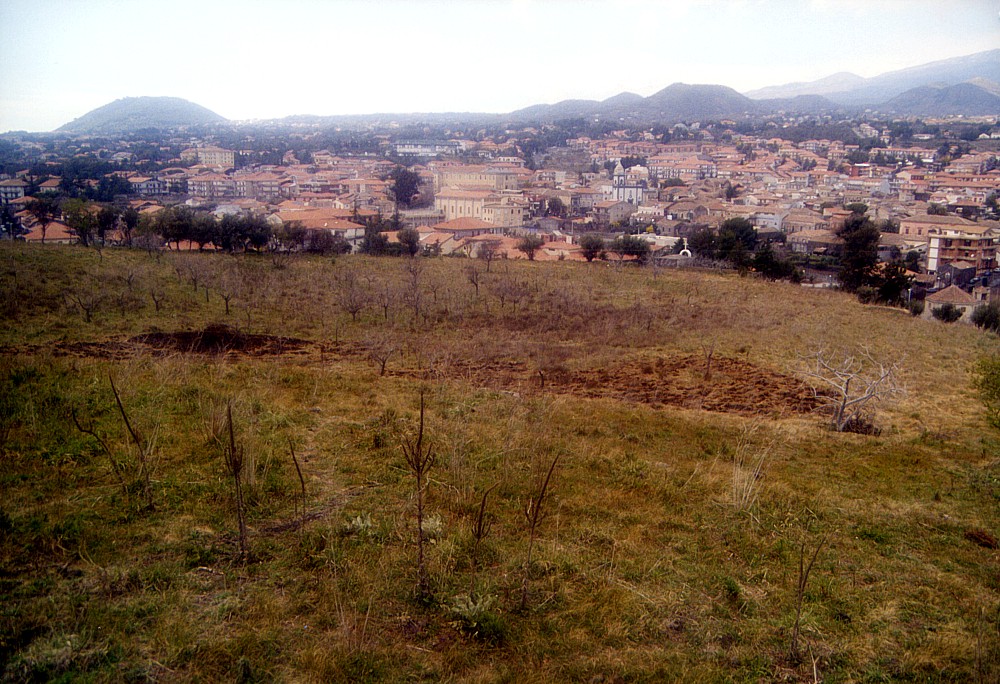
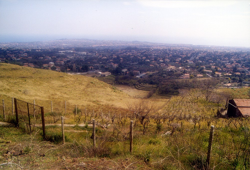
South
flank of the prehistoric and strongly terraced complex cone of
Monte Troina near the town of Pedara, with the snow-covered main
edifice of Mount Etna in the background, 12 May 1996. Monte Troina
consists of several nested cones, the southernmost of which, seen
in this photograph, is open to the south and actually contains
a small, horseshoe-shaped nested cone whose rim forms the sharp
rim in the left portion of the image |
Mamma
Etna's countless children
Monte Troina
SE flank, 15.060314° E, 37.611419° N
Summit elevation: 632 m (SW crater rim)
![]()
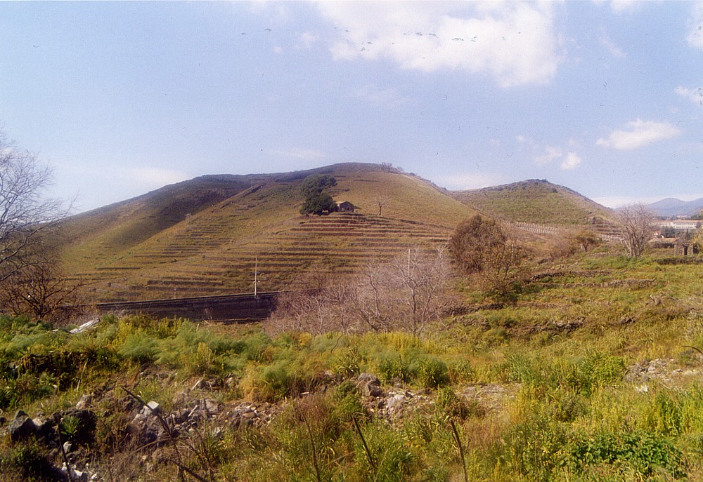
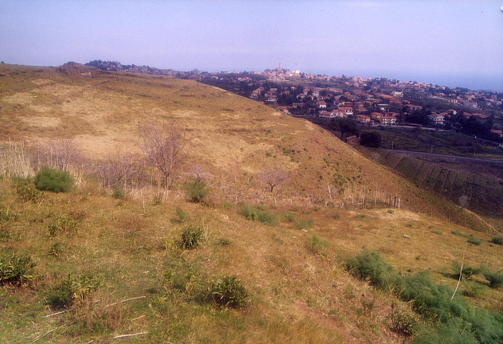
Lying
immediately to the south of the center of the town of Pedara, Monte Troina
is a complex of three coalesced cones lying along a NNW-SSE-trending eruptive
fissure with a minimum length of 700 m. The age of Monte Troina is certainly
prehistoric, and it appears more strongly modified by agricultural activity
than most other flank cones in the area. It is possible that further small
edifices produced by the same eruption lie on the northern extension of
the aforementioned fissure, beneath the historical center of Pedara.
The cone complex of Monte Troina has three major craters, the southernmost
of which is open to the south and appears to contain, on its southern
side, a small nested cone which is also open to the south; the shallow
central crater has a prominent breach on its southeast side, while the
equally shallow northernmost crater is inclined toward north. A sanctuary,
unfortunately almost entirely constructed of concrete and thus aesthetically
, lies on the northern rim of the northern crater. On the northern side,
near the town of Pedara, the height of Monte Troina is only about 20 meters,
but its summit stands nearly 100 m above the south base of the cone complex.
At the south base of Monte Troina lies a peculiar, broad and irregularly
shaped depression which might be a collapsed effusive vent or an explosion
crater. An investigation of the deposits on the rims of the southern crater
failed to reveal any lithic material that would have been ejected from
a nearby explosion crater, so that an origin by collapse of the depression
at the south base is more likely.
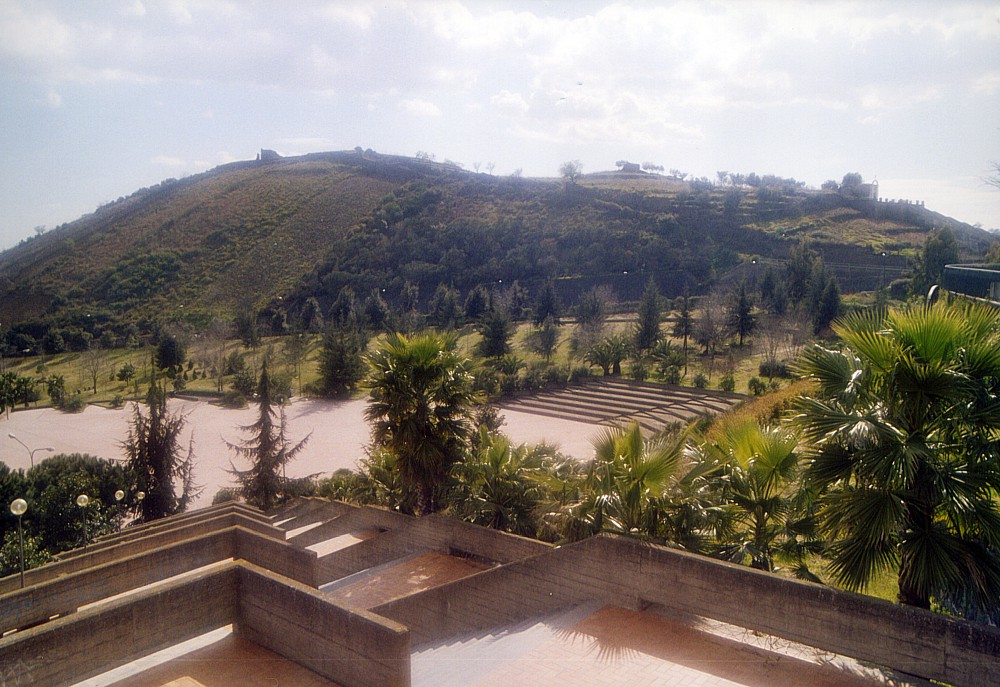
I first climbed Monte Troina on 5 March 2004, when most of the photographs
shown on this page were taken. Access to this complex of pyroclastic cones
is relatively easy; a small footpath leads to the summit area immediately
to the east of the concrete sanctuary on the northern side of the complex.
Small tracks go across all of the summit area, whose vegetation is relatively
sparse, and a visit to this area offers fine panoramic views over nearly
all of the numerous pyroclastic cones on the southern and southeastern
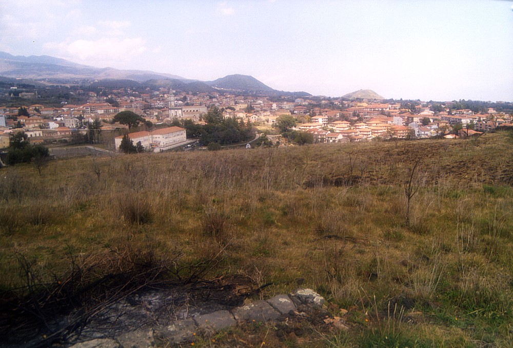
flank of Etna, and invites the visitor to marvel at the dense urbanization
of the area.
 |
 |
 |
Left:
when seen from east, the elongated shape of the Monte Trigona cone
cluster is quite evident. Actually it consists of two large and
two small, partially overlapping or nested cones. Stadium of Pedara
town is in the foreground Center: southeastern face of Monte Trigona, showing southern cone in foreground, and the narrow notch at left is a smaller crater surrounded by a low, horseshoe-shaped cone that lies within a larger crater open to the south. On the right side of the cone complex, another notch is seen opening in the southeast side of the central crater Right: silent neighbor with a violent past, Monte Troina rises behind the public garden of the town of Pedara. View is toward southwest. Photos taken 5 March 2004 |
||
 |
 |
 |
Left
and center: the smallest and northernmost of the three summit craters
of Monte Troina is an extremely shallow depression showing an overall
northward inclination. Left view is from southwest and right view
from southeast rims of the crater, with different portions of the
town of Pedara and several other flank cones in the background Right: largest of the three craters of Monte Troina, lying in the central portion of the cone complex. Notch in southeastern rim of this crater is seen at right. Photos taken 5 March 2004 |
||
 |
 |
 |
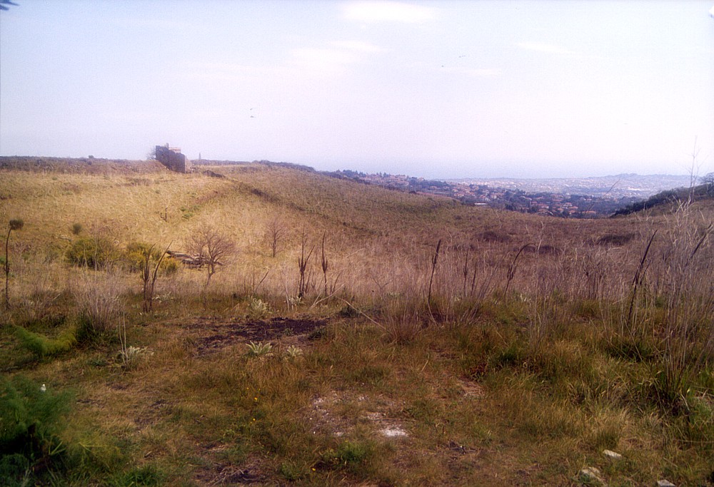
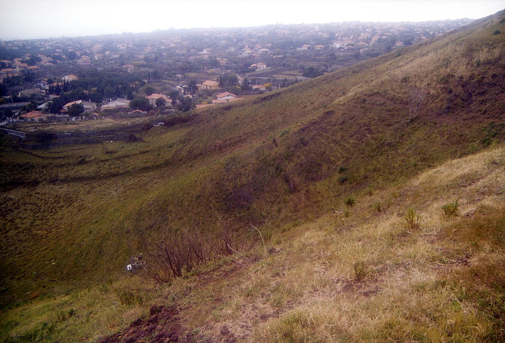
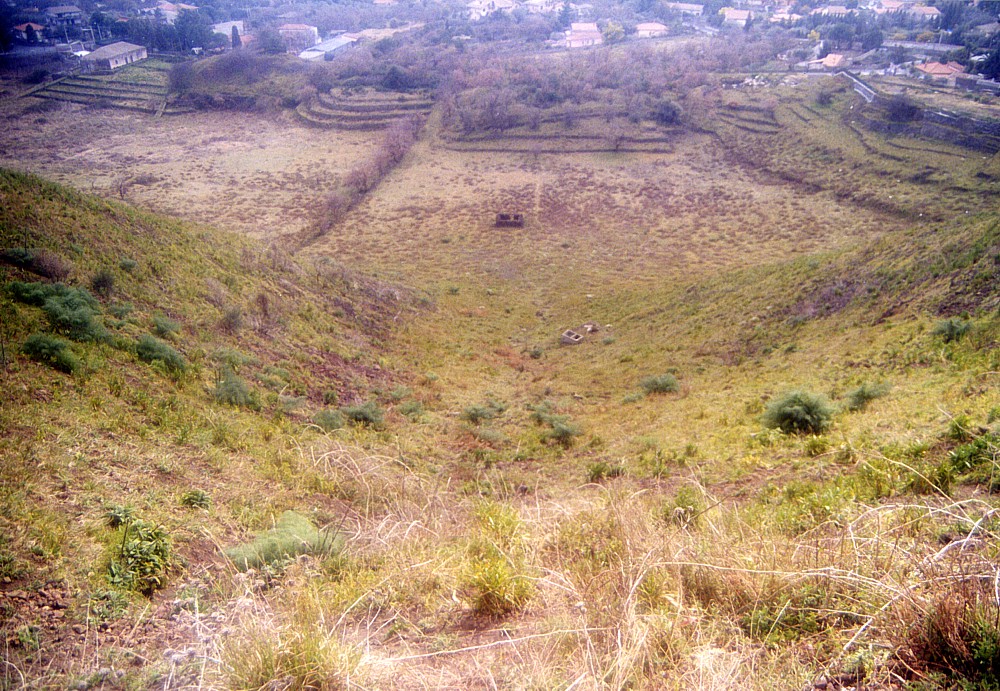
Southernmost
of the three Monte Troina craters. Left image is a view from its
western rim toward east, center image is looking in opposite direction
from east rim, and right image is a view down from the north rim
through the breach in the south side of the crater. Note dense urbanization
in background. Photos taken 5 March 2004 |
||
 |
 |
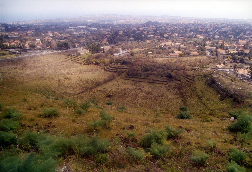 |
Left:
difficult to recognize in photograph, but this view shows the nested
"inner" southern crater, whose southward opening is seen
as a kind of trench in the center of the image; rim of the "outer"
southern crater is seen in center-left background Center: looking straight down through the open south side of the "inner" southern crater, onto the floor of a large depression that lies at the south base of Monte Troina - possibly a collapsed effusive vent Right: a more complete view of the depression at the south base of Monte Troina. The small dark cone of Monte Trigona can be seen in the distance, surrounded by buildings. Photos taken 5 March 2004 |
||
Copyright © Boris Behncke, "Italy's Volcanoes: The Cradle of Volcanology"
Page set up on 1 March 2004, last modified on 11 March 2004