
| Etna
index |
||
| Geology | Geological history | Cones and craters |
| Eruptive characteristics | Eruptions before 1971 | Eruptions since 1971 |
| Etna and Man | References | Web sites |
| Weather forecasts | FAQ | Latest news |
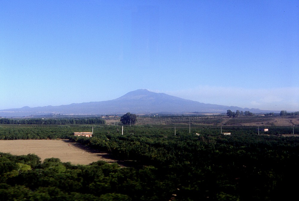 |
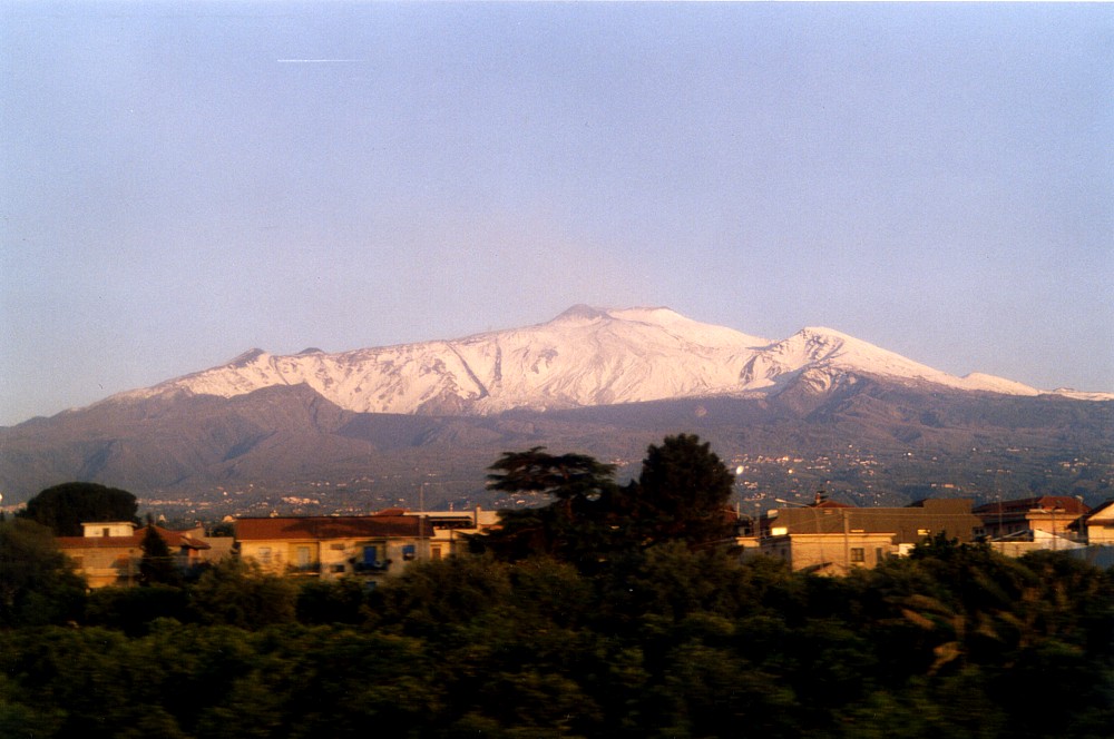
| This
is a photograph of a volcano that is going to erupt vigorously eight
days later, from two fissure systems on its southern (near) and
northeastern (far) flanks. This is how Mount Etna looked like on
19 October 2002, when viewed from the Catania-Palermo highway near
the town of Motta Sant'Anastasia. That morning there are some emissions
of brownish ash from one of the summit craters, but otherwise the
volcano is quiet, quieter than during the preceding four months. This is the story of the year 2002 at Etna, before its dramatic eruption that started during the night of 26-27 October 2002, before Piano Provenzana was devastated and the tourist complex around the Rifugio Sapienza had to endure in a peculiar "cat-and-mouse-game" that the volcano liked to play over a period of two months. The story begins in a period of quiet and peace, in January 2002, and continues in much the same manner until six days before the eruption |
Etna
photo gallery: 2002
Before the mountain moved - January to October 2002
![]()
This photo gallery covers the ten-and-a-half months period before the 2002-2003 eruption, during which I made only occasional visits to Etna, but took a large quantity of photographs to document the changes caused by the 2001 eruption. Many of these have become historical documents indeed, for they show scenes and features which no longer exist. They also show how little indicators there were of a great new eruption, much bigger and destructive than its predecessor in the summer of 2001.
Climbing Etna on a splendid winter's day, 30 January 2002
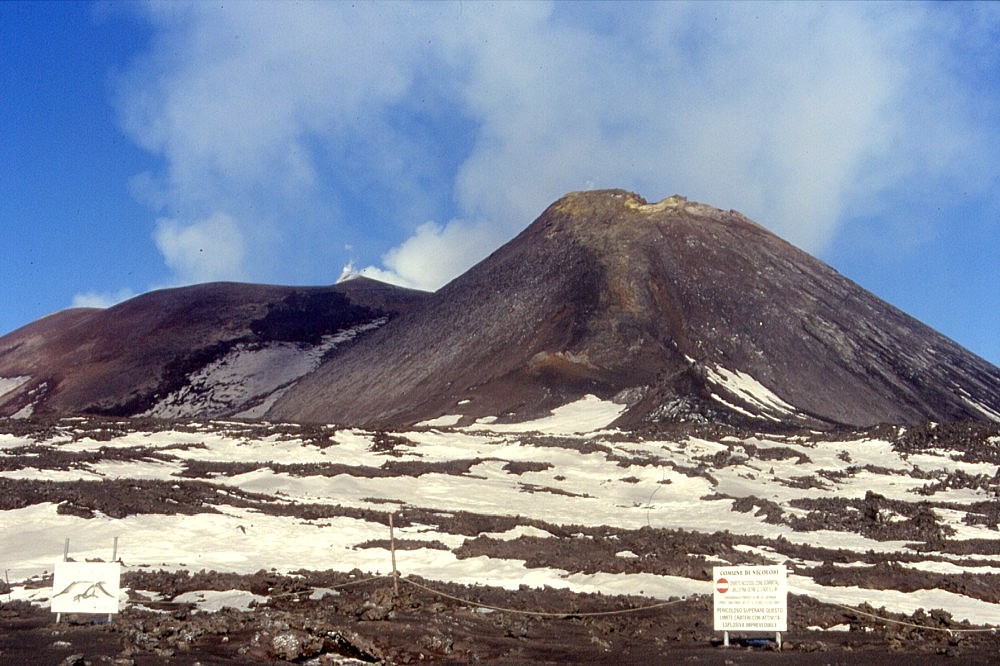 |
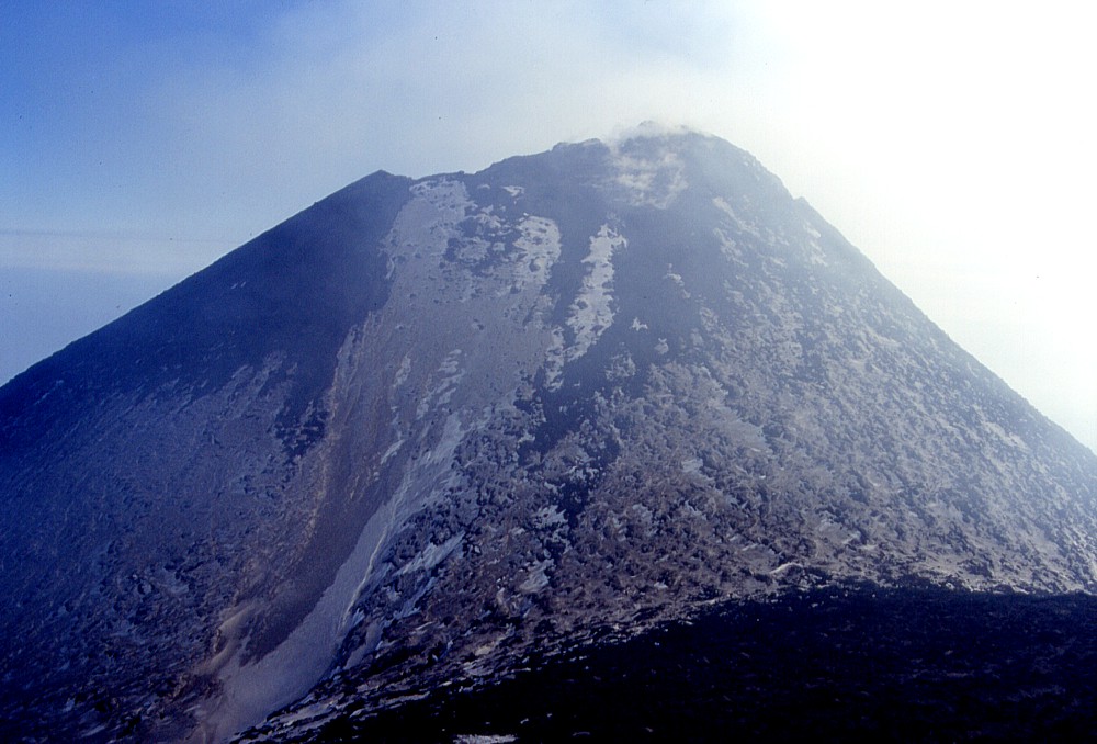
The
view from the Torre del Filosofo mountain hut toward the summit
craters is dominated by the proudly rising cone of the Southeast
Crater, which in this perspective appears even taller than the
old central summit cone (in left background), although it is slightly
lower. The bulk of this cone formed during a total of 105 episodes
of violent lava fountaining between September 1998 and July 2001,
but as of early 2002, when this photo was taken, the eastern portion
of its summit is beginning to crumble. Yellow sulfur deposits
are visible at the summit and also form a conspicuous stripe on
the southern (near) side of the cone, which coincides with a fissure
that reopened during nearly all of the paroxysmal eruptive episodes
of the year 2000 but remained inactive during their successors
in the spring and early summer of 2001. At the lower end of this
fissure, a small cone formed in the spring of 2000, which was
called "Sudestino" (little Southeast). To the right
of it, half-covered with snow, there is dark, steep-sided cone,
which formed during the July-August 2001 flank eruption |
 |
 |
 |
 |
 |
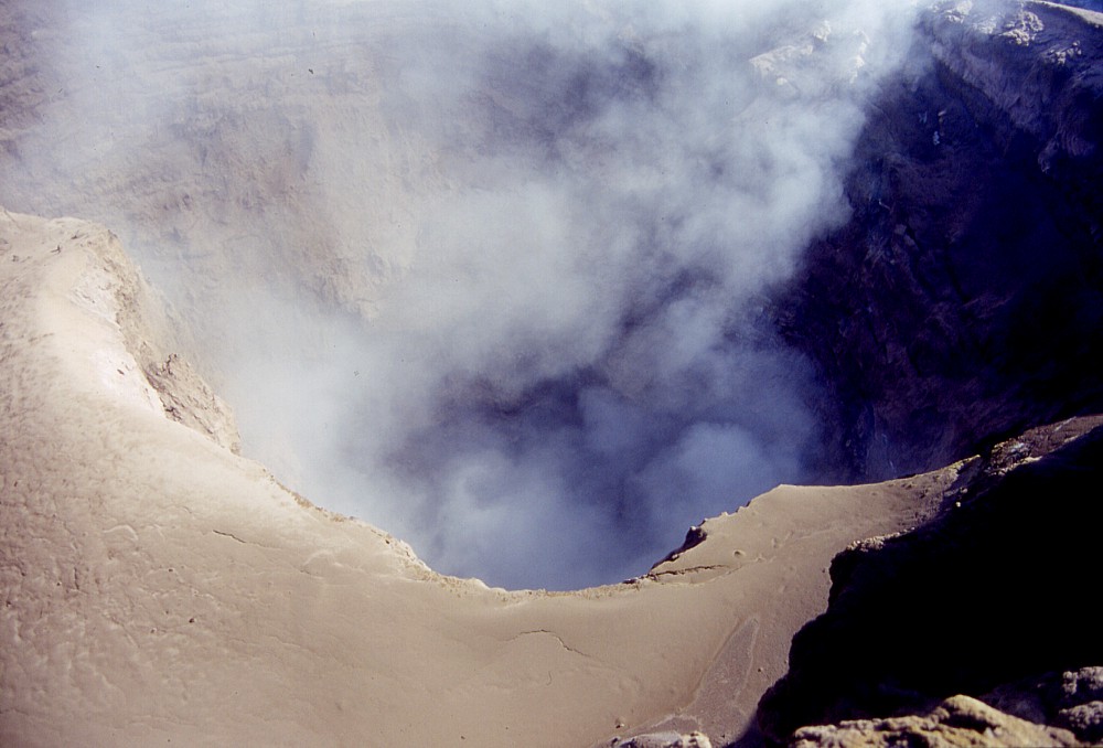 |
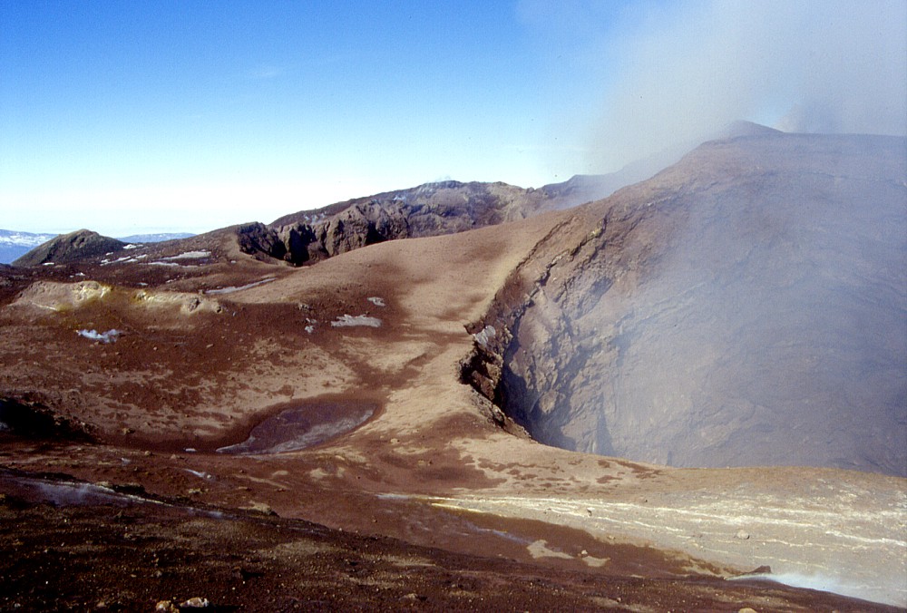
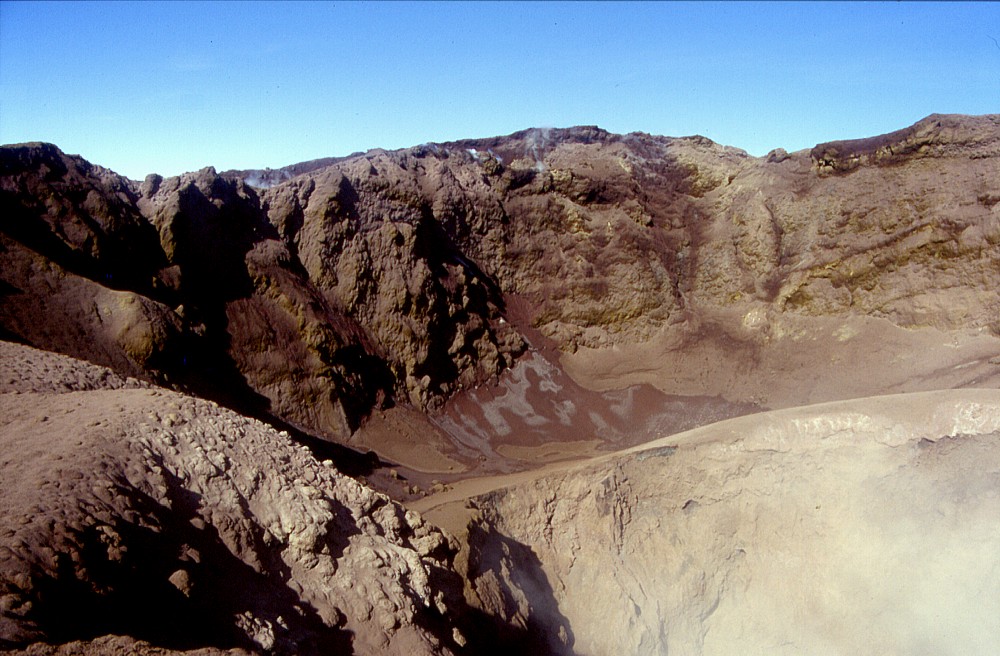
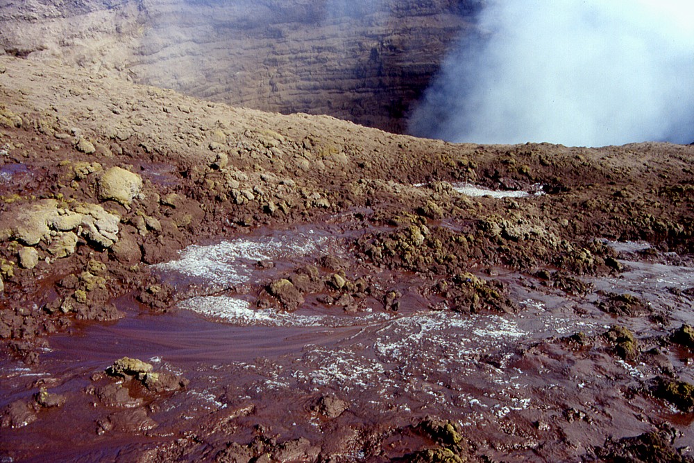
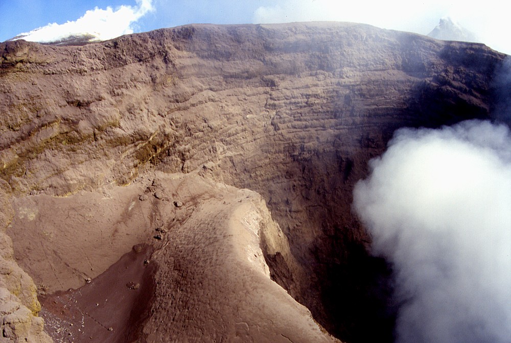
The
incredible landscape of the Bocca Nuova, a crater that was not
there before June 1968 and transformed into an enormous pit over
the first 30 years of its life before it was filled to overflow
in October-November 1999. Following the spectacular 1999 eruption,
collapse resumed at the two main vents that had existed within
the Bocca Nuova for at least five years before, forming two new
pits in its northwestern and southeastern parts. Top left: panoramic view from the southeastern rim of the Bocca Nuova to the southeastern (right) and northwestern (far left) pits piercing the crater floor Top center: a look into the southeastern pit of the Bocca Nuova, revealing numerous alternating lava flows and pyroclastic levels in the walls of the pit, which were deposited during the October-November 1999 eruption. Diameter of the pit is approximately 120 m Top right: northwestern portion of northwestern pit of the Bocca Nuova. Lower right corner of image shows the rim of an inner pit, which lies in the southeastern portion of the great pit. The flat terrace surrounding the inner pit was formed during the intermittent intracrater activity between September 2000 and April 2001 Bottom left: view of the terrace surrounding the inner pit (at lower right) within the northwestern pit of the Bocca Nuova, taken from the southern rim of the pit Bottom center: southern rim of the northwestern pit of the Bocca Nuova. In the foreground melting ice forms small flows of mud on the surrounding crater floor Bottom right: a view into the northwestern pit from its western rim, showing inner pit emitting gas. Not visible, but well audible on that day (30 January 2002) were deep-seated explosions which did not throw out any solid material but were very loud and impressive to whoever witnessed them while standing on the rims of the pit |
||
 |
 |
 |
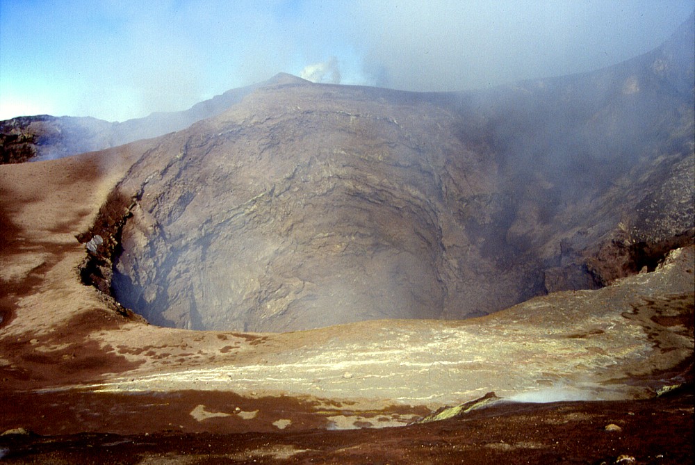
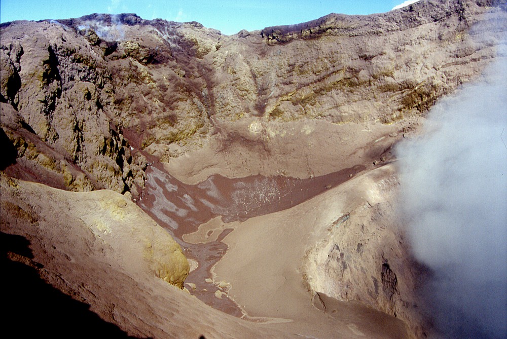
Left:
another view of the northwestern pit of the Bocca Nuova and its
degassing inner pit. Like the neighboring southeastern pit, this
pit shows an impressive succession of pyroclastic horizons alternating
with thin lava flows, which all constitute the voluminous crater
fill emplaced during the October-November 1999 eruption within
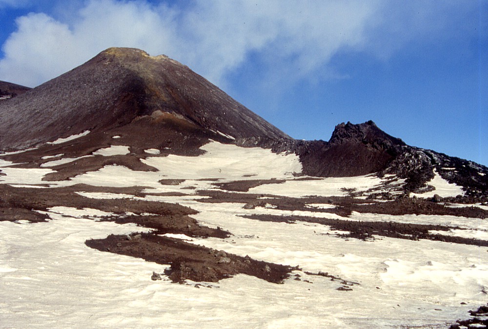
the Bocca Nuova Center: the steep cone of the Southeast Crater, seen from the eastern rim of the Voragine. Inactive since the 2001 eruption, the cone is largely covered with snow, but new fumaroles are active on its western (right) rim since the beginning of 2002 (and yet the Southeast Crater did not participate in any way neither during the 2002 summit activity nor during the 2002-2003 flank eruption) Right: the Southeast Crater is not alone, but several smaller features have formed since early 2000 at its southern base. The first of these formed in the spring of 2000 and built a small cone named "Sudestino", which is visible right in front of the Southeast Crater cone; the first vents to open during the 2001 flank eruption (at about 2950 m elevation) built up a short row of large "hornitos" or spatter cones, the largest of which is visible at right |
||
Distant glimpes of Etna, April-May 2002
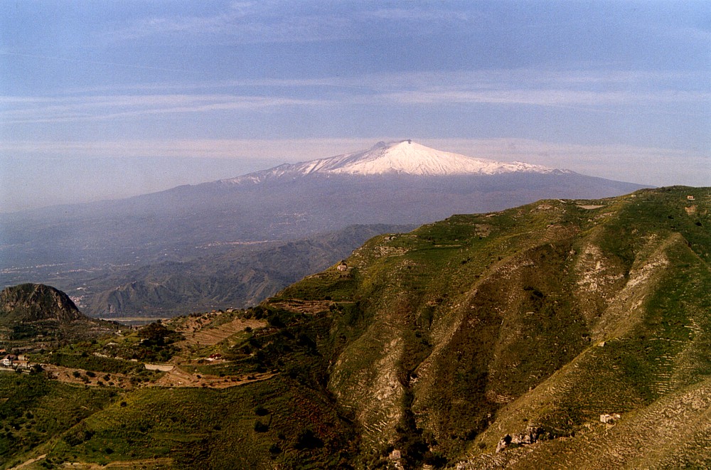 |
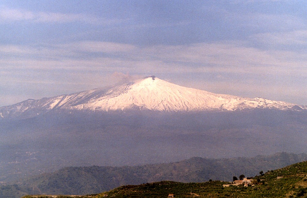
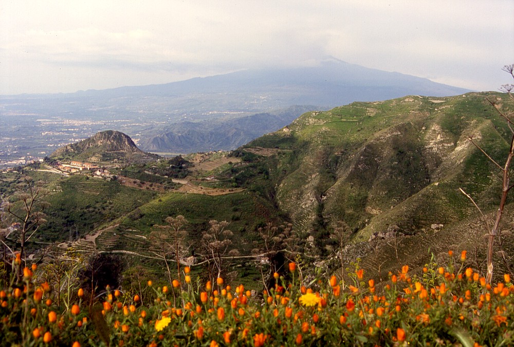
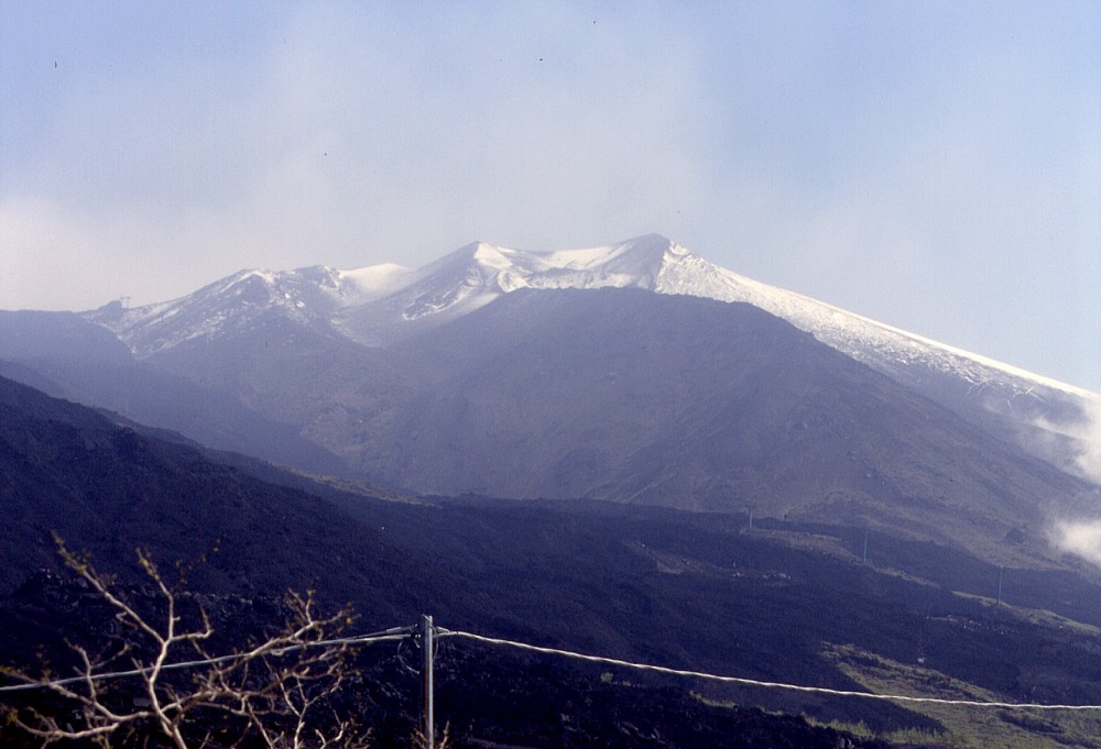
A
brilliantly clear view of snow-covered Etna from the scenic hills
above the town of Taormina, one early morning in mid-April 2002.
Note the melting of snow in the summit area (the cone of the Southeast
Crater is seen standing to the left of the summit, while the tallest
peak (actually 3318 m in elevation) is the Northeast Crater. Some
melting of snow is taking place on that crater as well |
 |
 |
 |
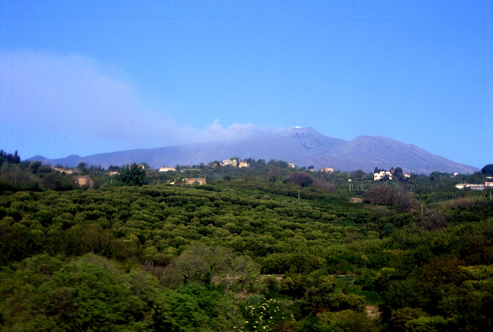
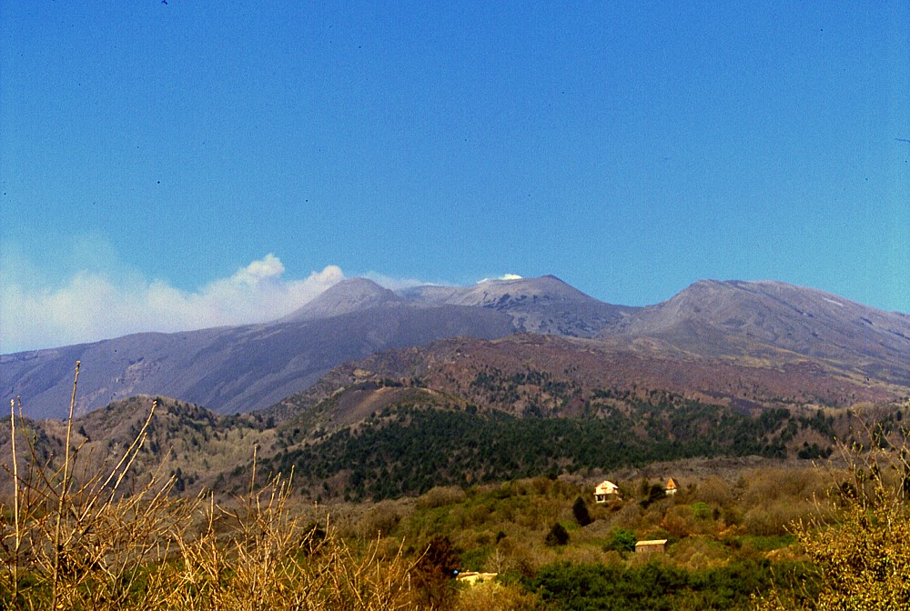
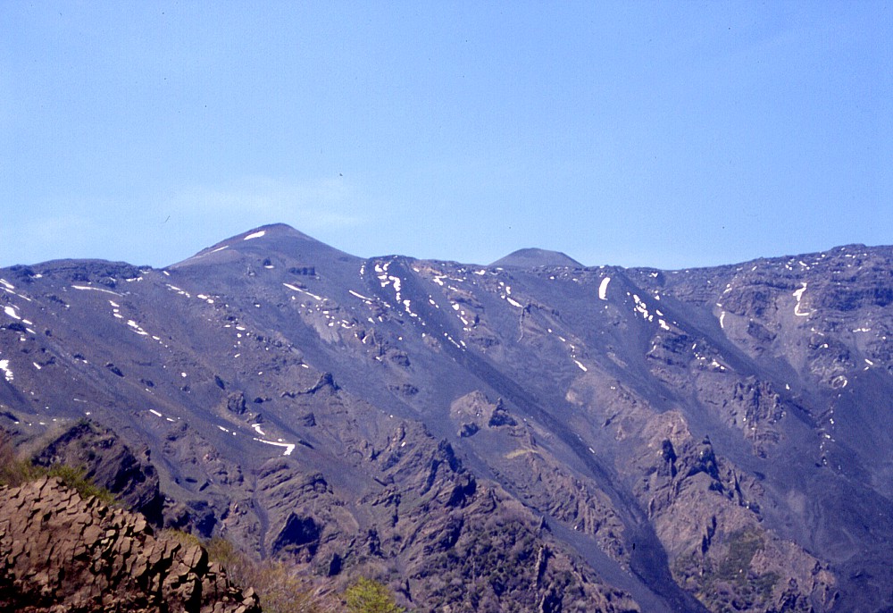
Scenes
of Etna seen from the east (from the northeast in the center image)
in April 2002, with snow falls alternating with rapid snow melts.
Ash emissions can be seen in the center and right photographs;
these started on 9 March from the Bocca Nuova, and 18 days later
from the Northeast Crater. Note how well the lava flows of the
July-August 2001 eruption can be distinguished in the left photograph
(when enlarged by clicking on the thumbnail), since the recently
fallen snow has rapidly melted on them |
||
 |
 |
 |
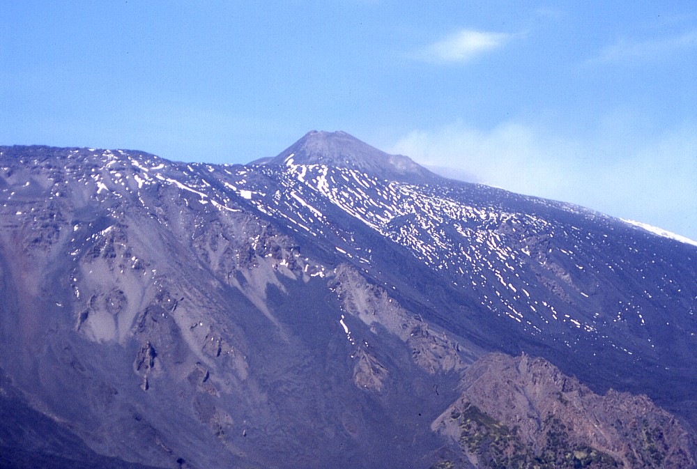
Left:
zoom on the upper portion of Etna from Taormina in mid-April 2002,
showing periodic emissions of brownish ash (old pulverized rock)
from the Northeast Crater Center: Etna's summit craters seen from northeast in late April 2002, with continued ash emissions but at this time mostly from the Bocca Nuova. The cone of the Southeast Crater can be seen at left, while the Northeast Crater stands further to the right at the summit. The ridge in the right part of the image belongs to the Pizzi Deneri, and the northern wall of the Valle del Bove can be seen in the middle ground Right: yet another view of Etna, this time partially shrouded in clouds, from the hills that tower above the town of Taormina, early May 2002 |
||
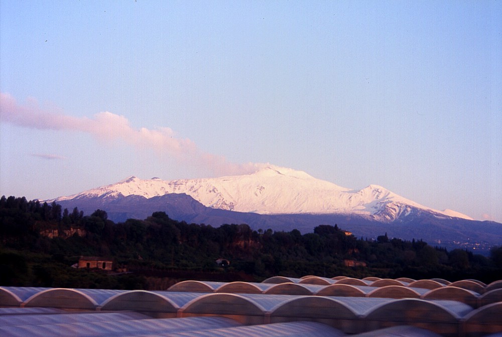
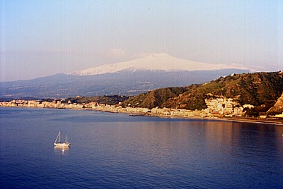 |
Postcard
view of Etna after a heavy snowfall in early May 2002, with parts
of the towns of Taormina (right) and Giardini (left) lining the
scenic coast of the Ionian Sea in the foreground. Note:
the image is not clickable due to low quality of original slide |
Marvellous Acqua della Rocca, early May 2002
 |
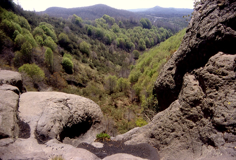 |
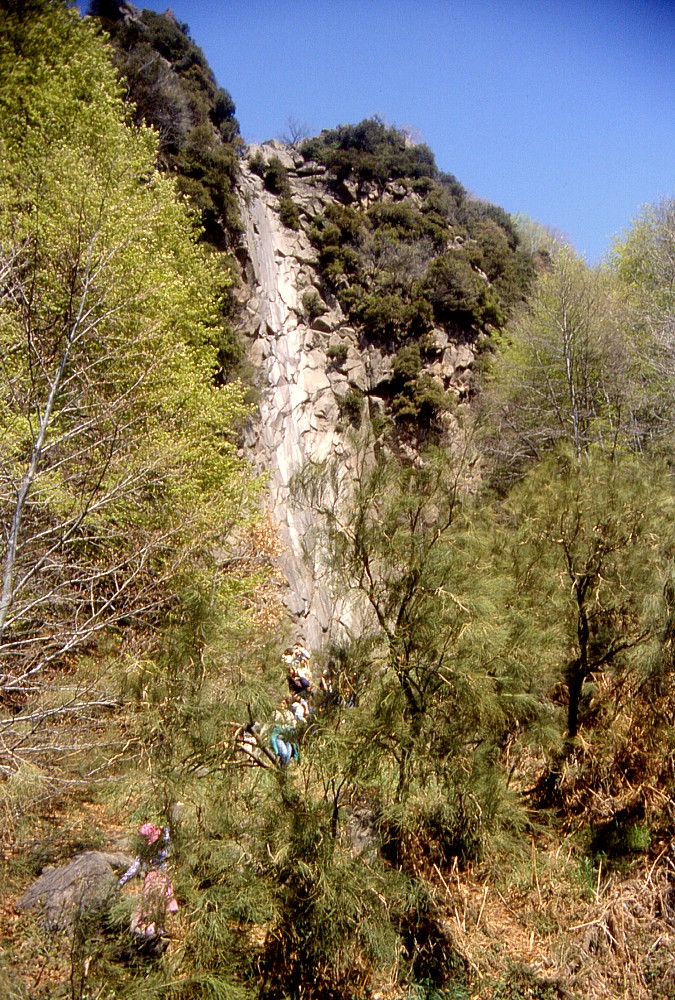
One
of the most beautiful spots on Etna, the scenic valley with the
dried-up cascade known locally as "Acqua della Rocca"
(water of the rock), on the southeastern flank of the volcano.
This is also one of the geologically most intriguing sites, since
it tells a fascinating story of a torrent of water that once ran
down through this valley, but which ceased flowing a few thousand
years ago because its source, located higher upslope, disappeared.
Some researchers believe that the source was actually a glacier,
which lay on a part of the volcano that was removed in the latest
catastrophic lateral collapse that occurred in the Valle del Bove
area. The left photograph shows the spectacular outcrop of polished rock where once the water used to plunge over a cliff about 80 m high. Right image is a view from the top of that cliff, down into the lower portion of the valley (which is also one of the greenest areas on the southern side of the mountain), with the prehistoric pyroclastic cone of Monte Monaco in the center-left background. Photos were taken on 1 May 2002 |
|
 |
 |
 |
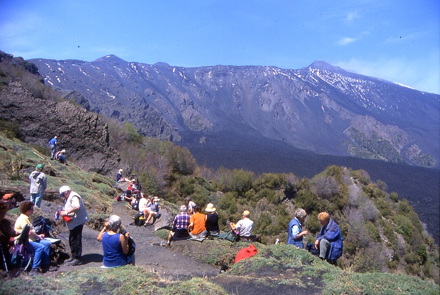
After
struggling their way up the steep upper portion of the "Acqua
della Rocca" footpath, a group of excursionists enjoys the
breathtaking view into the Valle del Bove from its southern crest,
and toward the upper part of the volcano, seen in the zoomed photographs
in the center and at right. Center photograph shows the sharp
peak of the Montagnola, formed during a strongly explosive flank
eruption in 1763, and a bit further to the right (north), the
more roundly shaped cone formed during the 2001 eruption, which
was quite explosive as well. Right photograph shows the cone of
the Southeast Crater and a dense vapor plume issuing from the
Bocca Nuova and the Northeast Crater, which are hidden behind
the plume |
||
Two "different" views of Etna, May 2002
 |
 |
Left:
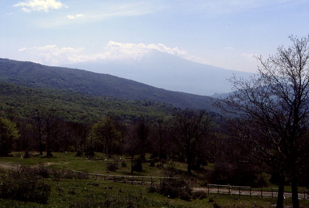
the enormous cone of Etna seen from the Monti Nebrodi to the northwest
in early May 2002. The Monti Nebrodi, which are not volcanic,
not only offer breathtaking views to the volcano, but an unexpected
variety of landscapes, with dense forests, lakes, and mountain
ranges that one would rather suggest in Germany or Switzerland,
but not in Sicily Right: a late snow fall on 24 May 2002 has whitened the large cone of the Montagnola on Etna's southern flank. This view highlights a few details that are otherwise less visible: the horseshoe-shaped crater of the Montagnola, which is open to the observer, and the peculiar dark ridge of lava which formed below the crater during its eruption in June-September 1763 (another flank eruption had occurred earlier that year on the western side of the volcano). In contrast with most other lava flow-fields on Etna, that of the Montagnola consists of countless short overlapping lobes that built up to a thickness of probably more than 100 m in places |
|
Return to the Etna photo gallery
Copyright © Boris Behncke, "Italy's Volcanoes: The Cradle of Volcanology"
Page set up on 10 August 2003