
| Etna
index |
||
| Geology | Geological history | Cones and craters |
| Eruptive characteristics | Eruptions before 1971 | Eruptions since 1971 |
| Etna and Man | References | Web sites |
| Weather forecasts | FAQ | Latest news |
 |
 |
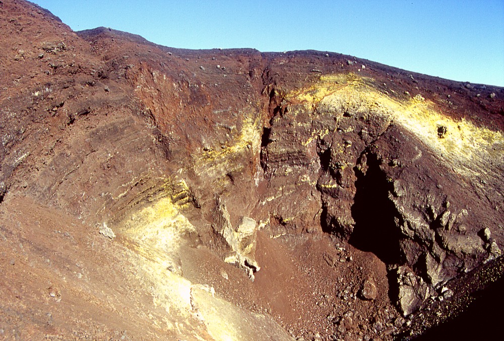
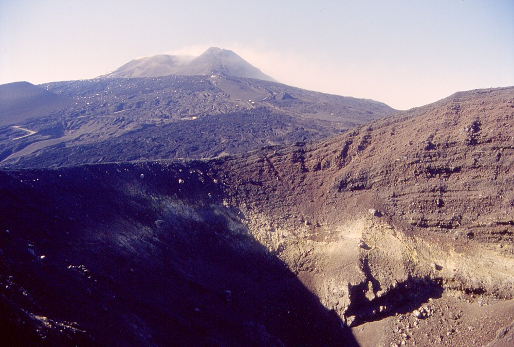
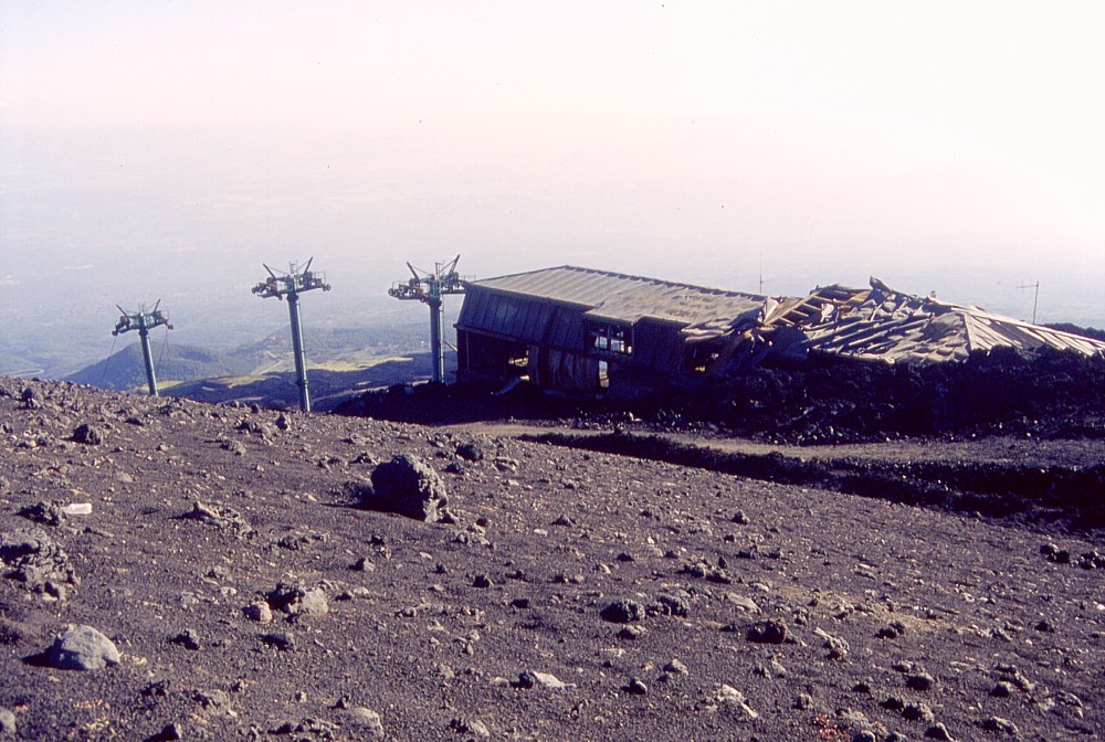
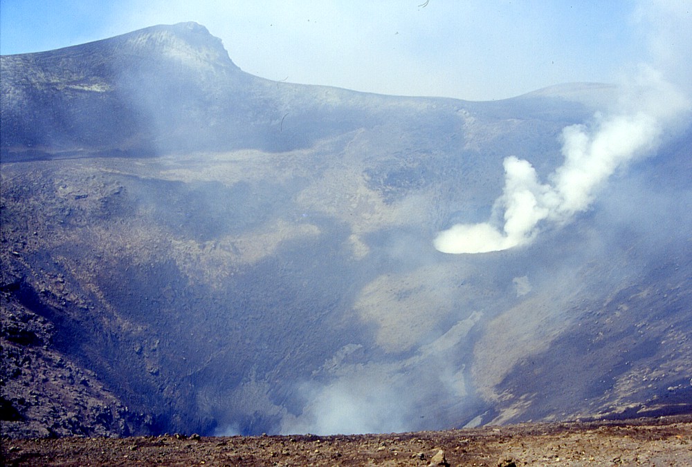
Ten
months after the July-August 2001 eruption, impressive scenes of
devastation are still visible near the most violent of the new vents,
the huge cone baptized Monte Josémaria Escrivà by
the direction of the Etna Natural Park in September 2002. The left
image shows the shattered remains of the uppermost ski lift, which,
until the 2001 eruption, led to the northern base of the Montagnola,
and was subjected to a tremendous bombardment by volcanic projectiles
from the growing cone (seen in the background). The Southeast Crater
can be seen at upper left, with the building of the Torre del Filosofo
mountain hut at its base. Right photograph is a look into the crater
of this huge new cone, still nameless at the time these photographs
were taken (late May 2002), with the southeastern crater wall in
the background. At the base of the crater wall is a spectacular
dike with several branches and a rounded lateral intrusion; note
the pair of oblique faults coinciding with the dike. During the
activity of this cone, explosions were frequently seen to break
through the sides of the cone, which were apparently fed by this
dike and another one on the opposite side of the crater |
|
Etna
photo gallery: 2002
Before the mountain moved - January to October 2002
![]()
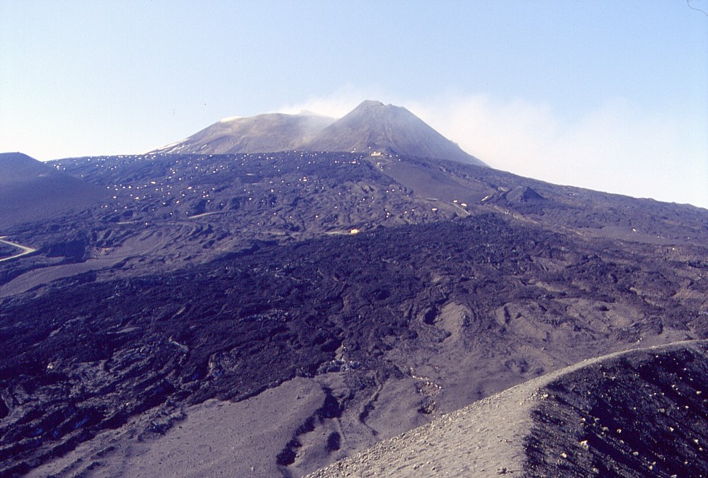
Spring 2002, time for excursions to the volcano, whose morphology has been dramatically altered during the eruption in July-August 2001. Scenes of utter devastation, and a dozen of small and large morphological features had been added to the landscape of Mount Etna's southern flank, and to a lesser degree to its northeastern flank (where more dramatic changes would occur later in 2002). I made four visits to these areas in May-October 2002, documenting photographically most of these features, before many of them vanished forever in the 2002-2003 eruption.
Mount Etna's violent baby, 28 July 2001, and revisited, 29-30 May 2002
 |
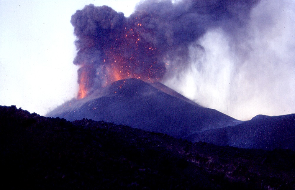 |
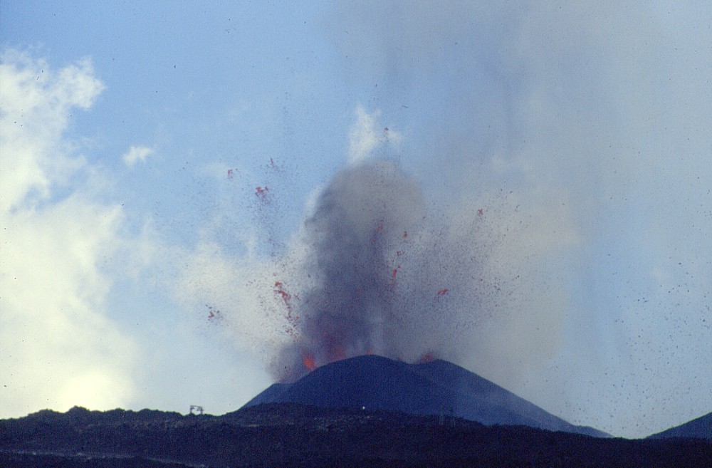
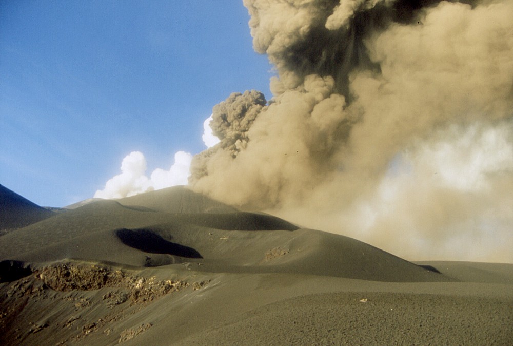
These
spectacular scenes are some of the most impressive moments during
the growth of that enormous new cone at about 2570 m elevation
(pre-eruption surface is reference), immediately to the north
of the Montagnola. The photographs are placed here to illustrate
the violence of the activity at this site, which in this form
lasted only for six days. Flashback: activity at this site began
on the afternoon of 18 July 2001, 40 hours after magma broke through
the surface some 500 m further downslope and 1.5 km to the south.
For one week, until 25 July, the activity there was phreatomagmatic
(that is, characterized by the explosive interaction of the rising
magma with a shallow aquifer) and no cone was built. Then, on
25 July, the activity became magmatic, and now a cone began to
grow very rapidly, due to constant powerful explosions whose noise
could be well heard as far as Catania, 25 km away, at rush-hour
(!). The climax of activity was on 28 July, when these photographs
were taken from only a few hundred meters away (the detonations
caused by the explosions would make your ears hurt at that distance).
Four days later, the activity diminished notably, and no further
significant growth of the cone occurred, which by this time was
about 100 m above the pre-eruption surface |
|
 |
 |
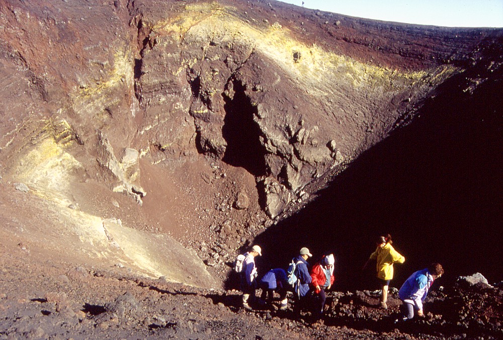 |
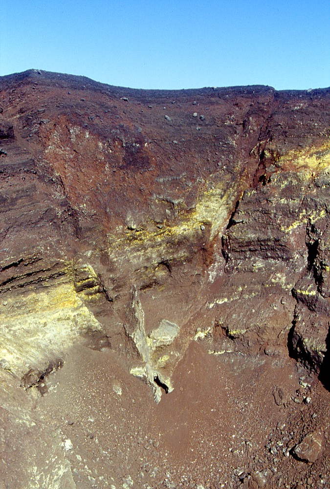
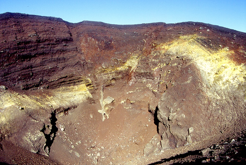
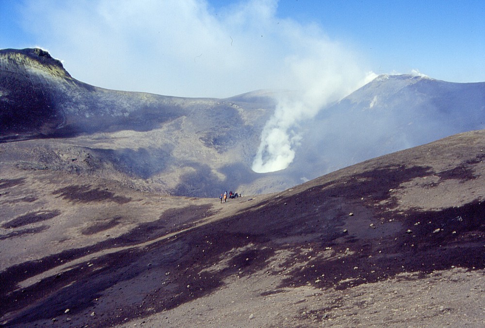
Three
views of the crater of the large cone at 2570 m elevation, 29
May 2002. The crater is about 150 m in diameter and about 70 m
deep, and the peculiar feature at the bottom of the opposite crater
wall is a dike with several lateral intrusions, which is seen
in more detail in a photograph at the top of this page. Right
photograph shows a group of excursionists in the foreground, while
another person is on the far rim of the crater (visible only in
the large version of this image, which you can obtain by clicking
on the thumbnail) |
||
 |
 |
 |
Gorgeous
panoramic views from the summit of Monte Josémaria Escrivà
on 29 May 2002: left and center photographs show the upper southern
flank with the summit crater complex in the background. Dark lavas
in the middle ground were erupted from a cluster of vents at 2700
m elevation (a small cone formed at these vents can be seen in
the left photograph below the right base of the Southeast Crater
cone). Center image shows the northern wall of the newly formed
crater in the foreground. Right photograph shows the opposite
side of the Monte Josémaria Escrivà. The large cone
in the left background is the Montagnola. Ruins of the uppermost
ski lift can be seen at the lower hill to its right, and a cluster
of volcanologically quite interesting vents, which were also active
during the July-August 2001 eruption, can be seen in the foreground.
These consist of a 30 m-diameter crater (visible at left) and
several dome-shaped features, the most conspicuous of which lies
in the center-right of the image, and a well-defined lava flow
channel is seen to its right. The whole complex of these minor
vents is surrounded by an arcuate subsidence fault |
||
 |
 |
 |
Left:
zoom on a peculiar feature, probably a small endogenous dome,
formed at the head of an effusive vent active in late July 2001
on the southern base of the large pyroclastic cone at 2570 m elevation
(Monte Josémaria Escrivà) Center: a wider-angle view of the same endogenous dome and the spectacular lava flow channel which extends from there over a distance of about 250 m to the southwest. The lava flows which represented the most serious threat to the tourist complex at the Rifugio Sapienza (lying below the crest visible at center right) came from this lava flow channel, including the two minor lobes which led to the destruction of the arrival station of the cable car Right: and this is what remains of the arrival station of the cable car after the 2001 eruption. One lava lobe reached the building on its upslope, northern (right) side, setting a part of it ablaze; another lava lobe surrounded its eastern (left) side on the evening of 30 July and entered into the bar (see the photos at the bottom of this page), causing a more general conflagration and total devastation of the building. Note intact poles of the cable car at left. As of mid-2003 (after the 2002-2003 eruption), the ruin of the building is no longer there, but the poles are still standing |
||
 |
 |
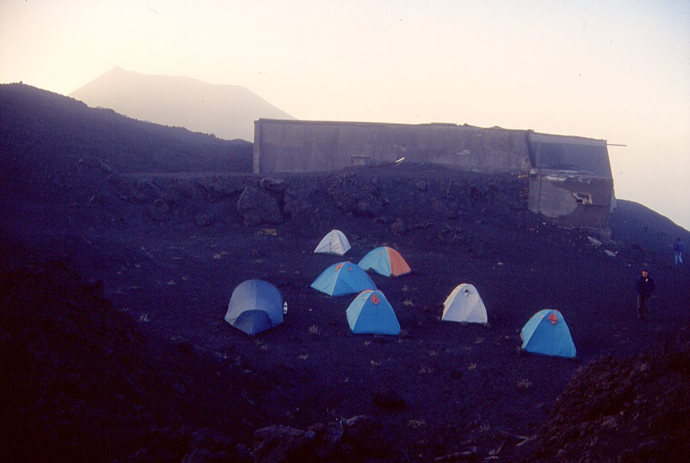 |
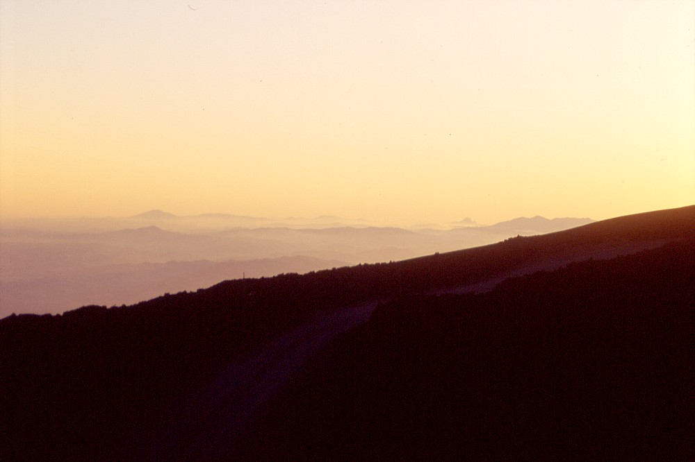
Daybreak
on 30 May 2002 has a feeling of eternity in a place that was dramatically
altered only ten months earlier, and which would undergo even
more dramatic changes five months later. These photographs were
taken at the ruin of the second-generation (post-1971 until 1983)
arrival station of the cable car, located somewhat higher upslope
than its successor (which was destroyed in 2001) and shown in
the right-hand photograph. Left image shows Monte Josémaria
Escrivà from that location, with the Montagnola in the
distance at right. Center photograph is a view to the Madonie
mountain range, nearly 200 km to the west. The right photograph
shows the tents of an excursion group that slept near the ruin
of the pre-1983 arrival station of the cable car, and Monte Josémaria
Escrivà is seen in the left background. What is so peculiar about this place is that it vanished without a trace during the 2002-2003 eruption on the southern flank. The lowermost of the new vents formed exactly in the place where the tents and building are standing in the right-hand photograph (see how this place looked like at an early stage of the 2002-2003 eruption). By pure coincidence I was with the last excursion group to sleep in that place, exactly one week before the beginning of the 2002-2003 eruption. At that time, there was virtually nothing that would have indicated a major eruption only one week later |
||
 |
 |
 |
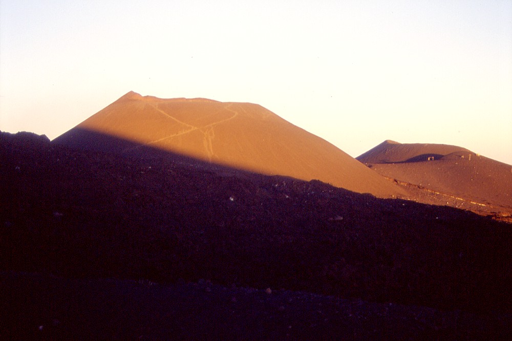
These
photos are history. It will never again be possible to take the
same photographs, because the places from which they were taken
have disappeared, and with them have some of the features seen
in these images. Left: the rising morning sun of 30 May 2002 casts a golden hue onto the strikingly similar (from this perspective) cones of Monte Josémaria Escrivà (left) and the 238 years older Montagnola (right). Seen from the pre-1983 arrival station of the cable car (now deeply buried below the lavas of the 2002-2003 eruption) Center: two prominent steep-sided spatter cones (hornitos) are seen in the left foreground, marking the lowermost portion of the second fissure that opened on the first day (17 July) of the 2001 eruption, at about 2690 m elevation. Interestingly, the magma that fed these vents (as well as those higher upslope and closer to the Southeast Crater as well as a small fissure on the upper northeastern flank) came from the central conduit system of Etna (the conduits that lead to the summit craters). The lower vents on the southern flank, including those of Monte Josémaria Escrivà (in the background, only about 1 km from the 2690 m vents), were fed from a different source. The area in the foreground was buried by about 50 m of new pyroclastic material during the 2002-2003 eruption Right: a panoramic view of what once was called Piano del Lago, the Plain of the Lake. Where the lake used to form during the spring snowmelt, there is now the huge cone of Monte Josémaria Escrivà (seen in the distance at right, with the Montagnola immediately behind it). A much smaller cone, only about 20 m high, is visible at left, which has formed at about 2740 m elevation. Monte Josémaria Escrivà is still there after the 2002-2003 eruption, but all other features that are seen in front of it in the photograph at right have vanished without any trace |
||
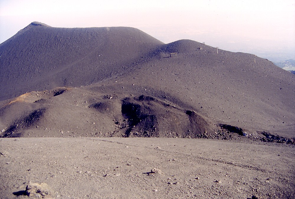
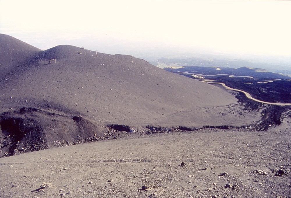
Summit visit , 30 May 2002
 |
A
narrow streak of black lava marks the site of the northeasternmost
outpost of the July-August 2001 eruption, in the Valle del Leone,
seen here from the eastern rim of the Voragine (one of Etna's
four summit craters, and inactive since 1999) on 30 May 2002.
The northern wall of the Valle del Leone (which is a kind of side
valley of the Valle del Bove, further to the right) and of the
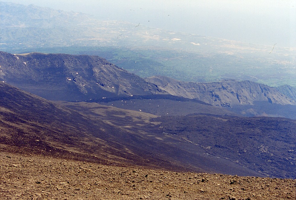
Valle del Bove is seen in the center of the image, and Etna's
northeastern flank with the Monti Peloritani and the Ionian coast
near Taormina in the background. The dark-colored lavas in right
foreground were erupted from the Southeast Crater in 2000 and
early 2001 |
 |
 |
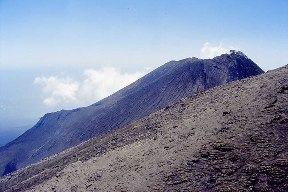 |
These
photographs show two places at Etna's summit, which at the turn
of the century (or the millennium) were the sites of extremely
violent eruptive activity, the Voragine (left and center images)
and the Southeast Crater (right photograph). The Voragine produced
two of the most powerful eruptive episodes of Etna of the past
few centuries in July 1998 and September 1999, and the Southeast
Crater holds the world record in the number of lava fountains
over a certain time period (Pu'u 'O'o, on the East Rift Zone of
Kilauea, Hawaii, had 48 eruptive episodes with lava fountains
in three-and-a-half years, the Southeast Crater produced 105 such
episodes in less than three years, and 66 of these in a seven-months
period in 2000). Both craters are seen very quiet and peaceful
at the time of these photographs (30 May 2002). White vapor is
seen to escape from a 30 m-diameter pit in the southern side of
the central pit of the Voragine (which is seen in the foreground
of the center photograph; note persons in left-hand photograph
for scale); that pit formed in the spring of 2000 without any
eruptive activity. Both the Voragine and the Southeast Crater
did not show any activity in the summer of 2002, but the earlier
of the two showed some sympathetic eruptive activity at the beginning
of the 2002-2003 eruption |
||
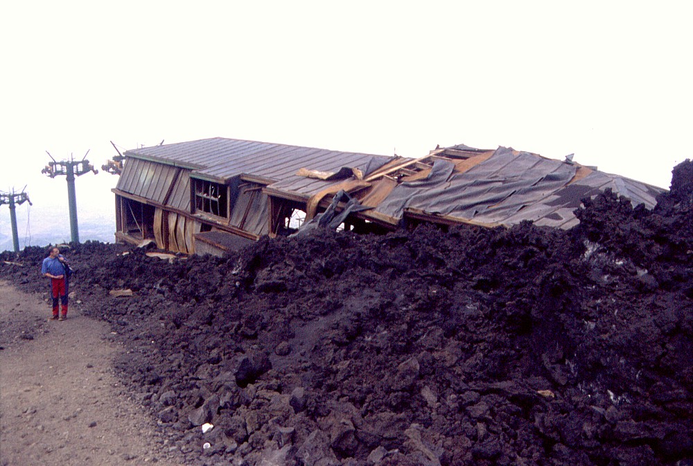
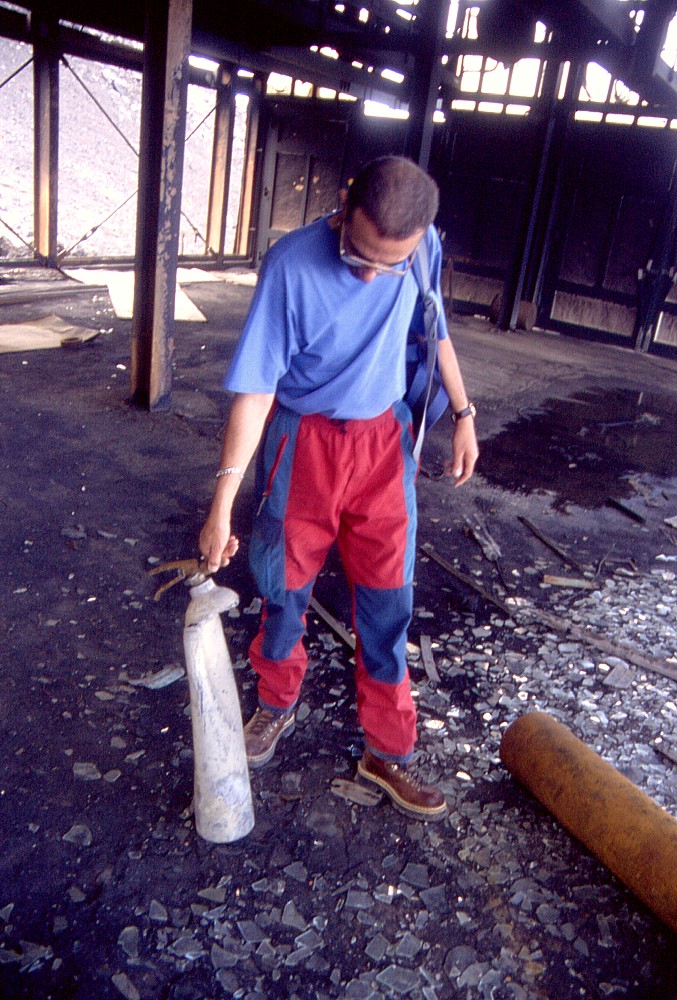
The museum that never was, June 2002
 |
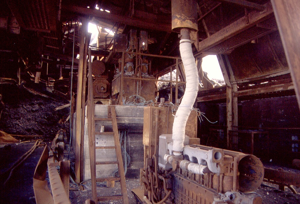
 |
Etna
played an evil game with the cable car on the southern flank in
2001 (it did so again, this time not only with the cable car,
in late 2002). The cable car, or better say, the third-generation
cable car (two earlier generations had fallen victim to the eruptions
in 1971 and 1983), had just been fully renovated, and should have
been reopened in late July 2001, when the eruption began from
numerous vents on the southern flank. During the first nine days
of the eruption, it suffered little damage, but things changed
when lava began to issue from a vent on the southern base of the
cone later to be named Monte Josémaria Escrivà.
On 26 July 2001, a lava flow entered the arrival station of the
cable car from above, causing a fire in its upper portion (seen
at right in the left-hand image). Four days later, a small lobe
of lava surrounded the eastern side of the building (left) and
entered through the windows of the bar in the ground floor. This
caused a large fire, which burned all that remained inside the
building. However, the lava advanced just enough to set the structure
ablaze and then stopped without crushing it - and left a museum
to the posterior world. While the ruin was still standing (it
was broken down in September 2002 as work for the reconstruction
of the cable car and its arrival station was started; this was
interrupted a few weeks later by the new eruption), visitors would
find a never-ending quantity of objects of all kinds inside, such
as the useless fire-extinguisher that Giuseppe Scarpinati holds
in the right image |
|
 |
 |
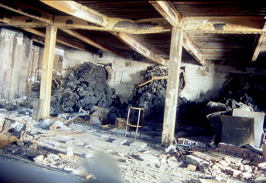 |
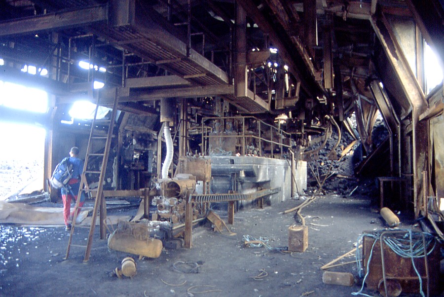
Before
the 2001 eruption, visitors to Etna who went uphill with the cable
car would, after a 20 minutes' ride, arrive in the main hall of
the arrival station of the cable car (seen after the destruction
in the left image). The cabins would stop right in the place shown
in the center photograph, and a staircase to the right led to
the ground floor of the building, where visitors had the chance
to buy souvenirs, have a sandwich, or drink a coffee, a juice,
or a beer, in the bar, which is shown in the photograph at right.
Note how the lava came in through the side windows of the bar,
forming three short lobes of equal length that stopped once they
had reached the floor. For many months after the eruption and
destruction of the building, a wealth of peculiar objects, including
numerous deformed bottles, could be found in this location. Someone
claimed to have found, shortly after the eruption, a few still-intact
bottles of wine amidst the devastation and said to have tasted
it, declaring that it was delicious |
||
 |
 |
 |
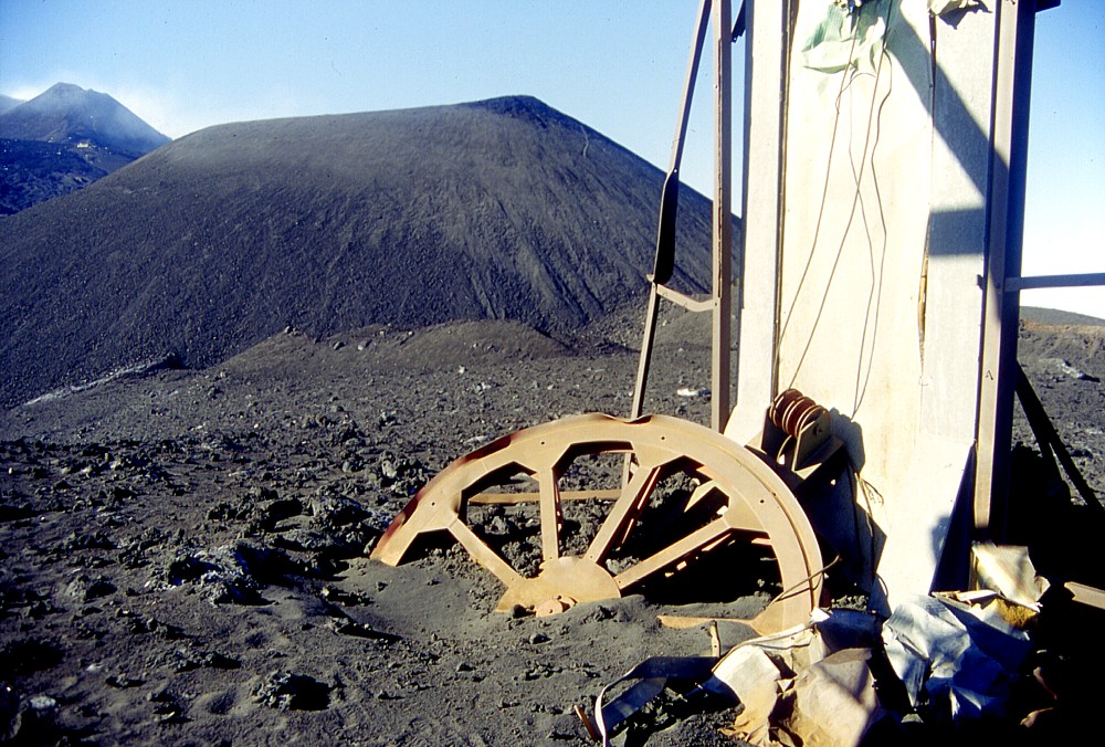
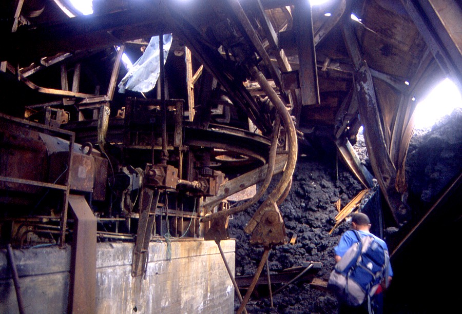
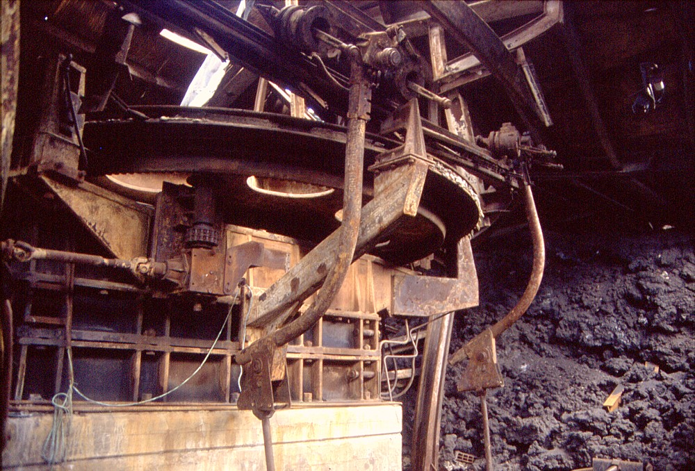
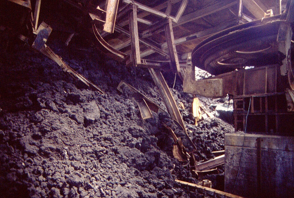
Scenes
from the main hall of the arrival station of the cable car. Left
and center images show the huge driving wheel of the cable car,
and the first of the two lava flows that reached the building,
which stopped immediately behind that structure. Right photograph
shows a part of the motor of the cable car |
||
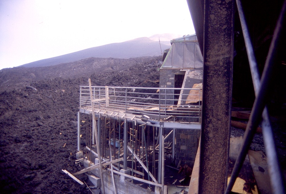 |
Nearly
finished at the time the 2001 eruption began, a new terrace on
the western side of the building of the arrival station of the
cable car would have invited tourists to relax and tan in the
sun |
Return to the Etna photo gallery
Copyright © Boris Behncke, "Italy's Volcanoes: The Cradle of Volcanology"
Page set up on 10 August 2003