
| Etna
index |
||
| Geology | Geological history | Cones and craters |
| Eruptive characteristics | Eruptions before 1971 | Eruptions since 1971 |
| Etna and Man | References | Web sites |
| Weather forecasts | FAQ | Latest news |
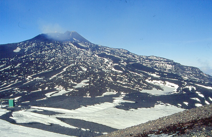 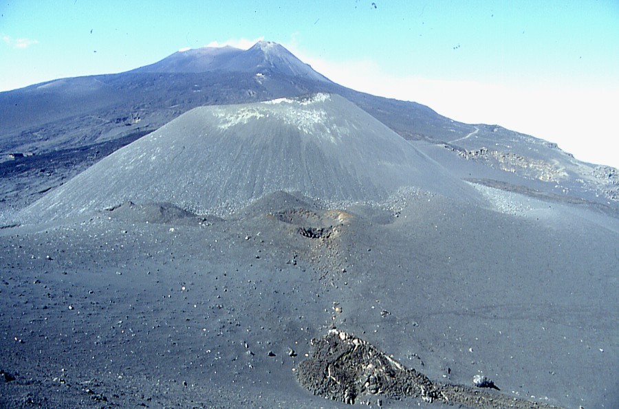 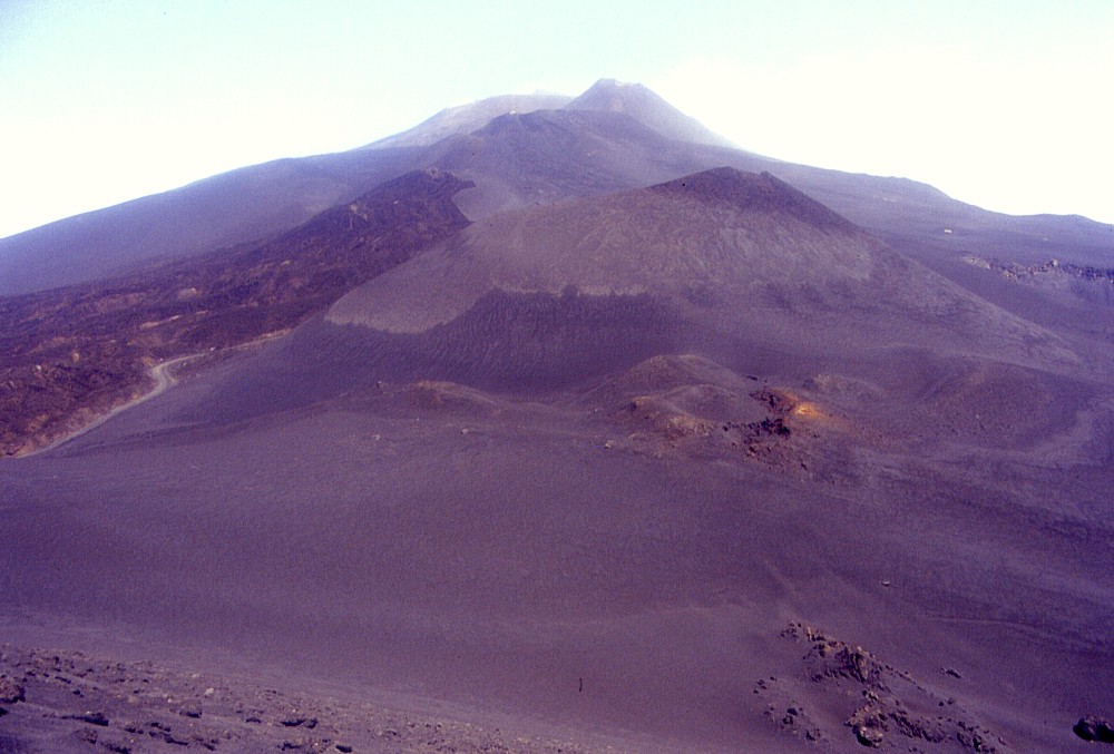 |
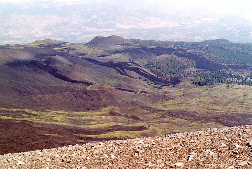
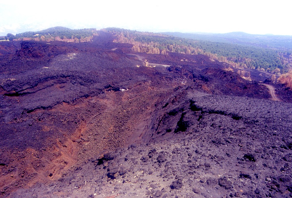
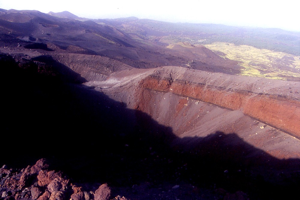
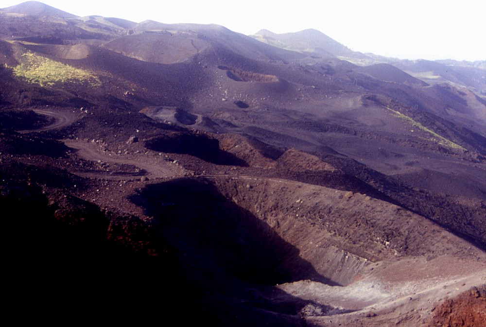
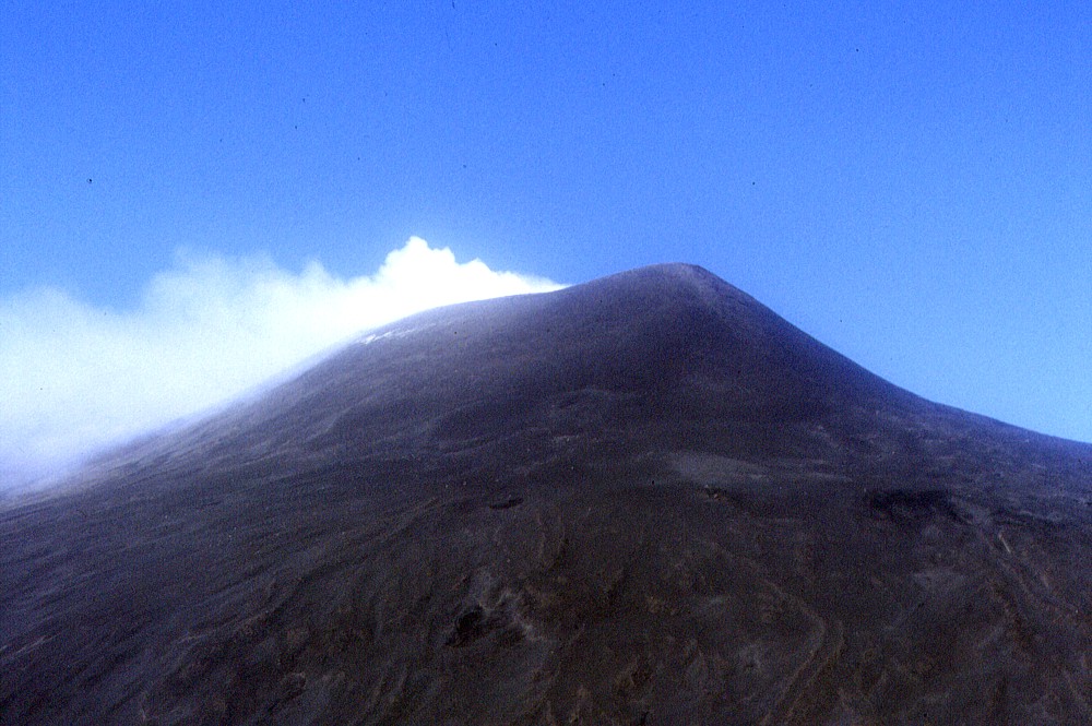
| The
incredible morphological changes brought by the latest two eruptions
(in 2001 and 2002-2003) on the upper southern flank can be appreciated
in these three photographs, all taken from the summit of the Montagnola
looking north. The relatively flat, gently sloping area in the foreground
of the top photo was, until 2001, known as the "Piano del Lago",
since during the spring snowmelt in many years a temporary lake
formed there. There will surely never ever be a lake again in that
area, because during the 2001 eruption a new cone was built up there,
which is well visible in the center photo. With the 2002-2003 eruption
the area has once more undergone a profound change: the bottom photograph
shows, behind the 2001 cone, a new twin cone, each of the "twins"
being twice as tall as the cone of 2001! Furthermore, there is a
dark lava field extending from the southern base of this new cone
complex (at left). N.B. The photographs were taken in May 2001,
September 2001 and July 2003, respectively; note that the bottom
photograph is not identical to that on the previous page and all
three images are clickable |
Etna
photo gallery: 2003
Return to Etna
![]()
Part 2: July 2003
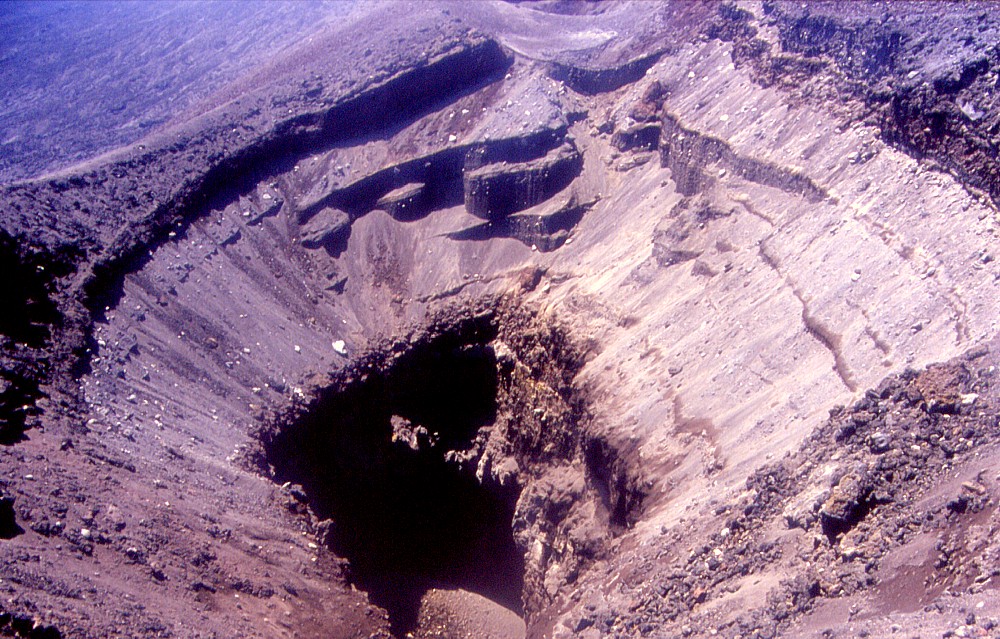
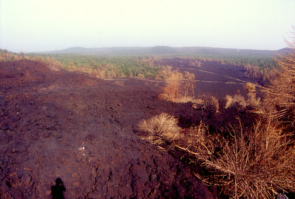
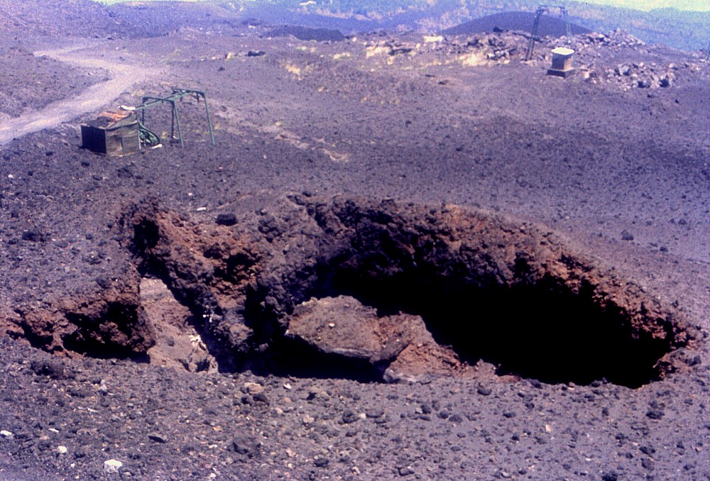
The visit was made in the forenoon, with excellent weather conditions, and for the first time I had the chance to visit the upper portion of the impressive eruptive fissure that cut the northeastern flank of Etna on early 27 October 2002. Some of the vents are still giving off steam, nearly nine months after the events. And, although already shown in some previous photographs, the tremendous chasm in the lower part of the same eruptive fissure, "the barrel of a gun", which emitted the huge lava flow that wiped out Piano Provenzana, never ceases to haunt me and other visitors. Here we see it from different viewing points.
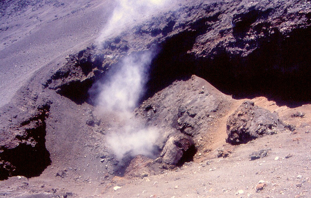 |
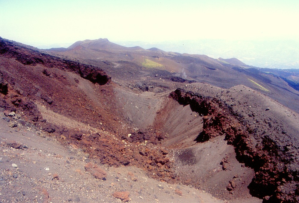
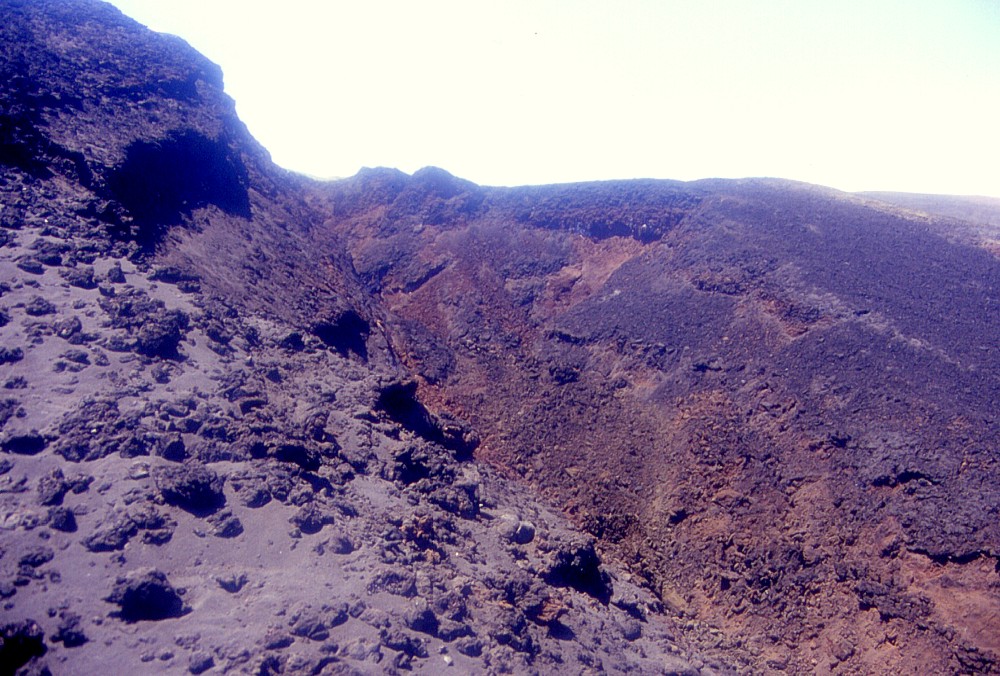
This
is the uppermost of the new craters formed on the Northeast Rift
of Etna on 27 October 2002, at about 2500 m elevation. Steam is
still issuing from this crater, indicating that the dike which
fed the eruption is still hot. Fumarolic activity had been common
in this area also before the eruption. Diameter of this crater
is about 50 m. Photograph taken on 12 July 2003, view is to the
south |
Etna, Northeast Rift, 17 and 26 July 2003
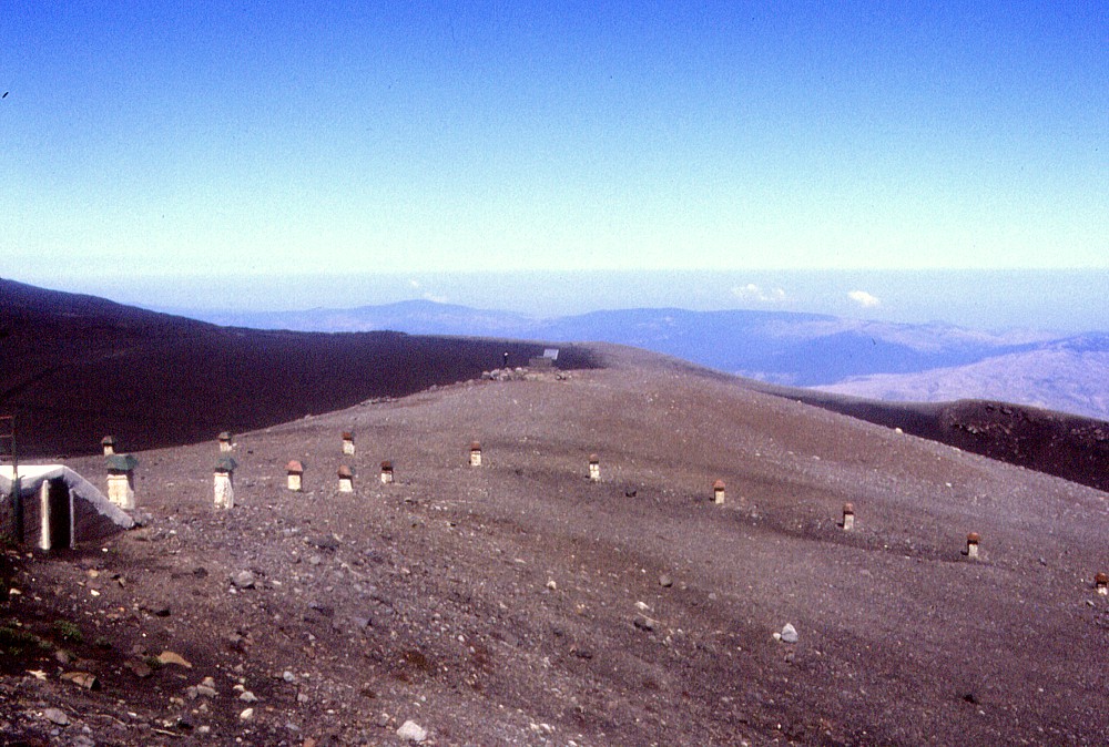
Both visits were made in the framework of the FASA (Fire Airborne Simulator Arrangement) Etna -- ASI Satellite campaign organized by the Roma Section of the Istituto Nazionale di Geofisica e Vulcanologia (INGV-Roma), which saw the participation of several Italian universities, the Consiglio Nazionale delle Ricerche (CNR), and the collaboration of the Institute of Remote Sensing Technology of the Deutsches Zentrum für Luft- und Raumfahrt (German Aerospace Center). The 17 July visit nearly coincided with a M~3 earthquake on the Pernicana Fault, which is closely related to the Northeast Rift (but no one in the field team did feel it). On 26 July, measurements were made on the Piano delle Concazze, above the upper termination of the Northeast Rift, with a gale-force wind blowing from the west. That day, a conspicuous fumarolic area was observed immediately below the eastern rim of the Northeast Crater. This fumarole field had been seen on various occasions in the past, but not since the 2002-2003 eruption. It seems to correspond to a circumferential fracture.
 |
 |
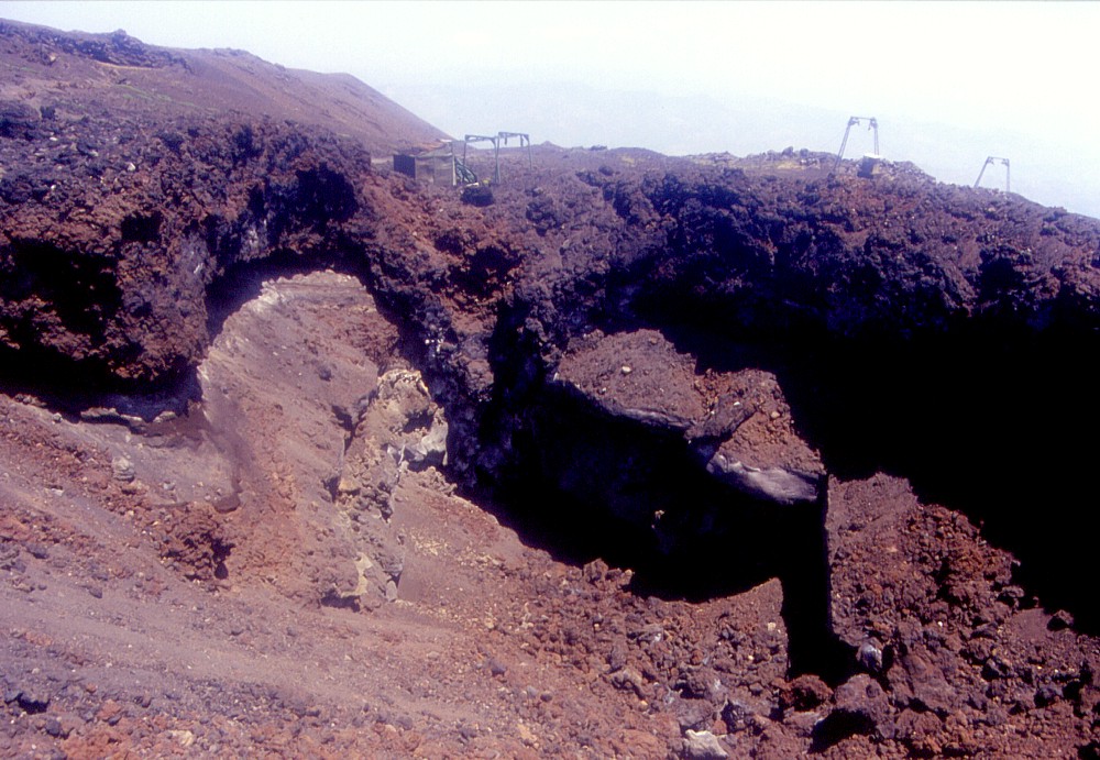
Left:
yet another view of the lava flows that cascaded down the steep
slope above Piano Provenzana, seen in the late afternoon of 17 July
2003. Piano Provenzana is at center right Right: one of the most peculiar eruptive vents of the 2002 eruption on the Northeast Rift (already shown in the 12 July photo gallery, photograph at left), in the intermediate section of the October-November 2002 eruptive fissure system. The vent opened 30-40 m from the arrival shack of one of the Piano Provenzana ski lifts (seen immediately behind the vent). Its activity probably lasted only a few minutes. Note the impressive system of dry fractures lying to the right of the ski lift shack, behind the short-lived vent |
|
 |
 |
Eruptive
vents in the upper portion of the 2002 eruptive fissure on the Northeast
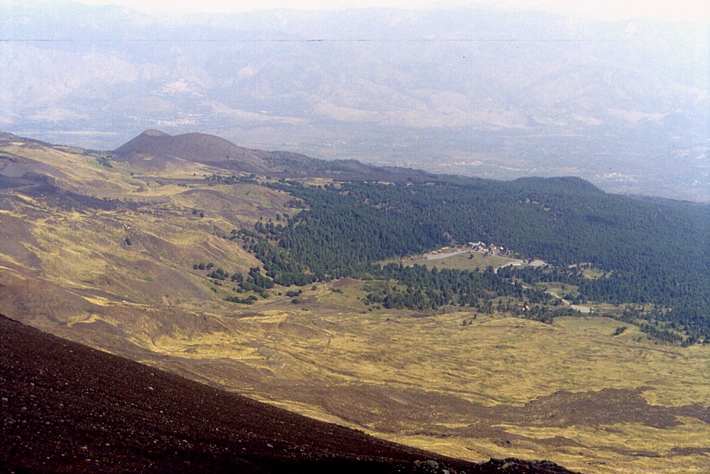
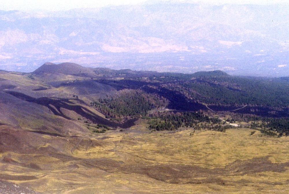
Rift, looking downrift. The large cone seen in the distance in both
photographs is Monte Nero, formed during a large eruption in 1646-1647.
Note the (pre-2002) stratigraphy exposed in the wall of the large
vent in the foreground of left image. Right photograph shows numerous
small vents further downslope, and dry (non-eruptive) fractures
cutting a large crater rim (of the 1809 eruption) in the background.
The photographs were taken on the late afternoon of 17 July 2003 |
|
 |
Are
these the new tourists that visit Piano Provenzana? Tourism operators
and mountain guides on Etna's northeastern flank are living a very
difficult period, since there are virtually no tourists coming to
that side of the volcano. Photo taken on 26 July 2003 through the
windshield of a jeep (this explains the reflections visible in upper
center and at extreme right) |
 |
 |
 |
Left
and center: two more views (taken 26 July 2003) of the peculiar
neighborhood of the ski lift and a small vent of the October-November
2002 eruption. Left photograph is a view from west, center image
is looking north. The shack at the end of the ski lift was damaged
but remained standing. Non-eruptive ground fractures are well visible
in the center image, passing about 20 m from the shack Right: this view shows a bit of Etna's geological history: the sole remaining portion of the rim of the Elittico caldera, formed about 15,000 years ago after a series of cataclysmic, highly explosive eruptions. In most places, the caldera rim has been buried by younger eruptive products, but a 1 km-section of it is still visible to the west of the Pizzi Deneri, above the upslope termination of the Northeast Rift. In this photograph the outer slope of the Ellittico edifice is to the right, and caldera fill is to the left, with lava flows erupted during the 1960s to 1970s from the Northeast Crater forming the present surface |
||
 |
 |
 |
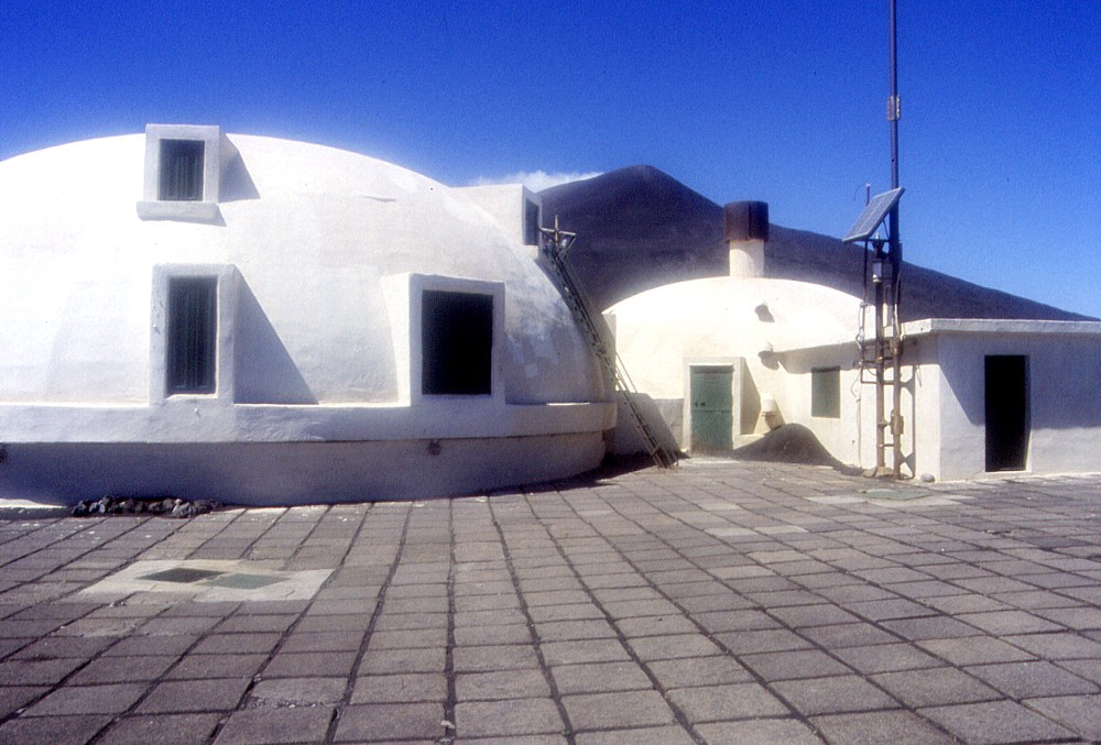
| Left:
The Etna Volcanological Observatory, built in the late 1970s to
early 1980s at the Pizzi Deneri, at about 2600 m elevation on Etna's
northeastern flank, following the destruction of the first Etna
Observatory (which had been located on the southern side of the
summit area) in 1971. This is not a permanent observation post (observatories
located in remote places on volcanoes have become somewhat obsolete
in recent years, as much volcano surveillance is now fully automatic
and strongly satellite-supported), but it is used during field campaigns
in the summit area |
||
 |
 |
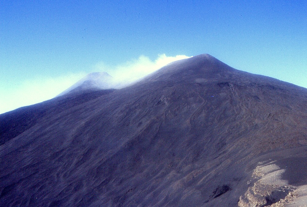
Two
views of the same place (Piano Provenzana) from approximately the
same viewing point (Pizzi Deneri), ten months apart. Left photograph
was taken on 10 September 2002, seven weeks before it was largely
covered by lava flows emitted from new fissures and craters on the
Northeast Rift. The post-eruption view at right was taken on 26
July 2003 and shows the two main lava flows that descended toward
Piano Provenzana, destroying nearly all of it on the first day of
the 2002-2003 eruption. The large pyroclastic cone seen in the upper
left part of both images is Monte Nero, formed during a much larger
eruption in 1646-1647 |
|
Part 3: The 1614-1624 lava field, 24 July 2003 (next page)
Return to the Etna photo gallery
Copyright © Boris Behncke, "Italy's Volcanoes: The Cradle of Volcanology"
Page set up on 11 June 2003, last modified on 11 August 2003