
| Etna
index |
||
| Geology | Geological history | Cones and craters |
| Eruptive characteristics | Eruptions before 1971 | Eruptions since 1971 |
| Etna and Man | References | Web sites |
| Weather forecasts | FAQ | Latest news |
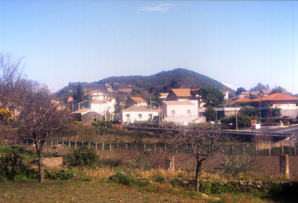 |
Looming
quietly above the village of the same name, the cone of Monterosso
rises only about 50 m above the surrounding landscape, but it
is the youngest of the many cones on the lower southeast flank
of Mount Etna: the eruption that gave birth to it occurred in
1329. At that time the area was much less densely populated than
it is now, yet the eruption caused great damage in the areas above
the town of Acireale. Were a similar eruption to occur today in
the same area, this would be a disaster of enormous proportions.
Photograph was taken from south on 4 March 2004 |
Mamma
Etna's countless children
Monterosso
SE flank, 15.096232° E, 37.648553° N
summit elevation: 595 m
![]()
The
latest authentically documented eruption on the lower southeast flank
of Mount Etna, according to historical sources, occurred in 1329 in an
area dotted by numerous older pyroclastic cones, about 4.5 km south of
the town of Zafferana. Although more recent reviews of the historical
eruptions of Etna often cite an eruption in 1334 at the site now occupied
by the village of Monterosso, the reviews of historical documents and
palaeomagnetic studies carried out by Tanguy et al. (1999; 2003) have
shown that this eruption actually occurred five years earlier. It formed
a modest-sized, horseshoe-shaped cone that was named Monte Rosso (one
of the most frequently used names for Etna's flank cones, which in this
case might be truly due to the strongly oxidized, red scoriae of which
the cone is composed). In addition, a large lava flow was poured out to
the east, in the direction of Acireale. Contemporary eyewitness accounts
describe the great terror experienced by the local population when, in
late June 1329, strong earthquakes heralded the opening of a new vent
higher upslope in the Valle del Bove, before, on 15 July 1329, the earth
opened at Monterosso. Large amounts of ash were thrown out not only by
the newly formed crater, but also by the summit crater, while lava advanced
in three main branches toward Acireale and Catania. A vast area of forest
and several small settlements were devastated by this eruption.
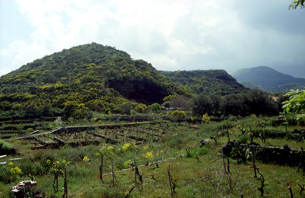
The source cone of the 1329 eruption, Monterosso, is now surrounded on
its south and west sides by the village of the same name, a charming accumulation
of small homes embedded in extensive gardens - except for a few examples
of the locally common practice of illegal construction as shown in one
of the photographs below. Like all the villages surrounding the town of
Zafferana, Monterosso boasts with the production of local honey, which
as all products coming from Etna is tremendously tasty and is sold in
an endless number of varieties. Vineyards are also common in the area.
The cone of Monterosso itself is occupied by fruit gardens on its southern
side, whereas the remainder is covered with bushes and small trees. A
small abandoned quarry at the southwest base of the cone shows the red
scoriae and bombs that probably inspired the name given to the cone. The
single crater, whose maximum width is slightly less than 200 m, is open
to the north, where presumably the main lava effusion took place, although
lava may also have been emitted from vents at the southern or eastern
base of the cone.
I visited and climbed Monterosso for the first time in early May 1997
and passed many times nearby since then. The photographs on this page
were taken in the spring of 1997 and in early March 2004.
 |
 |
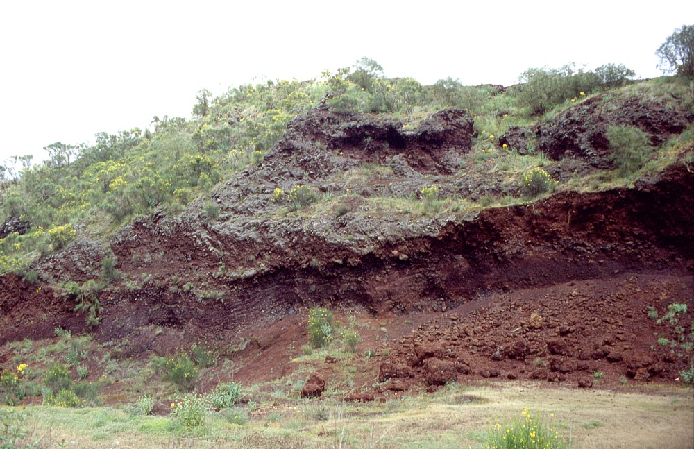 |
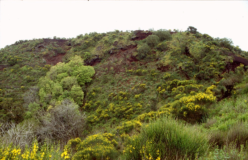
Left:
the horseshoe-shaped cone of Monterosso seen from northeast, showing
breach in the north side of the cone, and abandoned quarry on its
northeast side. Monte Gorna, a much
larger cone formed in Roman age, is seen in the distance at right Center: crater of Monterosso, seen from its southwest rim, and eastern crater rim in the background. The reddish scoriae that make up the cone are seen in many places between the bushes of broom that cover much of the cone and its crater Right: abandoned quarry at western base of Monterosso, showing reddish-brown scoriae and bombs deposited during the eruption of this cone. Photos taken 1 May 1997 |
||
Copyright © Boris Behncke, "Italy's Volcanoes: The Cradle of Volcanology"
Page set up on 9 March 2004