
| Etna
index |
||
| Geology | Geological history | Cones and craters |
| Eruptive characteristics | Eruptions before 1971 | Eruptions since 1971 |
| Etna and Man | References | Web sites |
| Weather forecasts | FAQ | Latest news |
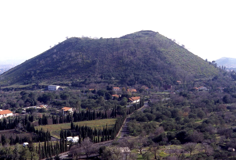 |
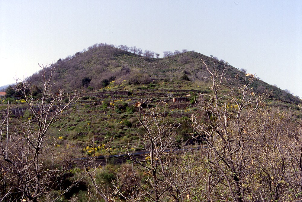
Seen
from Monte Arso, a pyroclastic cone
about 1.3 km to the NNE, the cone of Mompeloso appears fairly
regular, but seen from other sides it is seen to be elongated
to the south, where there are several minor vents that were produced
by the same eruption which built up the Mompeloso cone. That eruption
occurred after the massive explosive summit eruption in 122 B.C.
(the Mompeloso products overlie the related pyroclastic deposit),
probably sometime around A.D. 252-253. Photograph taken on 15
April 2000 |
Mamma
Etna's countless children
Mompeloso (or Monpeloso)
S flank, 15.03370° E, 37.63238° N
summit elevation: 943 m
![]()
|
|
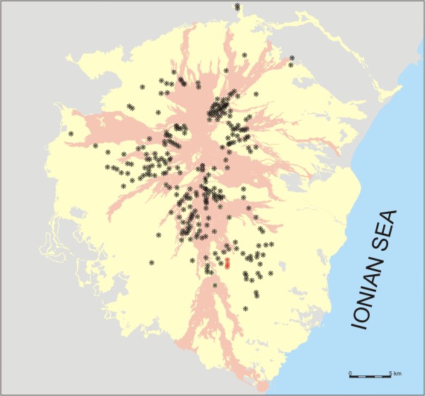
Location
of the Mompeloso and minor cones produced by the same eruption (red
asterisks). Black asterisks are other flank craters and cones of
Etna. Lavas erupted since 1600 are shown in pink; extent of Etnean
volcanics in light yellow. |
Rising
more than 100 m above the surrounding terrain, Mompeloso (sometimes also
named Monpeloso) is one of the most conspicuous flank cones that mark
the landscape around the town of Nicolosi, on the southern flank of Mount
Etna. At the same time, it is also one the most youthful, possibly the
third most recent in the area (after the Monti
Rossi, formed in 1669, and the unconspicuous Monte Gervasi that erupted
many centuries earlier). Stratigraphic studies carried out by Del Carlo
and Branca (1998) revealed that the products of the Mompeloso eruption
overlie the tephra deposit of the strongly explosive 122 B.C. summit eruption
(Coltelli et al. 1998) and are thus younger than that date. The most probable
candidate among the historically documented eruptions of Etna is that
reported to have taken place either in A.D. 252 or the year after, very
shortly after in Catania (at that time under the central Roman government)
a young girl named Agata was martyred to death for her refusal of the
romantic advances of the Questor of the town. The local folklore has it
that when the lava flow presumably emitted from the Mompeloso eruptive
fissure came alarmingly close to Catania, the veil of Agata was carried
in a procession to the lava front, which thereupon stopped miraculously
- one of several reasons why Agata became the patron saint of Catania.
Mompeloso is the largest cone produced along a N-S eruptive fissure about
0.8 km long, with several smaller edifices lying at its southern base.
These constitute a row of coalesced cones no more than 20 m above the
surrounding surface, which since long time have been extensively used
for agricultural purposes, with fruit gardens and vineyards lying on them,
some of which have been abandoned. Unfortunately the one lying closest
to the base of the main Mompeloso cone has been largely destroyed in the
spring of 2003, when the owner of the terrain had its top bulldozed flat,
probably with the intention of constructing a building in the place. A
further minor vent lies about half way up the south slope of the Mompeloso
cone, which is now a vineyard. The southern rim of the summit crater shows
a conspicuous notch, a result of the presence of smaller vents along the
eruptive fissure extending from the summit to the south.
I visited and climbed Mompeloso on 15 April 2000, when these photographs
were taken. The next time I returned to the place was in July 2003, to
see how the small crater on its south base was transformed into a flat
terrain.
 |
 |
 |
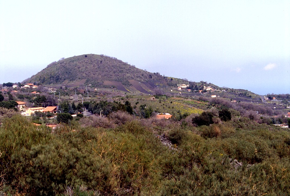
Left:
Mompeloso seen from the northern outskirts of Nicolosi, about 1
km to the W. Several smaller cones produced by the same eruption
lie to the south of the cone and form the low ridge at its right
base. In the foreground, barely recognizable, lies the much older
crater of Monte S. Nicolò
(not to be confused with the cone of
the same name near Monterosso) Center: view of Mompeloso from one of the minor vents at its southern base, whose crater forms a shallow depression seen in the foreground Right: southern face of the Mompeloso cone, with one of the smaller vents at its southern base in the foreground. Note the notch in the southern rim of the summit crater of the main cone |
||
 |
 |
 |
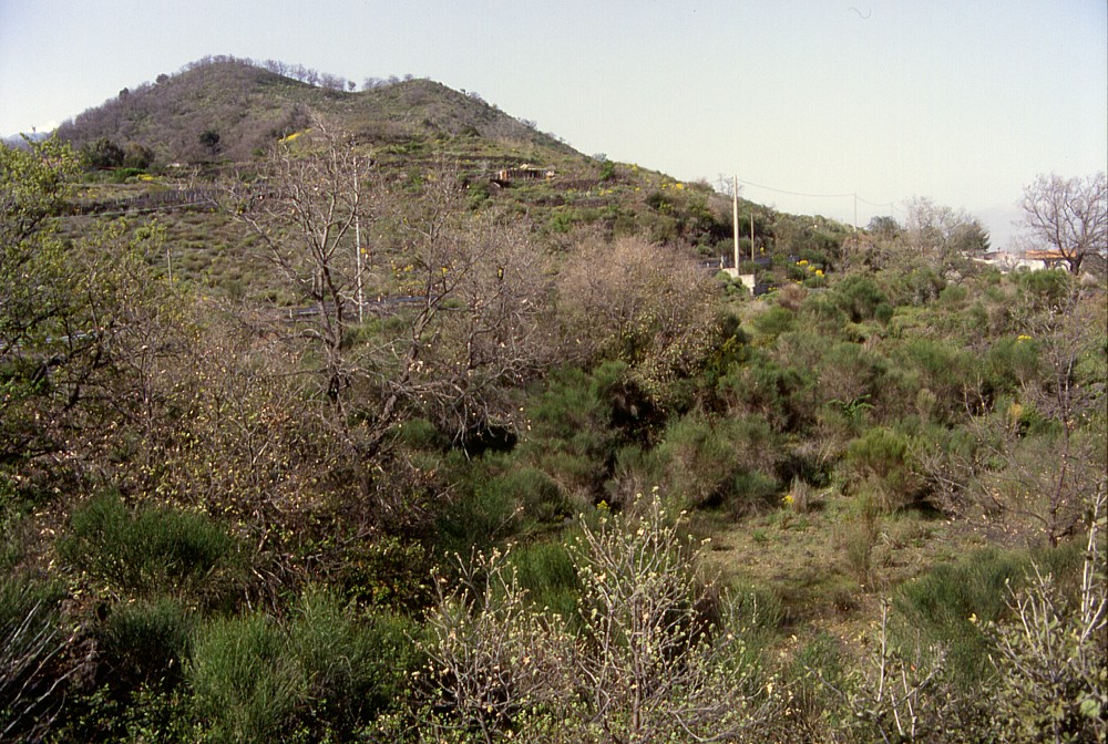
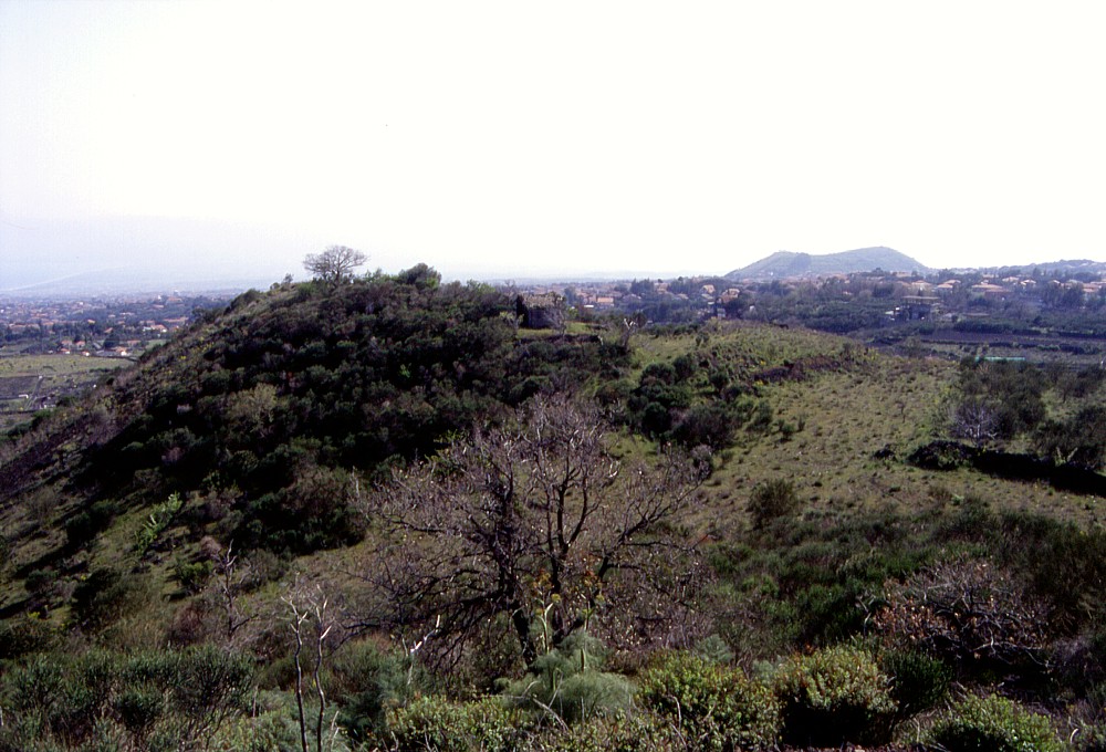
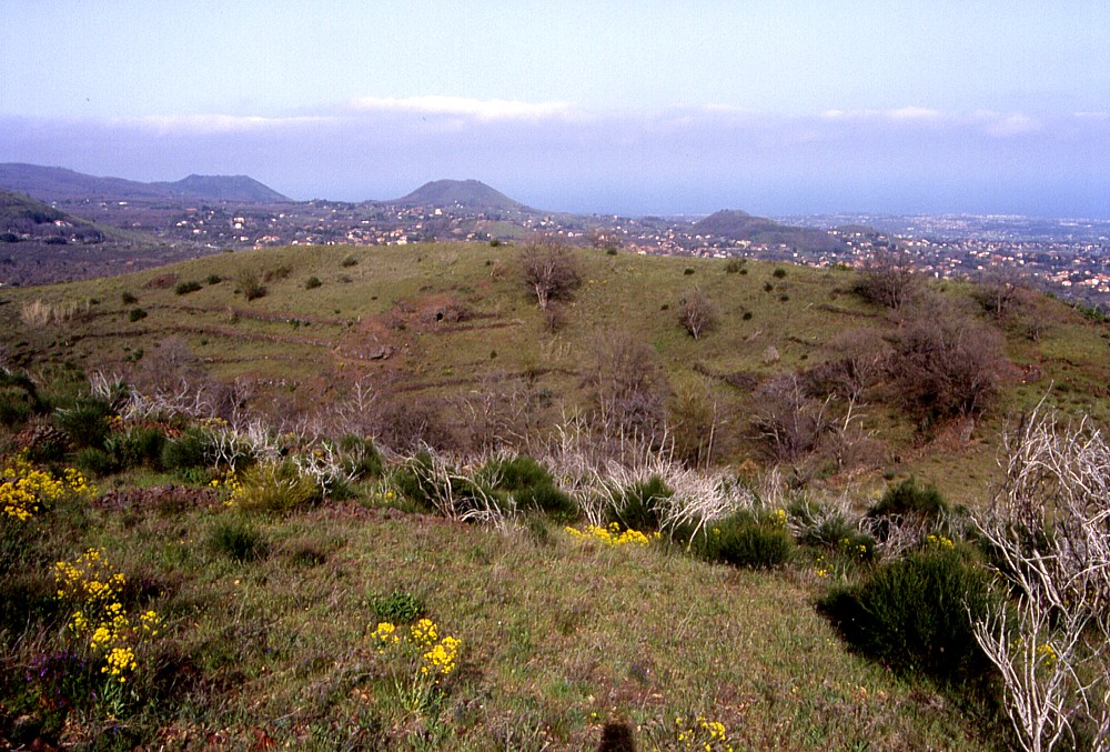
A
cluster of smaller vents, aligned along a N-S fissure, lies to the
south of the main Mompeloso cone. These vents have built low cones
around them, which are intensely used for agriculture (mainly vineyards
and fruit gardens) and much of their features is no longer recognizable.
The one closest to the main cone has been partially destroyed by
caterpillars in the spring of 2003, possibly in order to construct
a building in the place which admittedly is extremely scenic. The
photos above show a general view of these small cones seen from
the south slope of Mompeloso (left, with the densely populated area
between Catania and Nicolosi in the background), the largest of
these cones (center), and another small crater largely obscured
by vineyards on the lower south flank of the Mompeloso cone (right).
The cone seen in the distance in the center and right photographs
is Mompilieri, lying south of
the Monti Rossi |
||
 |
 |
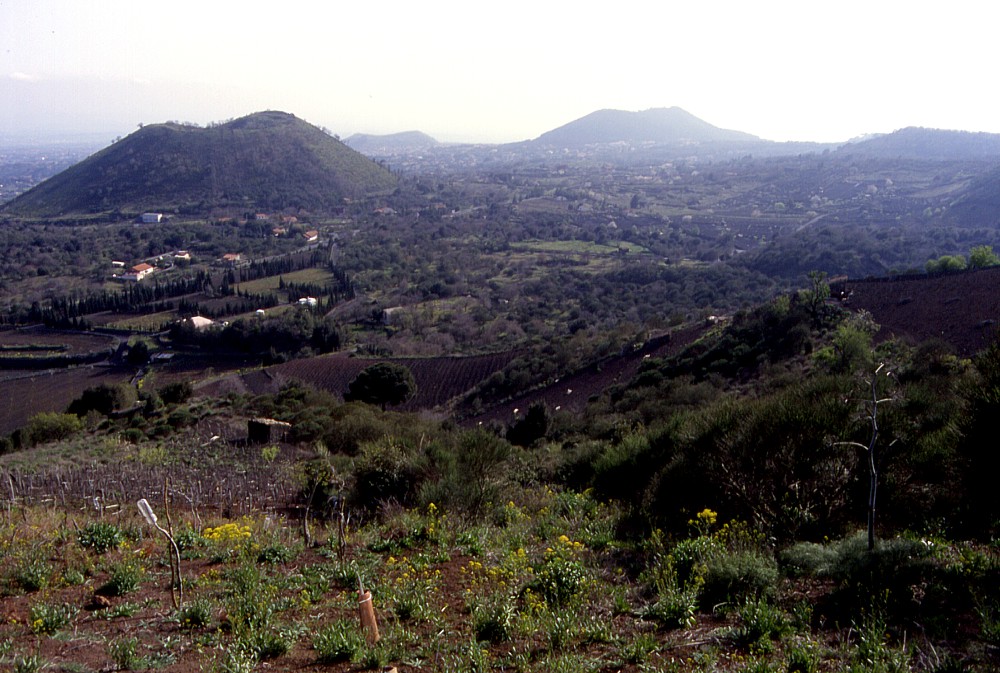 |
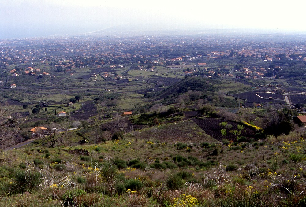
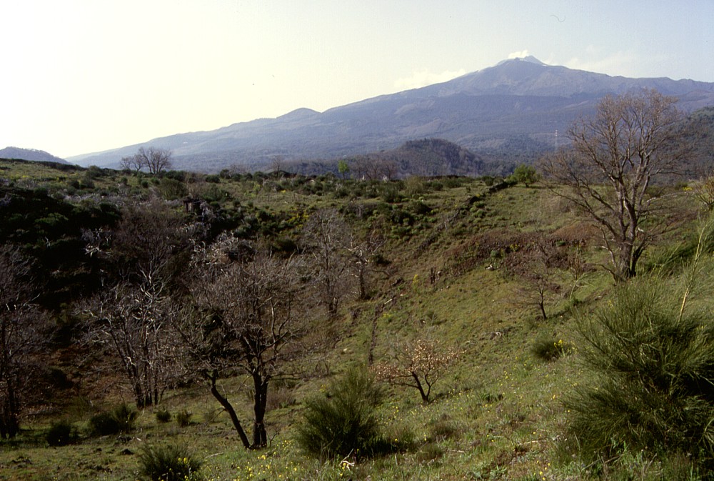
Left:
view across the summit crater of Mompeloso toward N, with the bulk
of Mount Etna in the background. The Mompeloso crater is a simple,
saucer-shaped depression periodically used for pasture Center: view from the W side of the summit crater of Mompeloso to its E rim, lying about 80 m away. In the background several conspicuous pyroclastic cones are seen; these are (from left to right) Monte Ilice, Monte Gorna, and Monte S. Nicolò, occupying the area next to the village of Monterosso, and in front of the latter, the Tre Monti near the town of Trecastagni Right: Mompeloso is seen here from the summit of nearby Monte Arso, about 1.3 km to the NNE, with the Monti Rossi and Mompilieri lying in the distance. View is to the SW |
||
|
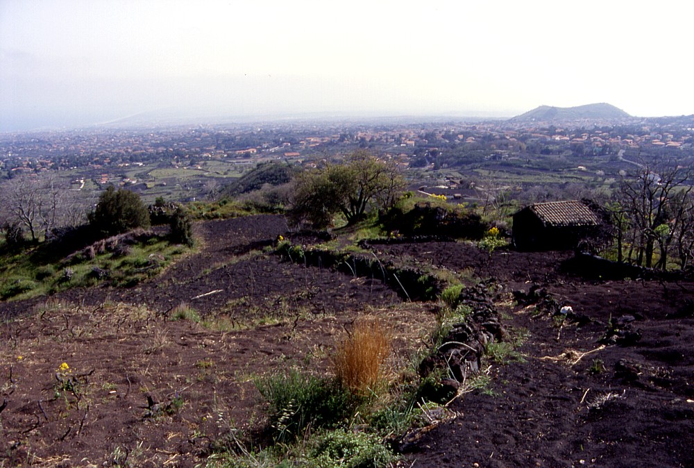
This
was once one of the smaller craters constituting the lower portion
of the Mompeloso eruptive fissure. In mid-July 2003, when this photograph
was taken, the crater was bulldozed into a flat area, presumably
in order to establish a building and/or garden on it |
Copyright © Boris Behncke, "Italy's Volcanoes: The Cradle of Volcanology"
Page set up on 14 December 2003