
| Etna
index |
||
| Geology | Geological history | Cones and craters |
| Eruptive characteristics | Eruptions before 1971 | Eruptions since 1971 |
| Etna and Man | References | Web sites |
| Weather forecasts | FAQ | Latest news |
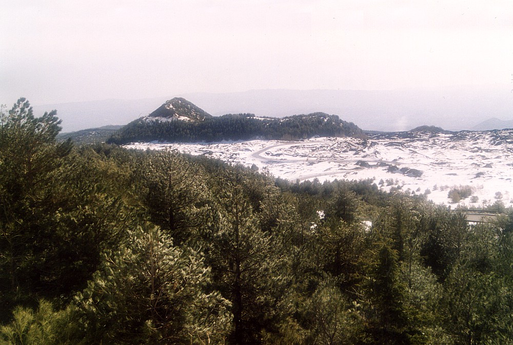 |
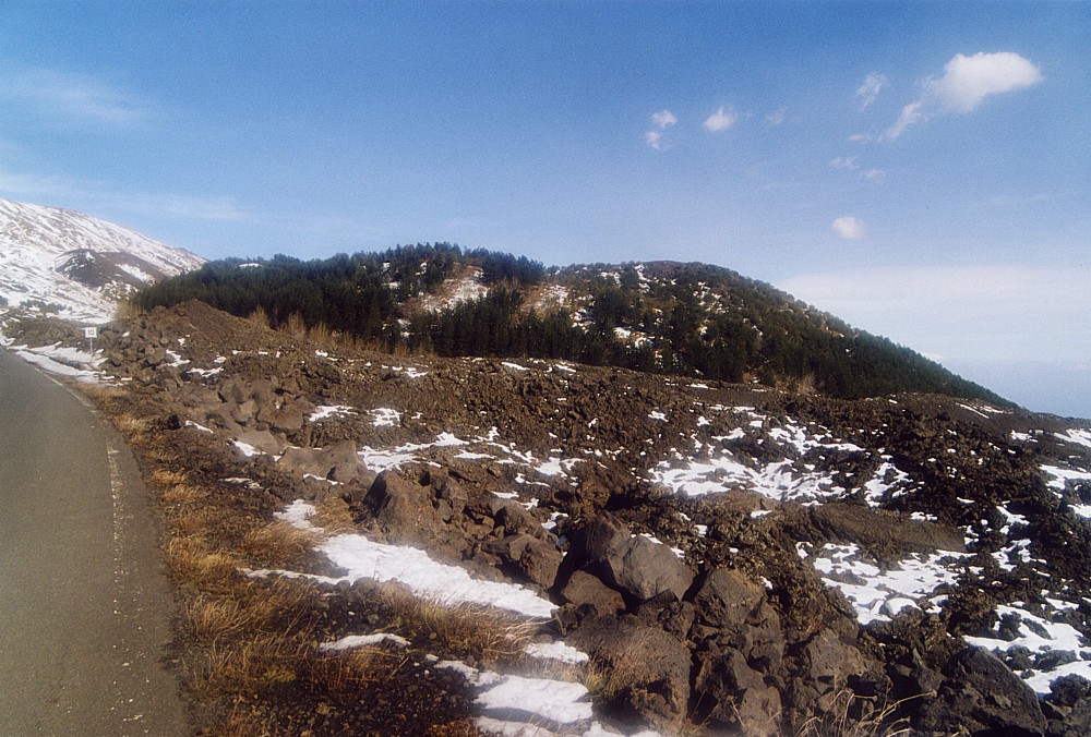
The
characteristic irregular outline of Monte Serra Pizzuta Calvarina
is seen in this mid-January 2004 photograph as it appears from
the Provincial Road 92, leading from Zafferana to the Rifugio
Sapienza area. This large prehistoric cone shows the effect of
a strong wind blowing east during its eruption, resulting in the
high crater rim on the eastern (left) side. To the south (far
side) the crater is open, as lava was delivered directly from
the main eruptive vent. The lower northern (near) flank of the
cone has been buried when lava flows surrounded the cone during
the eruptions of 1766 and 1892 |
Mamma
Etna's countless children
Monte Serra Pizzuta Calvarina
SSE flank, 15.025312° E, 37.690958° N
Summit elevation: 1702 m (E crater rim)
![]()
Among
the numerous flank cones of Mount Etna, this is certainly the one with
the name most difficult to remember. Monte Serra Pizzuta Calvarina means
"mountain of the sharp-peaked ridge of Calvarina", with Calvarina
being the name of the area in general. This is not to be confused with
another cone somewhat further down on the south flank, Monte
Serra Pizzuta, which also has a sharp peak forming its summit. Monte
Serra Pizzuta Calvarina is a broad, prehistoric cone of highly irregular
shape with a maximum base diameter of nearly 600 m (NW-SE) and a horseshoe-shaped
crater open to the south. The sharp peak that inspired the name of the
cone is the high east rim of the crater, evidently a result of a strong
wind blowing toward east during the growth of the cone. As can be seen
from the photographs on this page, the shape of the cone varies strongly
when viewed from different directions. The high east rim of the crater
stands up to 120 m above the southeast base of the cone, but on the other
sides the cone is only a few tens of meters high. In contrast with some
other of Etna's larger flank cones it is thus not very difficult to climb
Monte Serra Pizzuta Calvarina, and the climb is rewarded by a 360-degree
panoramic view. Access to the cone is easy, it is possible to arrive near
the northwestern base by car, and from there the climb to the summit takes
only a few minutes.
The age of Monte Serra Pizzuta Calvarina is not known, and the lavas emitted
through the open south side of the cone have been buried under more recent
lavas, most recently by those of the 1892 Monti Silvestri eruption.
Although I had previously passed dozens of times near Monte Serra Pizzuta
Calvarina, I first climbed it only in January 2004, and many of the photographs
on this page have been taken on that occasion.
 |
 |
 |
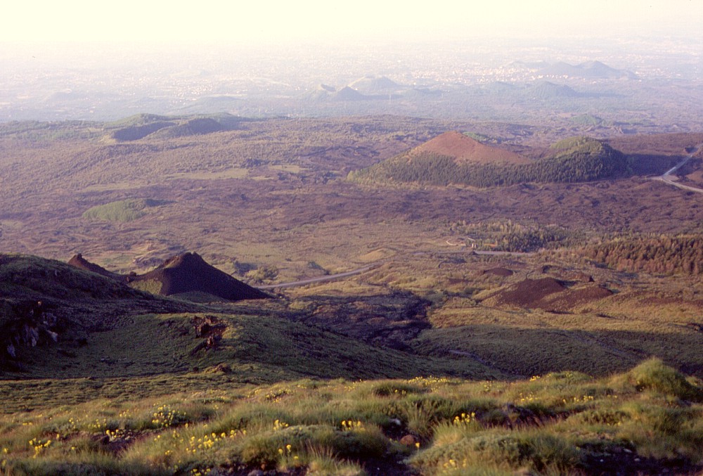
Left:
in this image, taken at sunrise on 24 May 1998, Monte Serra Pizzuta
Calvarina lies in center right (note the brownish high eastern crater
rim), against the backdrop of numerous other flank cones on Etna's
south flank. Monte Solfizio is
seen in left foreground, behind it is the low Monte
Salto del Cane, and in the background lie Monte
Arso, Mompeloso, Monte
Serra Pizzuta and the Monti Rossi
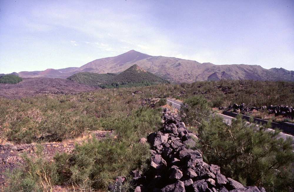
Center: seen from south, the steep-sided eastern crater rim of Monte Serra Pizzuta Calvarina (the forested irregular cone in the center of the image) is most evident. The prominent peak in the background is the Montagnola, a flank cone formed in 1763, which from this perspective completely hides the summit area further to the north. Note dark lava flow (of 1892) encroaching from left on Monte Serra Pizzuta Calvarina. Photo taken on 14 June 1997 Right: view from northwest toward Monte Serra Pizzuta Calvarina (at extreme left) in late October 2003. Dark hue of the area in the foregound is due to thick tephra deposit of the 2002-2003 eruption |
||
 |
 |
|
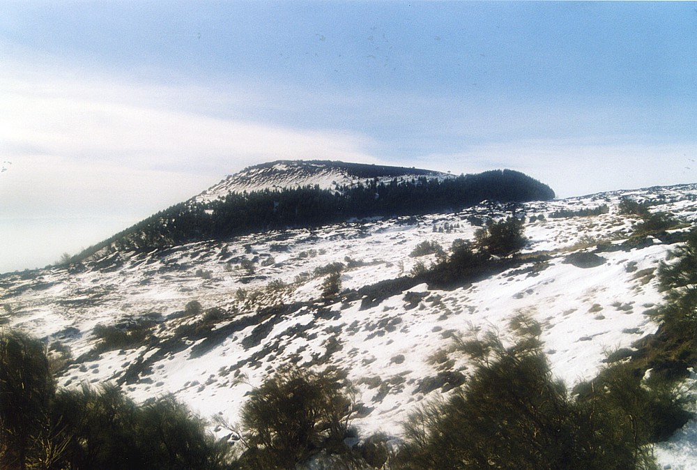
Photographs
taken in mid-January 2004, showing Monte Serra Pizzuta Calvarina
from southwest (left), and northeast (center), and view from the
summit of the cone at the high eastern crater rim toward southeast,
with lava lobes of 1766 and 1892 in the foreground; Monte
Salto del Cane is the low, rounded cone lying in upper central
portion of the image |
||
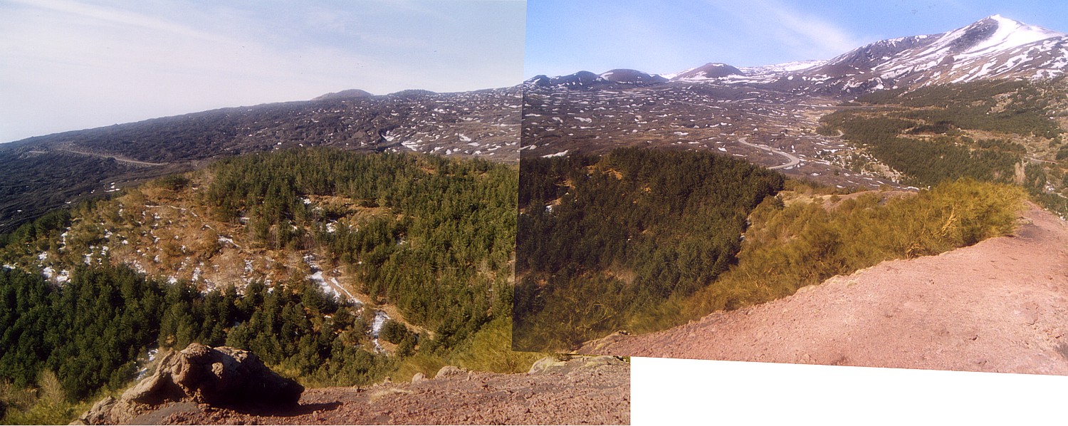 |
Photomosaic
taken from high eastern rim of the crater of Monte Serra Pizzuta
Calvarina in late January 2004, looking northwest. The irregular
crater rim is seen in the foreground; in the background lie the
Monti Silvestri (center right)
and the Montagnola (extreme right) |
Copyright © Boris Behncke, "Italy's Volcanoes: The Cradle of Volcanology"
Page set up on 22 February 2004